Coolville is a village located in Troy Township, Athens County, Ohio, United States, in the southeast area of the state. The population was 452 at the 2020 census.
| Name: | Coolville village |
|---|---|
| LSAD Code: | 47 |
| LSAD Description: | village (suffix) |
| State: | Ohio |
| County: | Athens County |
| Elevation: | 699 ft (213 m) |
| Total Area: | 1.00 sq mi (2.58 km²) |
| Land Area: | 0.98 sq mi (2.54 km²) |
| Water Area: | 0.02 sq mi (0.05 km²) |
| Total Population: | 454 |
| Population Density: | 463.27/sq mi (178.80/km²) |
| ZIP code: | 45723 |
| Area code: | 740 |
| FIPS code: | 3918588 |
| GNISfeature ID: | 1048628 |
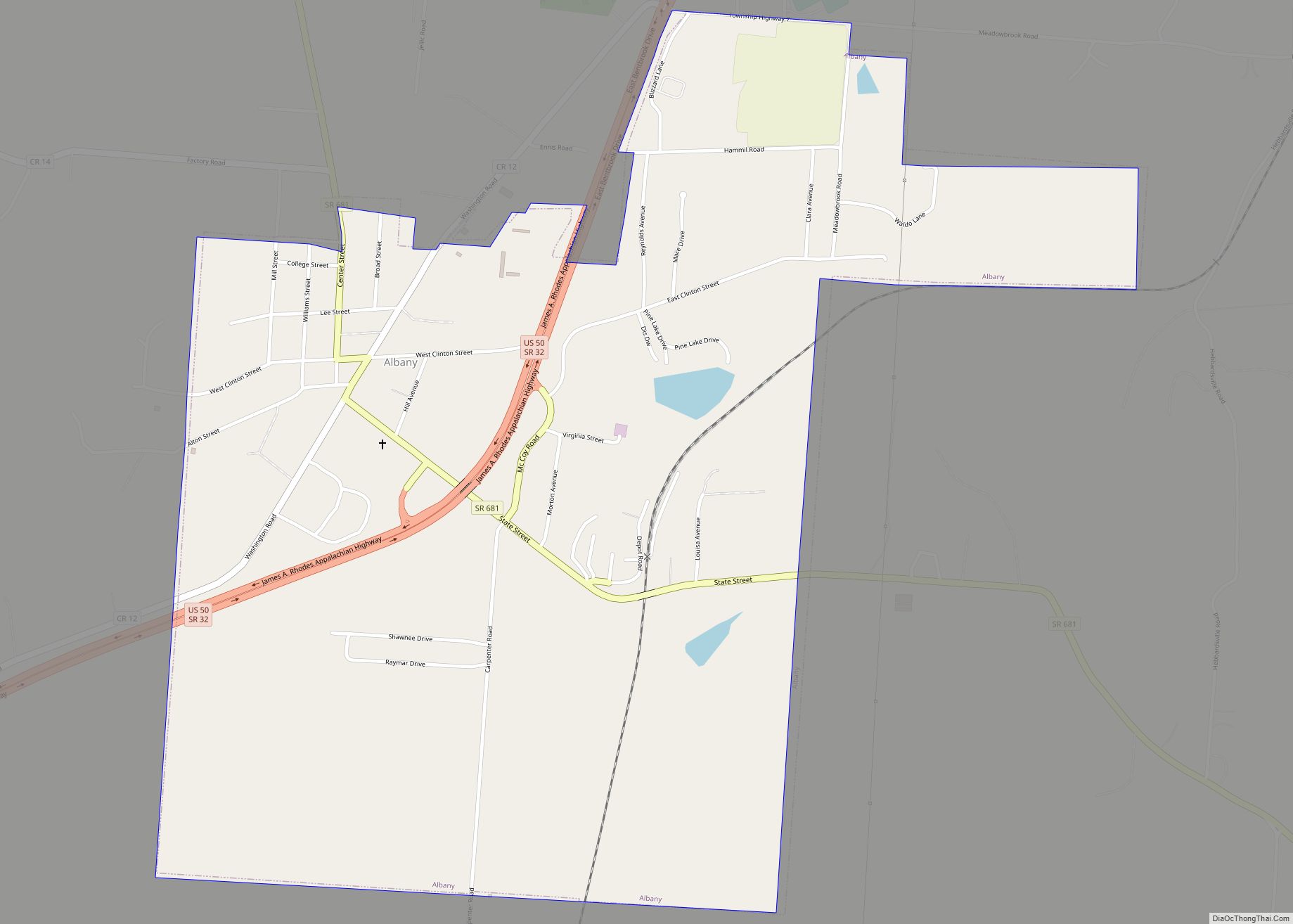
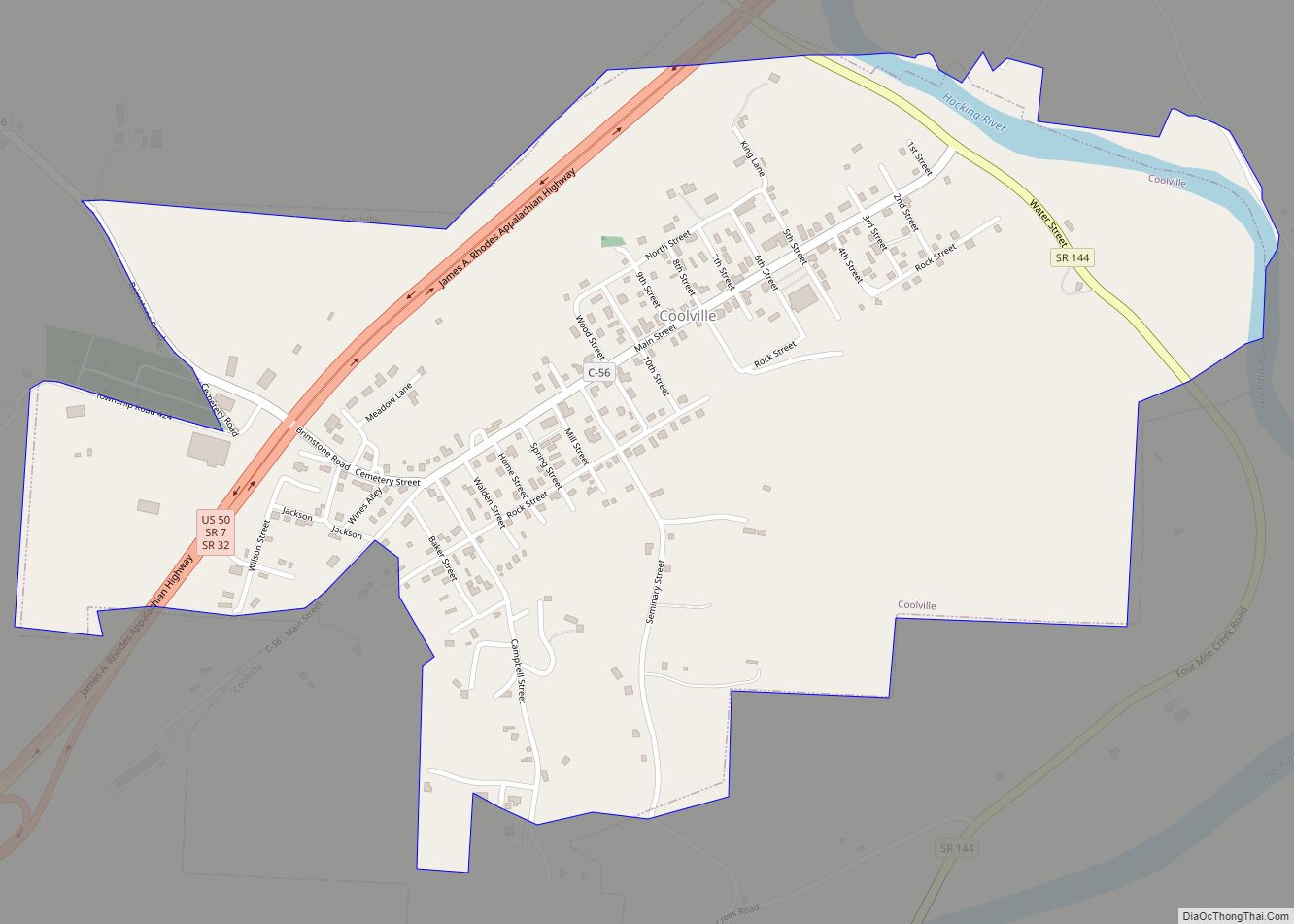
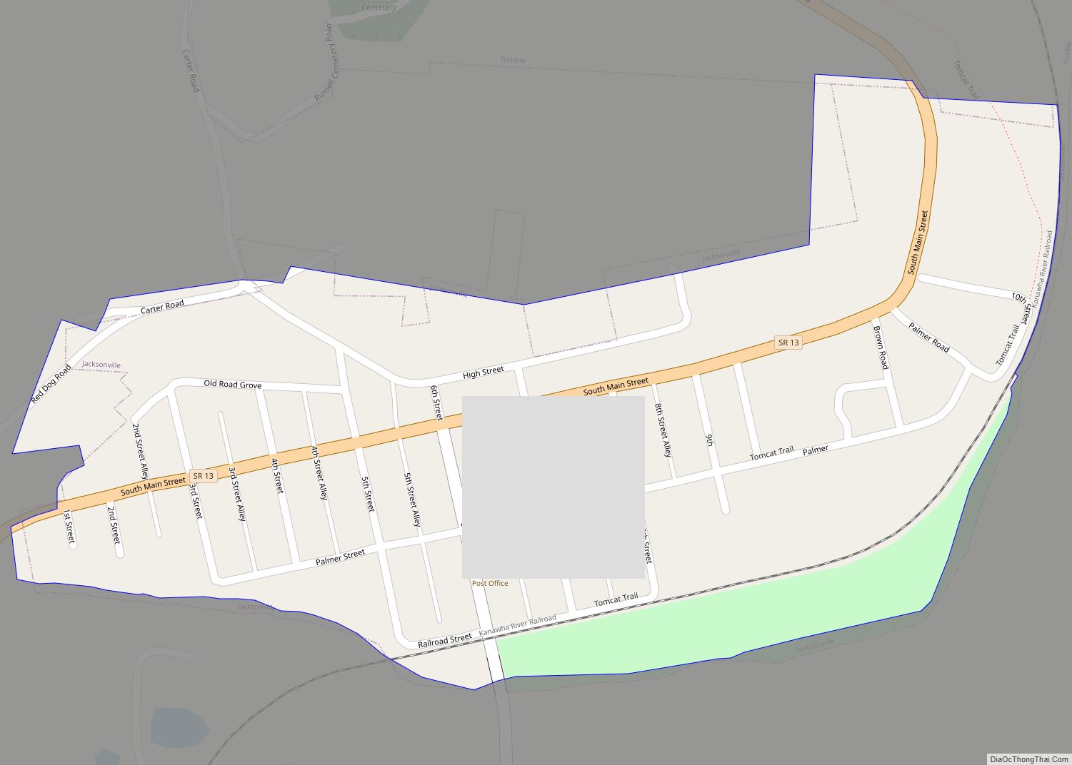
Online Interactive Map
Click on ![]() to view map in "full screen" mode.
to view map in "full screen" mode.
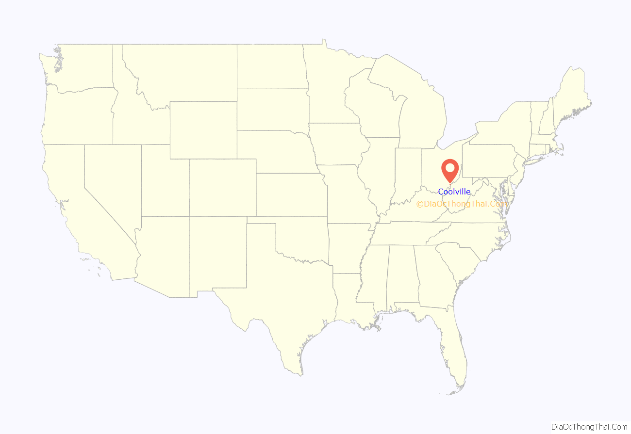
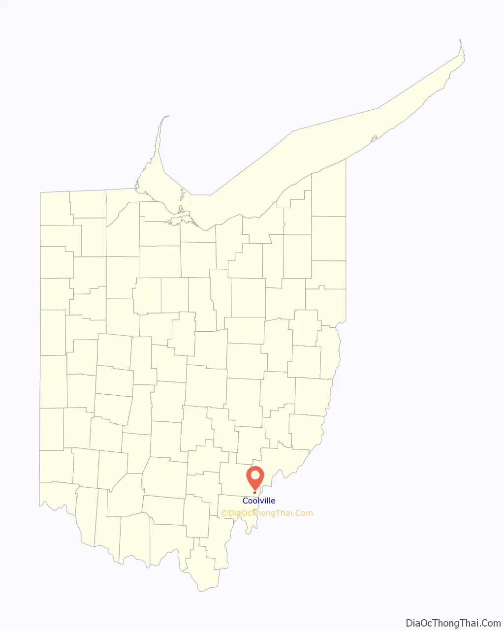
Coolville location map. Where is Coolville village?
History
In 1818 Coolville was platted (laid out by) by Simeon W. Cooley, for whom it is named. The village was incorporated in 1835.
By the 1830s, Coolville contained two stores, a gristmill, and a sawmill.
Coolville has been noted for its unusual place name. The village is located close to three other “hot/cold” communities: Torch and Frost (both unincorporated communities in Athens County), and Snowville in Meigs County.
Coolville consists of an elementary school, a bank, a library, a church/funeral home, a cemetery and a Family Dollar.
“Roots” General and Feed store was built in 1846 and still stands as a remodeled home with a business front.
The bank originally was built in the late 1800s on Main St, known today as the “Village Hall”.
Coolville Road Map
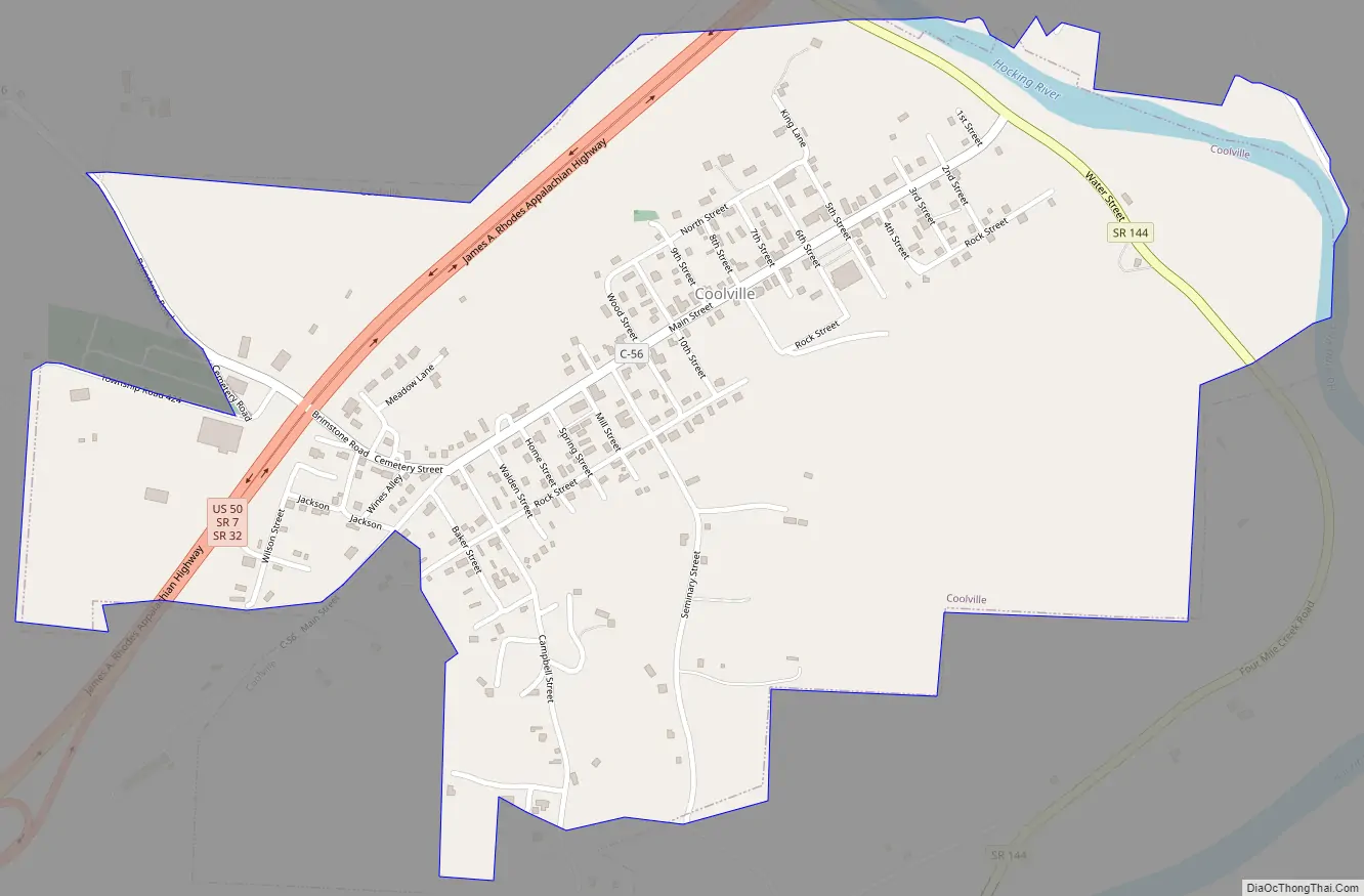
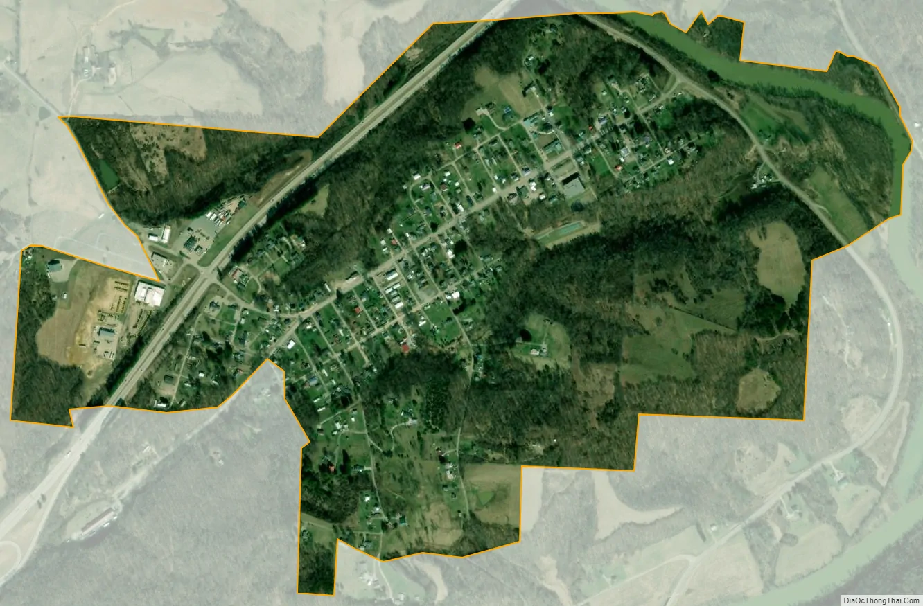
Coolville city Satellite Map
Geography
Coolville is located at 39°13′20″N 81°47′52″W / 39.22222°N 81.79778°W / 39.22222; -81.79778 (39.222197, -81.797639).
It is located on the right bank (west bank) of the Hocking River, a few miles upstream from its confluence with the Ohio River. US 50/SR 32/SR 7, Appalachian Corridor D, bypasses the town on the north side, just outside the built-up area, and provides highway access to the community. OH-144, located on the near bank of the Hocking River, also provides access.
According to the United States Census Bureau, the village has a total area of 0.85 square miles (2.20 km), of which 0.83 square miles (2.15 km) is land and 0.02 square miles (0.05 km) is water.
See also
Map of Ohio State and its subdivision:- Adams
- Allen
- Ashland
- Ashtabula
- Athens
- Auglaize
- Belmont
- Brown
- Butler
- Carroll
- Champaign
- Clark
- Clermont
- Clinton
- Columbiana
- Coshocton
- Crawford
- Cuyahoga
- Darke
- Defiance
- Delaware
- Erie
- Fairfield
- Fayette
- Franklin
- Fulton
- Gallia
- Geauga
- Greene
- Guernsey
- Hamilton
- Hancock
- Hardin
- Harrison
- Henry
- Highland
- Hocking
- Holmes
- Huron
- Jackson
- Jefferson
- Knox
- Lake
- Lake Erie
- Lawrence
- Licking
- Logan
- Lorain
- Lucas
- Madison
- Mahoning
- Marion
- Medina
- Meigs
- Mercer
- Miami
- Monroe
- Montgomery
- Morgan
- Morrow
- Muskingum
- Noble
- Ottawa
- Paulding
- Perry
- Pickaway
- Pike
- Portage
- Preble
- Putnam
- Richland
- Ross
- Sandusky
- Scioto
- Seneca
- Shelby
- Stark
- Summit
- Trumbull
- Tuscarawas
- Union
- Van Wert
- Vinton
- Warren
- Washington
- Wayne
- Williams
- Wood
- Wyandot
- Alabama
- Alaska
- Arizona
- Arkansas
- California
- Colorado
- Connecticut
- Delaware
- District of Columbia
- Florida
- Georgia
- Hawaii
- Idaho
- Illinois
- Indiana
- Iowa
- Kansas
- Kentucky
- Louisiana
- Maine
- Maryland
- Massachusetts
- Michigan
- Minnesota
- Mississippi
- Missouri
- Montana
- Nebraska
- Nevada
- New Hampshire
- New Jersey
- New Mexico
- New York
- North Carolina
- North Dakota
- Ohio
- Oklahoma
- Oregon
- Pennsylvania
- Rhode Island
- South Carolina
- South Dakota
- Tennessee
- Texas
- Utah
- Vermont
- Virginia
- Washington
- West Virginia
- Wisconsin
- Wyoming