Delphos is a city in Allen and Van Wert counties in the U.S. state of Ohio approximately 14 mi (23 km) northwest of Lima and 13 mi (21 km) east of Van Wert. The population was 7,117 at the 2020 census.
The Allen County portion of Delphos is part of the Lima Metropolitan Statistical Area, while the Van Wert County portion is part of the Van Wert Micropolitan Statistical Area.
| Name: | Delphos city |
|---|---|
| LSAD Code: | 25 |
| LSAD Description: | city (suffix) |
| State: | Ohio |
| County: | Allen County, Van Wert County |
| Elevation: | 774 ft (236 m) |
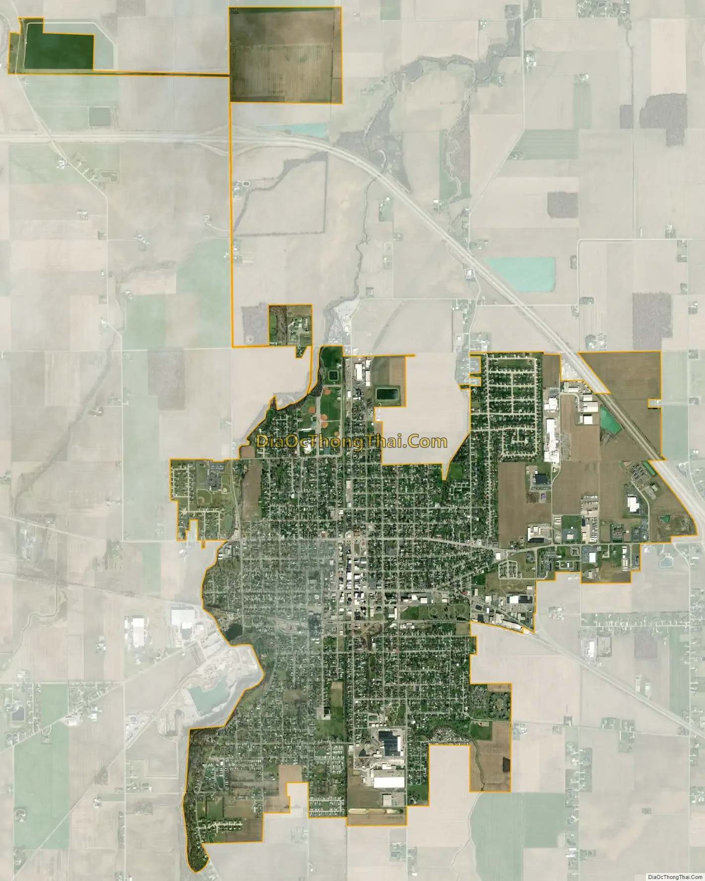
| Total Area: | 3.37 sq mi (8.72 km²) |
| Land Area: | 3.32 sq mi (8.60 km²) |
| Water Area: | 0.04 sq mi (0.12 km²) |
| Total Population: | 7,117 |
| Population Density: | 2,142.38/sq mi (827.16/km²) |
| ZIP code: | 45833 |
| Area code: | 419 |
| FIPS code: | 3921602 |
| GNISfeature ID: | 1056973 |
| Website: | http://www.cityofdelphos.com/ |
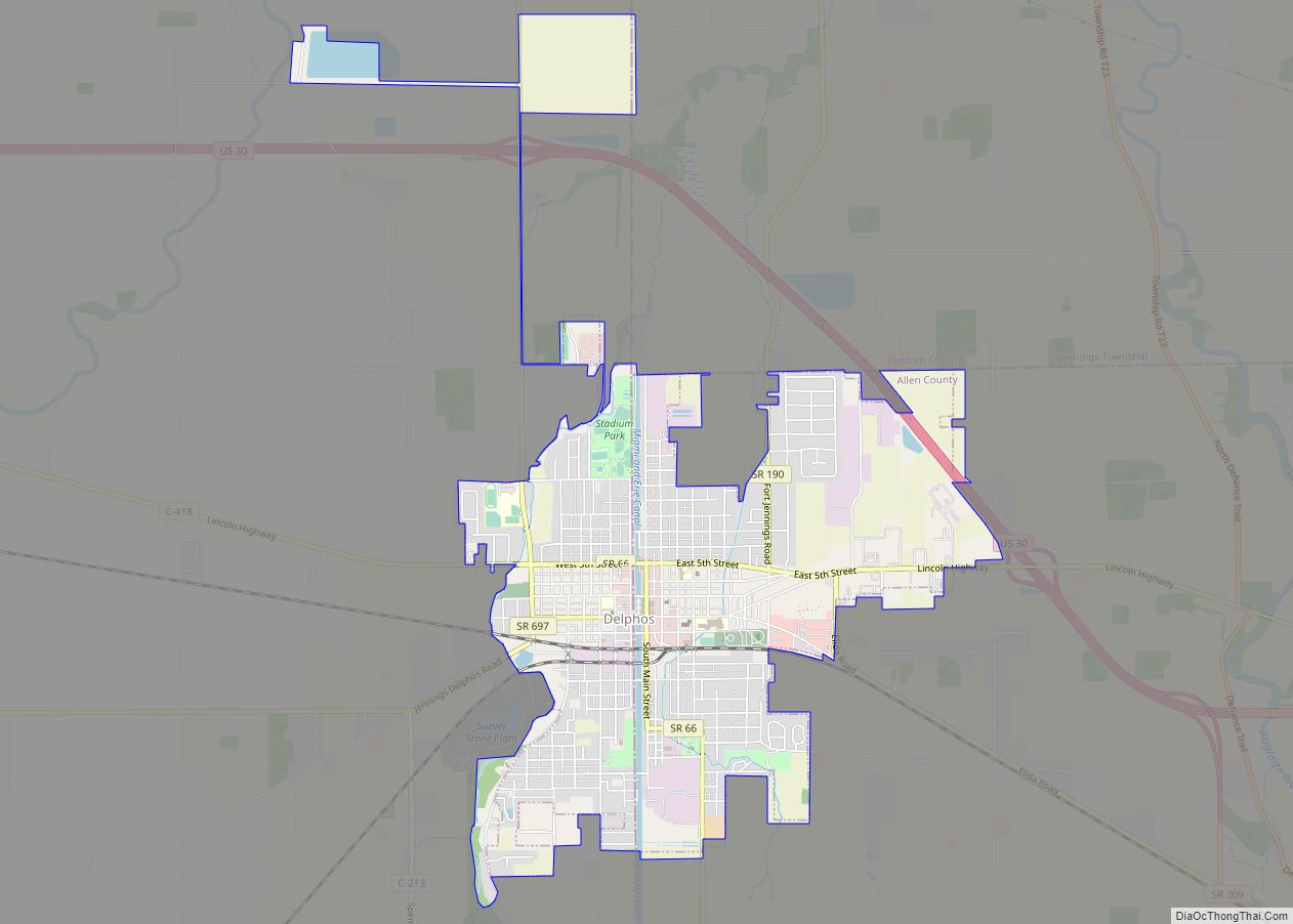
Online Interactive Map
Click on ![]() to view map in "full screen" mode.
to view map in "full screen" mode.
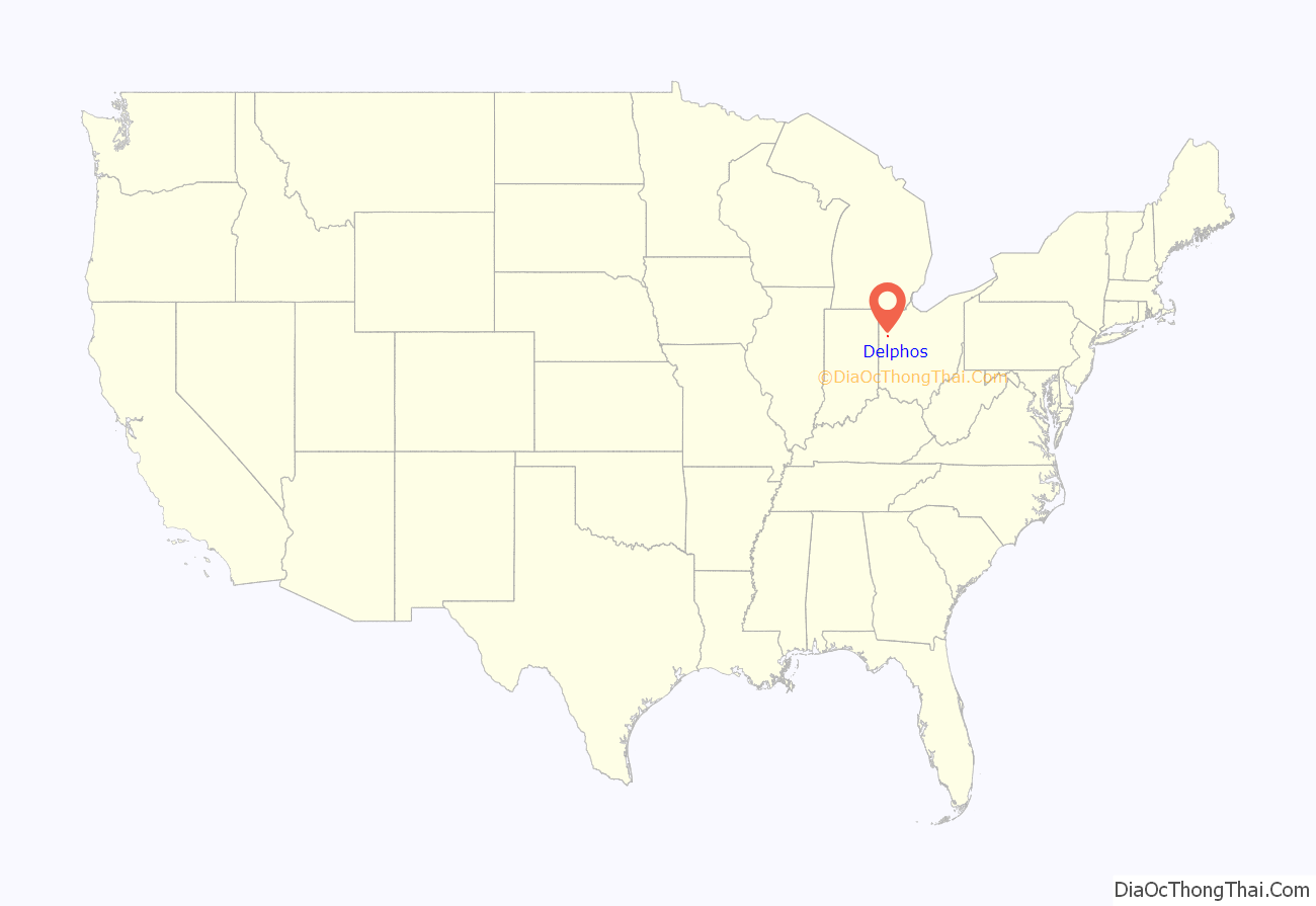
Delphos location map. Where is Delphos city?

History
Delphos had its start in the early 1850s with the merger of neighboring rival towns. These were the towns of Howard (in the northwest), Section 10 (in the east), Bredeick Street (south of Howard) and East Bredeick (named after Father John Otto Bredeick, a Bavarian priest, who had purchased the tract of land in 1840). In 1851, the four towns agreed to form a single town called Delphos. The city’s name is derived from the Greek god Delphus.
The Miami and Erie Canal, a 274 mile (441 km) canal connecting Cincinnati to Toledo, ran through Delphos. The first settlers to Delphos were mainly construction workers attracted by the work being done on the Canal. After 20 years of construction, the Canal was completed — an inaugural canal boat carrying the governor of Ohio passed through Delphos on July 4, 1845.
The Canal was crucial to the economic development of the city in the 19th century, since it positioned Delphos as a center of regional trade. Indeed, Delphos became one of the major ports along the Canal, with transshipment facilities linking the Canal to the growing rail network in the region. Industrialists were also attracted by the Canal. By 1879, more than 100 factories located in Delphos produced goods for national and international trade. However, rail transport eventually came to dominate long-haul commercial transport and Delphos’ importance as a hub of commerce waned.
Three Delphos buildings are listed on the National Register of Historic Places: the Marks-Family House and St. John’s Catholic Church on the Allen County side of the city, and the Bredeick-Lang House on the Van Wert County side (see Gallery below).
Delphos Road Map
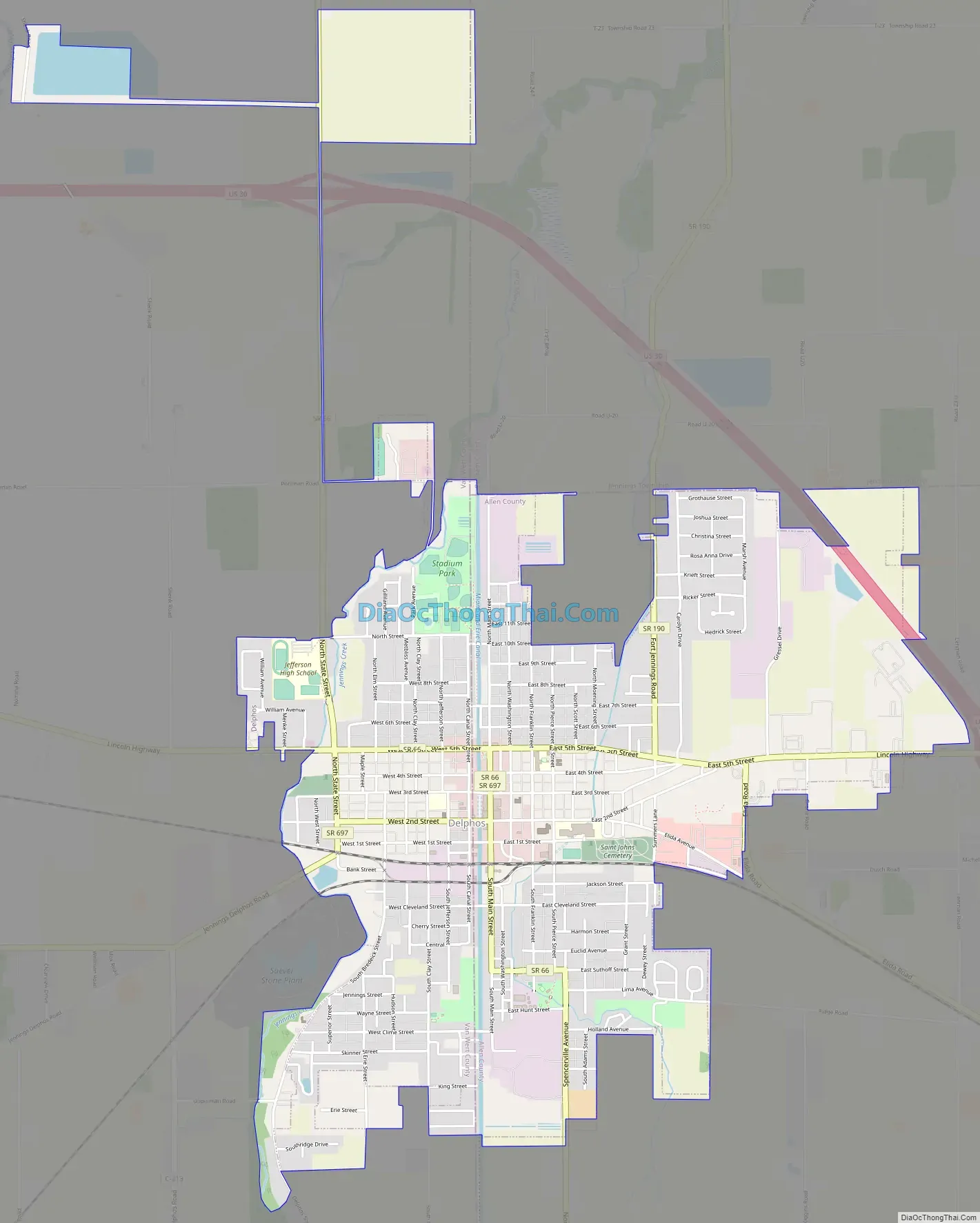
Delphos city Satellite Map
Geography
According to the United States Census Bureau, the city has a total area of 3.48 square miles (9.01 km), of which 3.44 square miles (8.91 km) is land and 0.04 square miles (0.10 km) is water.
See also
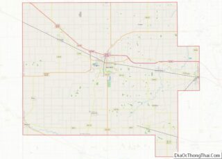
Map of Ohio State and its subdivision:- Adams
- Allen
- Ashland
- Ashtabula
- Athens
- Auglaize
- Belmont
- Brown
- Butler
- Carroll
- Champaign
- Clark
- Clermont
- Clinton
- Columbiana
- Coshocton
- Crawford
- Cuyahoga
- Darke
- Defiance
- Delaware
- Erie
- Fairfield
- Fayette
- Franklin
- Fulton
- Gallia
- Geauga
- Greene
- Guernsey
- Hamilton
- Hancock
- Hardin
- Harrison
- Henry
- Highland
- Hocking
- Holmes
- Huron
- Jackson
- Jefferson
- Knox
- Lake
- Lake Erie
- Lawrence
- Licking
- Logan
- Lorain
- Lucas
- Madison
- Mahoning
- Marion
- Medina
- Meigs
- Mercer
- Miami
- Monroe
- Montgomery
- Morgan
- Morrow
- Muskingum
- Noble
- Ottawa
- Paulding
- Perry
- Pickaway
- Pike
- Portage
- Preble
- Putnam
- Richland
- Ross
- Sandusky
- Scioto
- Seneca
- Shelby
- Stark
- Summit
- Trumbull
- Tuscarawas
- Union
- Van Wert
- Vinton
- Warren
- Washington
- Wayne
- Williams
- Wood
- Wyandot
- Alabama
- Alaska
- Arizona
- Arkansas
- California
- Colorado
- Connecticut
- Delaware
- District of Columbia
- Florida
- Georgia
- Hawaii
- Idaho
- Illinois
- Indiana
- Iowa
- Kansas
- Kentucky
- Louisiana
- Maine
- Maryland
- Massachusetts
- Michigan
- Minnesota
- Mississippi
- Missouri
- Montana
- Nebraska
- Nevada
- New Hampshire
- New Jersey
- New Mexico
- New York
- North Carolina
- North Dakota
- Ohio
- Oklahoma
- Oregon
- Pennsylvania
- Rhode Island
- South Carolina
- South Dakota
- Tennessee
- Texas
- Utah
- Vermont
- Virginia
- Washington
- West Virginia
- Wisconsin
- Wyoming