East Cleveland is a city in Cuyahoga County, Ohio, United States, and is the first suburb encountered when travelling east from Cleveland on Euclid Avenue. The population was 13,792 at the 2020 census. East Cleveland is bordered by the city of Cleveland to its north, west, and a small section of its southwestern edge, and by Cleveland Heights to the east and the majority of its southern limits.
| Name: | East Cleveland city |
|---|---|
| LSAD Code: | 25 |
| LSAD Description: | city (suffix) |
| State: | Ohio |
| County: | Cuyahoga County |
| Elevation: | 686 ft (209 m) |
| Total Area: | 3.09 sq mi (8.00 km²) |
| Land Area: | 3.08 sq mi (7.98 km²) |
| Water Area: | 0.01 sq mi (0.02 km²) |
| Total Population: | 13,792 |
| Population Density: | 4,473.56/sq mi (1,727.26/km²) |
| Area code: | 216 |
| FIPS code: | 3923380 |
| GNISfeature ID: | 1064577 |
| Website: | www.eastcleveland.org |
Online Interactive Map
Click on ![]() to view map in "full screen" mode.
to view map in "full screen" mode.
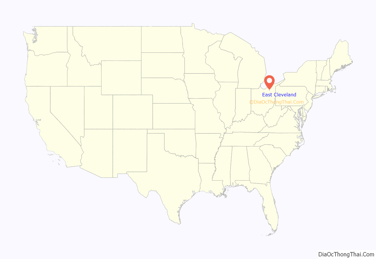
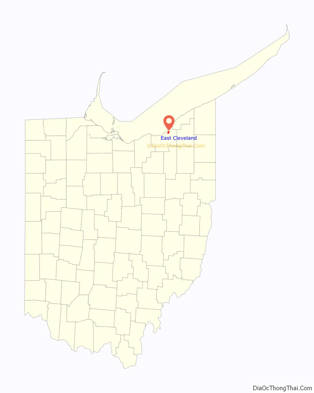
East Cleveland location map. Where is East Cleveland city?
History
Historically East Cleveland was partially founded by Scottish immigrants, whose names can still be found in the city such as Shaw, McIlrath, and Eddy. East Cleveland incorporated as a village in 1895 and became a city in 1911. This charter included provisions for women’s suffrage, which at the time was unheard of east of the Mississippi River. Before the charter passed, the city of Cleveland unsuccessfully attempted to annex the emerging municipality in 1910 and again in 1916.
East Cleveland is home to General Electric’s historic Nela Park, the world’s first industrial park. Nela Park, which was added to the National Register of Historic Places in 1975, continues to operate today as the functional headquarters for GE Lighting and is the city’s second largest employer. Huron Hospital, a satellite hospital of the Cleveland Clinic, was the city’s largest employer. Huron Hospital was a notable health care facility, being the only Level-II trauma center between Cleveland’s MetroHealth Medical Center, located on West 25th Street, and Hillcrest Hospital, located in Mayfield Heights. Huron Hospital closed in early spring of 2011.
East Cleveland includes a portion of Euclid Avenue, which from the 1860s through the 1920s was known as “Millionaires’ Row.” The many estates along this stretch of road in East Cleveland included the 248-acre (1.00 km) home of the late John D. Rockefeller, Standard Oil founder and “the world’s first billionaire.”
By the Great Depression a great number of homes along “Millionaires’ Row” were demolished or abandoned. Although commercial properties and fast-food chains replaced many Euclid Avenue homes during the second half of the 20th century, East Cleveland is still home to 18 of the original “Millionaire’s Row” homes, while only six are left in the city of Cleveland.
East Cleveland is also home to the historic Lake View Cemetery (pedestrian gardens) final resting place of John D. Rockefeller, James A. Garfield, Eliot Ness, Alan Freed, Ray Chapman, Garrett Morgan, Adella Prentiss Hughes, Al Lerner, Carl Stokes at 12316 Euclid Ave. East Cleveland.
After World War II, development of other suburbs within the region brought a number of changes to East Cleveland. By the 1960s, African Americans constituted an increasingly large portion of the city’s population. By 1984, East Cleveland was one of the largest primarily black communities in Ohio, with a population of 36,957. Since this time, however, the city has suffered from severe population decline, including a 34.4% decline between 2000 and 2010. The current population is less than 14,000, down from a high of over 40,000 at its peak in the 1950s.
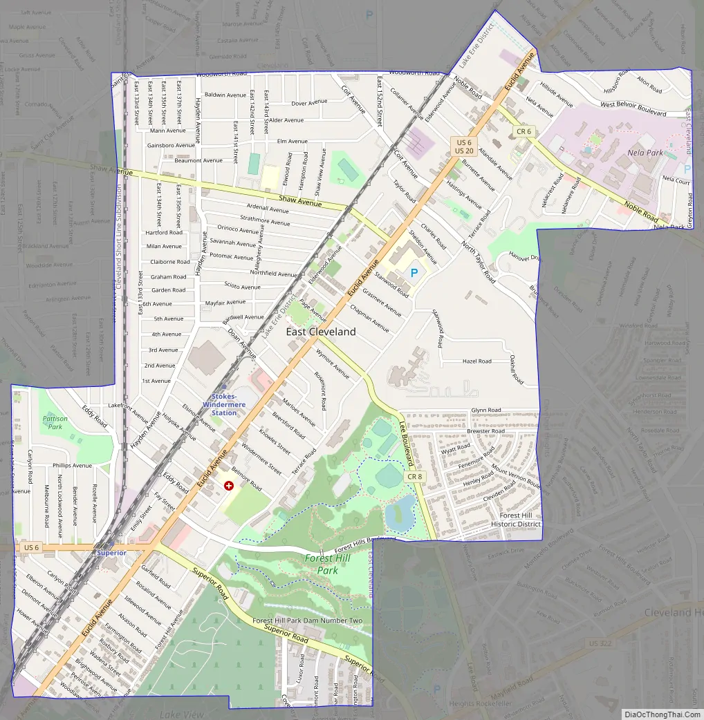
East Cleveland Road Map
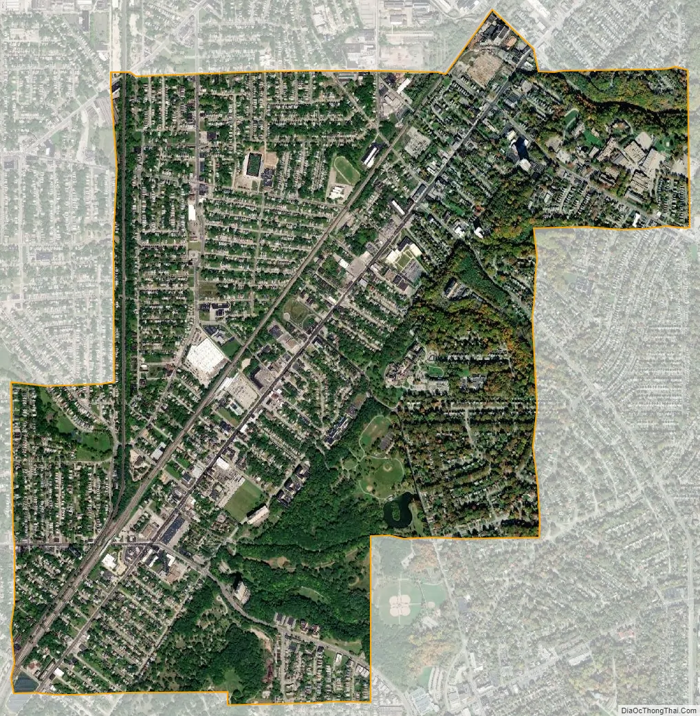
East Cleveland city Satellite Map
Geography
East Cleveland is located at 41°31′54″N 81°34′55″W / 41.53167°N 81.58194°W / 41.53167; -81.58194 (41.531701, -81.581948). According to the United States Census Bureau, the city has a total area of 3.10 square miles (8.03 km), of which 3.09 square miles (8.00 km) is land and 0.01 square miles (0.03 km) is water.
Most of the city is located in a relatively flat and relatively lower area contiguous with the city of Cleveland. A small portion of the city lies atop a steep hill, and is contiguous with the neighboring city of Cleveland Heights; it also lies in a relatively flat area at a higher elevation. Superior Road, Forest Hills Boulevard, Lee Road, Noble and North Taylor roads are the major through-streets ascending the hill. The McGregor Home and the Forest Hill Historic District are located on “the hill.”
Surrounding communities
The University Circle neighborhood of Cleveland is immediately to the west of East Cleveland, on the other side of a railway viaduct that carries the RTA Red Line. Case Western Reserve University, University Hospitals Cleveland Medical Center, and the Cleveland Museum of Art are in University Circle.
See also
Map of Ohio State and its subdivision:- Adams
- Allen
- Ashland
- Ashtabula
- Athens
- Auglaize
- Belmont
- Brown
- Butler
- Carroll
- Champaign
- Clark
- Clermont
- Clinton
- Columbiana
- Coshocton
- Crawford
- Cuyahoga
- Darke
- Defiance
- Delaware
- Erie
- Fairfield
- Fayette
- Franklin
- Fulton
- Gallia
- Geauga
- Greene
- Guernsey
- Hamilton
- Hancock
- Hardin
- Harrison
- Henry
- Highland
- Hocking
- Holmes
- Huron
- Jackson
- Jefferson
- Knox
- Lake
- Lake Erie
- Lawrence
- Licking
- Logan
- Lorain
- Lucas
- Madison
- Mahoning
- Marion
- Medina
- Meigs
- Mercer
- Miami
- Monroe
- Montgomery
- Morgan
- Morrow
- Muskingum
- Noble
- Ottawa
- Paulding
- Perry
- Pickaway
- Pike
- Portage
- Preble
- Putnam
- Richland
- Ross
- Sandusky
- Scioto
- Seneca
- Shelby
- Stark
- Summit
- Trumbull
- Tuscarawas
- Union
- Van Wert
- Vinton
- Warren
- Washington
- Wayne
- Williams
- Wood
- Wyandot
- Alabama
- Alaska
- Arizona
- Arkansas
- California
- Colorado
- Connecticut
- Delaware
- District of Columbia
- Florida
- Georgia
- Hawaii
- Idaho
- Illinois
- Indiana
- Iowa
- Kansas
- Kentucky
- Louisiana
- Maine
- Maryland
- Massachusetts
- Michigan
- Minnesota
- Mississippi
- Missouri
- Montana
- Nebraska
- Nevada
- New Hampshire
- New Jersey
- New Mexico
- New York
- North Carolina
- North Dakota
- Ohio
- Oklahoma
- Oregon
- Pennsylvania
- Rhode Island
- South Carolina
- South Dakota
- Tennessee
- Texas
- Utah
- Vermont
- Virginia
- Washington
- West Virginia
- Wisconsin
- Wyoming


