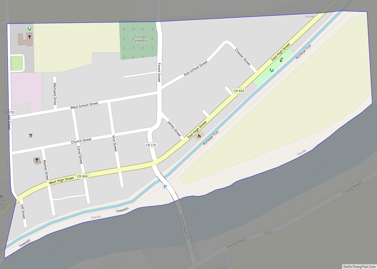
Florida is a village in Henry County, Ohio, United States, along the Maumee River. The population was 232 at the 2010 census.
| Name: | Florida village |
|---|---|
| LSAD Code: | 47 |
| LSAD Description: | village (suffix) |
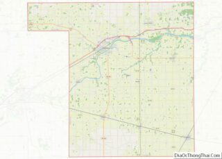
| State: | Ohio |
| County: | Henry County |
| Elevation: | 673 ft (205 m) |
| Total Area: | 0.23 sq mi (0.58 km²) |
| Land Area: | 0.23 sq mi (0.58 km²) |
| Water Area: | 0.00 sq mi (0.00 km²) |
| Total Population: | 215 |
| Population Density: | 955.56/sq mi (369.12/km²) |
| FIPS code: | 3927538 |
| GNISfeature ID: | 1064660 |
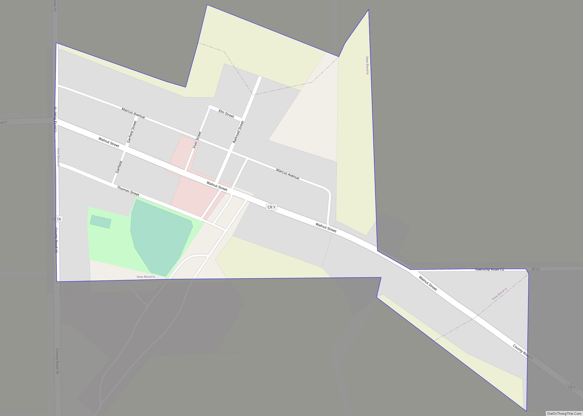
Online Interactive Map
Click on ![]() to view map in "full screen" mode.
to view map in "full screen" mode.
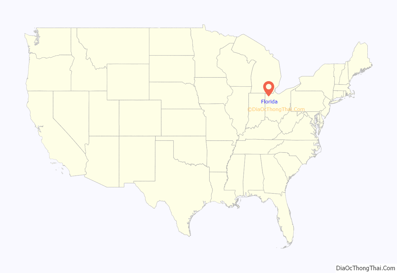
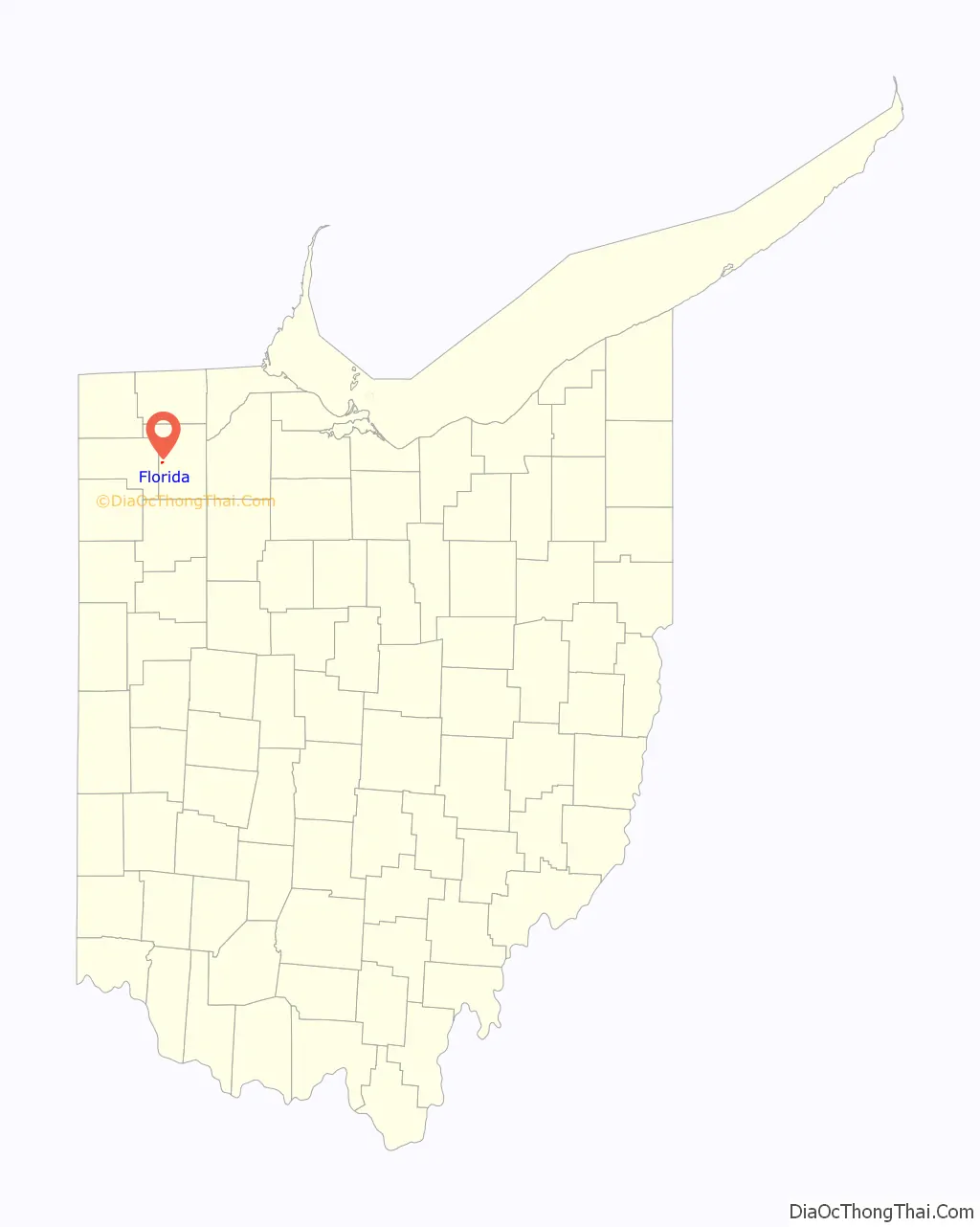
Florida location map. Where is Florida village?
History
Prior to European settlement Florida was the site of American Indian villages. The most notable village site was called Snake Town, established in 1792 and named after the Shawnee leader Snake (or Peteusha). Snake Town was located along the Maumee River and was at one time home to famous American historical figures including Blue Jacket of the Shawnee, Simon Girty, James Girty, and captive Oliver M. Spencer. A trading post operated by Jame Girty was located on the northern bank of the Maumee River across from Girty’s Island. Florida officially began in the 1843 when the Miami and Erie Canal was extended to that point connecting it to Independence and Defiance. During the canal era and pre Civil War Florida became a stop on the Underground Railroad. The Newell House which still stands today was a known stop where runaway African American slaves hid in the jail cell in the old Newell Home. From the Newell House African Americans made their way to Ridgeville Corners or Maumee, Ohio. The village was named after the state of Florida. A post office was established at Florida in 1843, and remained in operation until 1919.
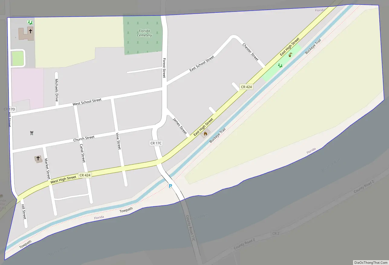
Florida Road Map
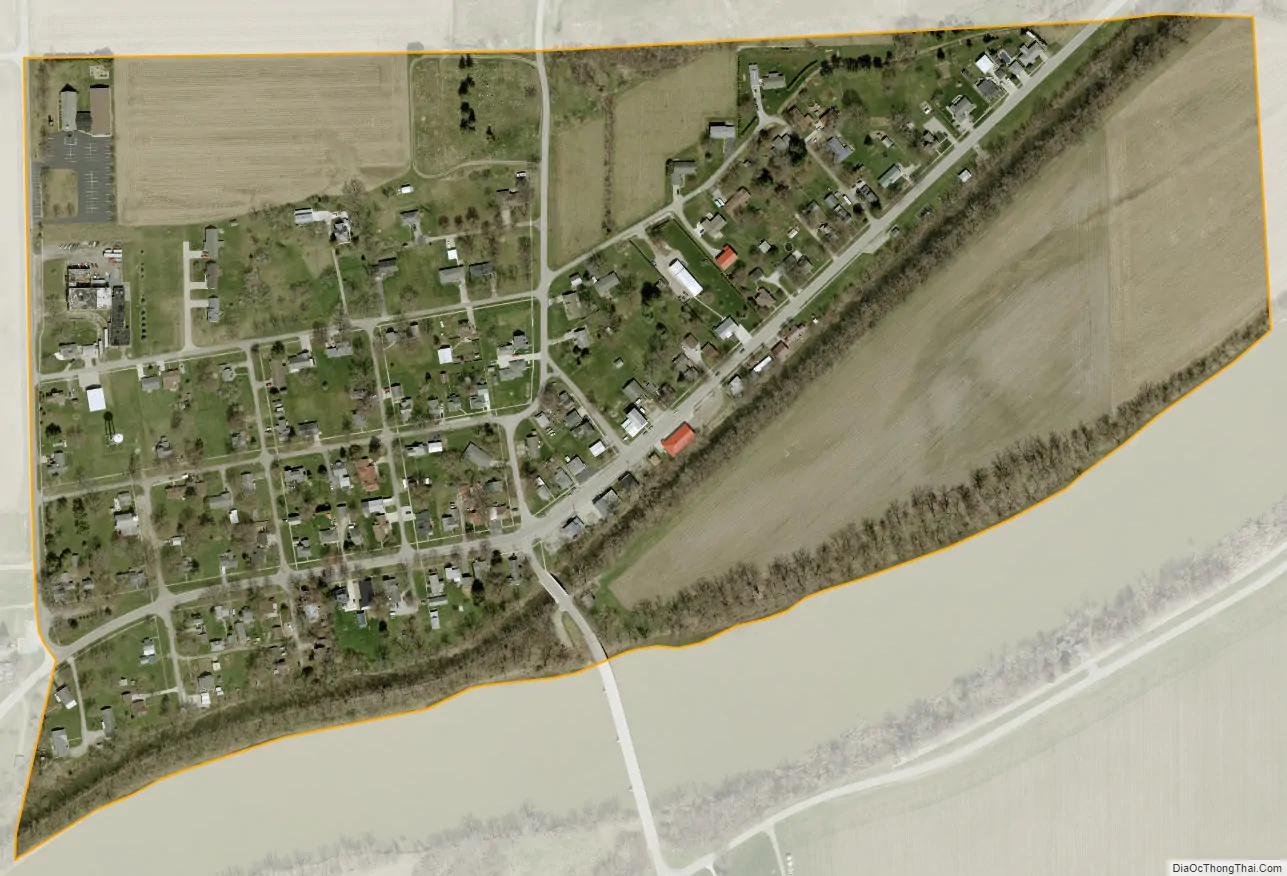
Florida city Satellite Map
Geography
Florida is located at 41°19′22″N 84°12′6″W / 41.32278°N 84.20167°W / 41.32278; -84.20167 (41.322751, -84.201653).
According to the United States Census Bureau, the village has a total area of 0.23 square miles (0.60 km), all land.
See also
Map of Ohio State and its subdivision:- Adams
- Allen
- Ashland
- Ashtabula
- Athens
- Auglaize
- Belmont
- Brown
- Butler
- Carroll
- Champaign
- Clark
- Clermont
- Clinton
- Columbiana
- Coshocton
- Crawford
- Cuyahoga
- Darke
- Defiance
- Delaware
- Erie
- Fairfield
- Fayette
- Franklin
- Fulton
- Gallia
- Geauga
- Greene
- Guernsey
- Hamilton
- Hancock
- Hardin
- Harrison
- Henry
- Highland
- Hocking
- Holmes
- Huron
- Jackson
- Jefferson
- Knox
- Lake
- Lake Erie
- Lawrence
- Licking
- Logan
- Lorain
- Lucas
- Madison
- Mahoning
- Marion
- Medina
- Meigs
- Mercer
- Miami
- Monroe
- Montgomery
- Morgan
- Morrow
- Muskingum
- Noble
- Ottawa
- Paulding
- Perry
- Pickaway
- Pike
- Portage
- Preble
- Putnam
- Richland
- Ross
- Sandusky
- Scioto
- Seneca
- Shelby
- Stark
- Summit
- Trumbull
- Tuscarawas
- Union
- Van Wert
- Vinton
- Warren
- Washington
- Wayne
- Williams
- Wood
- Wyandot
- Alabama
- Alaska
- Arizona
- Arkansas
- California
- Colorado
- Connecticut
- Delaware
- District of Columbia
- Florida
- Georgia
- Hawaii
- Idaho
- Illinois
- Indiana
- Iowa
- Kansas
- Kentucky
- Louisiana
- Maine
- Maryland
- Massachusetts
- Michigan
- Minnesota
- Mississippi
- Missouri
- Montana
- Nebraska
- Nevada
- New Hampshire
- New Jersey
- New Mexico
- New York
- North Carolina
- North Dakota
- Ohio
- Oklahoma
- Oregon
- Pennsylvania
- Rhode Island
- South Carolina
- South Dakota
- Tennessee
- Texas
- Utah
- Vermont
- Virginia
- Washington
- West Virginia
- Wisconsin
- Wyoming