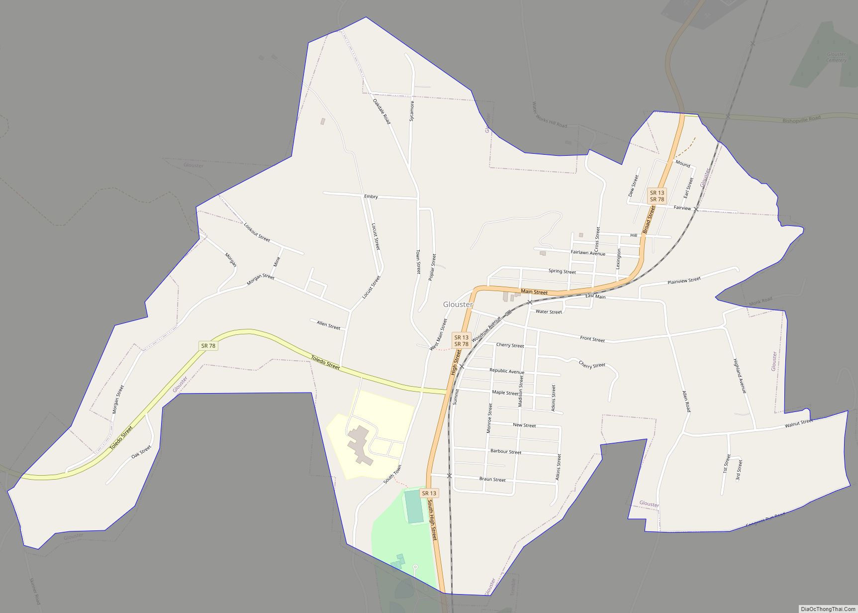
Glouster is a village in Trimble Township, Athens County, Ohio, United States. The population was 1,659 at the 2020 census. It is close to Burr Oak State Park.
| Name: | Glouster village |
|---|---|
| LSAD Code: | 47 |
| LSAD Description: | village (suffix) |
| State: | Ohio |
| County: | Athens County |
| Elevation: | 679 ft (207 m) |
| Total Area: | 1.32 sq mi (3.43 km²) |
| Land Area: | 1.31 sq mi (3.39 km²) |
| Water Area: | 0.01 sq mi (0.04 km²) |
| Total Population: | 1,659 |
| Population Density: | 1,267.38/sq mi (489.21/km²) |
| ZIP code: | 45732 |
| Area code: | 740 |
| FIPS code: | 3930674 |
| GNISfeature ID: | 1075930 |
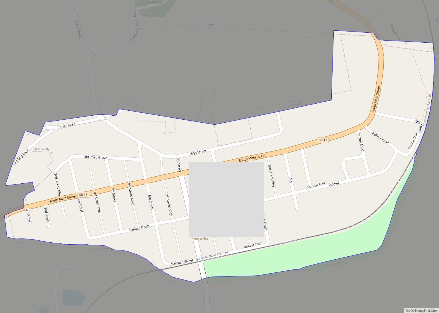
Online Interactive Map
Click on ![]() to view map in "full screen" mode.
to view map in "full screen" mode.
Glouster location map. Where is Glouster village?


History
Formerly called Sedalia, the present name of Glouster, after Gloucester, England, was adopted in 1886. A post office called Glouster has been in operation since 1887.
Glouster Road Map

Glouster city Satellite Map

Geography
Glouster is located at 39°30′9″N 82°4′56″W / 39.50250°N 82.08222°W / 39.50250; -82.08222 (39.502586, -82.082203), along Sunday Creek. The village is located entirely within the Sunday Creek watershed, mostly on riparian plains or old stream terraces.
According to the United States Census Bureau, the village has a total area of 1.34 square miles (3.47 km), of which 1.33 square miles (3.44 km) is land and 0.01 square miles (0.03 km) is water.
The surrounding area consists of gently rolling hills and large wooded areas, all within the unglaciated Allegheny Plateau. Nearby public and semi-public areas include the Trimble State Wildlife Area, the Sunday Creek State Wildlife Area, the Trimble Community Forest, the Wayne National Forest, and Burr Oak State Park.
Glouster Community Park is located along the west side of Ohio State Route 13, between the highway and Sunday Creek, on the south end of the village.
See also
Map of Ohio State and its subdivision:- Adams
- Allen
- Ashland
- Ashtabula
- Athens
- Auglaize
- Belmont
- Brown
- Butler
- Carroll
- Champaign
- Clark
- Clermont
- Clinton
- Columbiana
- Coshocton
- Crawford
- Cuyahoga
- Darke
- Defiance
- Delaware
- Erie
- Fairfield
- Fayette
- Franklin
- Fulton
- Gallia
- Geauga
- Greene
- Guernsey
- Hamilton
- Hancock
- Hardin
- Harrison
- Henry
- Highland
- Hocking
- Holmes
- Huron
- Jackson
- Jefferson
- Knox
- Lake
- Lake Erie
- Lawrence
- Licking
- Logan
- Lorain
- Lucas
- Madison
- Mahoning
- Marion
- Medina
- Meigs
- Mercer
- Miami
- Monroe
- Montgomery
- Morgan
- Morrow
- Muskingum
- Noble
- Ottawa
- Paulding
- Perry
- Pickaway
- Pike
- Portage
- Preble
- Putnam
- Richland
- Ross
- Sandusky
- Scioto
- Seneca
- Shelby
- Stark
- Summit
- Trumbull
- Tuscarawas
- Union
- Van Wert
- Vinton
- Warren
- Washington
- Wayne
- Williams
- Wood
- Wyandot
- Alabama
- Alaska
- Arizona
- Arkansas
- California
- Colorado
- Connecticut
- Delaware
- District of Columbia
- Florida
- Georgia
- Hawaii
- Idaho
- Illinois
- Indiana
- Iowa
- Kansas
- Kentucky
- Louisiana
- Maine
- Maryland
- Massachusetts
- Michigan
- Minnesota
- Mississippi
- Missouri
- Montana
- Nebraska
- Nevada
- New Hampshire
- New Jersey
- New Mexico
- New York
- North Carolina
- North Dakota
- Ohio
- Oklahoma
- Oregon
- Pennsylvania
- Rhode Island
- South Carolina
- South Dakota
- Tennessee
- Texas
- Utah
- Vermont
- Virginia
- Washington
- West Virginia
- Wisconsin
- Wyoming