Greenwich is a village in Huron County, Ohio, United States. The population was 1,476 at the 2010 census. It is served by a branch of the Willard Memorial Library.
| Name: | Greenwich village |
|---|---|
| LSAD Code: | 47 |
| LSAD Description: | village (suffix) |
| State: | Ohio |
| County: | Huron County |
| Elevation: | 1,030 ft (314 m) |
| Total Area: | 1.56 sq mi (4.03 km²) |
| Land Area: | 1.52 sq mi (3.93 km²) |
| Water Area: | 0.04 sq mi (0.10 km²) |
| Total Population: | 1,409 |
| Population Density: | 928.81/sq mi (358.52/km²) |
| ZIP code: | 44837 |
| Area code: | 419 |
| FIPS code: | 3932368 |
| GNISfeature ID: | 1064763 |
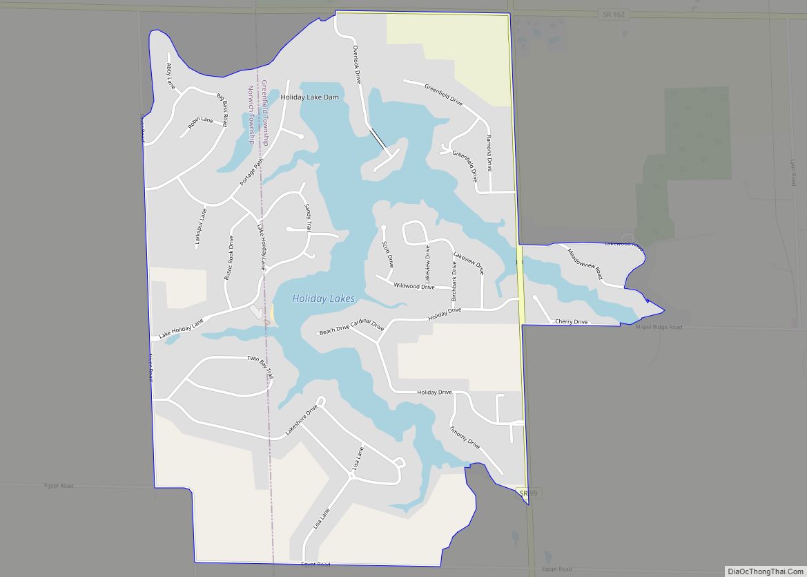
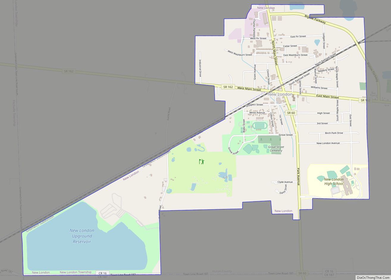
Online Interactive Map
Click on ![]() to view map in "full screen" mode.
to view map in "full screen" mode.
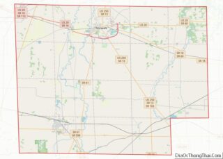
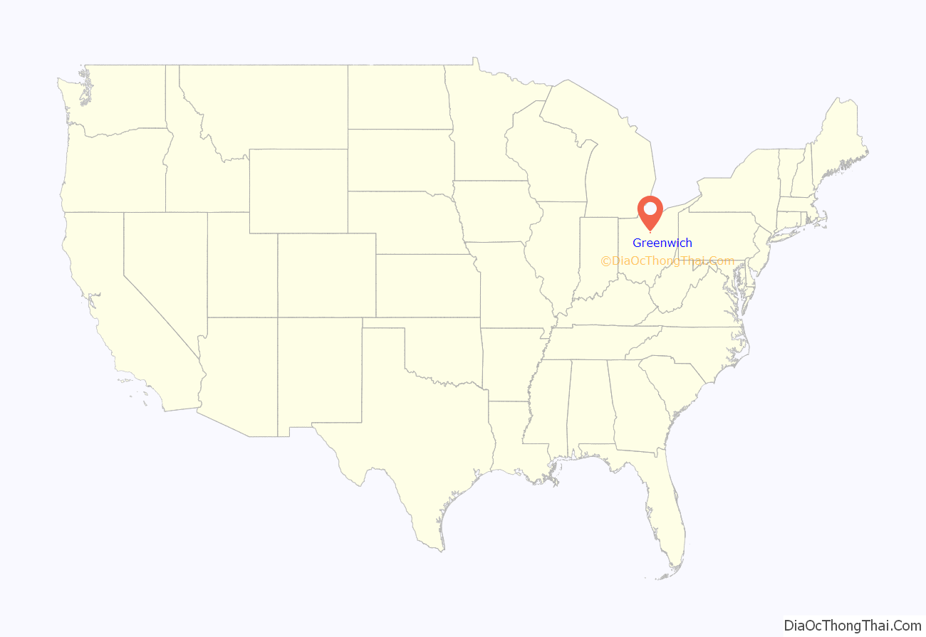
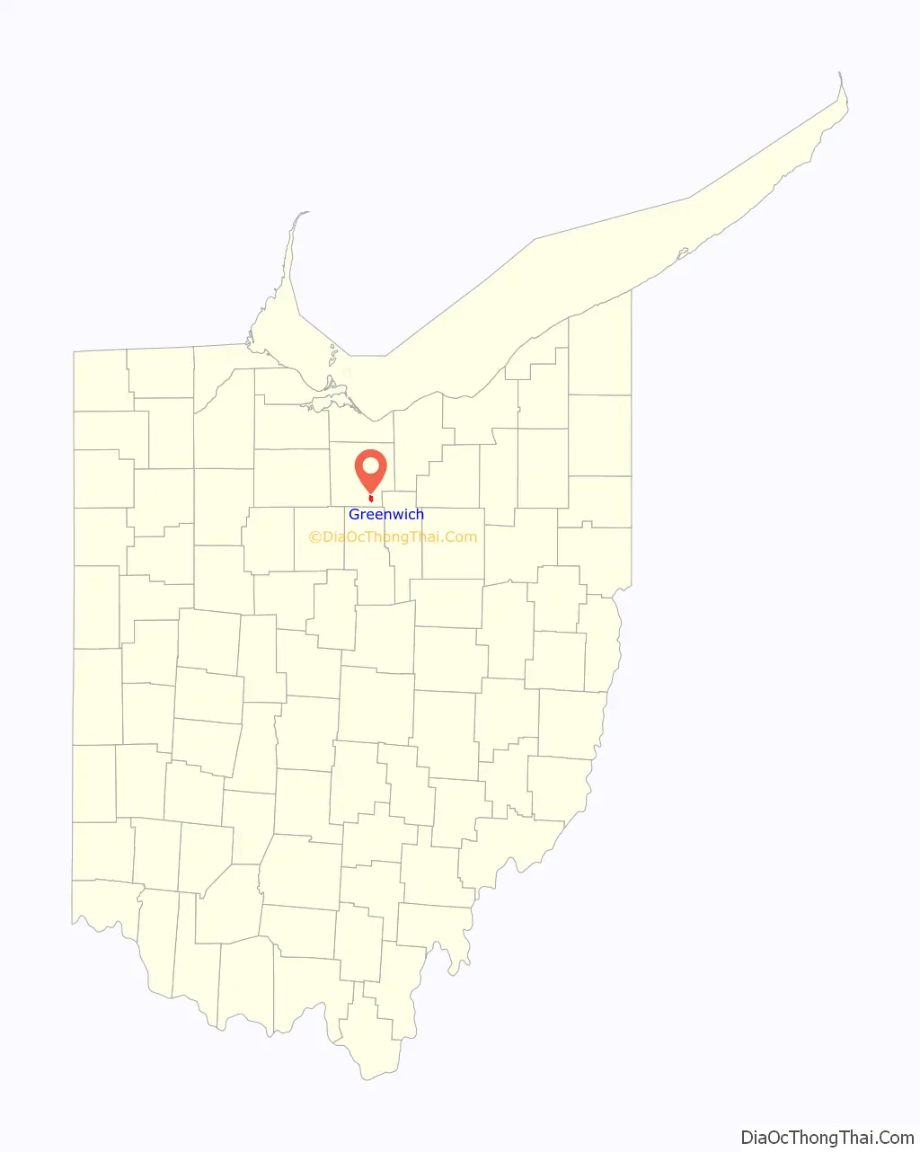
Greenwich location map. Where is Greenwich village?
History
A post office called Greenwich was established in 1828 and the municipality was incorporated as a village in 1879. The village name comes from Greenwich Township, which is named after the town of Greenwich, Connecticut.
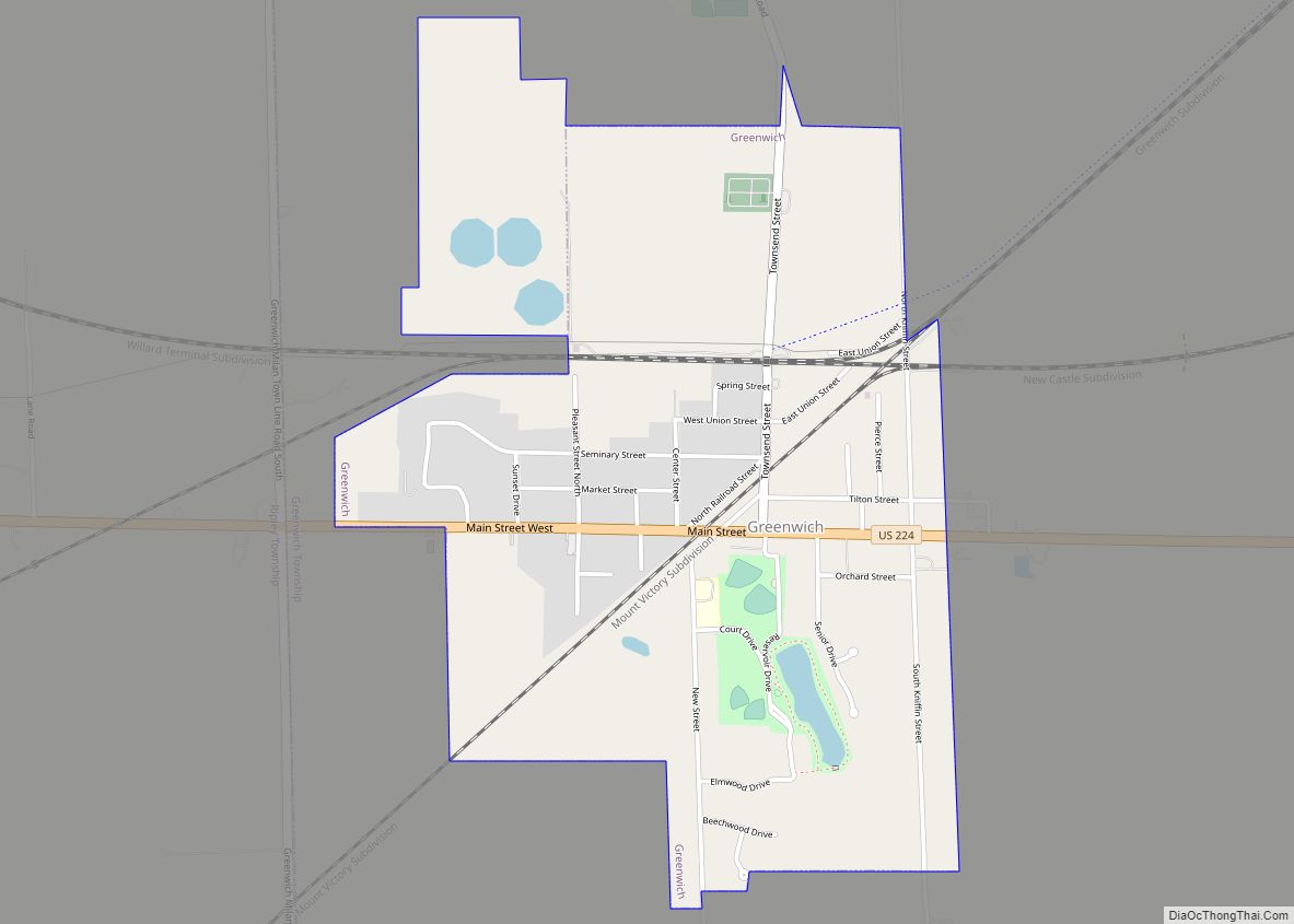
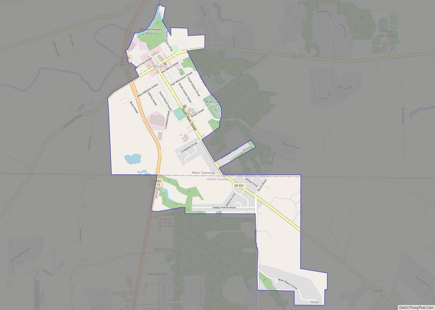
Greenwich Road Map
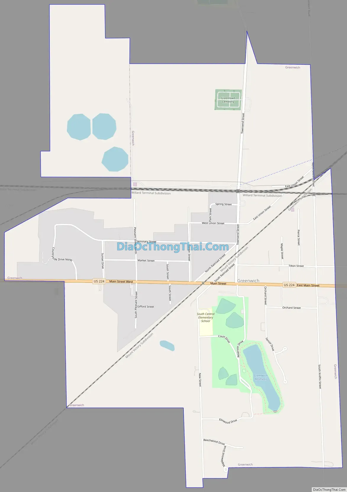
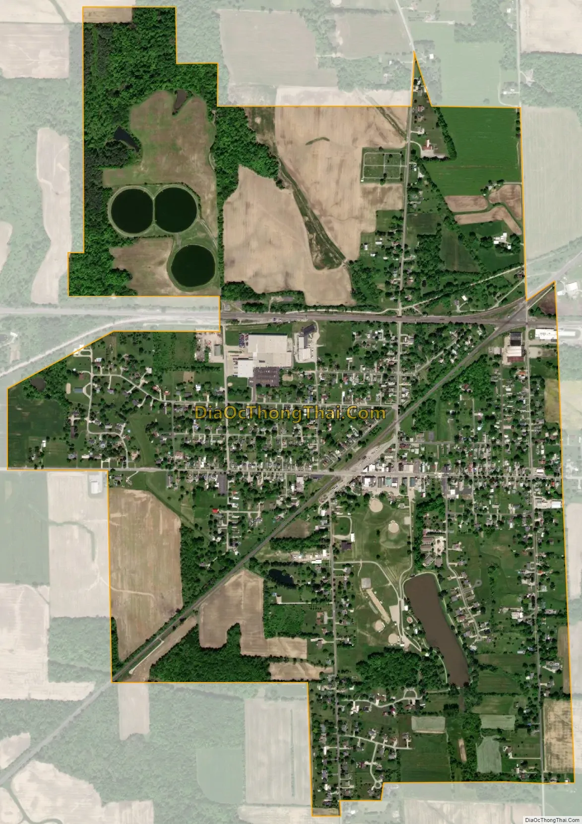
Greenwich city Satellite Map
Geography
Greenwich is located at 41°1′51″N 82°31′2″W / 41.03083°N 82.51722°W / 41.03083; -82.51722 (41.030877, -82.517181).
According to the United States Census Bureau, the village has a total area of 1.37 square miles (3.55 km), of which 1.35 square miles (3.50 km) is land and 0.02 square miles (0.05 km) is water.
See also
Map of Ohio State and its subdivision:- Adams
- Allen
- Ashland
- Ashtabula
- Athens
- Auglaize
- Belmont
- Brown
- Butler
- Carroll
- Champaign
- Clark
- Clermont
- Clinton
- Columbiana
- Coshocton
- Crawford
- Cuyahoga
- Darke
- Defiance
- Delaware
- Erie
- Fairfield
- Fayette
- Franklin
- Fulton
- Gallia
- Geauga
- Greene
- Guernsey
- Hamilton
- Hancock
- Hardin
- Harrison
- Henry
- Highland
- Hocking
- Holmes
- Huron
- Jackson
- Jefferson
- Knox
- Lake
- Lake Erie
- Lawrence
- Licking
- Logan
- Lorain
- Lucas
- Madison
- Mahoning
- Marion
- Medina
- Meigs
- Mercer
- Miami
- Monroe
- Montgomery
- Morgan
- Morrow
- Muskingum
- Noble
- Ottawa
- Paulding
- Perry
- Pickaway
- Pike
- Portage
- Preble
- Putnam
- Richland
- Ross
- Sandusky
- Scioto
- Seneca
- Shelby
- Stark
- Summit
- Trumbull
- Tuscarawas
- Union
- Van Wert
- Vinton
- Warren
- Washington
- Wayne
- Williams
- Wood
- Wyandot
- Alabama
- Alaska
- Arizona
- Arkansas
- California
- Colorado
- Connecticut
- Delaware
- District of Columbia
- Florida
- Georgia
- Hawaii
- Idaho
- Illinois
- Indiana
- Iowa
- Kansas
- Kentucky
- Louisiana
- Maine
- Maryland
- Massachusetts
- Michigan
- Minnesota
- Mississippi
- Missouri
- Montana
- Nebraska
- Nevada
- New Hampshire
- New Jersey
- New Mexico
- New York
- North Carolina
- North Dakota
- Ohio
- Oklahoma
- Oregon
- Pennsylvania
- Rhode Island
- South Carolina
- South Dakota
- Tennessee
- Texas
- Utah
- Vermont
- Virginia
- Washington
- West Virginia
- Wisconsin
- Wyoming