Harrisville is a village in Harrison County, Ohio, United States. The population was 179 at the 2020 census.
| Name: | Harrisville village |
|---|---|
| LSAD Code: | 47 |
| LSAD Description: | village (suffix) |
| State: | Ohio |
| County: | Harrison County |
| Elevation: | 1,250 ft (381 m) |
| Total Area: | 0.15 sq mi (0.39 km²) |
| Land Area: | 0.15 sq mi (0.39 km²) |
| Water Area: | 0.00 sq mi (0.00 km²) |
| Total Population: | 179 |
| Population Density: | 1,177.63/sq mi (455.12/km²) |
| ZIP code: | 43974 |
| Area code: | 740 |
| FIPS code: | 3934090 |
| GNISfeature ID: | 1048821 |
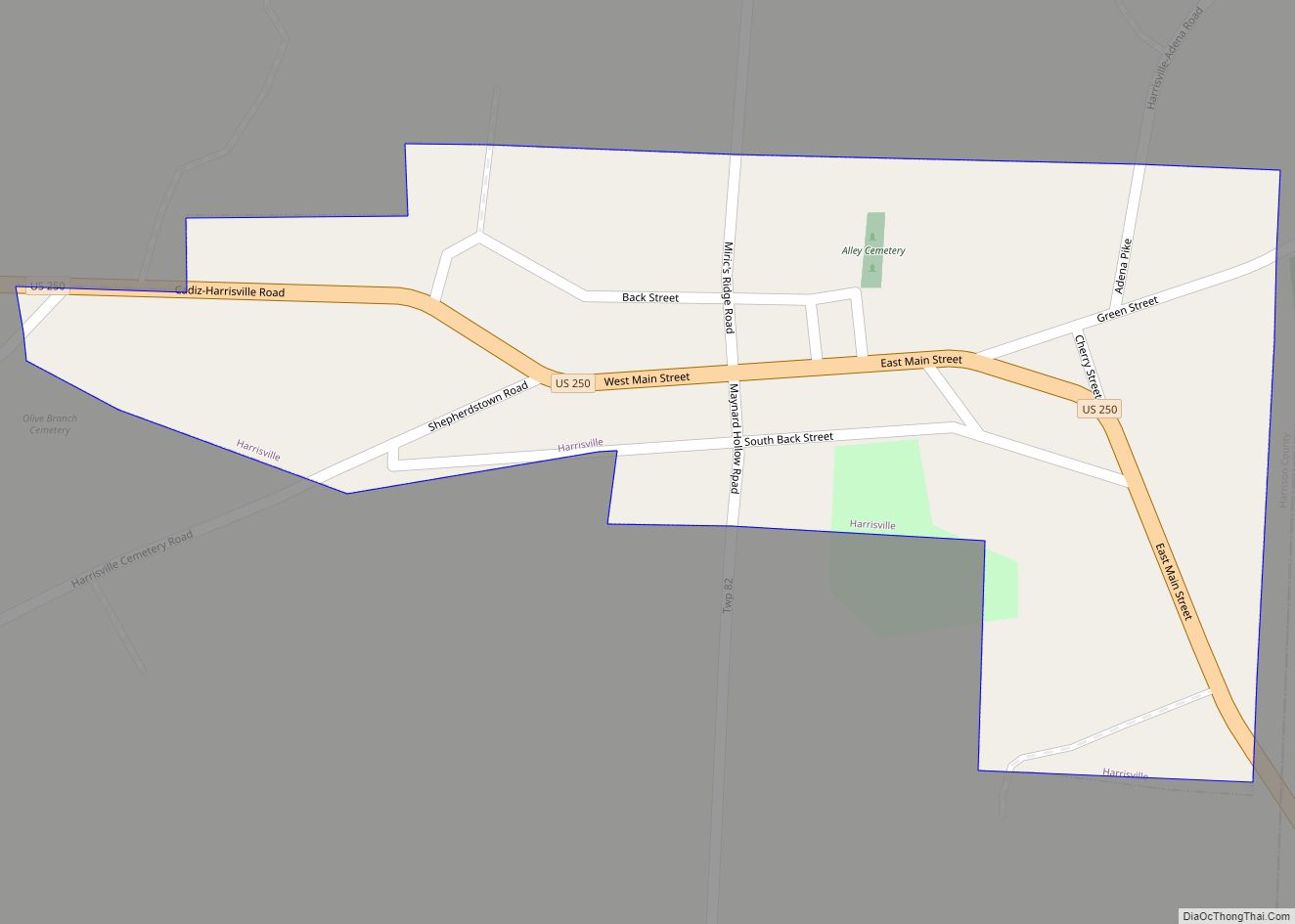
Online Interactive Map
Click on ![]() to view map in "full screen" mode.
to view map in "full screen" mode.
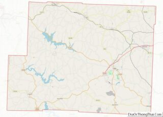
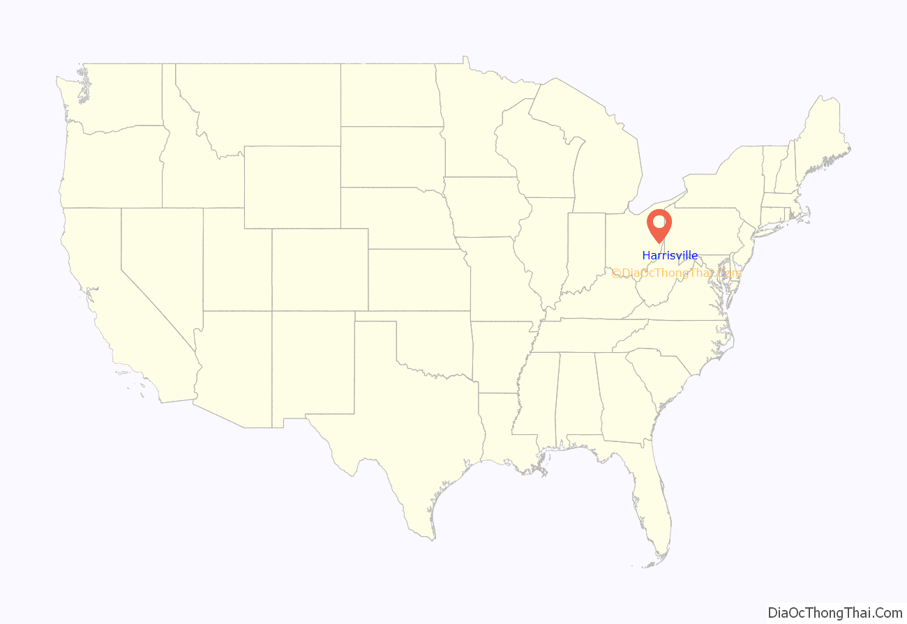
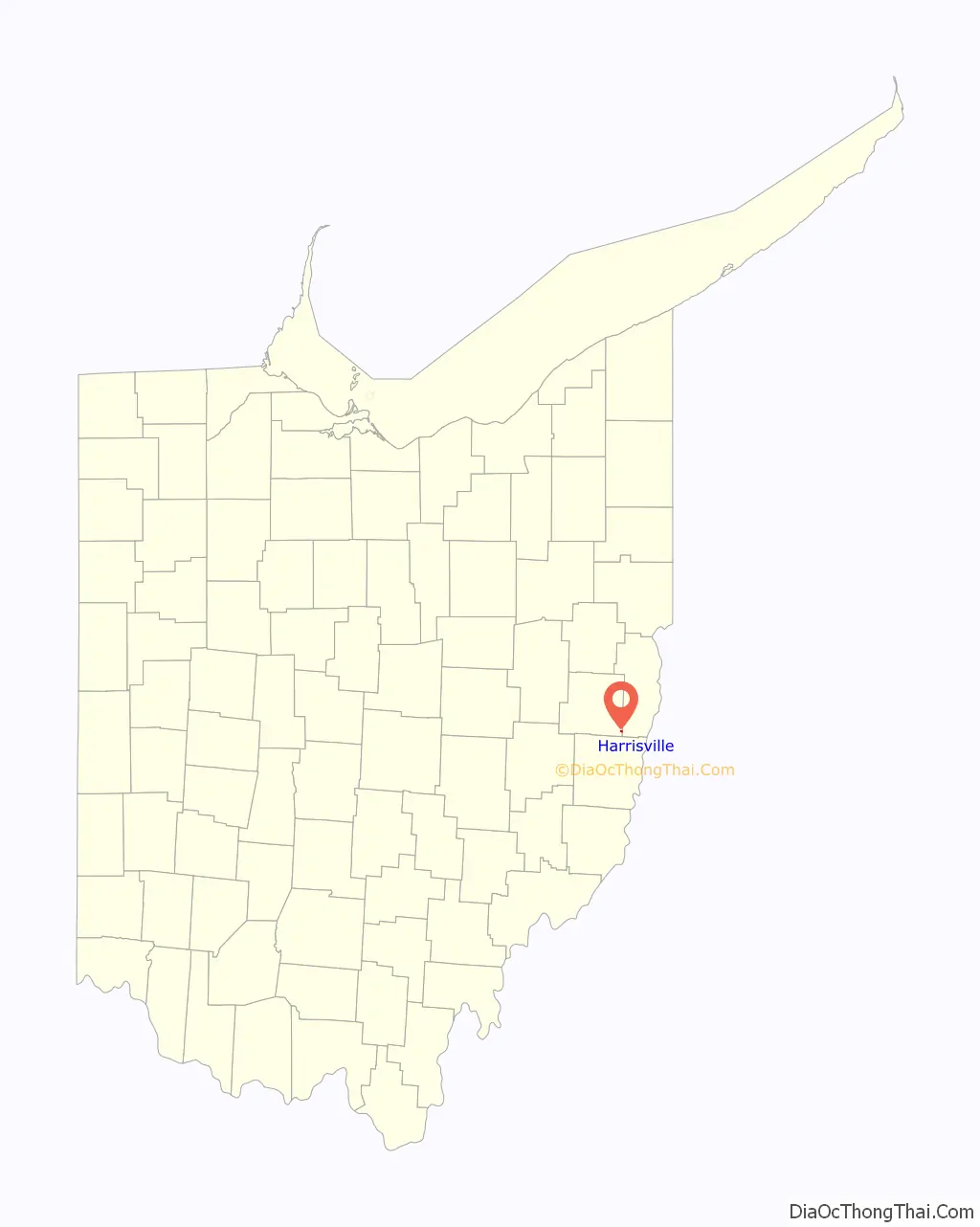
Harrisville location map. Where is Harrisville village?
History
Harrisville was platted by John Wells, Thomas Gray, Store Hutchinson, and Robert Dutton on October 19, 1814. The plat was filed on January 9, 1815 with John Wells as proprietor. In 1834, local women made one of the first known demands for women’s suffrage. A petition signed by thirty-five women called on Congress to abolish slavery in the District of Columbia, and for “immediate enfranchisement of every human being that shall tread this soil.”
During Morgan’s Raid, a Union victory in the Civil War in 1863, Confederate Brig. Gen. John Hunt Morgan traveled through the Moorefield, Harrisville, New Athens, Smithfield, New Alexandria, Wintersville, Two Ridge, Richmond, East Springfield, Bergholz, and Monroeville on his way to defeat at the Battle of Salineville.
Harrisville Road Map
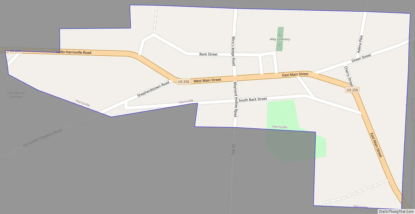
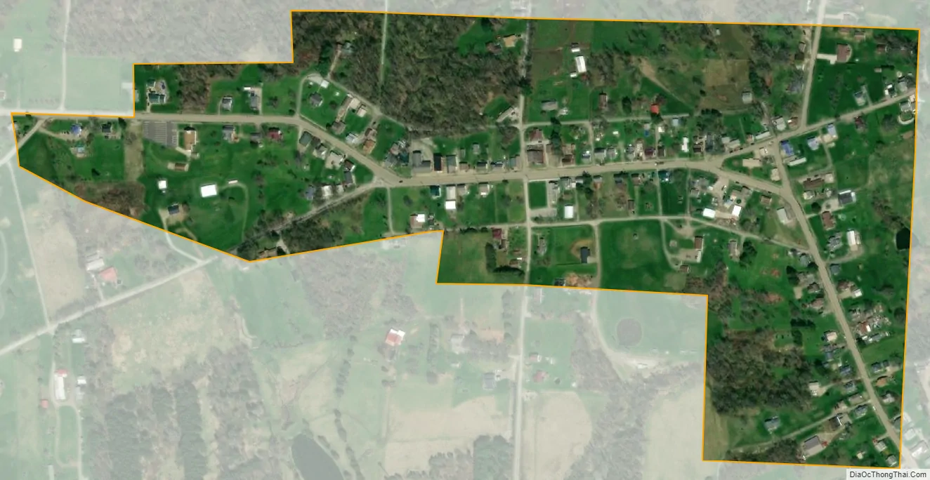
Harrisville city Satellite Map
Geography
Harrisville is located at 40°10′55″N 80°53′13″W / 40.18194°N 80.88694°W / 40.18194; -80.88694 (40.181820, -80.886956).
According to the United States Census Bureau, the village has a total area of 0.15 square miles (0.39 km), all land.
See also
Map of Ohio State and its subdivision:- Adams
- Allen
- Ashland
- Ashtabula
- Athens
- Auglaize
- Belmont
- Brown
- Butler
- Carroll
- Champaign
- Clark
- Clermont
- Clinton
- Columbiana
- Coshocton
- Crawford
- Cuyahoga
- Darke
- Defiance
- Delaware
- Erie
- Fairfield
- Fayette
- Franklin
- Fulton
- Gallia
- Geauga
- Greene
- Guernsey
- Hamilton
- Hancock
- Hardin
- Harrison
- Henry
- Highland
- Hocking
- Holmes
- Huron
- Jackson
- Jefferson
- Knox
- Lake
- Lake Erie
- Lawrence
- Licking
- Logan
- Lorain
- Lucas
- Madison
- Mahoning
- Marion
- Medina
- Meigs
- Mercer
- Miami
- Monroe
- Montgomery
- Morgan
- Morrow
- Muskingum
- Noble
- Ottawa
- Paulding
- Perry
- Pickaway
- Pike
- Portage
- Preble
- Putnam
- Richland
- Ross
- Sandusky
- Scioto
- Seneca
- Shelby
- Stark
- Summit
- Trumbull
- Tuscarawas
- Union
- Van Wert
- Vinton
- Warren
- Washington
- Wayne
- Williams
- Wood
- Wyandot
- Alabama
- Alaska
- Arizona
- Arkansas
- California
- Colorado
- Connecticut
- Delaware
- District of Columbia
- Florida
- Georgia
- Hawaii
- Idaho
- Illinois
- Indiana
- Iowa
- Kansas
- Kentucky
- Louisiana
- Maine
- Maryland
- Massachusetts
- Michigan
- Minnesota
- Mississippi
- Missouri
- Montana
- Nebraska
- Nevada
- New Hampshire
- New Jersey
- New Mexico
- New York
- North Carolina
- North Dakota
- Ohio
- Oklahoma
- Oregon
- Pennsylvania
- Rhode Island
- South Carolina
- South Dakota
- Tennessee
- Texas
- Utah
- Vermont
- Virginia
- Washington
- West Virginia
- Wisconsin
- Wyoming