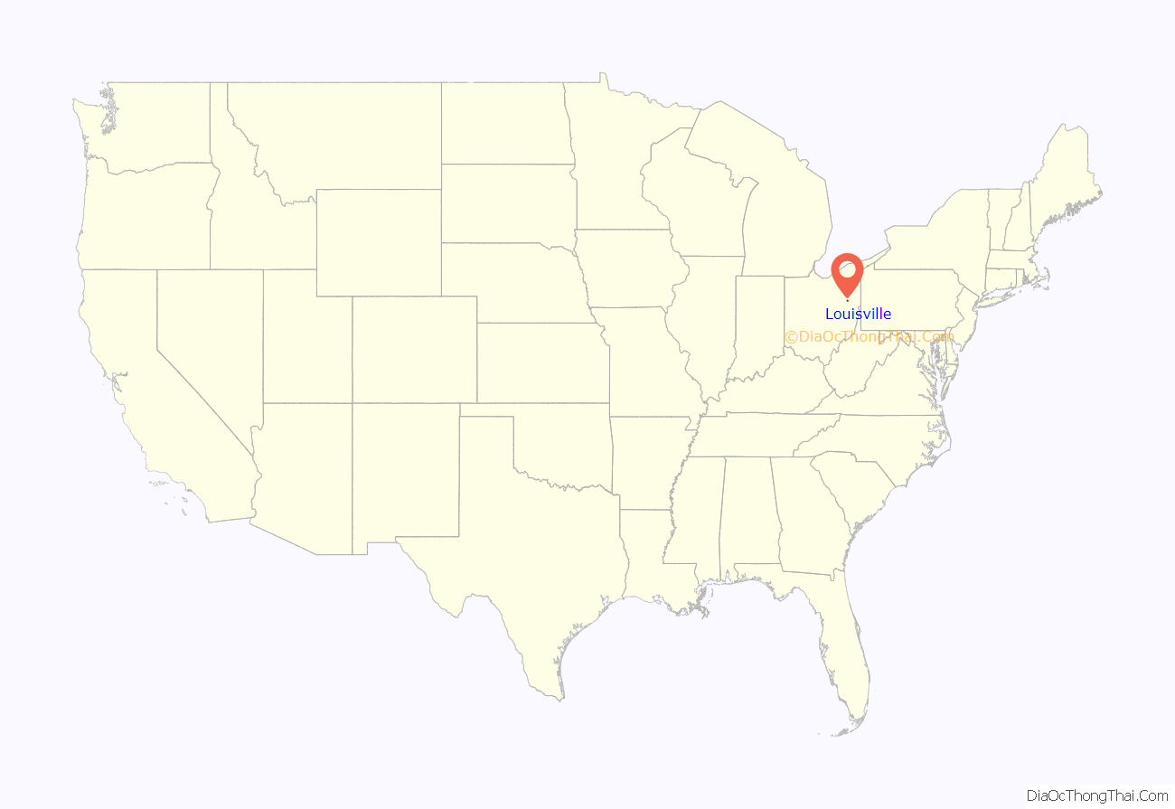
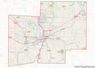
Louisville (/ˈluːɪsvɪl/) is a city in Stark County, Ohio, United States. The population was 9,521 at the time of the 2020 census. Located 7 miles (11 km) northeast of Canton, it is a suburb of the Canton–Massillon metropolitan area.
| Name: | Louisville city |
|---|---|
| LSAD Code: | 25 |
| LSAD Description: | city (suffix) |
| State: | Ohio |
| County: | Stark County |
| Elevation: | 1,142 ft (348 m) |
| Total Area: | 5.70 sq mi (14.76 km²) |
| Land Area: | 5.70 sq mi (14.76 km²) |
| Water Area: | 0.00 sq mi (0.00 km²) |
| Total Population: | 9,521 |
| Population Density: | 1,670.35/sq mi (644.90/km²) |
| ZIP code: | 44641 |
| Area code: | 330 |
| FIPS code: | 3945094 |
| GNISfeature ID: | 1061447 |
| Website: | http://www.louisvilleohio.com/ |
Online Interactive Map
Click on ![]() to view map in "full screen" mode.
to view map in "full screen" mode.
Louisville location map. Where is Louisville city?
History
On October 8, 1834, Louisville was formally settled by Henry Lautzenheiser, from Germany, and Henry Fainot, a French Huguenot. The city was named after Lautzenheiser’s son, Lewis, and called Lewisville, Ohio. The name of the town was also considered appropriate because it was initially surveyed by the similar-sounding name of Lewis Vail. When the post office was established in 1837, with Sam Petree as its first postmaster, it was discovered Ohio already had a Lewisville, so the spelling was changed to Louisville.
Within Louisville’s early days, the town competed with the fellow Nimishillen Township community of Harrisburg (also known as Barryville) for growth. Harrisburg initially flourished due to its accessibility as a stagecoach stop between Canton, Alliance, Cleveland, and Pittsburgh. Meanwhile, Louisville also grew, due to its location upon the east branch of the Nimishillen Creek, which flows toward Canton. However, when the Pittsburgh, Fort Wayne and Chicago Railway was laid through Louisville in 1852, Louisville began to grow more quickly than Harrisburg, which struggled with the difficulty of hauling its main product, wheat, by barge. Today, Harrisburg is now an unincorporated community, marked only by a handful of businesses and a Roman Catholic parish.
On April 1, 1872, Louisville was officially incorporated as a village, with George Violand elected as Louisville’s first mayor. By the late 19th Century, Louisville contained many quickly growing businesses, including: a plow manufacturing company, a wooden mill, a brewery, a basket factory, flour mills, tanneries, a brick yard, two hotels, a shoe factory, and a number of taverns/saloons (Louisville had twenty saloons at one point, giving the town a rather notorious reputation). Two of these businesses, Star Mill and the Town Tavern, remain open to this day. Furthermore, many of the buildings constructed within Louisville during this time period are listed upon the National Register of Historic Places. Such locations include Saint Louis Catholic Church, which was completed in 1870 and dedicated in 1878, and the city’s historic downtown district, roughly bordered by Chapel Street, Lincoln Court, St. Louis Court, Nickelplate Street, East Gorgas Street, and Center Court. The city’s current weekly newspaper, The Louisville Herald, was first published in 1887. For a brief time, the town also had a Roman Catholic college, established by the Reverend Louis Hoffer, located across the street from St. Louis Church. Called Saint Louis College, it opened in 1866 under the operation of the Diocese of Cleveland. The Congregation of St. Basil of Toronto assumed control of the college the following year, and Saint Louis College closed in 1873, due to lack of funds and transportation difficulties for the students. After briefly serving as an all-girls academy and a school for deaf mutes, The building became an orphanage under the guidance of the Vincentian Sisters of Charity. The Saint Louis Orphan Asylum closed in 1925, and became a hospice for the elderly, named St. Joseph’s, in 1927. The old red brick building was razed in 1975, as St. Joseph’s moved across the street from St. Thomas Aquinas High School. A McDonald’s is now located upon the site.
The early 1880s saw the arrival of telephone toll lines to Louisville. Louisville’s first public street lights, twelve oil burners, were lit downtown for Christmas 1884. In 1894, a public water system was established for Louisville, and a sewage system installation followed in 1910. The town’s Main Street became Louisville’s first fully paved road in 1914. In 1960, Louisville’s residents voted for the village to become a city.
Constitution Town
Louisville is also known as the “Constitution Town” because a resident of Louisville, Olga T. Weber, petitioned for the establishment of Constitution Day for the United States in 1952. Her lobbying led the Ohio General Assembly to proclaim September 17 as a statewide “Constitution Day,” under a law signed by then-governor Frank J. Lausche. The following year, Weber urged the United States Senate to declare the week of September 17–23 as “Constitution Week”. Her request was approved by both the Senate and the United States House of Representatives, and signed into law by President Dwight D. Eisenhower. On April 15, 1957, Louisville’s City Council officially declared itself “The Constitution Town.” The city continues to hold a “Constitution Week” celebration annually during the week of September 17.
Louisville Road Map
Louisville city Satellite Map
Geography
The east branch of Nimishillen Creek flows through the city.
According to the United States Census Bureau, the city has a total area of 5.49 square miles (14.22 km), all land.
See also
Map of Ohio State and its subdivision:- Adams
- Allen
- Ashland
- Ashtabula
- Athens
- Auglaize
- Belmont
- Brown
- Butler
- Carroll
- Champaign
- Clark
- Clermont
- Clinton
- Columbiana
- Coshocton
- Crawford
- Cuyahoga
- Darke
- Defiance
- Delaware
- Erie
- Fairfield
- Fayette
- Franklin
- Fulton
- Gallia
- Geauga
- Greene
- Guernsey
- Hamilton
- Hancock
- Hardin
- Harrison
- Henry
- Highland
- Hocking
- Holmes
- Huron
- Jackson
- Jefferson
- Knox
- Lake
- Lake Erie
- Lawrence
- Licking
- Logan
- Lorain
- Lucas
- Madison
- Mahoning
- Marion
- Medina
- Meigs
- Mercer
- Miami
- Monroe
- Montgomery
- Morgan
- Morrow
- Muskingum
- Noble
- Ottawa
- Paulding
- Perry
- Pickaway
- Pike
- Portage
- Preble
- Putnam
- Richland
- Ross
- Sandusky
- Scioto
- Seneca
- Shelby
- Stark
- Summit
- Trumbull
- Tuscarawas
- Union
- Van Wert
- Vinton
- Warren
- Washington
- Wayne
- Williams
- Wood
- Wyandot
- Alabama
- Alaska
- Arizona
- Arkansas
- California
- Colorado
- Connecticut
- Delaware
- District of Columbia
- Florida
- Georgia
- Hawaii
- Idaho
- Illinois
- Indiana
- Iowa
- Kansas
- Kentucky
- Louisiana
- Maine
- Maryland
- Massachusetts
- Michigan
- Minnesota
- Mississippi
- Missouri
- Montana
- Nebraska
- Nevada
- New Hampshire
- New Jersey
- New Mexico
- New York
- North Carolina
- North Dakota
- Ohio
- Oklahoma
- Oregon
- Pennsylvania
- Rhode Island
- South Carolina
- South Dakota
- Tennessee
- Texas
- Utah
- Vermont
- Virginia
- Washington
- West Virginia
- Wisconsin
- Wyoming
