Masury is an unincorporated community and census-designated place in eastern Trumbull County, Ohio, United States. The population was 2,001 at the 2020 census. It is part of the Youngstown–Warren metropolitan area.
| Name: | Masury CDP |
|---|---|
| LSAD Code: | 57 |
| LSAD Description: | CDP (suffix) |
| State: | Ohio |
| County: | Trumbull County |
| Elevation: | 919 ft (280 m) |
| Total Area: | 3.48 sq mi (9.01 km²) |
| Land Area: | 3.46 sq mi (8.97 km²) |
| Water Area: | 0.02 sq mi (0.05 km²) |
| Total Population: | 2,001 |
| Population Density: | 577.99/sq mi (223.15/km²) |
| ZIP code: | 44438 |
| Area code: | 234/330 |
| FIPS code: | 3948272 |
| GNISfeature ID: | 1048952 |
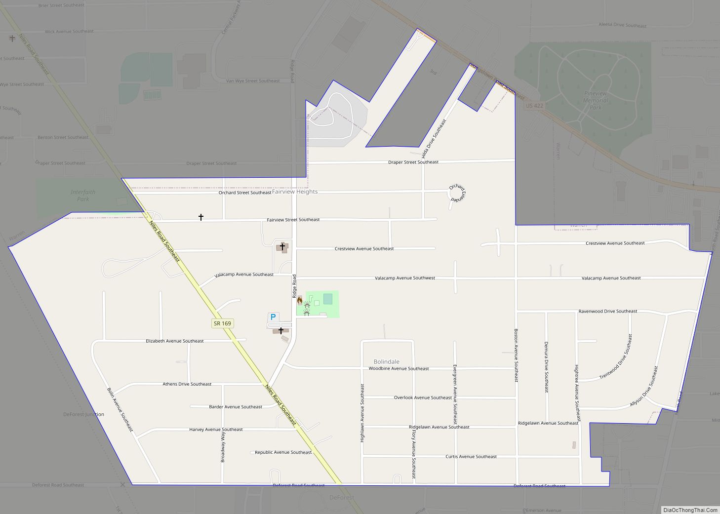
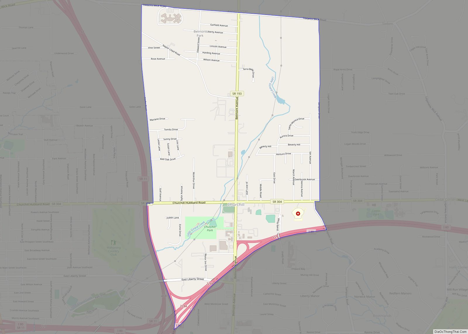
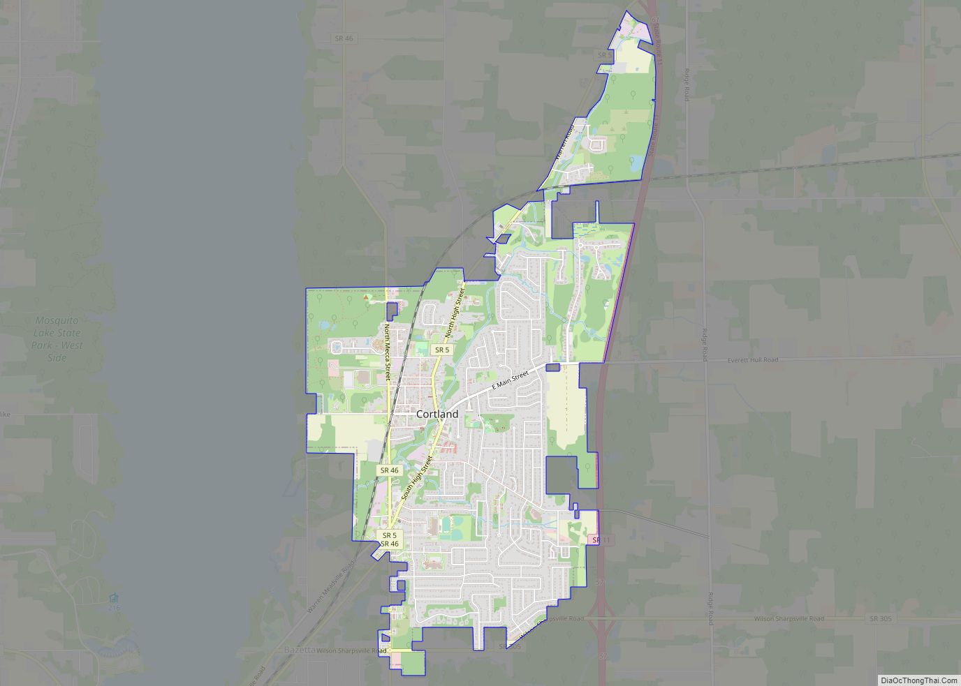
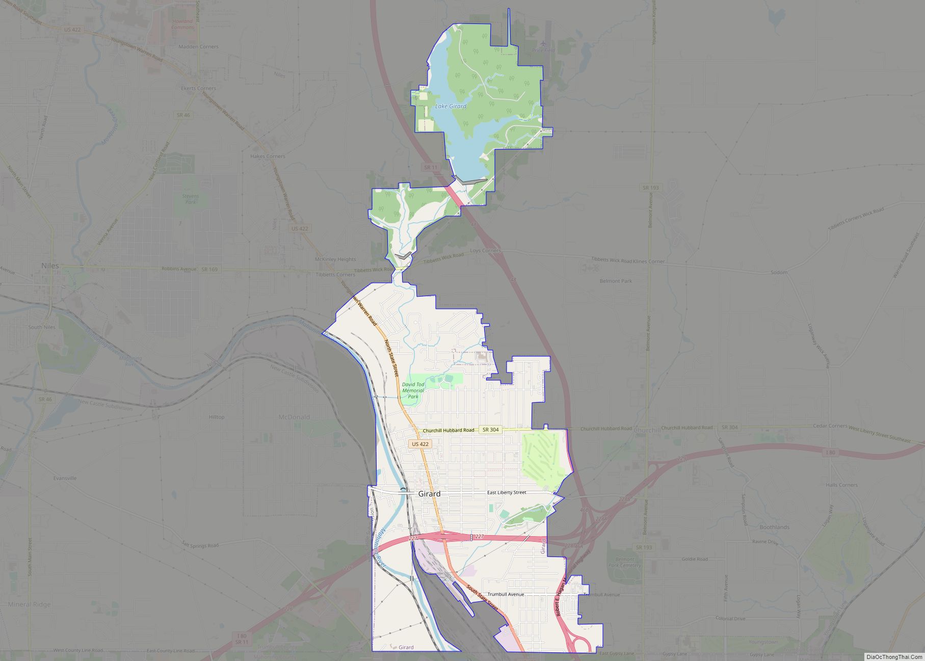
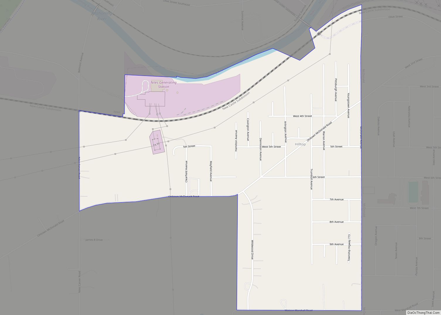
Online Interactive Map
Click on ![]() to view map in "full screen" mode.
to view map in "full screen" mode.
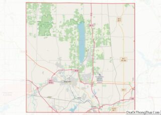
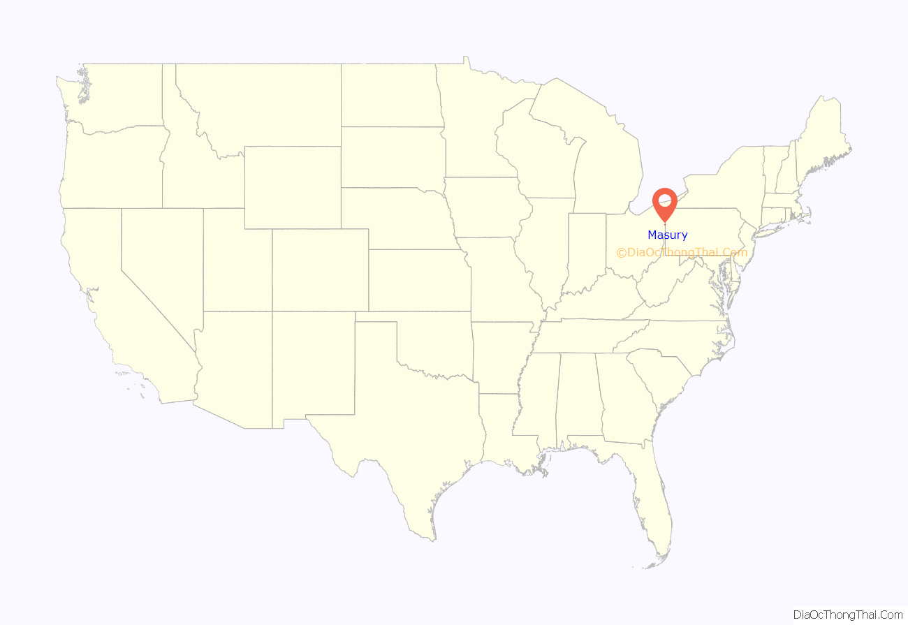
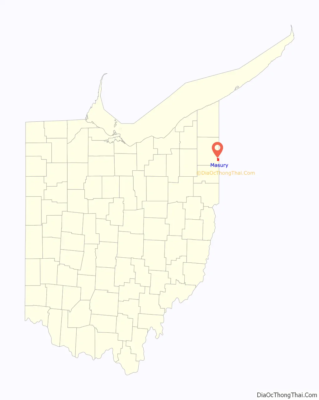
Masury location map. Where is Masury CDP?
History
The community has the name of Colonel Fred L. M. Masury, a first settler.
At 7:10 p.m. on May 31, 1985, Masury was struck by an F-5 tornado as it passed through Hubbard into Wheatland, Pennsylvania. One person died in Masury as a result of the tornado. The base of the tornado spread over half a mile and wind speed was estimated at over 300 mph. The storm moved through Masury quickly and went on to destroy nearly 95% of Wheatland’s industrial area.
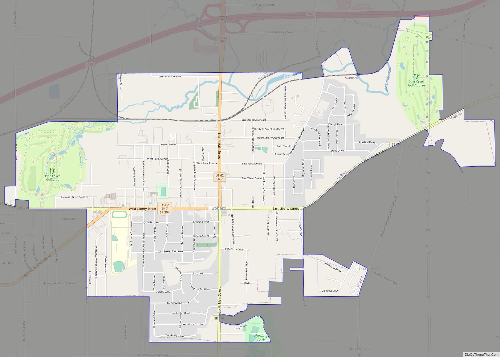
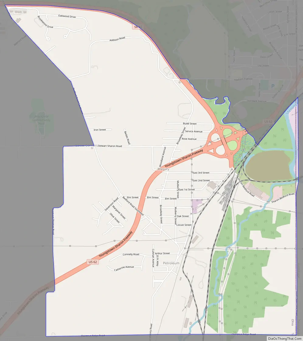
Masury Road Map
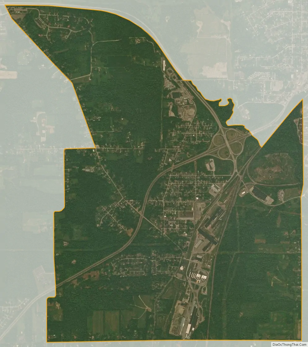
Masury city Satellite Map
Geography
Masury is located at 41°12′28″N 80°32′12″W / 41.20778°N 80.53667°W / 41.20778; -80.53667 (41.207736, -80.536628).
According to the United States Census Bureau, the CDP has a total area of 3.7 square miles (9.6 km), of which 3.6 square miles (9.3 km) is land and 0.04 square miles (0.10 km) (0.82%) is water.
See also
Map of Ohio State and its subdivision:- Adams
- Allen
- Ashland
- Ashtabula
- Athens
- Auglaize
- Belmont
- Brown
- Butler
- Carroll
- Champaign
- Clark
- Clermont
- Clinton
- Columbiana
- Coshocton
- Crawford
- Cuyahoga
- Darke
- Defiance
- Delaware
- Erie
- Fairfield
- Fayette
- Franklin
- Fulton
- Gallia
- Geauga
- Greene
- Guernsey
- Hamilton
- Hancock
- Hardin
- Harrison
- Henry
- Highland
- Hocking
- Holmes
- Huron
- Jackson
- Jefferson
- Knox
- Lake
- Lake Erie
- Lawrence
- Licking
- Logan
- Lorain
- Lucas
- Madison
- Mahoning
- Marion
- Medina
- Meigs
- Mercer
- Miami
- Monroe
- Montgomery
- Morgan
- Morrow
- Muskingum
- Noble
- Ottawa
- Paulding
- Perry
- Pickaway
- Pike
- Portage
- Preble
- Putnam
- Richland
- Ross
- Sandusky
- Scioto
- Seneca
- Shelby
- Stark
- Summit
- Trumbull
- Tuscarawas
- Union
- Van Wert
- Vinton
- Warren
- Washington
- Wayne
- Williams
- Wood
- Wyandot
- Alabama
- Alaska
- Arizona
- Arkansas
- California
- Colorado
- Connecticut
- Delaware
- District of Columbia
- Florida
- Georgia
- Hawaii
- Idaho
- Illinois
- Indiana
- Iowa
- Kansas
- Kentucky
- Louisiana
- Maine
- Maryland
- Massachusetts
- Michigan
- Minnesota
- Mississippi
- Missouri
- Montana
- Nebraska
- Nevada
- New Hampshire
- New Jersey
- New Mexico
- New York
- North Carolina
- North Dakota
- Ohio
- Oklahoma
- Oregon
- Pennsylvania
- Rhode Island
- South Carolina
- South Dakota
- Tennessee
- Texas
- Utah
- Vermont
- Virginia
- Washington
- West Virginia
- Wisconsin
- Wyoming