Mayfield Heights is a city in Cuyahoga County, Ohio, United States. It is an eastern suburb of Cleveland. The population was 20,351 at the 2020 census.
| Name: | Mayfield Heights city |
|---|---|
| LSAD Code: | 25 |
| LSAD Description: | city (suffix) |
| State: | Ohio |
| County: | Cuyahoga County |
| Founded: | 1920 |
| Incorporated: | 1950 |
| Elevation: | 1,086 ft (331 m) |
| Total Area: | 4.18 sq mi (10.82 km²) |
| Land Area: | 4.17 sq mi (10.80 km²) |
| Water Area: | 0.01 sq mi (0.02 km²) |
| Total Population: | 20,351 |
| Population Density: | 4,881.51/sq mi (1,884.87/km²) |
| Area code: | 440 |
| FIPS code: | 3948482 |
| GNISfeature ID: | 1056413 |
| Website: | www.mayfieldheights.org |
Online Interactive Map
Click on ![]() to view map in "full screen" mode.
to view map in "full screen" mode.
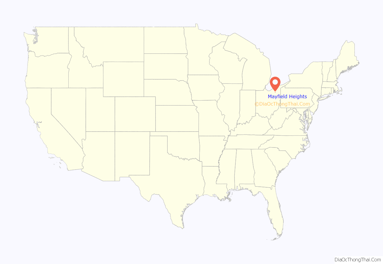
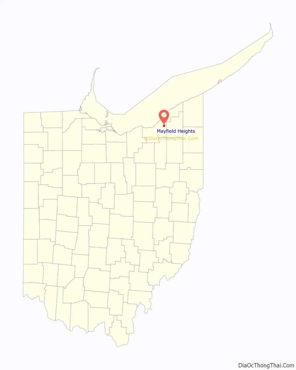
Mayfield Heights location map. Where is Mayfield Heights city?
History
Mayfield Heights was initially built up as a streetcar suburb of Cleveland. It was incorporated as a village in 1925 and as a city in 1951. The city derives its name from Mayfield Township, now defunct. One location in the city, the W.A. Thorp House, was listed on the National Register of Historic Places in 1978.
The city has a large community of Italian Americans, including newly-arrived immigrants and those who migrated eastward along Mayfield Road from Little Italy on Cleveland’s East Side. Since the dissolution of the USSR in 1991, they have been joined by a significant number of immigrants from Russia and other former Soviet republics.
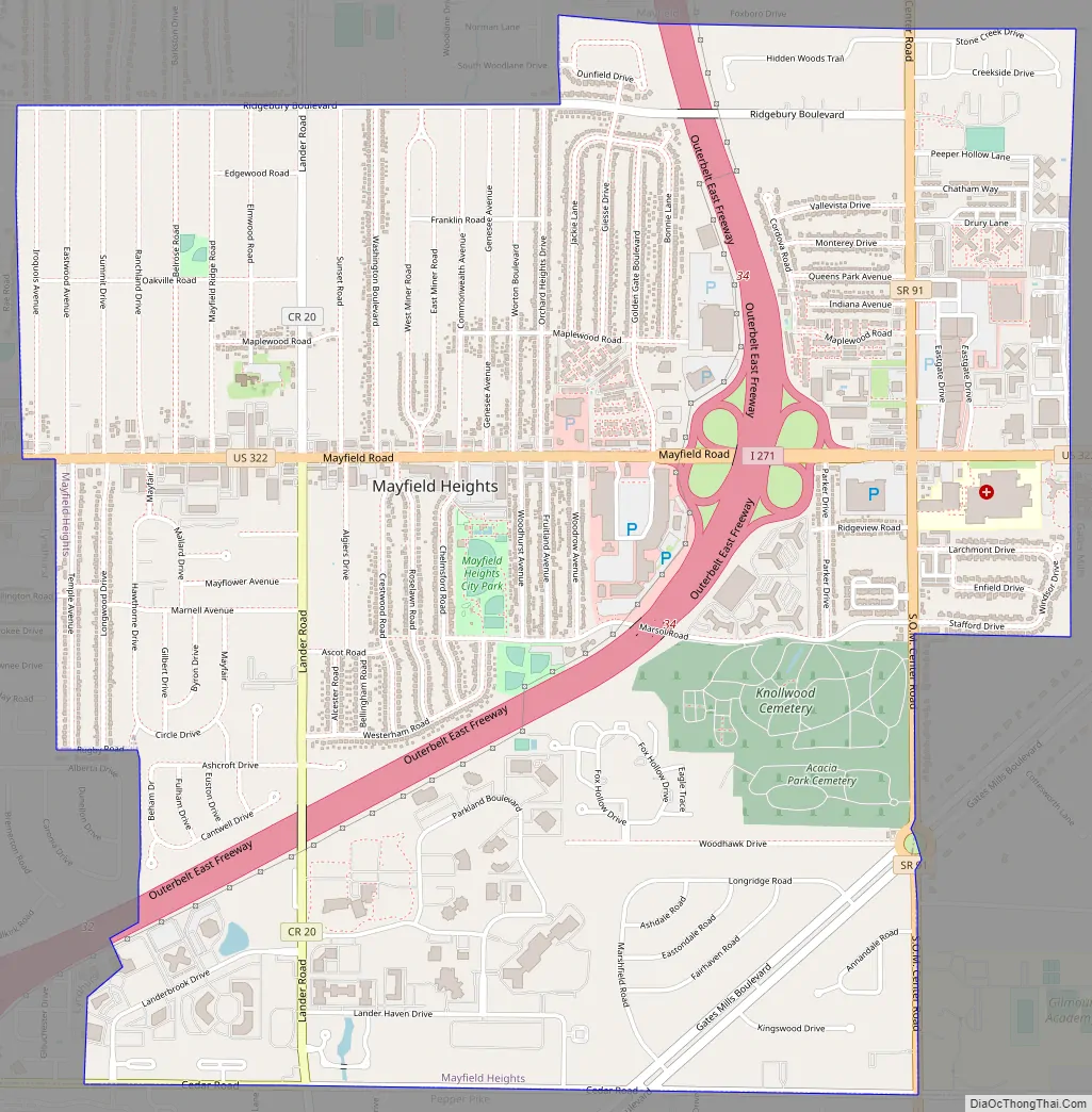
Mayfield Heights Road Map
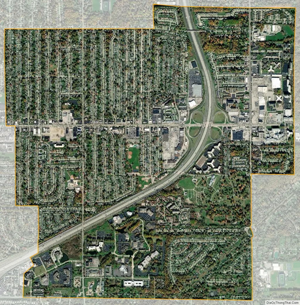
Mayfield Heights city Satellite Map
Geography
Mayfield Heights is located at 41°31′03″N 81°27′21″W / 41.517402°N 81.455889°W / 41.517402; -81.455889.
According to the United States Census Bureau, the city has a total area of 4.18 square miles (10.83 km), of which 4.17 square miles (10.80 km) is land and 0.01 square miles (0.03 km) is water.
See also
Map of Ohio State and its subdivision:- Adams
- Allen
- Ashland
- Ashtabula
- Athens
- Auglaize
- Belmont
- Brown
- Butler
- Carroll
- Champaign
- Clark
- Clermont
- Clinton
- Columbiana
- Coshocton
- Crawford
- Cuyahoga
- Darke
- Defiance
- Delaware
- Erie
- Fairfield
- Fayette
- Franklin
- Fulton
- Gallia
- Geauga
- Greene
- Guernsey
- Hamilton
- Hancock
- Hardin
- Harrison
- Henry
- Highland
- Hocking
- Holmes
- Huron
- Jackson
- Jefferson
- Knox
- Lake
- Lake Erie
- Lawrence
- Licking
- Logan
- Lorain
- Lucas
- Madison
- Mahoning
- Marion
- Medina
- Meigs
- Mercer
- Miami
- Monroe
- Montgomery
- Morgan
- Morrow
- Muskingum
- Noble
- Ottawa
- Paulding
- Perry
- Pickaway
- Pike
- Portage
- Preble
- Putnam
- Richland
- Ross
- Sandusky
- Scioto
- Seneca
- Shelby
- Stark
- Summit
- Trumbull
- Tuscarawas
- Union
- Van Wert
- Vinton
- Warren
- Washington
- Wayne
- Williams
- Wood
- Wyandot
- Alabama
- Alaska
- Arizona
- Arkansas
- California
- Colorado
- Connecticut
- Delaware
- District of Columbia
- Florida
- Georgia
- Hawaii
- Idaho
- Illinois
- Indiana
- Iowa
- Kansas
- Kentucky
- Louisiana
- Maine
- Maryland
- Massachusetts
- Michigan
- Minnesota
- Mississippi
- Missouri
- Montana
- Nebraska
- Nevada
- New Hampshire
- New Jersey
- New Mexico
- New York
- North Carolina
- North Dakota
- Ohio
- Oklahoma
- Oregon
- Pennsylvania
- Rhode Island
- South Carolina
- South Dakota
- Tennessee
- Texas
- Utah
- Vermont
- Virginia
- Washington
- West Virginia
- Wisconsin
- Wyoming


