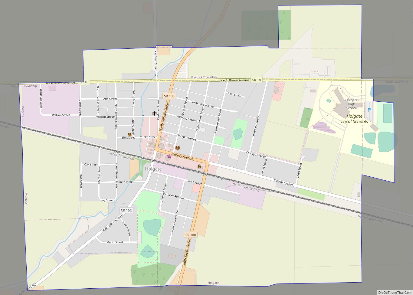
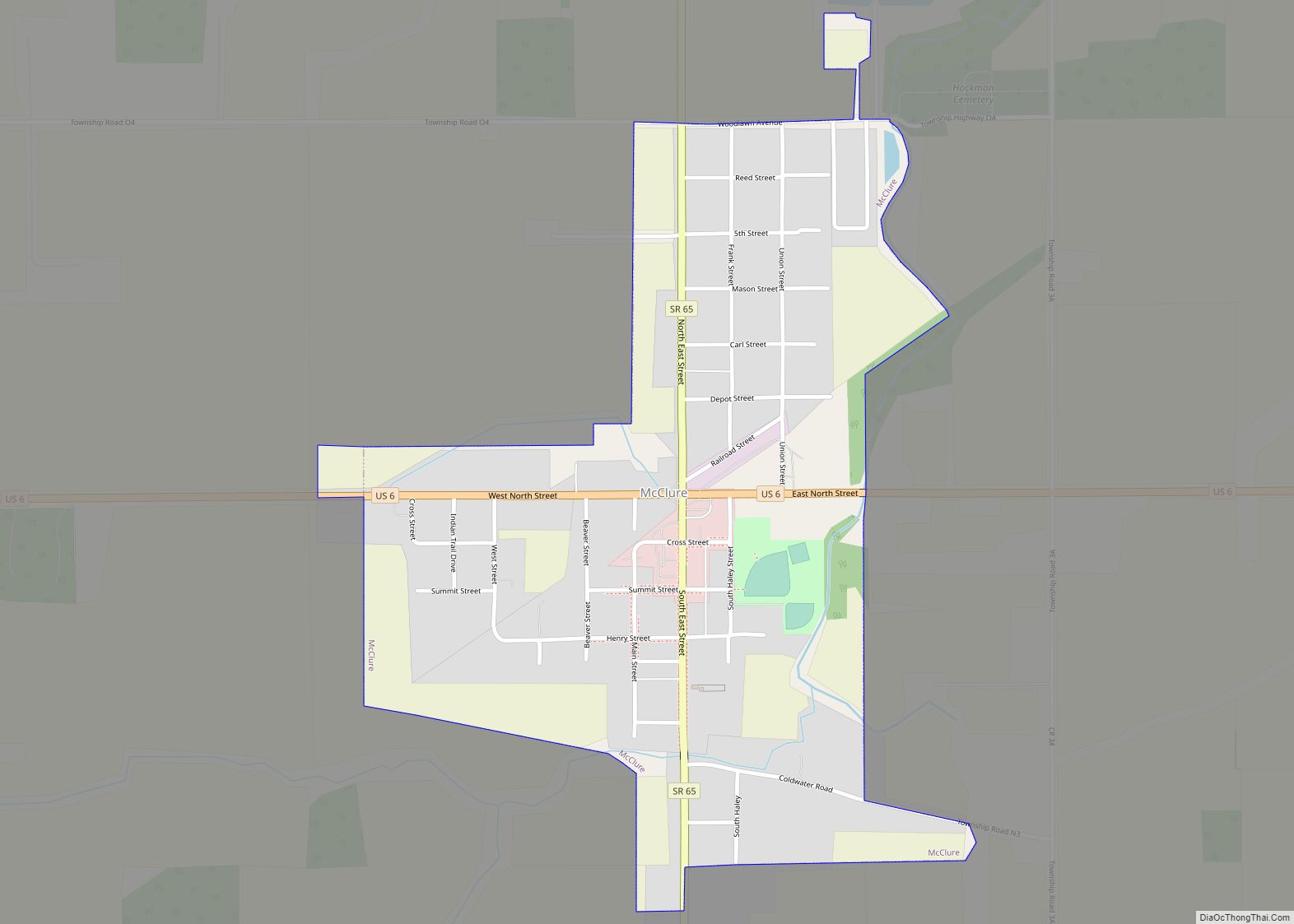
McClure is a village in Henry County, Ohio, United States. The population was 725 at the 2010 census.
| Name: | McClure village |
|---|---|
| LSAD Code: | 47 |
| LSAD Description: | village (suffix) |
| State: | Ohio |
| County: | Henry County |
| Elevation: | 676 ft (206 m) |
| Total Area: | 0.50 sq mi (1.29 km²) |
| Land Area: | 0.50 sq mi (1.29 km²) |
| Water Area: | 0.00 sq mi (0.00 km²) |
| Total Population: | 700 |
| Population Density: | 1,405.62/sq mi (542.63/km²) |
| ZIP code: | 43534 |
| Area code: | 419 |
| FIPS code: | 3945794 |
| GNISfeature ID: | 1056416 |
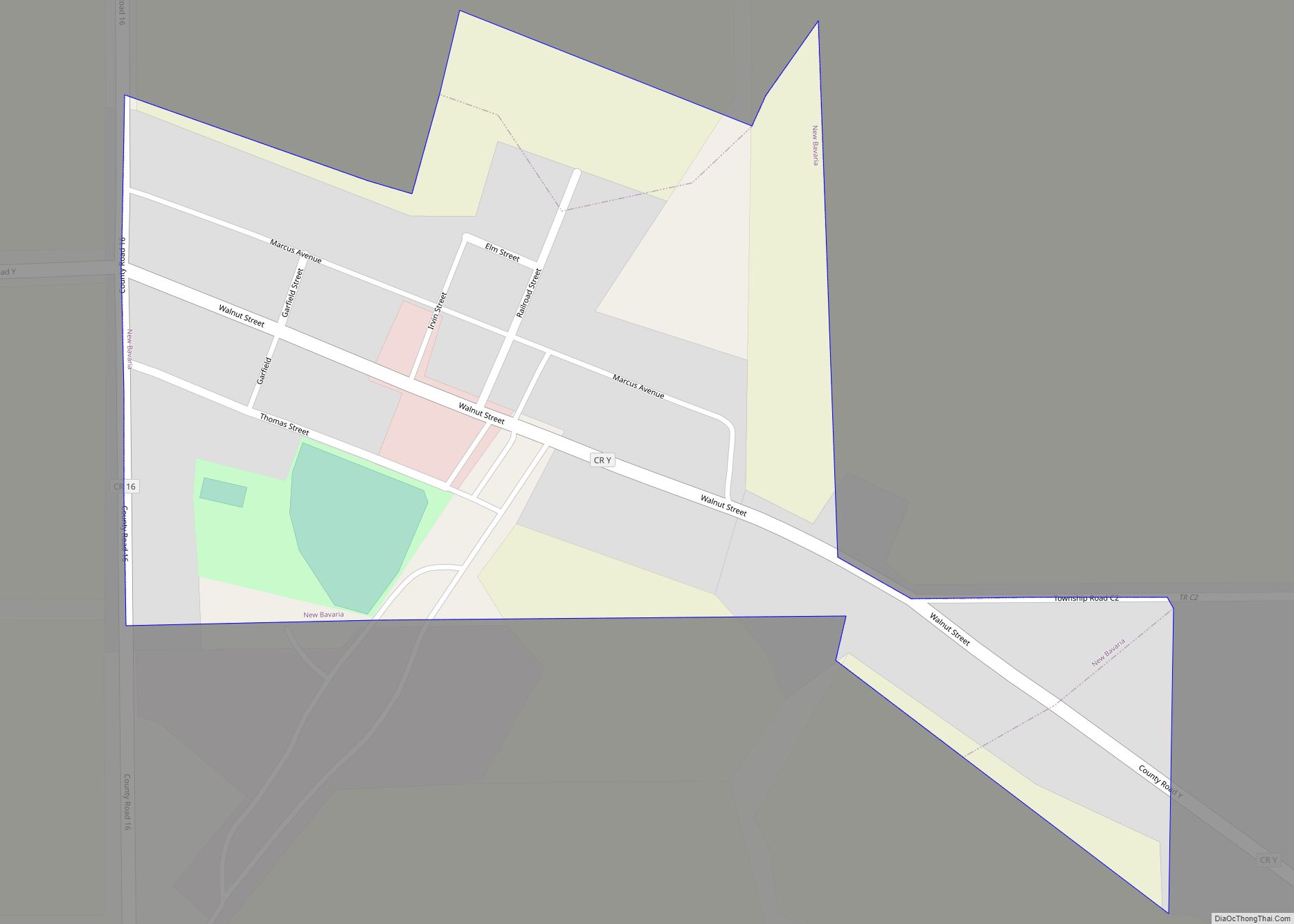
Online Interactive Map
Click on ![]() to view map in "full screen" mode.
to view map in "full screen" mode.
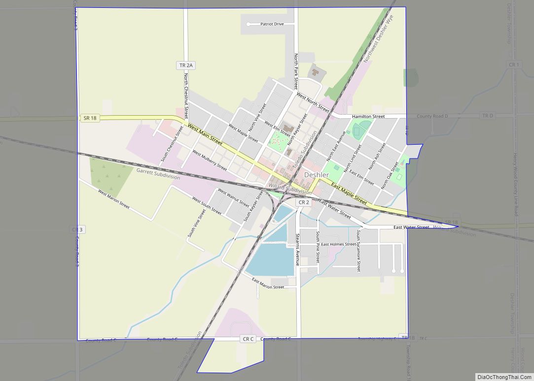
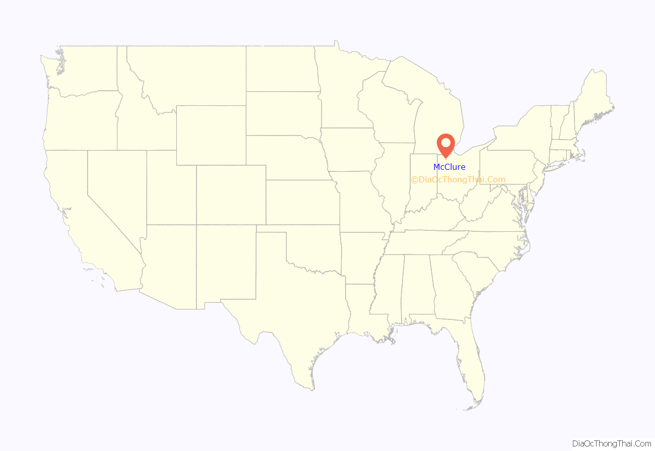
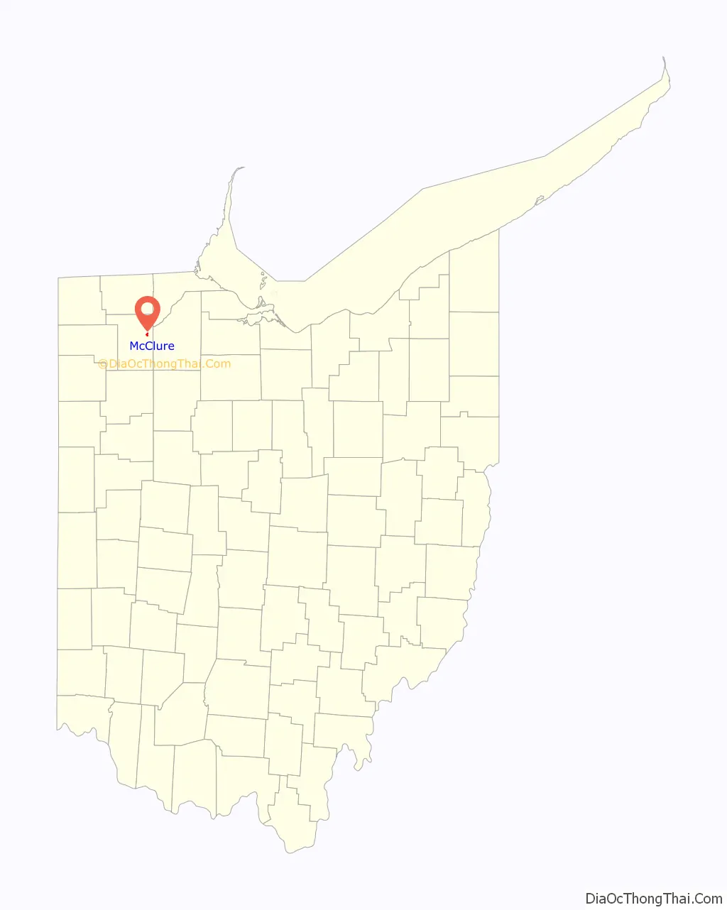
McClure location map. Where is McClure village?
History
McClure was laid out in the late 1870s, and named after John McClure, an original owner of the town site.
In the 1960s and the first half of the 1970s, McClure had the distinction of being the last place in Ohio with a manual telephone system. Since the installation of the first telephone system in the 1890s, by The Ohio Bell Telephone Co., residents used the same method to signal their town’s operator; they turned a crank on their phone. The operator in most cases knew their voice or knew the person being called. They had phone numbers, such as 6, or 328, or 77, but as the operators knew everyone’s name, numbers were rarely used.
When Ohio Bell refused to run lines to McClure’s rural residents, they formed a separate company, with volunteer labor used to build lines connecting the residents. The new company in 1908 bought the Bell equipment, and in 1909 changed its name to the Citizens Mutual Telephone Co. Long Distance calls were routed via Bell System equipment in Napoleon to the toll center in Maumee, and onward.
In the 1940s, the company opened a five-circuit toll line to Bowling Green, replacing the two-line circuit to Napoleon for long distance traffic. In the 1960s, realizing the need to modernize, the Citizens board began to consider selling the company. In February, 1968, members of the Citizens Mutual Co. circulated a ballot asking members if they wished to modernize their system. In late 1969, the Citizen’s Mutual board voted to be acquired by Otto Miller of Liberty Center. Mr. Miller renamed the company to its present name: McClure Telephone Company.
The Ohio Public Utilities Commission approved the $100,000 sale in August, 1971. The company spent the next several years building a new central office and running new lines to its nearly 500 subscribers. Mr. Miller liked to say he was taking McClure from the horse and buggy era, directly to the jet age. In November, 1975, McClure residents at last gave up their hand-cranked magneto telephones, and the friendly operators working above the local store. The operators served as a personal answering service for the residents, and would volunteer before ringing the number if someone was at home, and if they weren’t, where they were, or when they’d be home. For the first time, subscribers heard a dial tone upon lifting the receiver, instead of the familiar question: “number please.”
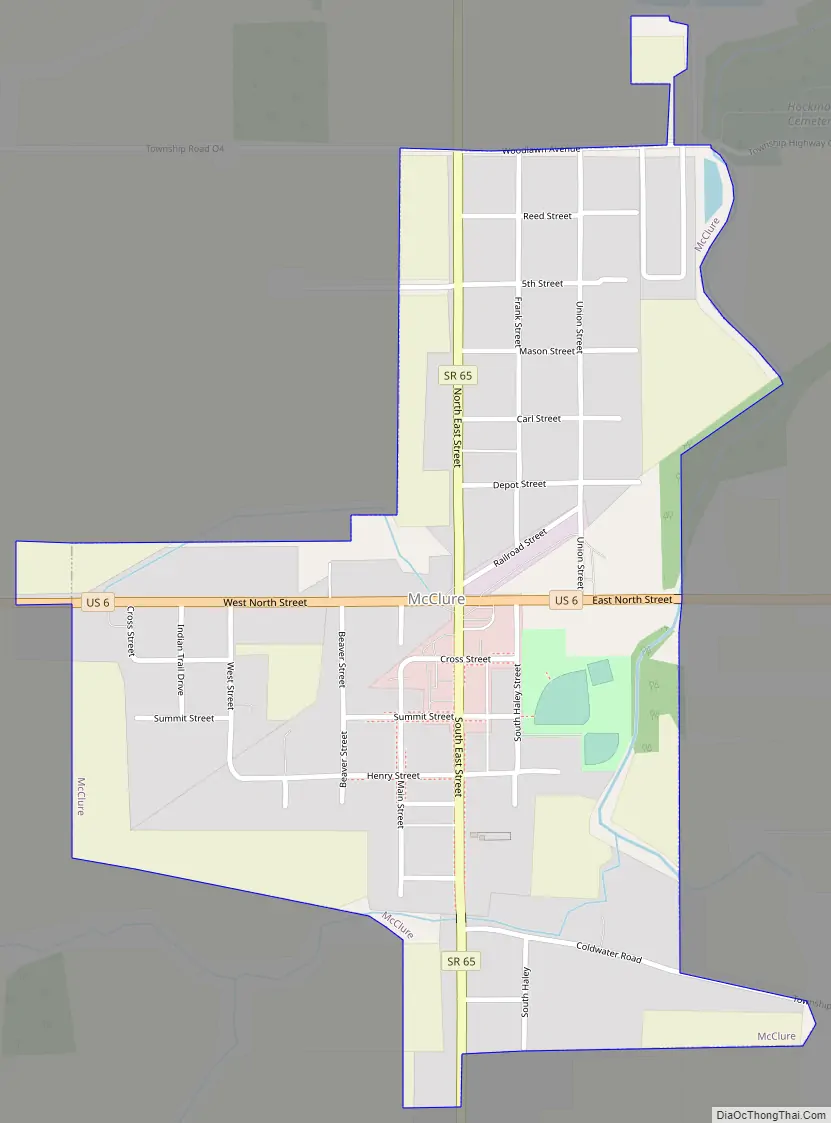
McClure Road Map
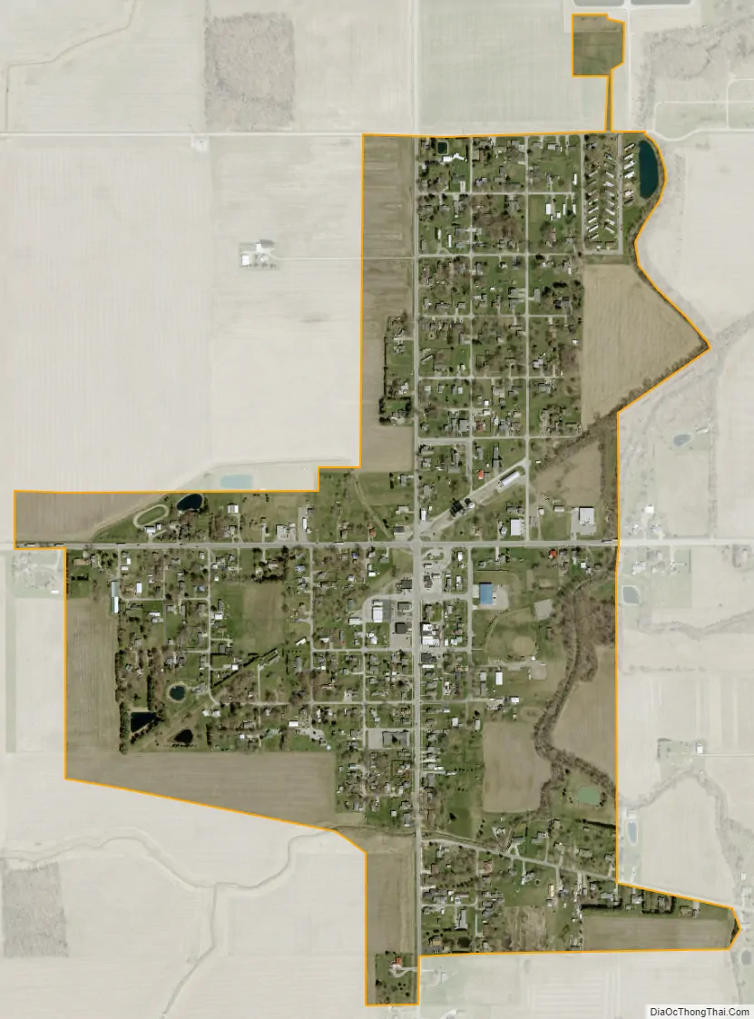
McClure city Satellite Map
Geography
McClure is located at 41°22′16″N 83°56′32″W / 41.37111°N 83.94222°W / 41.37111; -83.94222 (41.371175, -83.942084).
According to the United States Census Bureau, the village has a total area of 0.50 square miles (1.29 km), all land.
See also
Map of Ohio State and its subdivision:- Adams
- Allen
- Ashland
- Ashtabula
- Athens
- Auglaize
- Belmont
- Brown
- Butler
- Carroll
- Champaign
- Clark
- Clermont
- Clinton
- Columbiana
- Coshocton
- Crawford
- Cuyahoga
- Darke
- Defiance
- Delaware
- Erie
- Fairfield
- Fayette
- Franklin
- Fulton
- Gallia
- Geauga
- Greene
- Guernsey
- Hamilton
- Hancock
- Hardin
- Harrison
- Henry
- Highland
- Hocking
- Holmes
- Huron
- Jackson
- Jefferson
- Knox
- Lake
- Lake Erie
- Lawrence
- Licking
- Logan
- Lorain
- Lucas
- Madison
- Mahoning
- Marion
- Medina
- Meigs
- Mercer
- Miami
- Monroe
- Montgomery
- Morgan
- Morrow
- Muskingum
- Noble
- Ottawa
- Paulding
- Perry
- Pickaway
- Pike
- Portage
- Preble
- Putnam
- Richland
- Ross
- Sandusky
- Scioto
- Seneca
- Shelby
- Stark
- Summit
- Trumbull
- Tuscarawas
- Union
- Van Wert
- Vinton
- Warren
- Washington
- Wayne
- Williams
- Wood
- Wyandot
- Alabama
- Alaska
- Arizona
- Arkansas
- California
- Colorado
- Connecticut
- Delaware
- District of Columbia
- Florida
- Georgia
- Hawaii
- Idaho
- Illinois
- Indiana
- Iowa
- Kansas
- Kentucky
- Louisiana
- Maine
- Maryland
- Massachusetts
- Michigan
- Minnesota
- Mississippi
- Missouri
- Montana
- Nebraska
- Nevada
- New Hampshire
- New Jersey
- New Mexico
- New York
- North Carolina
- North Dakota
- Ohio
- Oklahoma
- Oregon
- Pennsylvania
- Rhode Island
- South Carolina
- South Dakota
- Tennessee
- Texas
- Utah
- Vermont
- Virginia
- Washington
- West Virginia
- Wisconsin
- Wyoming