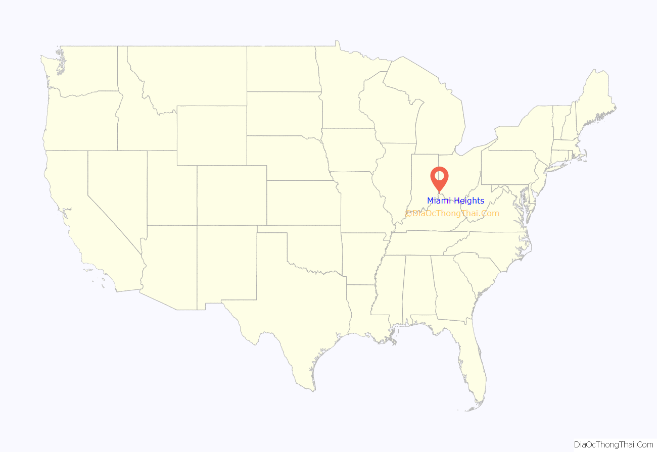
Miami Heights is a census-designated place (CDP) in Miami Township, Hamilton County, Ohio, United States. The population was 4,731 at the 2010 census.
| Name: | Miami Heights CDP |
|---|---|
| LSAD Code: | 57 |
| LSAD Description: | CDP (suffix) |
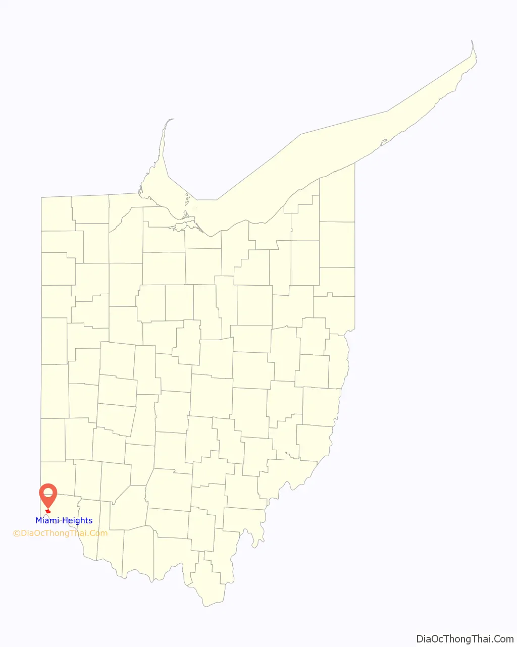
| State: | Ohio |
| County: | Hamilton County |
| Elevation: | 830 ft (250 m) |
| Total Area: | 3.84 sq mi (9.94 km²) |
| Land Area: | 3.84 sq mi (9.94 km²) |
| Water Area: | 0.00 sq mi (0.00 km²) |
| Total Population: | 5,166 |
| Population Density: | 1,346.01/sq mi (519.68/km²) |
| FIPS code: | 3949420 |
| GNISfeature ID: | 1062892 |
Online Interactive Map
Click on ![]() to view map in "full screen" mode.
to view map in "full screen" mode.
Miami Heights location map. Where is Miami Heights CDP?
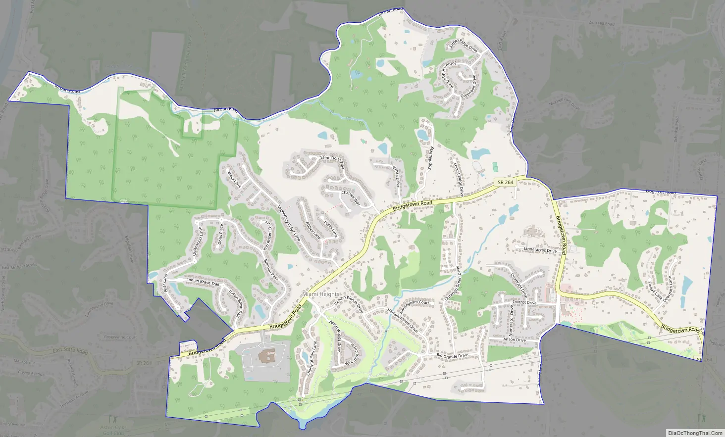
Miami Heights Road Map
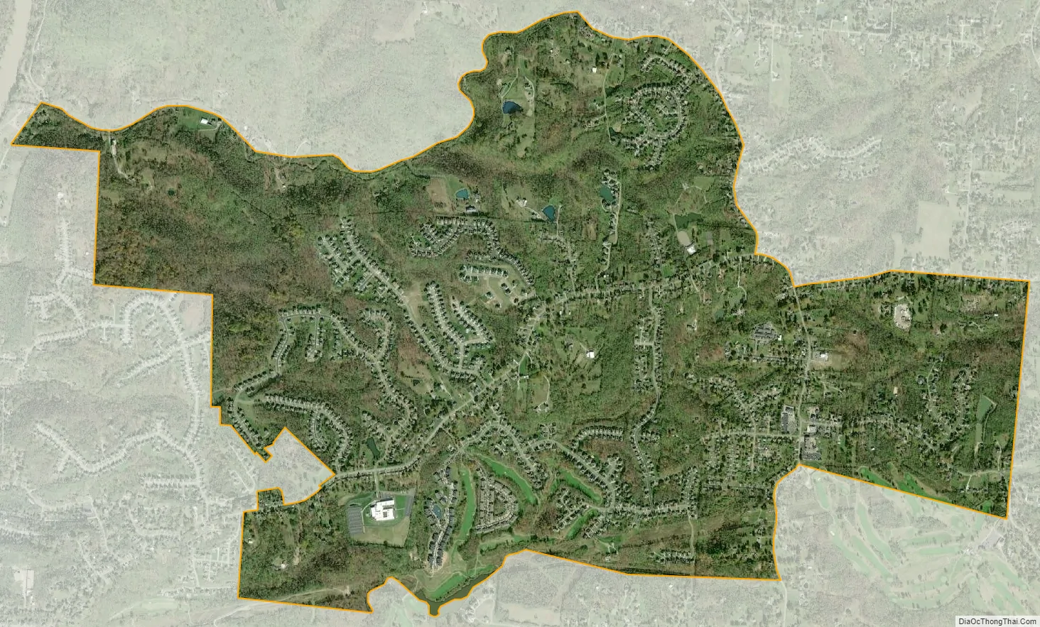
Miami Heights city Satellite Map
Geography
Miami Heights is located at 39°9′53″N 84°43′14″W / 39.16472°N 84.72056°W / 39.16472; -84.72056, 14 miles (23 km) northwest of downtown Cincinnati. Ohio State Route 264 (Bridgetown Road) is the main road through the community, running east into Mack and Bridgetown and west into Cleves. Its neighbors are Grandview to the north, Mack to the east and south, North Bend to the southwest, and Cleves to the west.
According to the United States Census Bureau, the CDP has a total area of 3.5 square miles (9.1 km), all land.
See also
Map of Ohio State and its subdivision:- Adams
- Allen
- Ashland
- Ashtabula
- Athens
- Auglaize
- Belmont
- Brown
- Butler
- Carroll
- Champaign
- Clark
- Clermont
- Clinton
- Columbiana
- Coshocton
- Crawford
- Cuyahoga
- Darke
- Defiance
- Delaware
- Erie
- Fairfield
- Fayette
- Franklin
- Fulton
- Gallia
- Geauga
- Greene
- Guernsey
- Hamilton
- Hancock
- Hardin
- Harrison
- Henry
- Highland
- Hocking
- Holmes
- Huron
- Jackson
- Jefferson
- Knox
- Lake
- Lake Erie
- Lawrence
- Licking
- Logan
- Lorain
- Lucas
- Madison
- Mahoning
- Marion
- Medina
- Meigs
- Mercer
- Miami
- Monroe
- Montgomery
- Morgan
- Morrow
- Muskingum
- Noble
- Ottawa
- Paulding
- Perry
- Pickaway
- Pike
- Portage
- Preble
- Putnam
- Richland
- Ross
- Sandusky
- Scioto
- Seneca
- Shelby
- Stark
- Summit
- Trumbull
- Tuscarawas
- Union
- Van Wert
- Vinton
- Warren
- Washington
- Wayne
- Williams
- Wood
- Wyandot
- Alabama
- Alaska
- Arizona
- Arkansas
- California
- Colorado
- Connecticut
- Delaware
- District of Columbia
- Florida
- Georgia
- Hawaii
- Idaho
- Illinois
- Indiana
- Iowa
- Kansas
- Kentucky
- Louisiana
- Maine
- Maryland
- Massachusetts
- Michigan
- Minnesota
- Mississippi
- Missouri
- Montana
- Nebraska
- Nevada
- New Hampshire
- New Jersey
- New Mexico
- New York
- North Carolina
- North Dakota
- Ohio
- Oklahoma
- Oregon
- Pennsylvania
- Rhode Island
- South Carolina
- South Dakota
- Tennessee
- Texas
- Utah
- Vermont
- Virginia
- Washington
- West Virginia
- Wisconsin
- Wyoming


