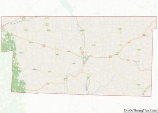
Millersburg is a village and the county seat of Holmes County, Ohio, United States. Located 66 miles (106 km) south of Cleveland, it is in the heart of Ohio’s Amish Country, and is part of a large regional tourism industry. The population was 3,151 at the 2020 census. Holmes County Airport, located two miles southwest of Millersburg, serves the county.
| Name: | Millersburg village |
|---|---|
| LSAD Code: | 47 |
| LSAD Description: | village (suffix) |
| State: | Ohio |
| County: | Holmes County |
| Elevation: | 899 ft (274 m) |
| Total Area: | 2.54 sq mi (6.59 km²) |
| Land Area: | 2.54 sq mi (6.57 km²) |
| Water Area: | 0.01 sq mi (0.02 km²) |
| Total Population: | 3,151 |
| Population Density: | 1,242.51/sq mi (479.78/km²) |
| ZIP code: | 44654 |
| Area code: | 330 |
| FIPS code: | 3950372 |
| GNISfeature ID: | 1057849 |
| Website: | http://www.millersburgohio.com/ |
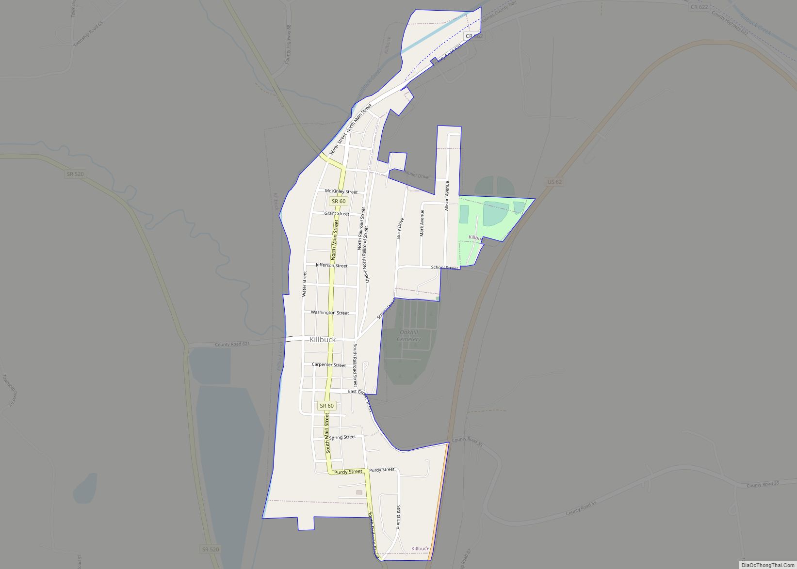
Online Interactive Map
Click on ![]() to view map in "full screen" mode.
to view map in "full screen" mode.
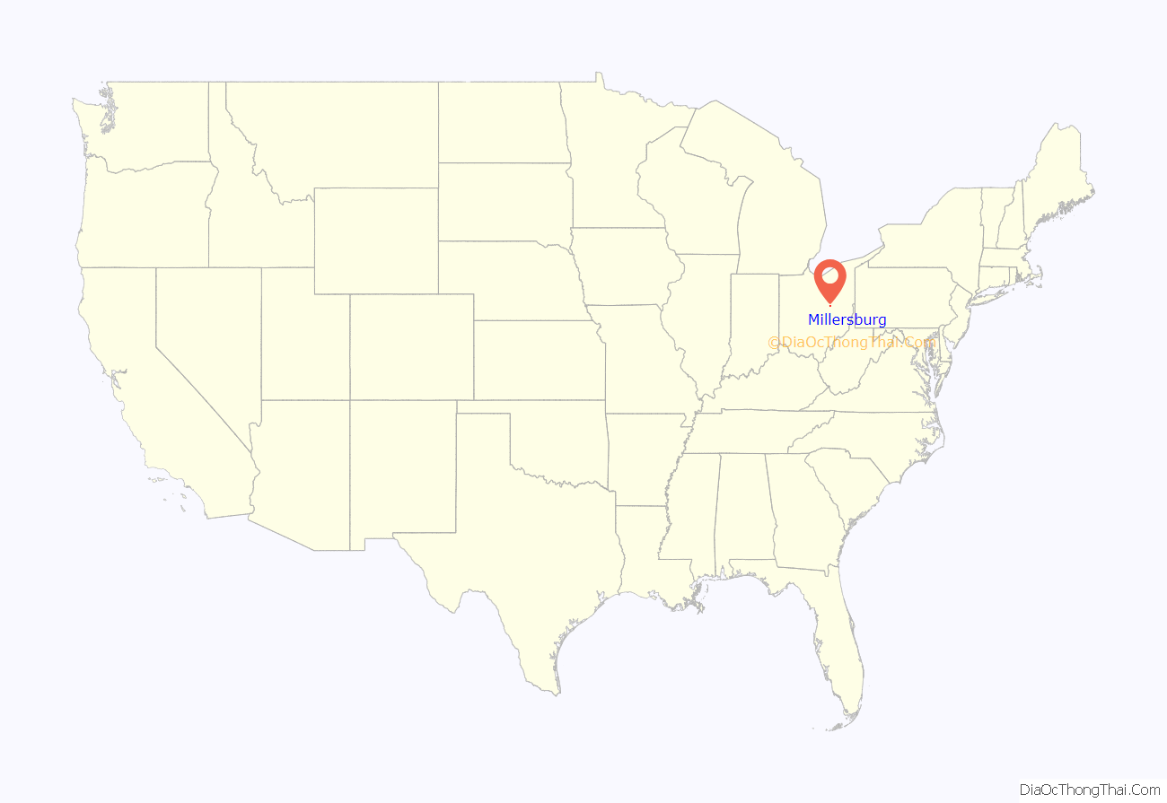
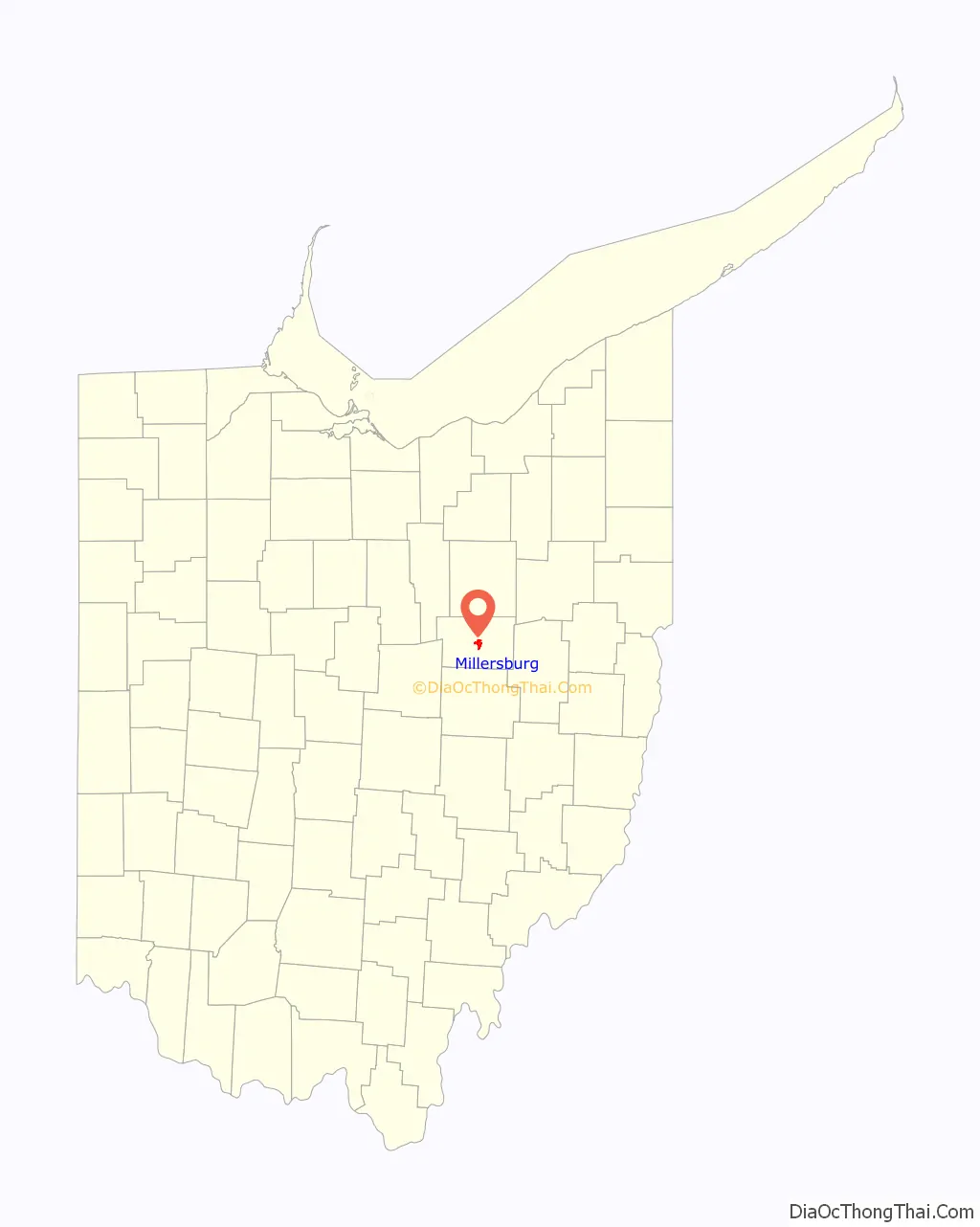
Millersburg location map. Where is Millersburg village?
History
The Old Town of Millersburg was laid out by Adam Johnson and Charles Miller of Coshocton County in November 1815. It was located at the north side of the northwest quarter of Section 12, township 9, range 7 adjoining the School Lands, and very near the northwest corner of said quarter section. The Northwest corner, lot 1, was a little over the hill towards the present mill dam and the northeast corner, lot 9, was about 100 steps west of the present Wooster Road. The center of the town was very nearly the center of Walkups Addition. The principal streets were Bridge, High and Market, each four rods wide. The direction of the former was east and west, and ll rods south of the school land; and was located on the State Road east and west through the county, that crosses the Killbuck near the present mill dam.
Thomas Haskins was the first settler on the town plat, settling there in the spring of 1819, on lot 21, corner of Bridge and High streets. In the spring of 1820, James Withrow erected a one-and-a-half-story building on Lot 33 cornering on Bridge and High streets and diagonally across them from the Haskins tavern.
In late 1820 a cabin was erected in the northeast corner of the town for a school house. Joseph Edger of Berlin taught at the school that winter, and it was the first school in the town. During that winter the Rev. Harper, a Presbyterian minister, preached in the school house which was the first sermon delivered in Millersburg. On April 8, 1824, Andrew Johnston and Charles Miller filed a plan for the present town of Millersburg. “New Town” as it was referred to, was situated southeast of the original town of Millersburg (Old Town). The new plan laid out 194 lots. The center of this plan consisted of a block for public use. The main east–west street was named Jackson. To the north of this was Clinton and to the south, Adams. The north–south streets were Mad Anthony, Washington, Clay, Monroe and Crawford with the main intersection being Clay and Jackson. The first two residences in the town were built by James French and William Painter. When Millersburg was accepted as the county seat of the newly formed Holmes County it began to prosper.
In 1833, Millersburg contained ten stores, four taverns, four practicing physicians, three attorneys, one printing office, one meeting house, one apothecary’s shop, and 73 dwelling houses.
On April 1, 1892, an unidentified black male was lynched in Millersburg. Papers reported that he was the only black man in the county and had been “annoying people in various ways”. The man was found hanged on the courthouse lawn one morning after several people heard noises during the night.
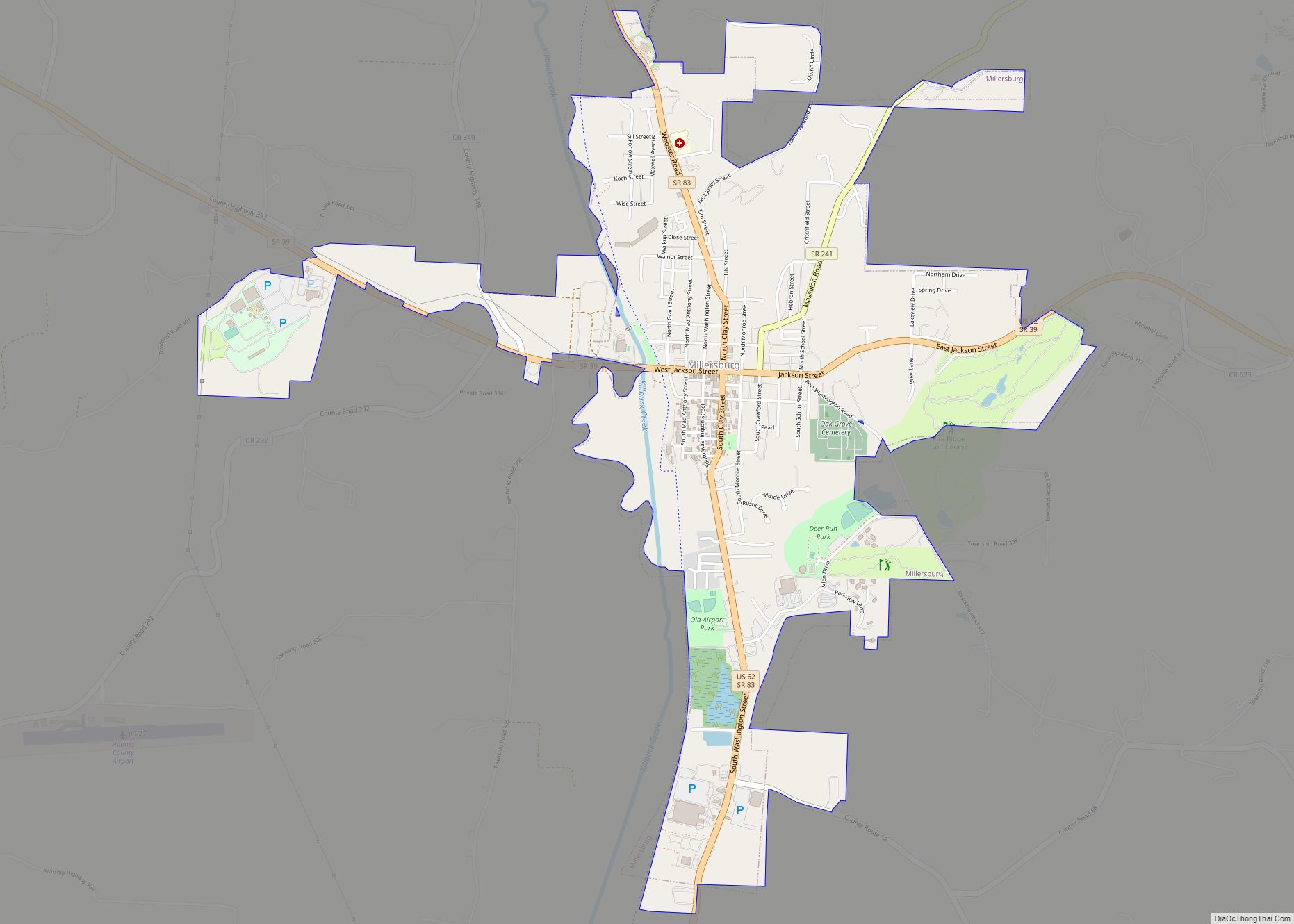
Millersburg Road Map
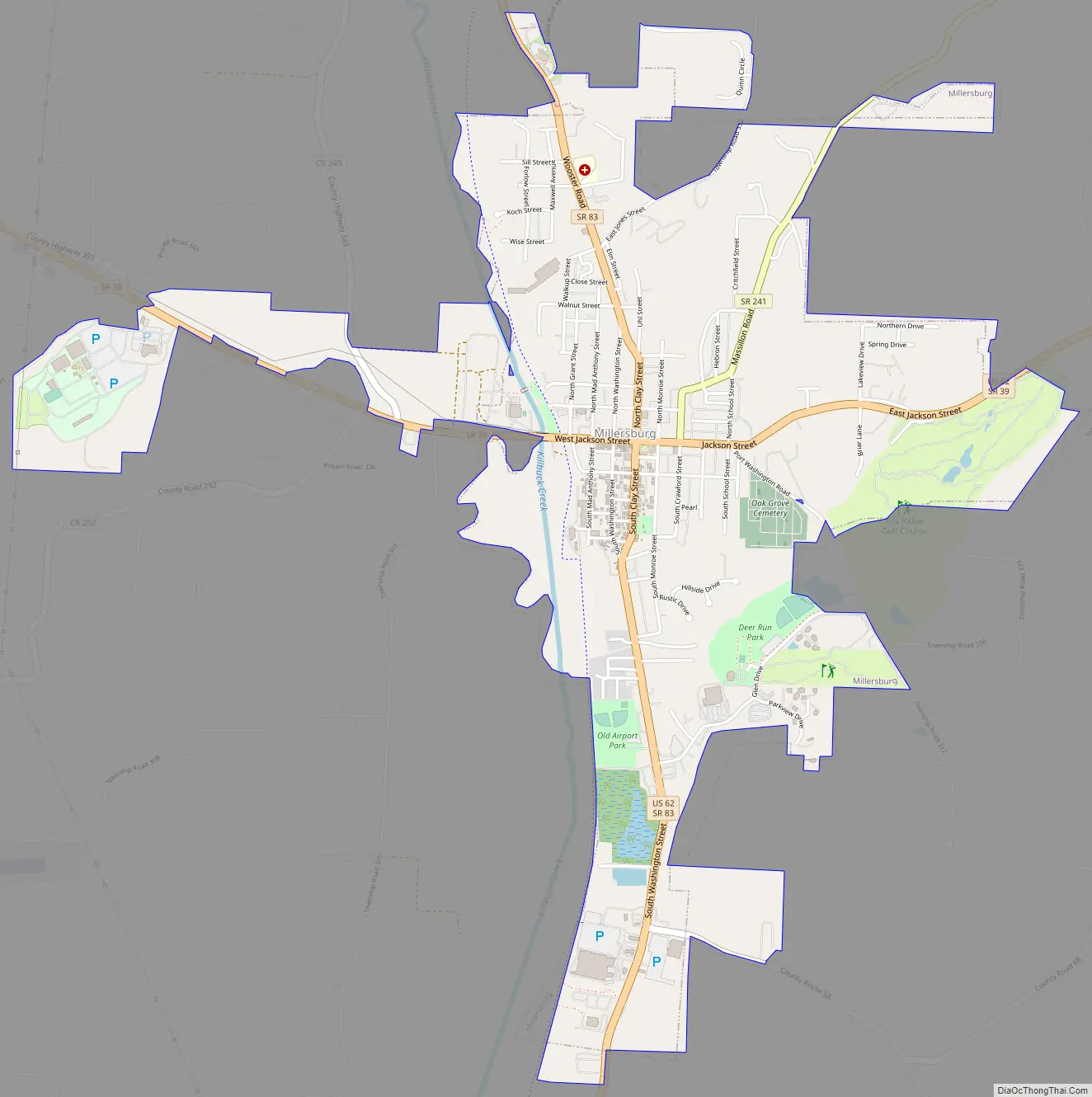
Millersburg city Satellite Map

Geography
Millersburg is located at 40°33′18″N 81°55′5″W / 40.55500°N 81.91806°W / 40.55500; -81.91806 (40.554901, -81.917940), along Killbuck Creek. Millersburg is located 817 feet (249 m) above sea level.
According to the United States Census Bureau, the village has a total area of 2.23 square miles (5.78 km), of which 2.22 square miles (5.75 km) is land and 0.01 square miles (0.03 km) is water.
See also
Map of Ohio State and its subdivision:- Adams
- Allen
- Ashland
- Ashtabula
- Athens
- Auglaize
- Belmont
- Brown
- Butler
- Carroll
- Champaign
- Clark
- Clermont
- Clinton
- Columbiana
- Coshocton
- Crawford
- Cuyahoga
- Darke
- Defiance
- Delaware
- Erie
- Fairfield
- Fayette
- Franklin
- Fulton
- Gallia
- Geauga
- Greene
- Guernsey
- Hamilton
- Hancock
- Hardin
- Harrison
- Henry
- Highland
- Hocking
- Holmes
- Huron
- Jackson
- Jefferson
- Knox
- Lake
- Lake Erie
- Lawrence
- Licking
- Logan
- Lorain
- Lucas
- Madison
- Mahoning
- Marion
- Medina
- Meigs
- Mercer
- Miami
- Monroe
- Montgomery
- Morgan
- Morrow
- Muskingum
- Noble
- Ottawa
- Paulding
- Perry
- Pickaway
- Pike
- Portage
- Preble
- Putnam
- Richland
- Ross
- Sandusky
- Scioto
- Seneca
- Shelby
- Stark
- Summit
- Trumbull
- Tuscarawas
- Union
- Van Wert
- Vinton
- Warren
- Washington
- Wayne
- Williams
- Wood
- Wyandot
- Alabama
- Alaska
- Arizona
- Arkansas
- California
- Colorado
- Connecticut
- Delaware
- District of Columbia
- Florida
- Georgia
- Hawaii
- Idaho
- Illinois
- Indiana
- Iowa
- Kansas
- Kentucky
- Louisiana
- Maine
- Maryland
- Massachusetts
- Michigan
- Minnesota
- Mississippi
- Missouri
- Montana
- Nebraska
- Nevada
- New Hampshire
- New Jersey
- New Mexico
- New York
- North Carolina
- North Dakota
- Ohio
- Oklahoma
- Oregon
- Pennsylvania
- Rhode Island
- South Carolina
- South Dakota
- Tennessee
- Texas
- Utah
- Vermont
- Virginia
- Washington
- West Virginia
- Wisconsin
- Wyoming