Mount Pleasant is a village in southern Jefferson County, Ohio, United States. The population was 394 at the 2020 census. It is part of the Weirton–Steubenville metropolitan area. Founded in 1803 by anti-slavery Quakers, the village was an early center of abolitionist activity and a well-known haven for fugitive slaves on the Underground Railroad.
| Name: | Mount Pleasant village |
|---|---|
| LSAD Code: | 47 |
| LSAD Description: | village (suffix) |
| State: | Ohio |
| County: | Jefferson County |
| Elevation: | 1,240 ft (378 m) |
| Total Area: | 0.26 sq mi (0.66 km²) |
| Land Area: | 0.26 sq mi (0.66 km²) |
| Water Area: | 0.00 sq mi (0.00 km²) |
| Total Population: | 394 |
| Population Density: | 1,545.10/sq mi (596.85/km²) |
| ZIP code: | 43939 |
| Area code: | 740 |
| FIPS code: | 3952976 |
| GNISfeature ID: | 1048993 |
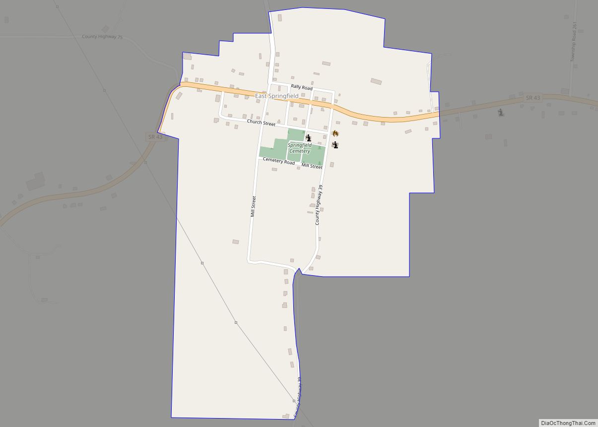
Online Interactive Map
Click on ![]() to view map in "full screen" mode.
to view map in "full screen" mode.
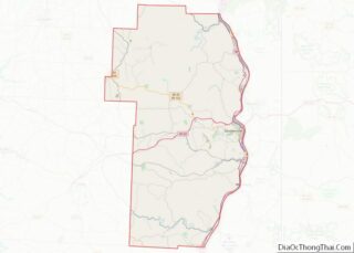
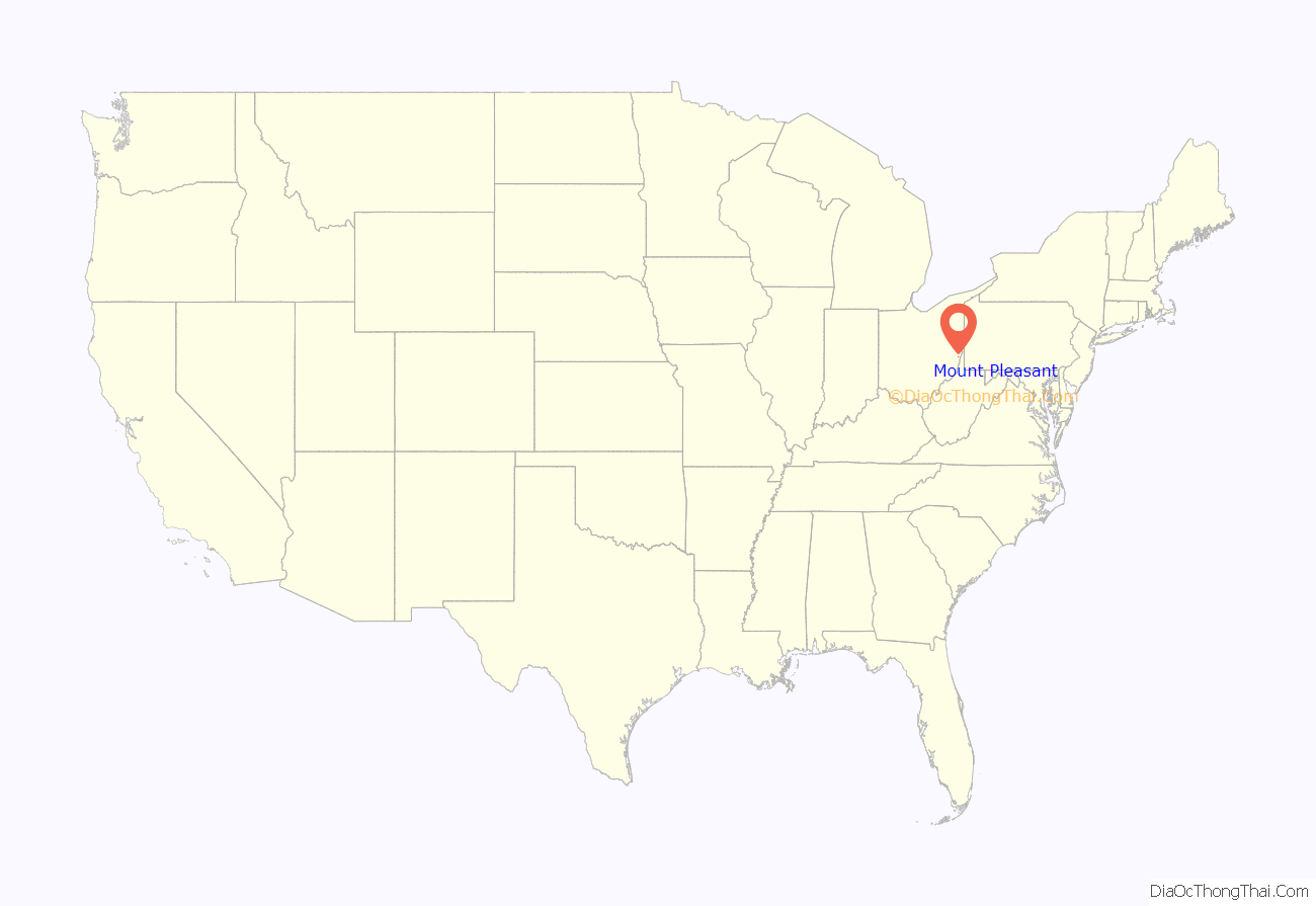
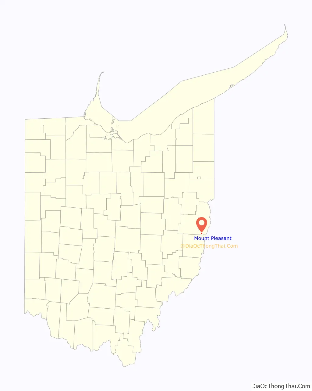
Mount Pleasant location map. Where is Mount Pleasant village?
History
Mount Pleasant was laid out in 1803. It was named from its scenic landscape. An early variant name was Jesse-Bobtown.
In 1817, Quaker Charles Osborn established The Philanthropist, the first newspaper in the country advocating the abolition of slavery, in Mount Pleasant. The abolitionist James Birney would later adopt the name The Philanthropist for his anti-slavery newspaper, published in Cincinnati and distributed in New Richmond, Ohio beginning in 1836.
In 1821, the Quaker abolitionist Benjamin Lundy started publishing The Genius of Universal Emancipation, another abolitionist newspaper, also in Mount Pleasant. The paper eventually moved to Baltimore, Maryland. Lundy’s house is a National Historic Landmark. Most of the village has been designated a historic district, the Mount Pleasant Historic District; it too is a National Historic Landmark.
Mount Pleasant Road Map
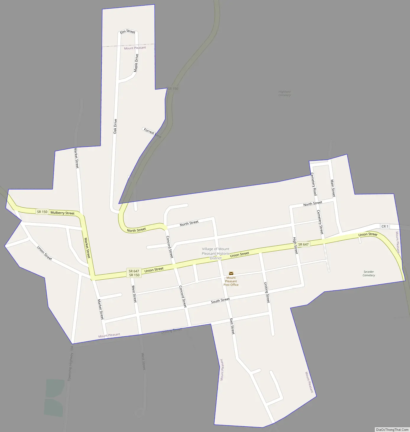
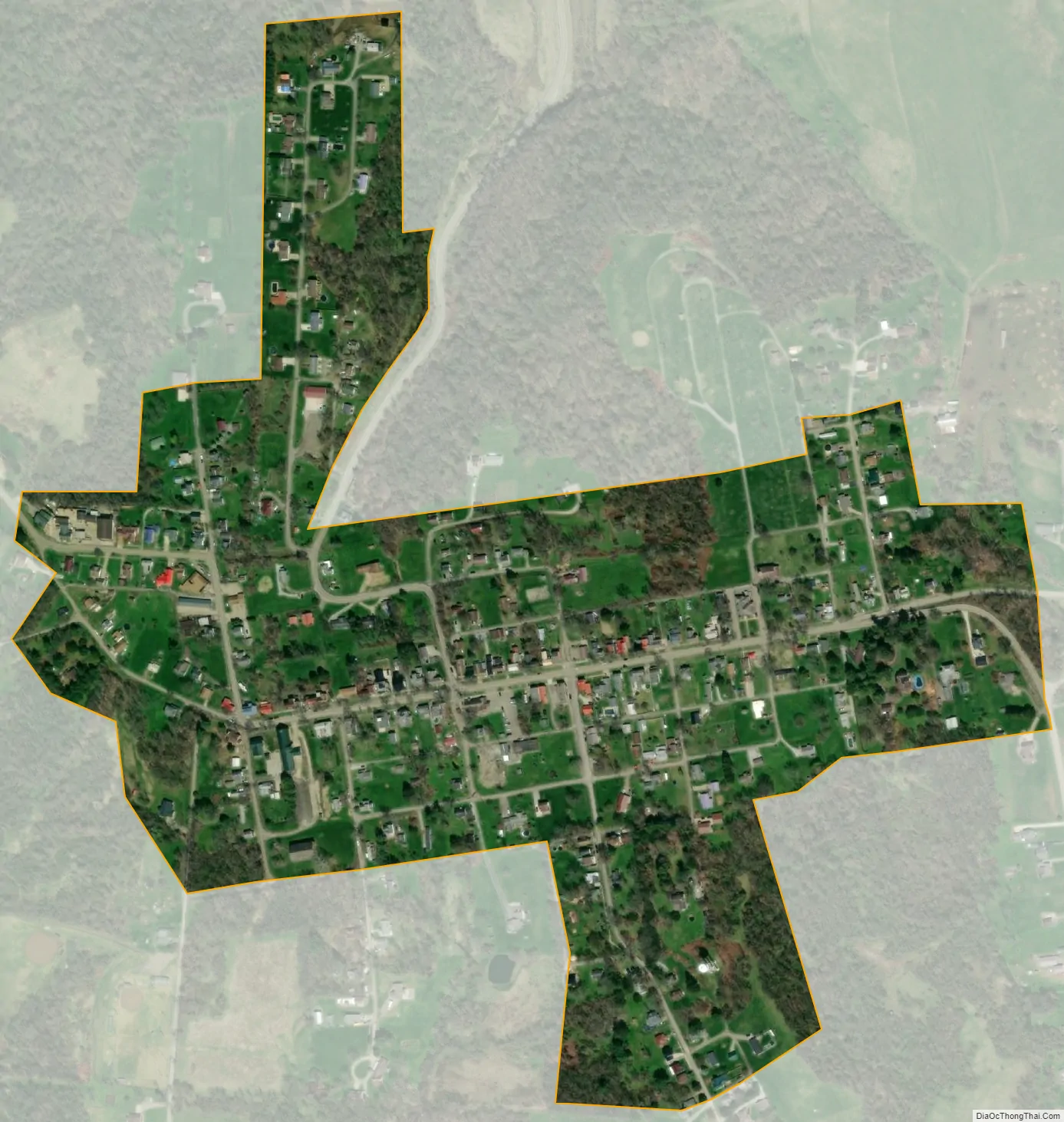
Mount Pleasant city Satellite Map
Geography
Mount Pleasant is located at 40°10′32″N 80°47′59″W / 40.17556°N 80.79972°W / 40.17556; -80.79972 (40.175602, −80.799686).
According to the United States Census Bureau, the village has a total area of 0.26 square miles (0.67 km), all land.
See also
Map of Ohio State and its subdivision:- Adams
- Allen
- Ashland
- Ashtabula
- Athens
- Auglaize
- Belmont
- Brown
- Butler
- Carroll
- Champaign
- Clark
- Clermont
- Clinton
- Columbiana
- Coshocton
- Crawford
- Cuyahoga
- Darke
- Defiance
- Delaware
- Erie
- Fairfield
- Fayette
- Franklin
- Fulton
- Gallia
- Geauga
- Greene
- Guernsey
- Hamilton
- Hancock
- Hardin
- Harrison
- Henry
- Highland
- Hocking
- Holmes
- Huron
- Jackson
- Jefferson
- Knox
- Lake
- Lake Erie
- Lawrence
- Licking
- Logan
- Lorain
- Lucas
- Madison
- Mahoning
- Marion
- Medina
- Meigs
- Mercer
- Miami
- Monroe
- Montgomery
- Morgan
- Morrow
- Muskingum
- Noble
- Ottawa
- Paulding
- Perry
- Pickaway
- Pike
- Portage
- Preble
- Putnam
- Richland
- Ross
- Sandusky
- Scioto
- Seneca
- Shelby
- Stark
- Summit
- Trumbull
- Tuscarawas
- Union
- Van Wert
- Vinton
- Warren
- Washington
- Wayne
- Williams
- Wood
- Wyandot
- Alabama
- Alaska
- Arizona
- Arkansas
- California
- Colorado
- Connecticut
- Delaware
- District of Columbia
- Florida
- Georgia
- Hawaii
- Idaho
- Illinois
- Indiana
- Iowa
- Kansas
- Kentucky
- Louisiana
- Maine
- Maryland
- Massachusetts
- Michigan
- Minnesota
- Mississippi
- Missouri
- Montana
- Nebraska
- Nevada
- New Hampshire
- New Jersey
- New Mexico
- New York
- North Carolina
- North Dakota
- Ohio
- Oklahoma
- Oregon
- Pennsylvania
- Rhode Island
- South Carolina
- South Dakota
- Tennessee
- Texas
- Utah
- Vermont
- Virginia
- Washington
- West Virginia
- Wisconsin
- Wyoming