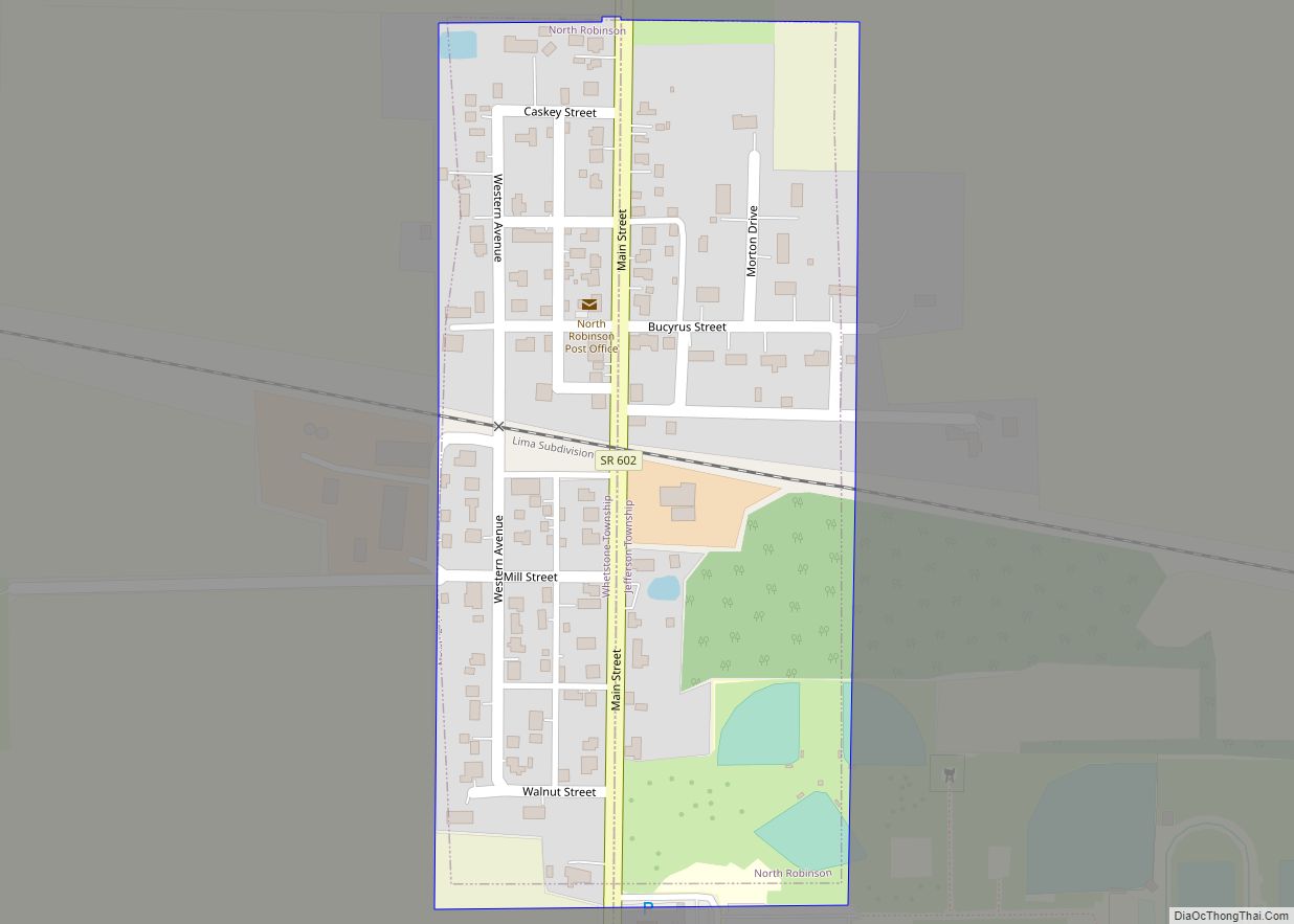
North Robinson is a village in Crawford County, Ohio, United States. The population was 205 at the 2010 census.
| Name: | North Robinson village |
|---|---|
| LSAD Code: | 47 |
| LSAD Description: | village (suffix) |
| State: | Ohio |
| County: | Crawford County |
| Elevation: | 1,073 ft (327 m) |
| Total Area: | 0.11 sq mi (0.28 km²) |
| Land Area: | 0.11 sq mi (0.28 km²) |
| Water Area: | 0.00 sq mi (0.00 km²) |
| Total Population: | 219 |
| Population Density: | 2,066.04/sq mi (794.97/km²) |
| ZIP code: | 44856 |
| Area code: | 419 |
| FIPS code: | 3956994 |
| GNISfeature ID: | 1057730 |
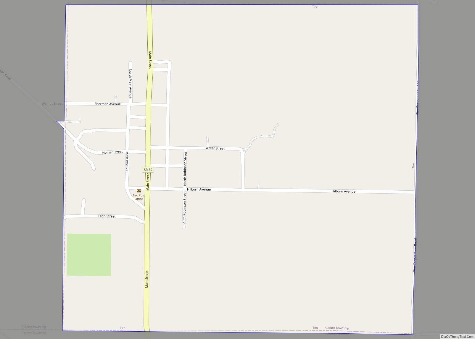
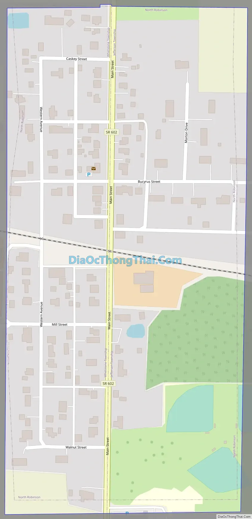
Online Interactive Map
Click on ![]() to view map in "full screen" mode.
to view map in "full screen" mode.
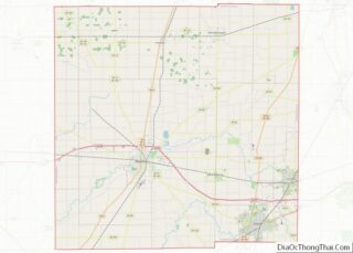
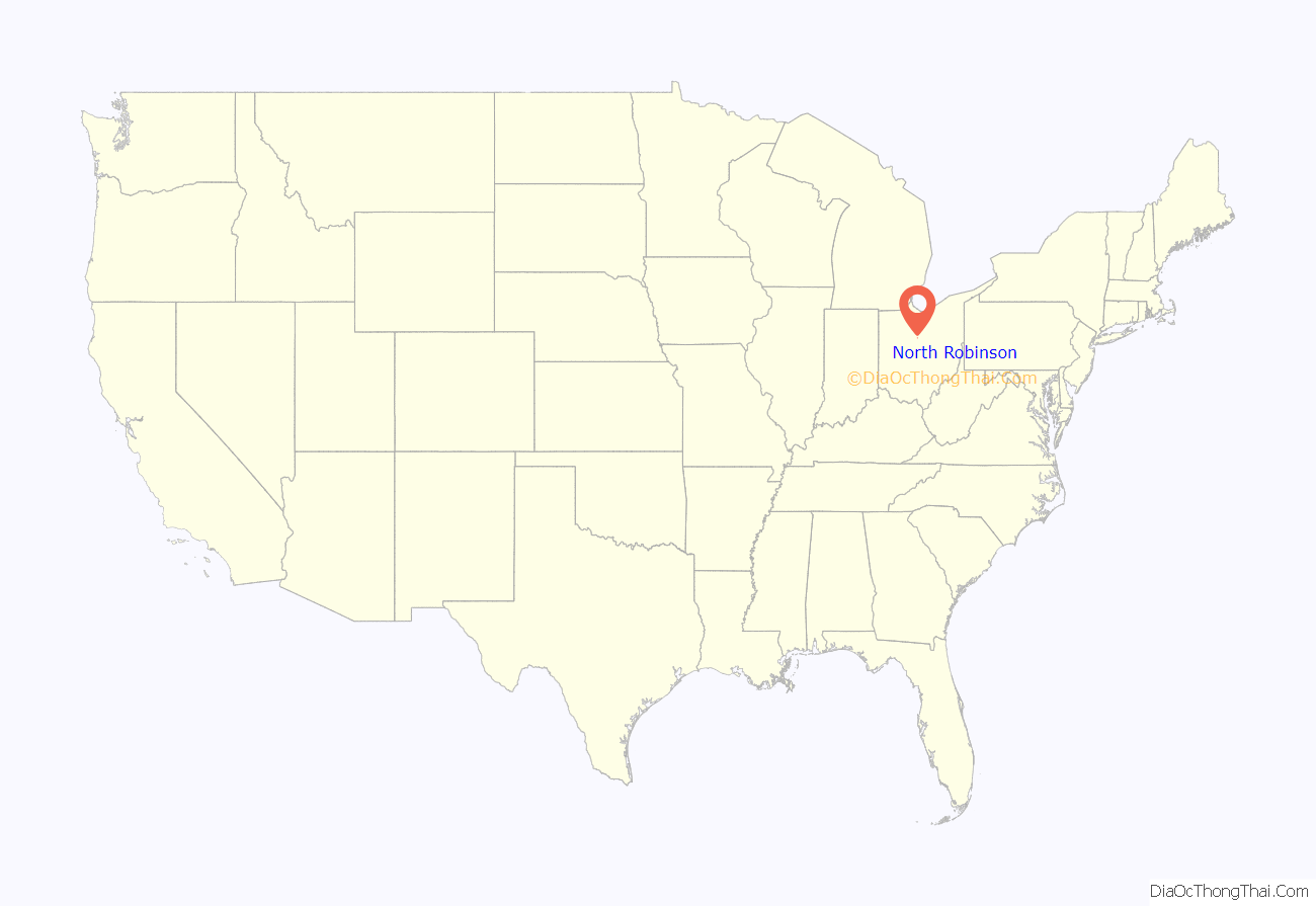
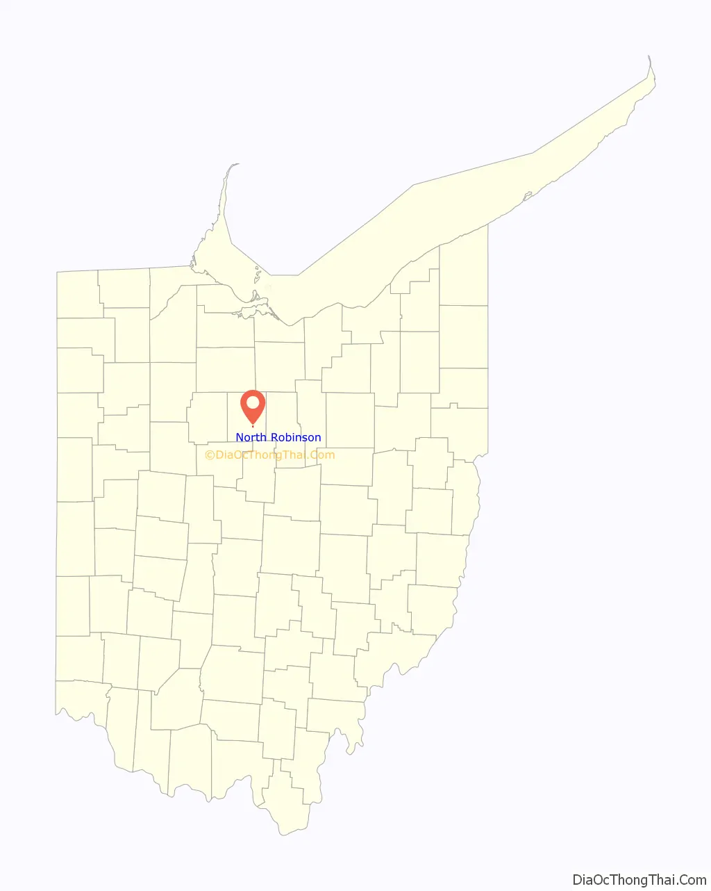
North Robinson location map. Where is North Robinson village?
History
North Robinson was laid out in 1861. It was named for the Robinson family of pioneer settlers.
On September 4, 2017 a tornado which turned out to be the only one of the day struck the village doing high end EF2 damage to a house.
North Robinson Road Map
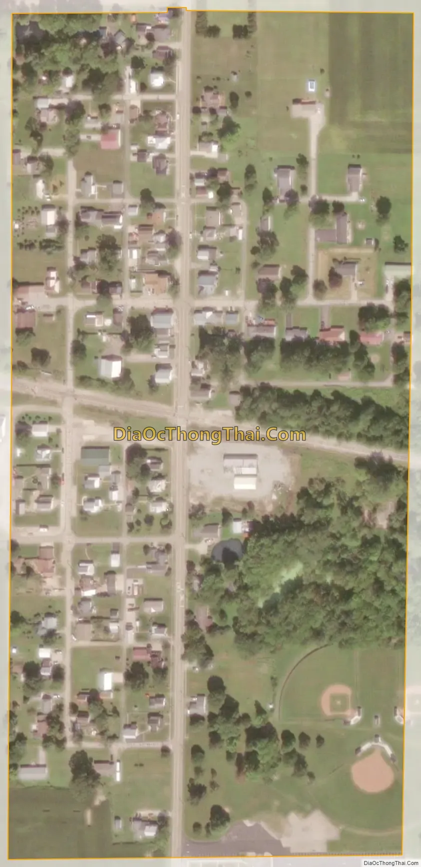
North Robinson city Satellite Map
Geography
North Robinson is located at 40°47′34″N 82°51′27″W / 40.79278°N 82.85750°W / 40.79278; -82.85750 (40.792804, -82.857596).
According to the United States Census Bureau, the village has a total area of 0.10 square miles (0.26 km), all land.
See also
Map of Ohio State and its subdivision:- Adams
- Allen
- Ashland
- Ashtabula
- Athens
- Auglaize
- Belmont
- Brown
- Butler
- Carroll
- Champaign
- Clark
- Clermont
- Clinton
- Columbiana
- Coshocton
- Crawford
- Cuyahoga
- Darke
- Defiance
- Delaware
- Erie
- Fairfield
- Fayette
- Franklin
- Fulton
- Gallia
- Geauga
- Greene
- Guernsey
- Hamilton
- Hancock
- Hardin
- Harrison
- Henry
- Highland
- Hocking
- Holmes
- Huron
- Jackson
- Jefferson
- Knox
- Lake
- Lake Erie
- Lawrence
- Licking
- Logan
- Lorain
- Lucas
- Madison
- Mahoning
- Marion
- Medina
- Meigs
- Mercer
- Miami
- Monroe
- Montgomery
- Morgan
- Morrow
- Muskingum
- Noble
- Ottawa
- Paulding
- Perry
- Pickaway
- Pike
- Portage
- Preble
- Putnam
- Richland
- Ross
- Sandusky
- Scioto
- Seneca
- Shelby
- Stark
- Summit
- Trumbull
- Tuscarawas
- Union
- Van Wert
- Vinton
- Warren
- Washington
- Wayne
- Williams
- Wood
- Wyandot
- Alabama
- Alaska
- Arizona
- Arkansas
- California
- Colorado
- Connecticut
- Delaware
- District of Columbia
- Florida
- Georgia
- Hawaii
- Idaho
- Illinois
- Indiana
- Iowa
- Kansas
- Kentucky
- Louisiana
- Maine
- Maryland
- Massachusetts
- Michigan
- Minnesota
- Mississippi
- Missouri
- Montana
- Nebraska
- Nevada
- New Hampshire
- New Jersey
- New Mexico
- New York
- North Carolina
- North Dakota
- Ohio
- Oklahoma
- Oregon
- Pennsylvania
- Rhode Island
- South Carolina
- South Dakota
- Tennessee
- Texas
- Utah
- Vermont
- Virginia
- Washington
- West Virginia
- Wisconsin
- Wyoming