Orrville is a city in Wayne County, Ohio, United States. It is about 9 miles east of Wooster and 20 miles southwest of Akron. The population was 8,452 at the 2020 census. It is part of the Wooster micropolitan area. The J.M. Smucker Company, manufacturer of the Smucker’s food brand, is headquartered in Orrville.
| Name: | Orrville city |
|---|---|
| LSAD Code: | 25 |
| LSAD Description: | city (suffix) |
| State: | Ohio |
| County: | Wayne County |
| Elevation: | 1,060 ft (323 m) |
| Total Area: | 5.62 sq mi (14.55 km²) |
| Land Area: | 5.61 sq mi (14.53 km²) |
| Water Area: | 0.01 sq mi (0.03 km²) |
| Total Population: | 8,452 |
| Population Density: | 1,506.86/sq mi (581.82/km²) |
| ZIP code: | 44667 |
| Area code: | 330 |
| FIPS code: | 3958828 |
| GNISfeature ID: | 1065216 |
| Website: | orrville.com |
Online Interactive Map
Click on ![]() to view map in "full screen" mode.
to view map in "full screen" mode.
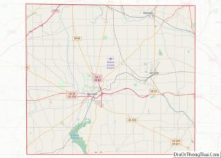
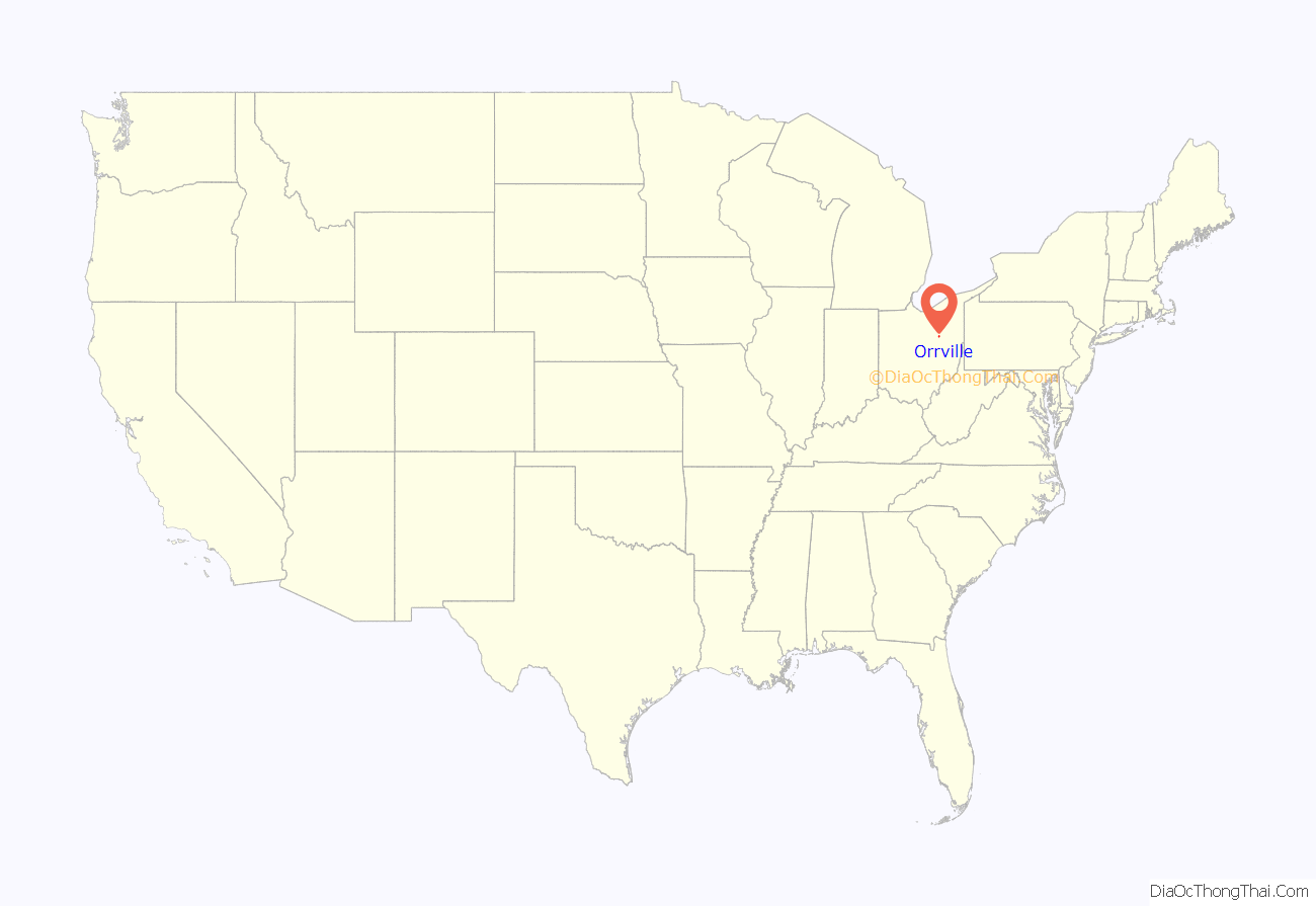
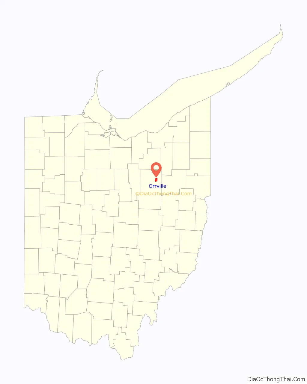
Orrville location map. Where is Orrville city?
History
Orrville was laid out in 1852, and named after Judge Smith Orr, proprietor. A post office called Orrville has been in operation since 1852.
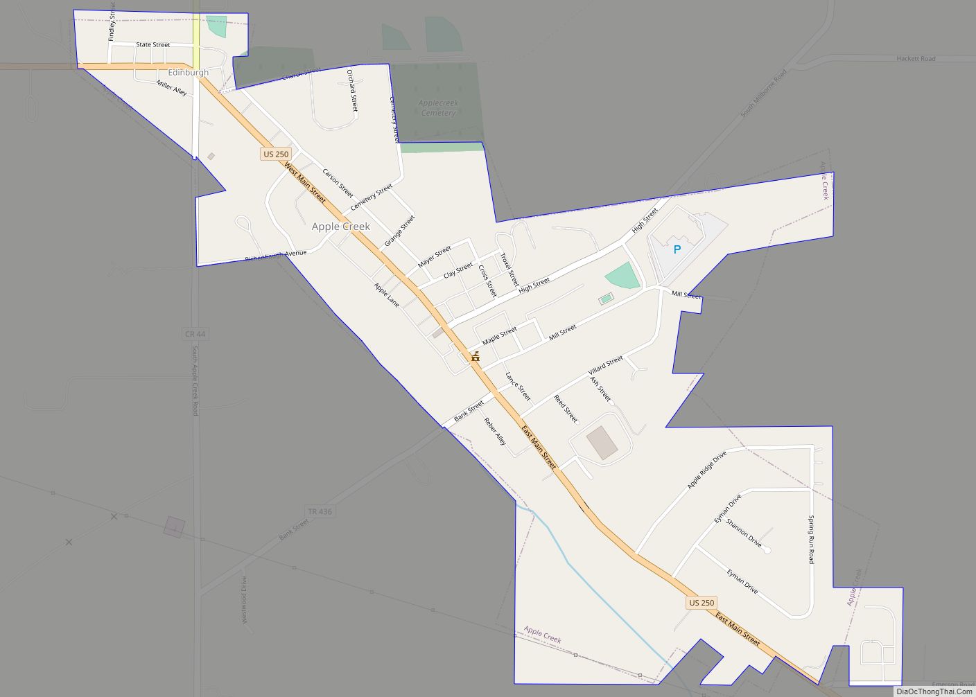
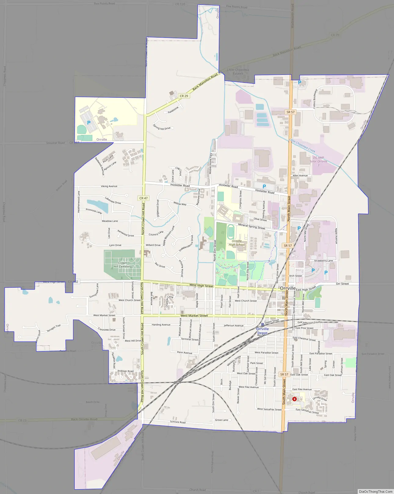
Orrville Road Map
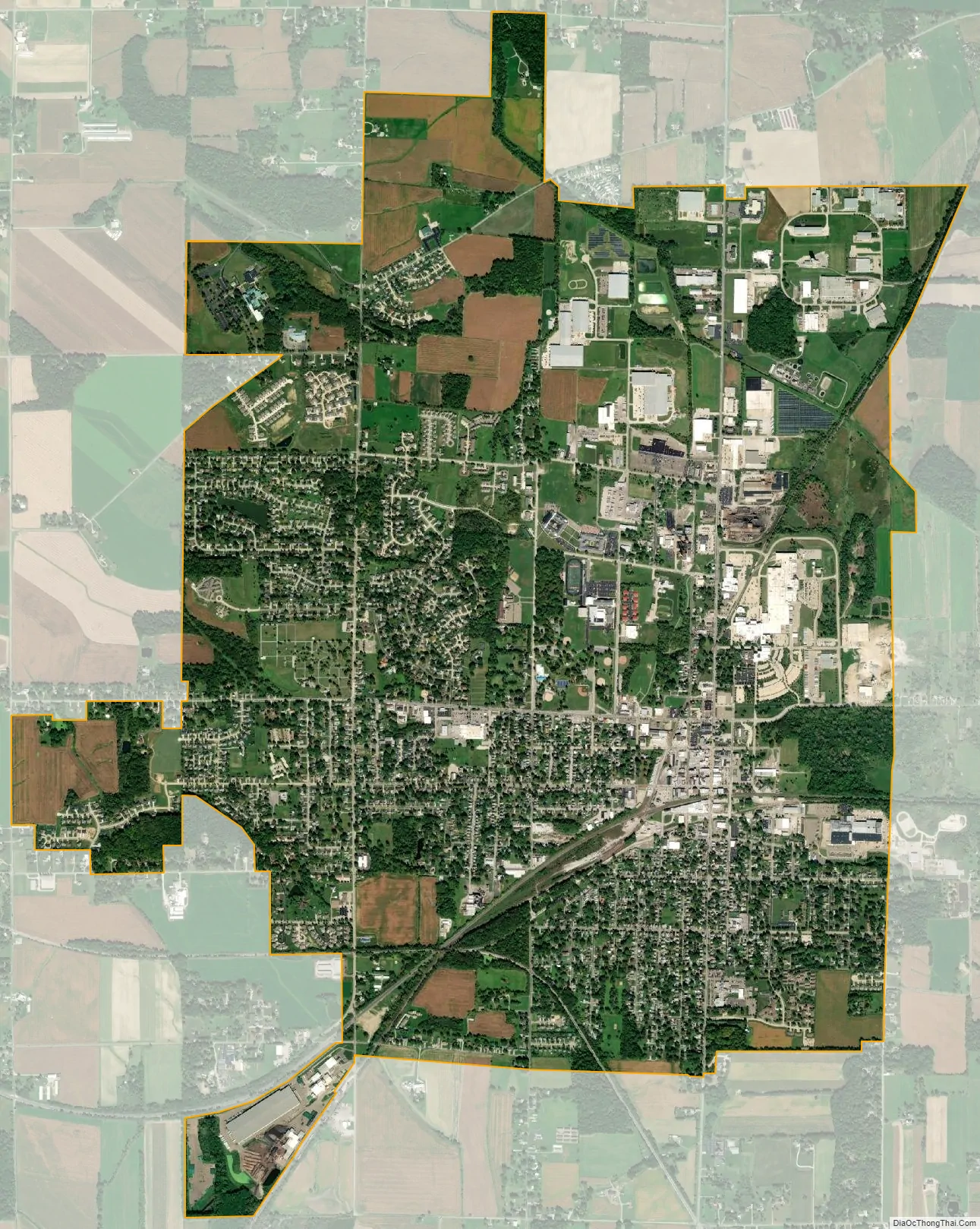
Orrville city Satellite Map
Geography
Orrville is located at 40°50′N 81°46′W / 40.833°N 81.767°W / 40.833; -81.767 (40.8414, −81.7715).
According to the United States Census Bureau, the city has a total area of 5.75 square miles (14.89 km), of which 5.74 square miles (14.87 km) is land and 0.01 square miles (0.03 km) is water.
See also
Map of Ohio State and its subdivision:- Adams
- Allen
- Ashland
- Ashtabula
- Athens
- Auglaize
- Belmont
- Brown
- Butler
- Carroll
- Champaign
- Clark
- Clermont
- Clinton
- Columbiana
- Coshocton
- Crawford
- Cuyahoga
- Darke
- Defiance
- Delaware
- Erie
- Fairfield
- Fayette
- Franklin
- Fulton
- Gallia
- Geauga
- Greene
- Guernsey
- Hamilton
- Hancock
- Hardin
- Harrison
- Henry
- Highland
- Hocking
- Holmes
- Huron
- Jackson
- Jefferson
- Knox
- Lake
- Lake Erie
- Lawrence
- Licking
- Logan
- Lorain
- Lucas
- Madison
- Mahoning
- Marion
- Medina
- Meigs
- Mercer
- Miami
- Monroe
- Montgomery
- Morgan
- Morrow
- Muskingum
- Noble
- Ottawa
- Paulding
- Perry
- Pickaway
- Pike
- Portage
- Preble
- Putnam
- Richland
- Ross
- Sandusky
- Scioto
- Seneca
- Shelby
- Stark
- Summit
- Trumbull
- Tuscarawas
- Union
- Van Wert
- Vinton
- Warren
- Washington
- Wayne
- Williams
- Wood
- Wyandot
- Alabama
- Alaska
- Arizona
- Arkansas
- California
- Colorado
- Connecticut
- Delaware
- District of Columbia
- Florida
- Georgia
- Hawaii
- Idaho
- Illinois
- Indiana
- Iowa
- Kansas
- Kentucky
- Louisiana
- Maine
- Maryland
- Massachusetts
- Michigan
- Minnesota
- Mississippi
- Missouri
- Montana
- Nebraska
- Nevada
- New Hampshire
- New Jersey
- New Mexico
- New York
- North Carolina
- North Dakota
- Ohio
- Oklahoma
- Oregon
- Pennsylvania
- Rhode Island
- South Carolina
- South Dakota
- Tennessee
- Texas
- Utah
- Vermont
- Virginia
- Washington
- West Virginia
- Wisconsin
- Wyoming