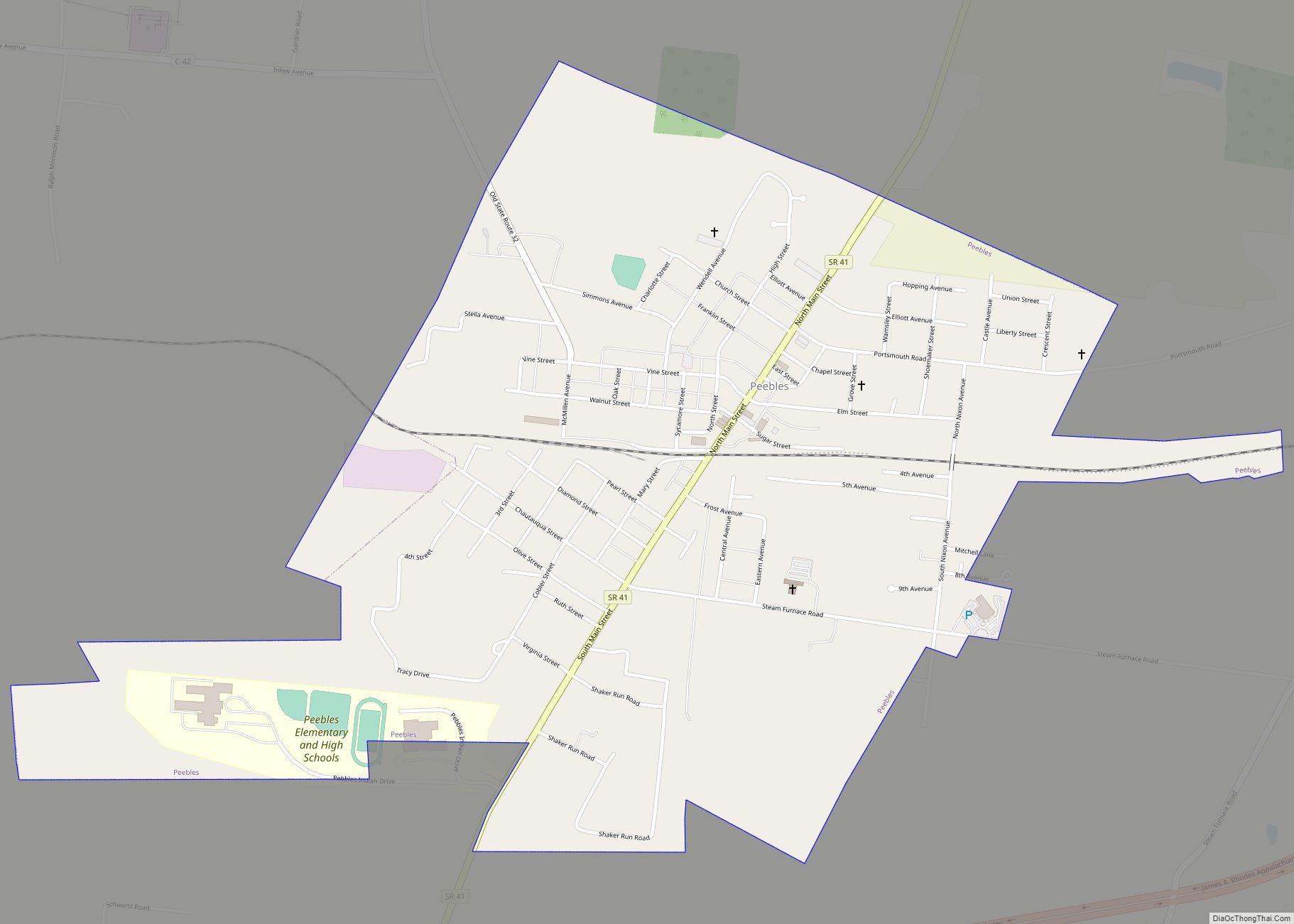
Peebles is a village in Meigs Township, Adams County, Ohio, United States. It is sixty-four miles east of Cincinnati. The population was 1,774 at the 2020 census.
| Name: | Peebles village |
|---|---|
| LSAD Code: | 47 |
| LSAD Description: | village (suffix) |
| State: | Ohio |
| County: | Adams County |
| Elevation: | 827 ft (252 m) |
| Total Area: | 1.21 sq mi (3.14 km²) |
| Land Area: | 1.21 sq mi (3.14 km²) |
| Water Area: | 0.00 sq mi (0.00 km²) |
| Total Population: | 1,774 |
| Population Density: | 1,461.29/sq mi (564.11/km²) |
| ZIP code: | 45660 |
| Area code: | 937, 326 |
| FIPS code: | 3961420 |
| GNISfeature ID: | 1044358 |
Online Interactive Map
Click on ![]() to view map in "full screen" mode.
to view map in "full screen" mode.
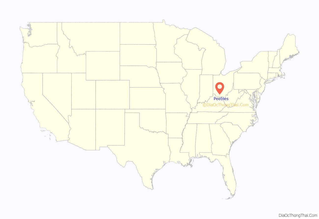
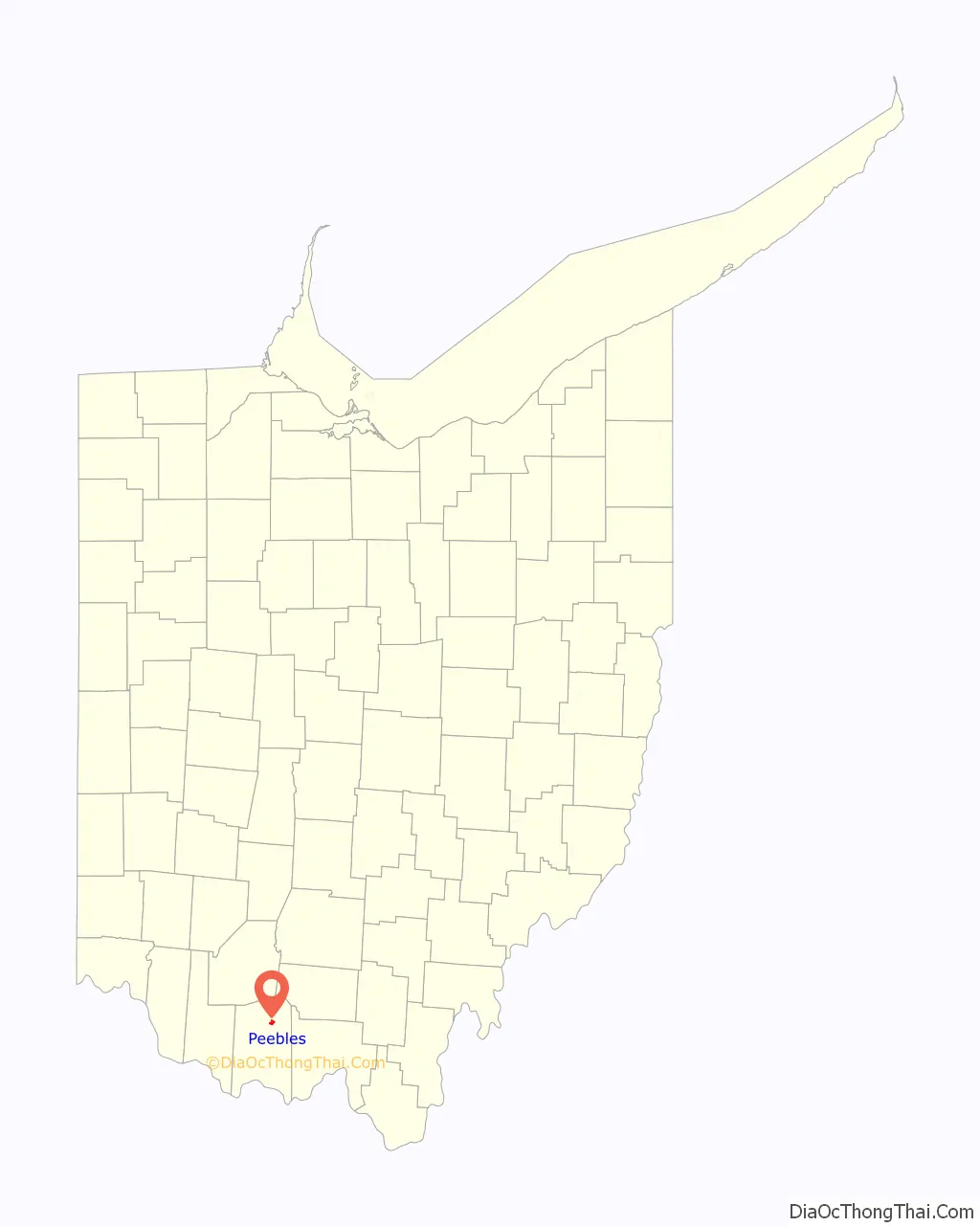
Peebles location map. Where is Peebles village?
History
Peebles was founded in 1881 with the building of the railroad through that territory. It was named for John G. Peebles, who was instrumental in bringing the railroad to the settlement. That railroad was the Cincinnati & Eastern Railroad, today the Cincinnati Eastern Railroad (CCET).
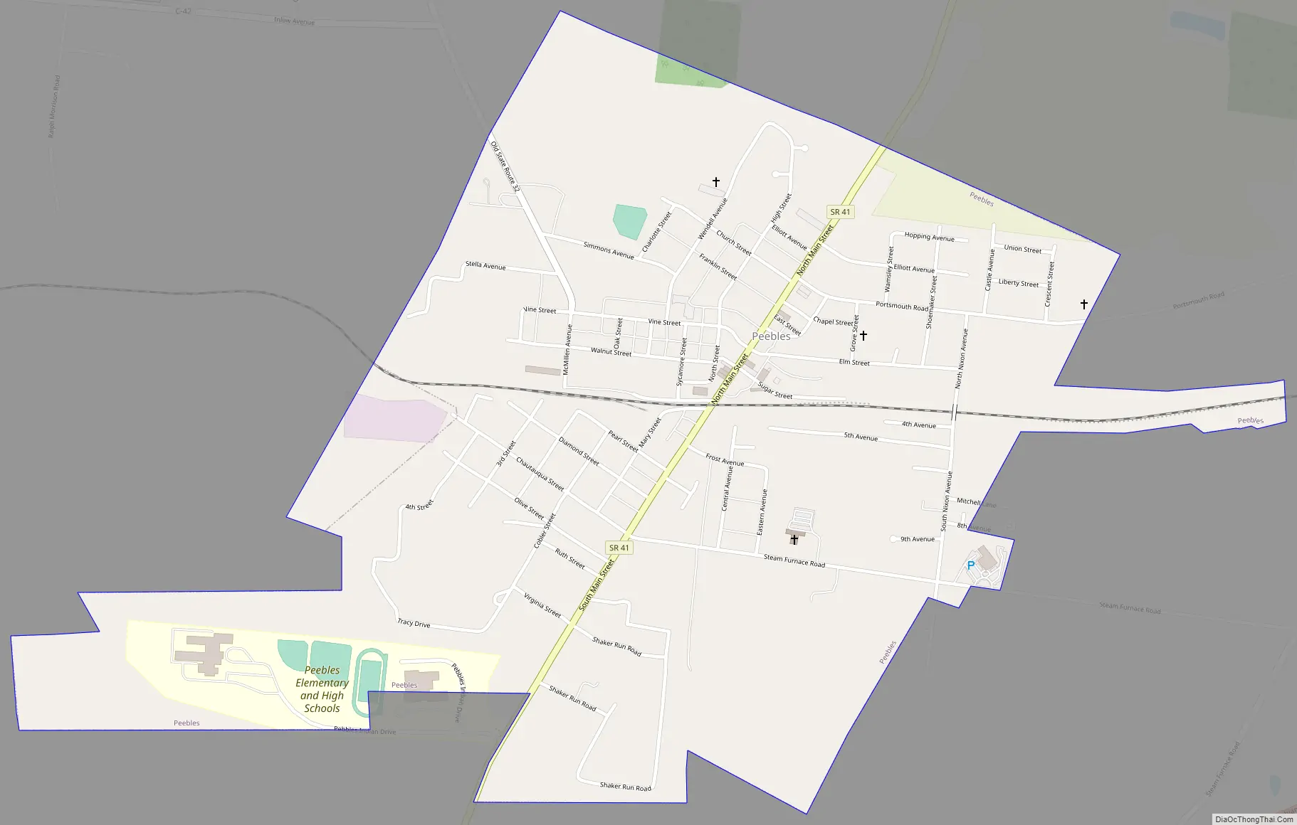
Peebles Road Map
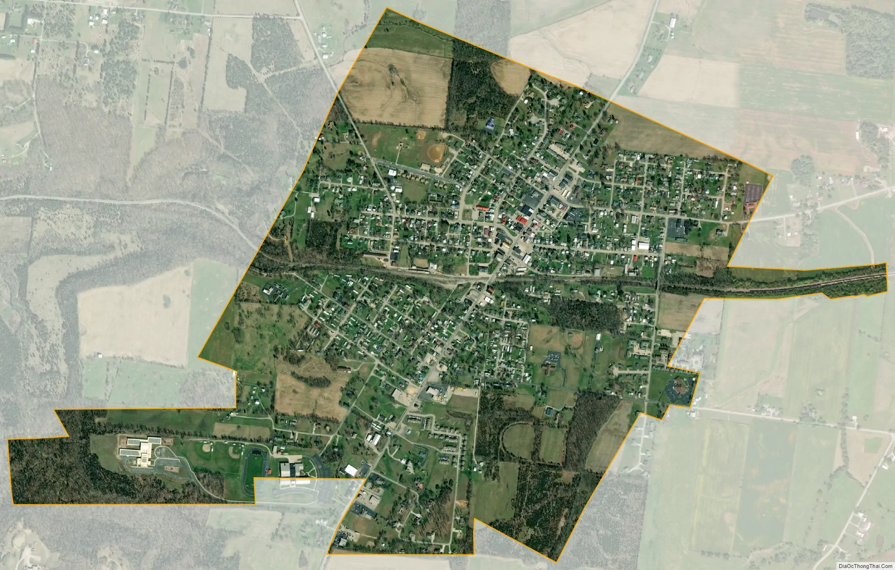
Peebles city Satellite Map
Geography
According to the United States Census Bureau, the village has a total area of 1.18 square miles (3.06 km), all land.
See also
Map of Ohio State and its subdivision:- Adams
- Allen
- Ashland
- Ashtabula
- Athens
- Auglaize
- Belmont
- Brown
- Butler
- Carroll
- Champaign
- Clark
- Clermont
- Clinton
- Columbiana
- Coshocton
- Crawford
- Cuyahoga
- Darke
- Defiance
- Delaware
- Erie
- Fairfield
- Fayette
- Franklin
- Fulton
- Gallia
- Geauga
- Greene
- Guernsey
- Hamilton
- Hancock
- Hardin
- Harrison
- Henry
- Highland
- Hocking
- Holmes
- Huron
- Jackson
- Jefferson
- Knox
- Lake
- Lake Erie
- Lawrence
- Licking
- Logan
- Lorain
- Lucas
- Madison
- Mahoning
- Marion
- Medina
- Meigs
- Mercer
- Miami
- Monroe
- Montgomery
- Morgan
- Morrow
- Muskingum
- Noble
- Ottawa
- Paulding
- Perry
- Pickaway
- Pike
- Portage
- Preble
- Putnam
- Richland
- Ross
- Sandusky
- Scioto
- Seneca
- Shelby
- Stark
- Summit
- Trumbull
- Tuscarawas
- Union
- Van Wert
- Vinton
- Warren
- Washington
- Wayne
- Williams
- Wood
- Wyandot
- Alabama
- Alaska
- Arizona
- Arkansas
- California
- Colorado
- Connecticut
- Delaware
- District of Columbia
- Florida
- Georgia
- Hawaii
- Idaho
- Illinois
- Indiana
- Iowa
- Kansas
- Kentucky
- Louisiana
- Maine
- Maryland
- Massachusetts
- Michigan
- Minnesota
- Mississippi
- Missouri
- Montana
- Nebraska
- Nevada
- New Hampshire
- New Jersey
- New Mexico
- New York
- North Carolina
- North Dakota
- Ohio
- Oklahoma
- Oregon
- Pennsylvania
- Rhode Island
- South Carolina
- South Dakota
- Tennessee
- Texas
- Utah
- Vermont
- Virginia
- Washington
- West Virginia
- Wisconsin
- Wyoming