Perrysville is a village in Ashland County, Ohio, United States. The population was 729 at the 2020 census.
| Name: | Perrysville village |
|---|---|
| LSAD Code: | 47 |
| LSAD Description: | village (suffix) |
| State: | Ohio |
| County: | Ashland County |
| Elevation: | 994 ft (303 m) |
| Total Area: | 0.79 sq mi (2.05 km²) |
| Land Area: | 0.79 sq mi (2.05 km²) |
| Water Area: | 0.00 sq mi (0.00 km²) |
| Total Population: | 729 |
| Population Density: | 922.78/sq mi (356.15/km²) |
| ZIP code: | 44864 |
| Area code: | 419 |
| FIPS code: | 3962190 |
| GNISfeature ID: | 1068213 |
| Website: | www.villageofperrysville.com |
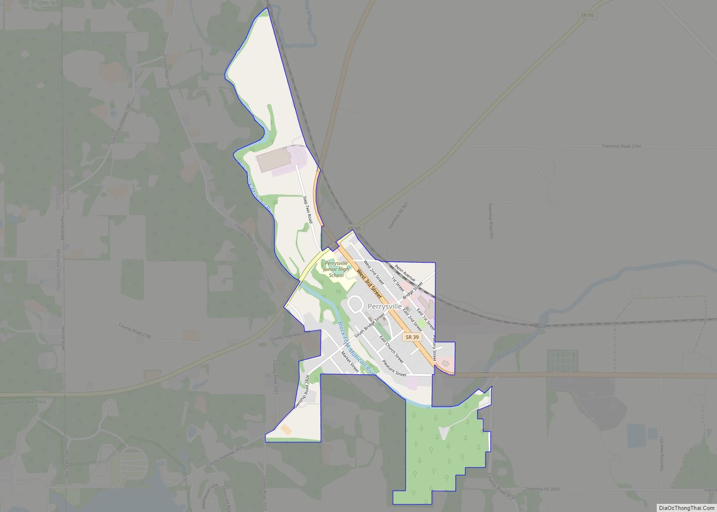
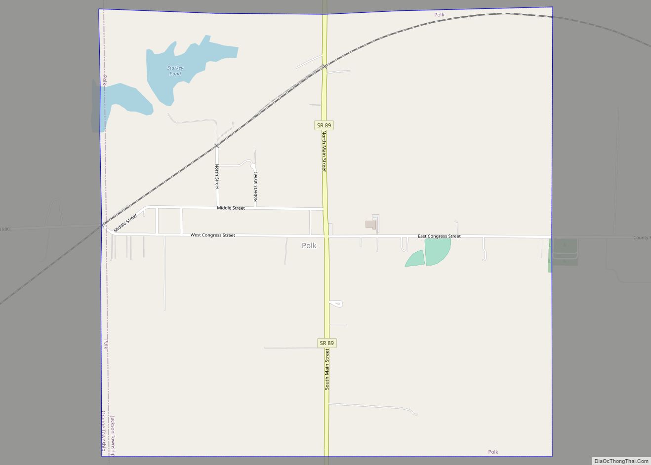
Online Interactive Map
Click on ![]() to view map in "full screen" mode.
to view map in "full screen" mode.
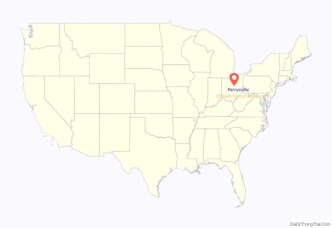
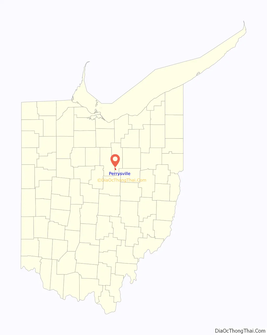
Perrysville location map. Where is Perrysville village?
History
The area was first permanently settled in 1810, but the village was not laid out until 1812. One of the settlers, Judge Coulter, picked the most beautiful spot for a village with the intentions of laying out a village, and although he had no name planned his neighbors jokingly called it “Coulterville.” Perrysville was originally called Freeport, and under the latter name was laid out in 1815. The present name honors Oliver Hazard Perry, remembered for leading American forces in a decisive naval victory at the Battle of Lake Erie. A post office called Perryville was established in 1820, and the name was changed to Perrysville in 1883.
Perrysville Road Map
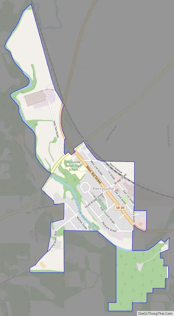
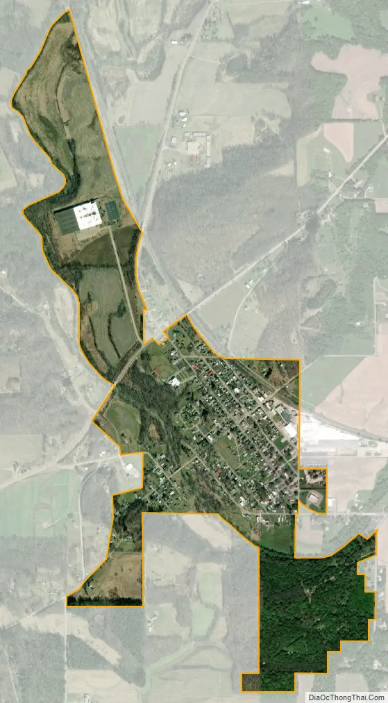
Perrysville city Satellite Map
Geography
Perrysville is located at 40°39′26″N 82°18′41″W / 40.65722°N 82.31139°W / 40.65722; -82.31139 (40.657280, -82.311518), along the Black Fork of the Mohican River.
According to the United States Census Bureau, the village has a total area of 0.79 square miles (2.05 km), all land. The village is the third largest municipality in the county after Ashland and Loudonville.
The Black Fork of the Mohican River passes the southwestern edge of the village.
Perrysville is roughly 30 miles from the cities of Mansfield, Ashland, Wooster, and Mt. Vernon. Nearby attractions include Mohican Forest, Pleasant Hill Lake, Malabar Farm, and St. Gregory Palamas Monastery.
The geography of the area, especially the multiple branches forming the Mohican River, make Perrysville and neighboring Loudonville premier locations for camping, canoeing, and eco-tourism.
See also
Map of Ohio State and its subdivision:- Adams
- Allen
- Ashland
- Ashtabula
- Athens
- Auglaize
- Belmont
- Brown
- Butler
- Carroll
- Champaign
- Clark
- Clermont
- Clinton
- Columbiana
- Coshocton
- Crawford
- Cuyahoga
- Darke
- Defiance
- Delaware
- Erie
- Fairfield
- Fayette
- Franklin
- Fulton
- Gallia
- Geauga
- Greene
- Guernsey
- Hamilton
- Hancock
- Hardin
- Harrison
- Henry
- Highland
- Hocking
- Holmes
- Huron
- Jackson
- Jefferson
- Knox
- Lake
- Lake Erie
- Lawrence
- Licking
- Logan
- Lorain
- Lucas
- Madison
- Mahoning
- Marion
- Medina
- Meigs
- Mercer
- Miami
- Monroe
- Montgomery
- Morgan
- Morrow
- Muskingum
- Noble
- Ottawa
- Paulding
- Perry
- Pickaway
- Pike
- Portage
- Preble
- Putnam
- Richland
- Ross
- Sandusky
- Scioto
- Seneca
- Shelby
- Stark
- Summit
- Trumbull
- Tuscarawas
- Union
- Van Wert
- Vinton
- Warren
- Washington
- Wayne
- Williams
- Wood
- Wyandot
- Alabama
- Alaska
- Arizona
- Arkansas
- California
- Colorado
- Connecticut
- Delaware
- District of Columbia
- Florida
- Georgia
- Hawaii
- Idaho
- Illinois
- Indiana
- Iowa
- Kansas
- Kentucky
- Louisiana
- Maine
- Maryland
- Massachusetts
- Michigan
- Minnesota
- Mississippi
- Missouri
- Montana
- Nebraska
- Nevada
- New Hampshire
- New Jersey
- New Mexico
- New York
- North Carolina
- North Dakota
- Ohio
- Oklahoma
- Oregon
- Pennsylvania
- Rhode Island
- South Carolina
- South Dakota
- Tennessee
- Texas
- Utah
- Vermont
- Virginia
- Washington
- West Virginia
- Wisconsin
- Wyoming