Plainville is a census-designated place (CDP) in Hamilton County, Ohio, United States. The population was 120 at the 2020 census.
| Name: | Plainville CDP |
|---|---|
| LSAD Code: | 57 |
| LSAD Description: | CDP (suffix) |
| State: | Ohio |
| County: | Hamilton County |
| Elevation: | 499 ft (152 m) |
| Total Area: | 0.09 sq mi (0.24 km²) |
| Land Area: | 0.09 sq mi (0.24 km²) |
| Water Area: | 0.00 sq mi (0.00 km²) |
| Total Population: | 120 |
| Population Density: | 1,318.68/sq mi (508.21/km²) |
| FIPS code: | 3963072 |
| GNISfeature ID: | 1056477 |
Online Interactive Map
Click on ![]() to view map in "full screen" mode.
to view map in "full screen" mode.
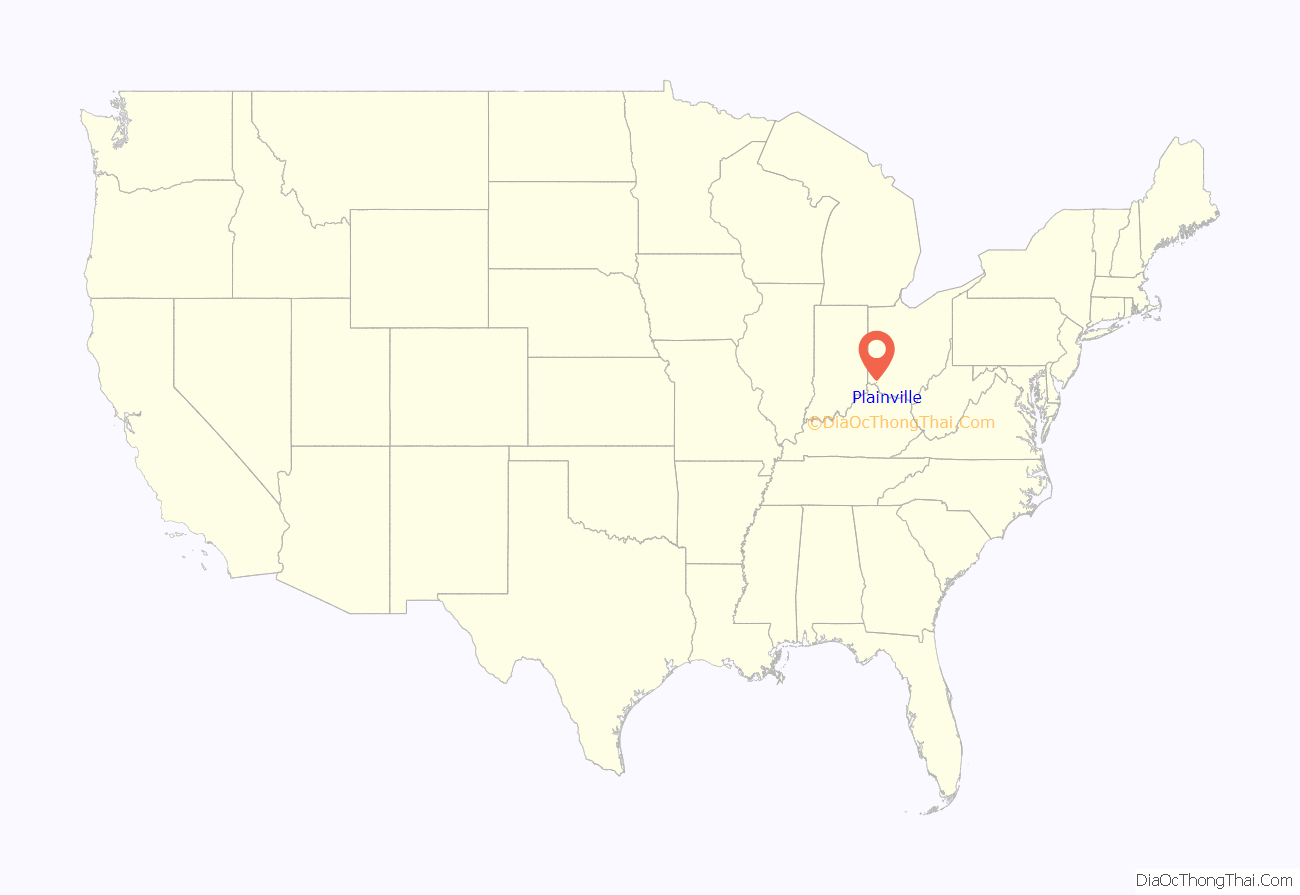
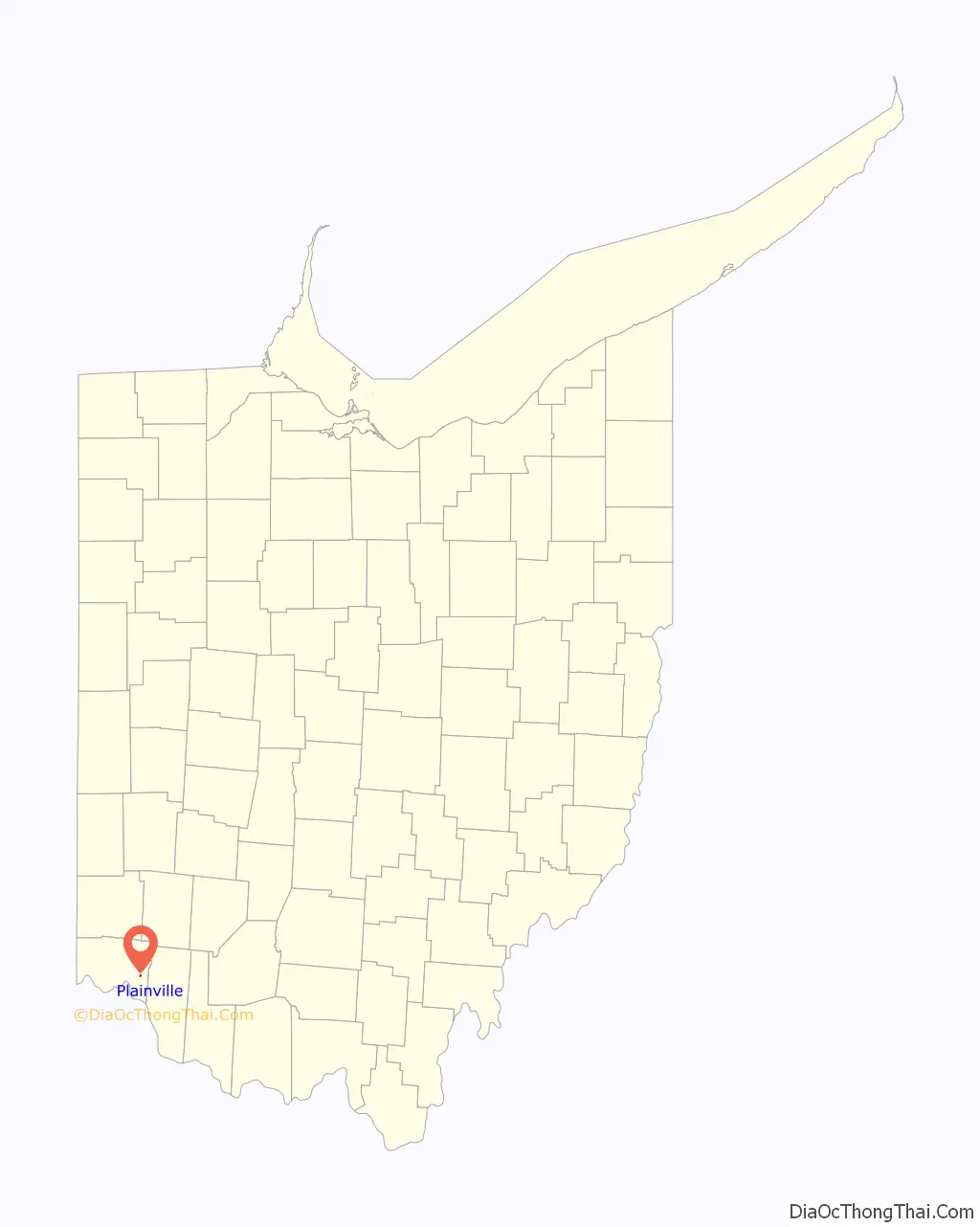
Plainville location map. Where is Plainville CDP?
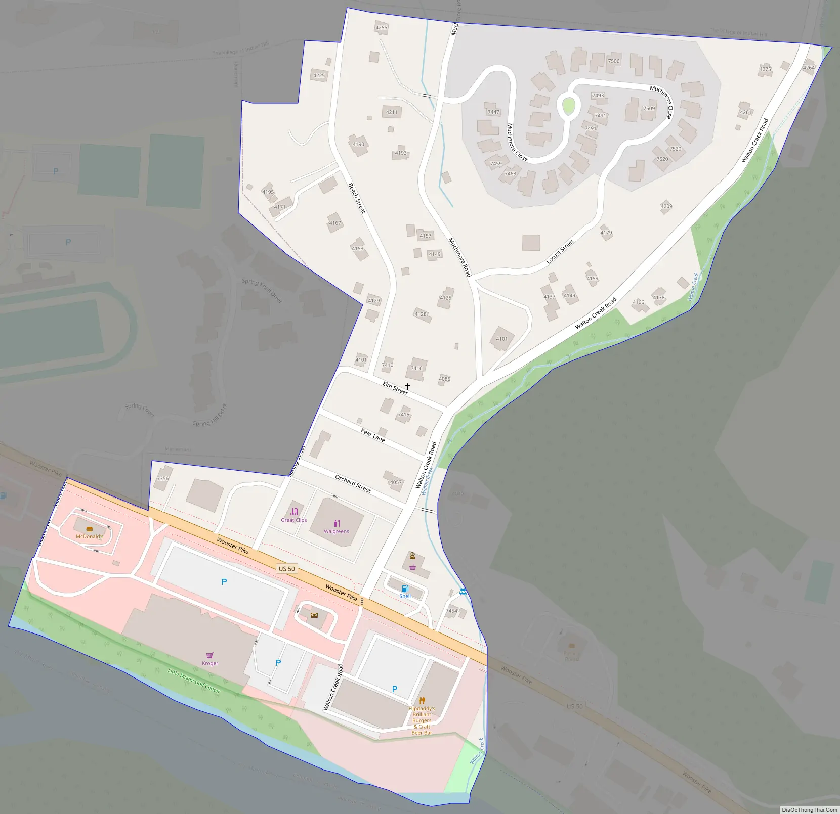
Plainville Road Map
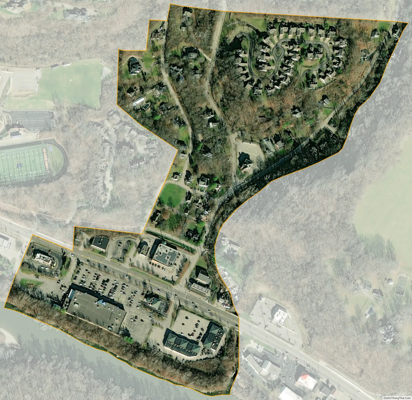
Plainville city Satellite Map
Geography
Plainville is located at 39°8′31″N 84°21′35″W / 39.14194°N 84.35972°W / 39.14194; -84.35972 in a valley on the banks of the Little Miami River, opposite Newtown and adjacent to Mariemont and Indian Hill. Plainville is part of the Greater Cincinnati area and the Mariemont City School District. Many of the residences and structures are from the 19th century, and the old Plainville School which was built in 1910 and closed in 1957 still stands on Walton Creek Road and now serves as the home theater for the Mariemont Players theater troupe.
According to the United States Census Bureau, the CDP has a total area of 0.077 square miles (0.2 km), all land.
See also
Map of Ohio State and its subdivision:- Adams
- Allen
- Ashland
- Ashtabula
- Athens
- Auglaize
- Belmont
- Brown
- Butler
- Carroll
- Champaign
- Clark
- Clermont
- Clinton
- Columbiana
- Coshocton
- Crawford
- Cuyahoga
- Darke
- Defiance
- Delaware
- Erie
- Fairfield
- Fayette
- Franklin
- Fulton
- Gallia
- Geauga
- Greene
- Guernsey
- Hamilton
- Hancock
- Hardin
- Harrison
- Henry
- Highland
- Hocking
- Holmes
- Huron
- Jackson
- Jefferson
- Knox
- Lake
- Lake Erie
- Lawrence
- Licking
- Logan
- Lorain
- Lucas
- Madison
- Mahoning
- Marion
- Medina
- Meigs
- Mercer
- Miami
- Monroe
- Montgomery
- Morgan
- Morrow
- Muskingum
- Noble
- Ottawa
- Paulding
- Perry
- Pickaway
- Pike
- Portage
- Preble
- Putnam
- Richland
- Ross
- Sandusky
- Scioto
- Seneca
- Shelby
- Stark
- Summit
- Trumbull
- Tuscarawas
- Union
- Van Wert
- Vinton
- Warren
- Washington
- Wayne
- Williams
- Wood
- Wyandot
- Alabama
- Alaska
- Arizona
- Arkansas
- California
- Colorado
- Connecticut
- Delaware
- District of Columbia
- Florida
- Georgia
- Hawaii
- Idaho
- Illinois
- Indiana
- Iowa
- Kansas
- Kentucky
- Louisiana
- Maine
- Maryland
- Massachusetts
- Michigan
- Minnesota
- Mississippi
- Missouri
- Montana
- Nebraska
- Nevada
- New Hampshire
- New Jersey
- New Mexico
- New York
- North Carolina
- North Dakota
- Ohio
- Oklahoma
- Oregon
- Pennsylvania
- Rhode Island
- South Carolina
- South Dakota
- Tennessee
- Texas
- Utah
- Vermont
- Virginia
- Washington
- West Virginia
- Wisconsin
- Wyoming


