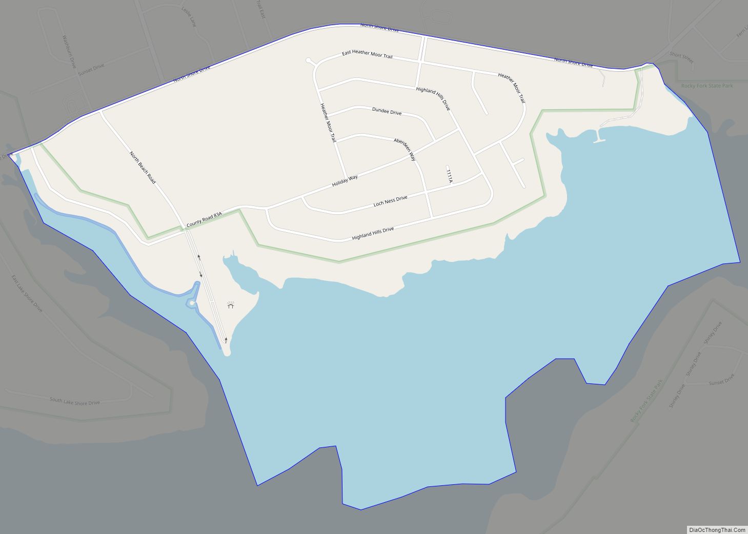
Rocky Fork Point is an unincorporated community and census-designated place in Highland County, Ohio, United States. Its population was 639 as of the 2010 census.
| Name: | Rocky Fork Point CDP |
|---|---|
| LSAD Code: | 57 |
| LSAD Description: | CDP (suffix) |
| State: | Ohio |
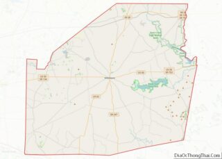
| County: | Highland County |
| Elevation: | 974 ft (297 m) |
| Total Area: | 1.22 sq mi (3.17 km²) |
| Land Area: | 0.71 sq mi (1.84 km²) |
| Water Area: | 0.51 sq mi (1.33 km²) |
| Total Population: | 742 |
| Population Density: | 1,042.13/sq mi (402.19/km²) |
| Area code: | 937, 326 |
| FIPS code: | 3968004 |
| GNISfeature ID: | 2633223 |
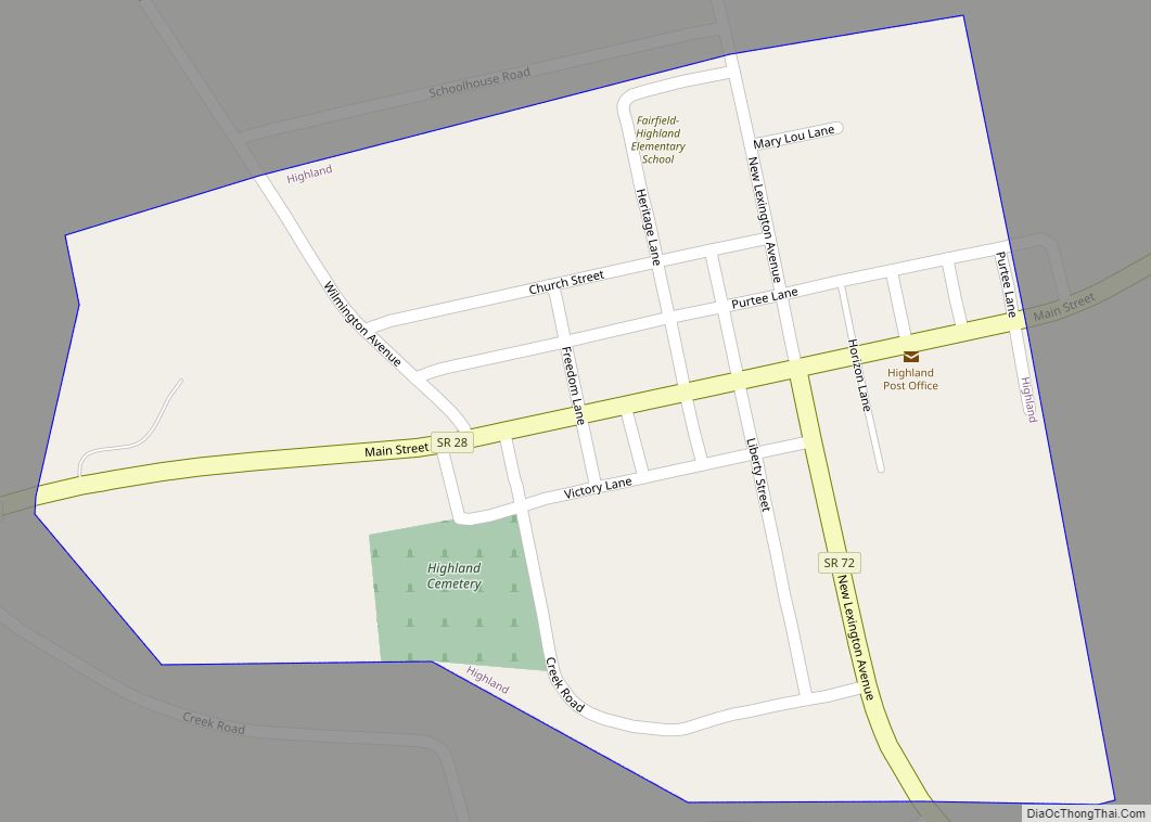
Online Interactive Map
Click on ![]() to view map in "full screen" mode.
to view map in "full screen" mode.
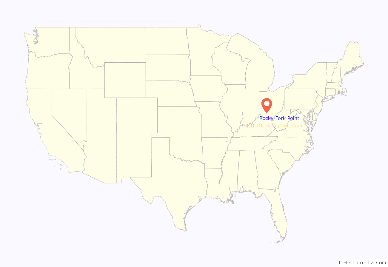
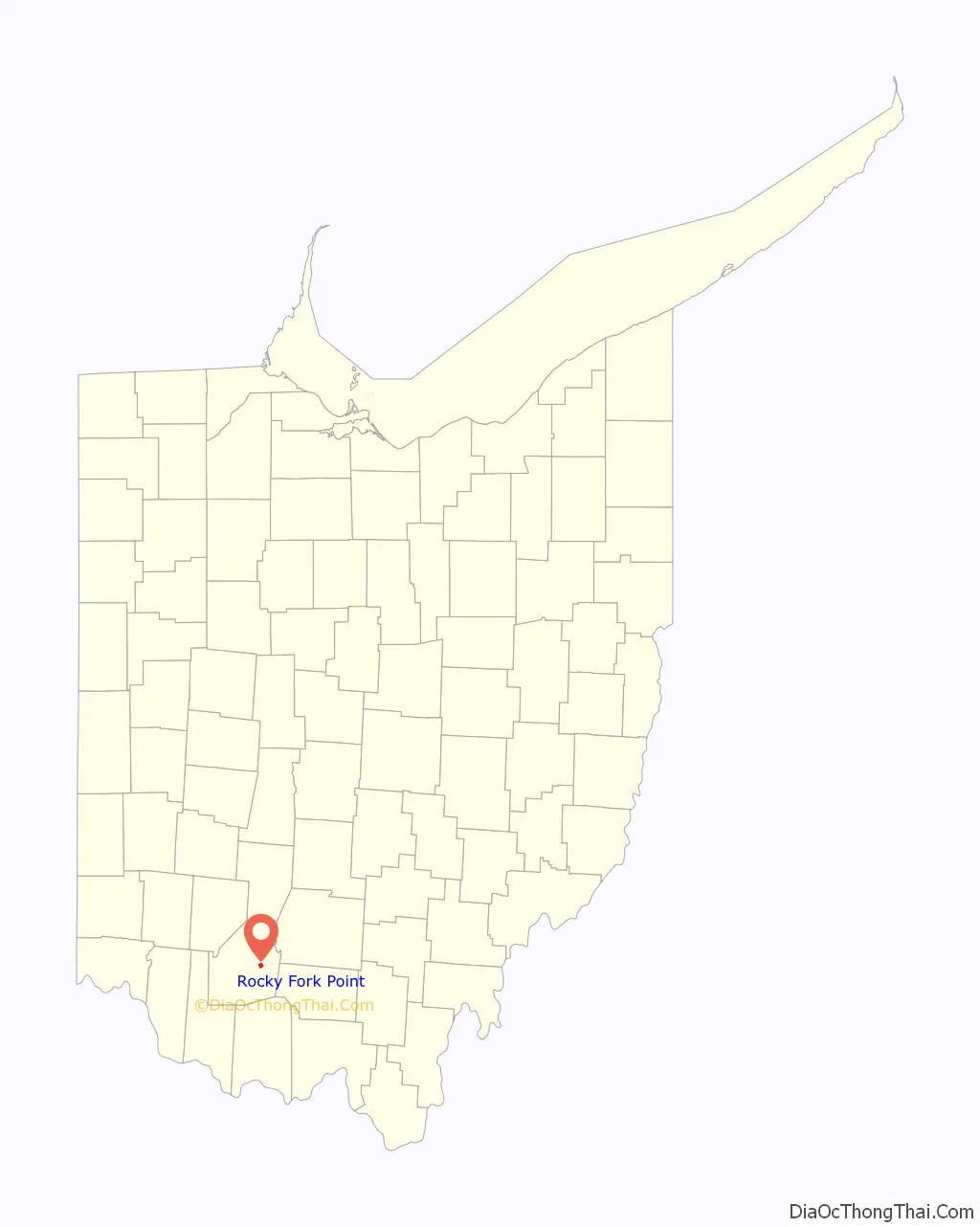
Rocky Fork Point location map. Where is Rocky Fork Point CDP?
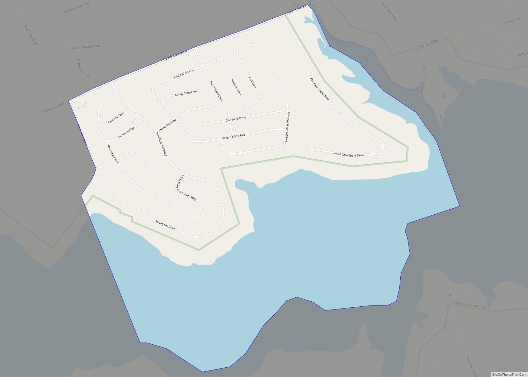
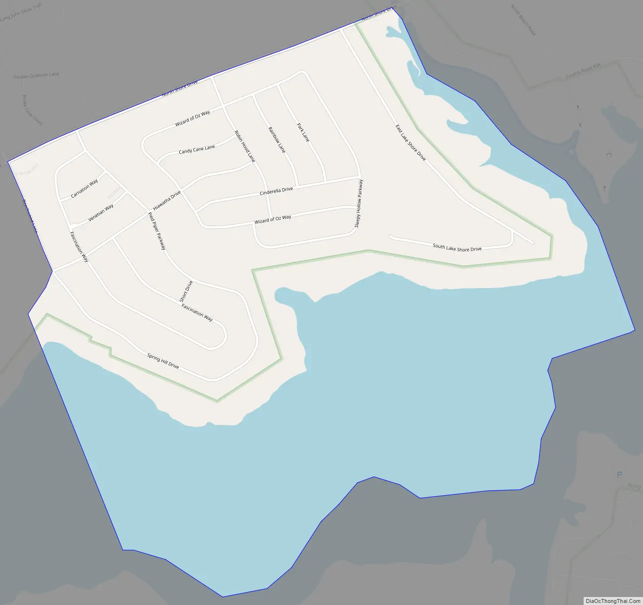
Rocky Fork Point Road Map
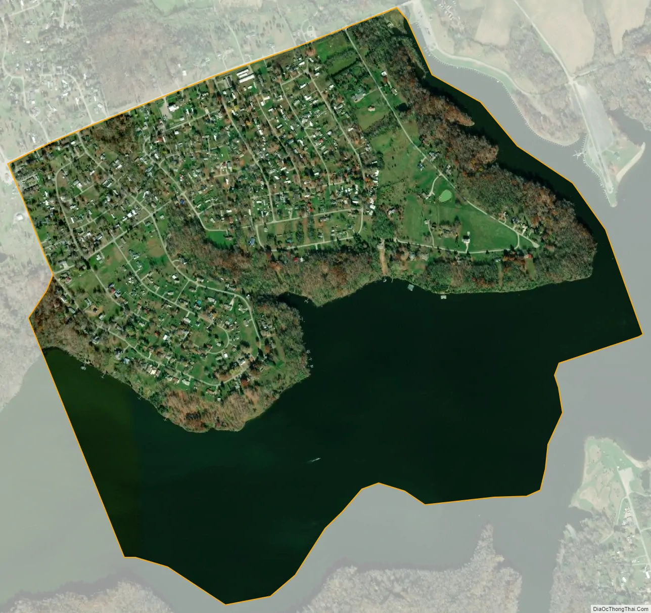
Rocky Fork Point city Satellite Map
Geography
The community is in eastern Highland County, along the southern edge of Paint Township. It is bordered to the east by the Highland Holiday CDP. Both communities sit on the north shore of Rocky Fork Lake, a reservoir built on the Rocky Fork, an east-flowing tributary of Paint Creek, which in turn flows east to the Scioto River and is part of the Ohio River watershed. According to the U.S. Census Bureau, the Rocky Fork Point CDP has an area of 1.224 square miles (3.17 km); 0.712 square miles (1.84 km) of its area is land, and 0.512 square miles (1.33 km) is water. The community is 7 miles (11 km) east of Hillsboro, the Highland county seat.
See also
Map of Ohio State and its subdivision:- Adams
- Allen
- Ashland
- Ashtabula
- Athens
- Auglaize
- Belmont
- Brown
- Butler
- Carroll
- Champaign
- Clark
- Clermont
- Clinton
- Columbiana
- Coshocton
- Crawford
- Cuyahoga
- Darke
- Defiance
- Delaware
- Erie
- Fairfield
- Fayette
- Franklin
- Fulton
- Gallia
- Geauga
- Greene
- Guernsey
- Hamilton
- Hancock
- Hardin
- Harrison
- Henry
- Highland
- Hocking
- Holmes
- Huron
- Jackson
- Jefferson
- Knox
- Lake
- Lake Erie
- Lawrence
- Licking
- Logan
- Lorain
- Lucas
- Madison
- Mahoning
- Marion
- Medina
- Meigs
- Mercer
- Miami
- Monroe
- Montgomery
- Morgan
- Morrow
- Muskingum
- Noble
- Ottawa
- Paulding
- Perry
- Pickaway
- Pike
- Portage
- Preble
- Putnam
- Richland
- Ross
- Sandusky
- Scioto
- Seneca
- Shelby
- Stark
- Summit
- Trumbull
- Tuscarawas
- Union
- Van Wert
- Vinton
- Warren
- Washington
- Wayne
- Williams
- Wood
- Wyandot
- Alabama
- Alaska
- Arizona
- Arkansas
- California
- Colorado
- Connecticut
- Delaware
- District of Columbia
- Florida
- Georgia
- Hawaii
- Idaho
- Illinois
- Indiana
- Iowa
- Kansas
- Kentucky
- Louisiana
- Maine
- Maryland
- Massachusetts
- Michigan
- Minnesota
- Mississippi
- Missouri
- Montana
- Nebraska
- Nevada
- New Hampshire
- New Jersey
- New Mexico
- New York
- North Carolina
- North Dakota
- Ohio
- Oklahoma
- Oregon
- Pennsylvania
- Rhode Island
- South Carolina
- South Dakota
- Tennessee
- Texas
- Utah
- Vermont
- Virginia
- Washington
- West Virginia
- Wisconsin
- Wyoming