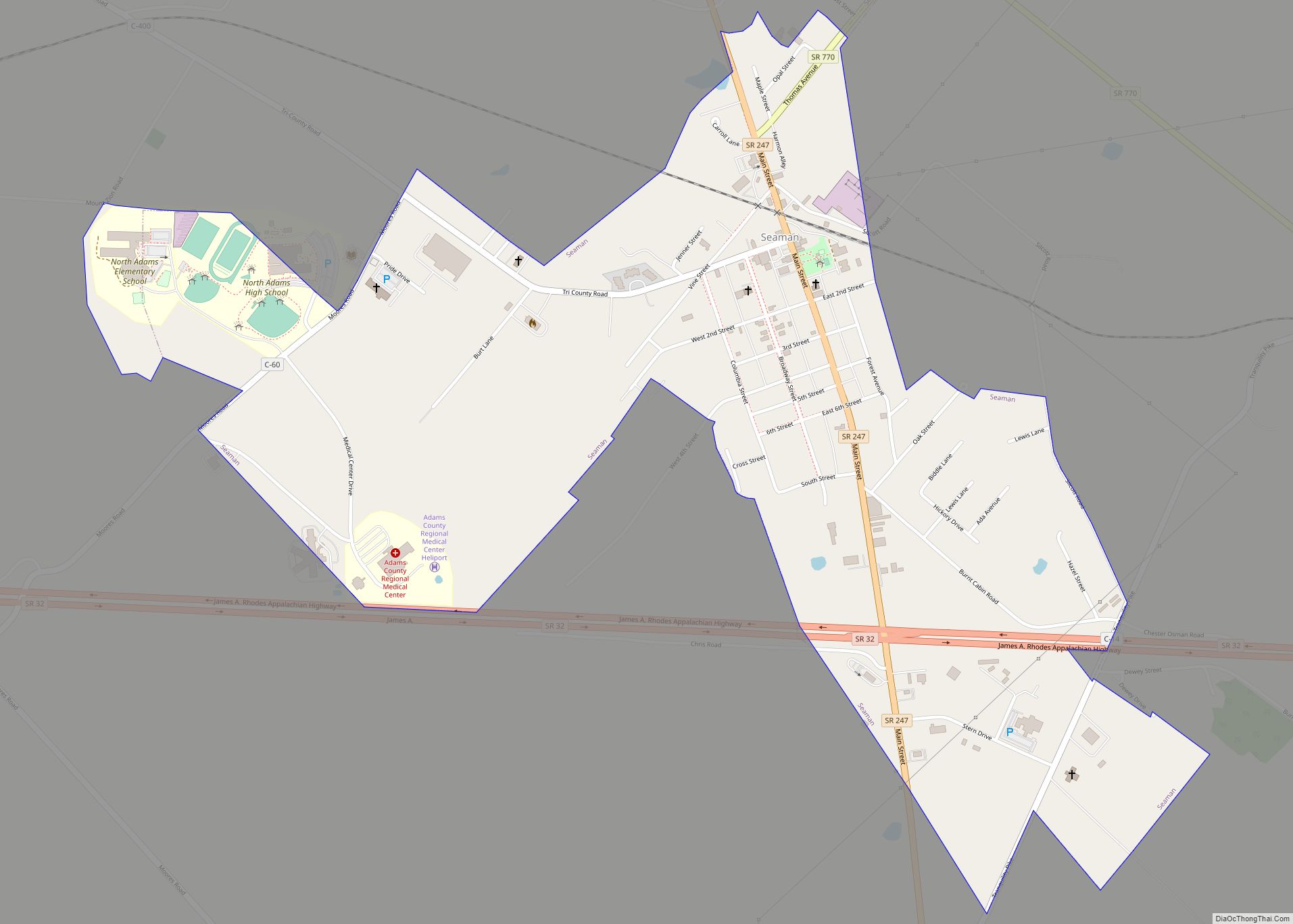
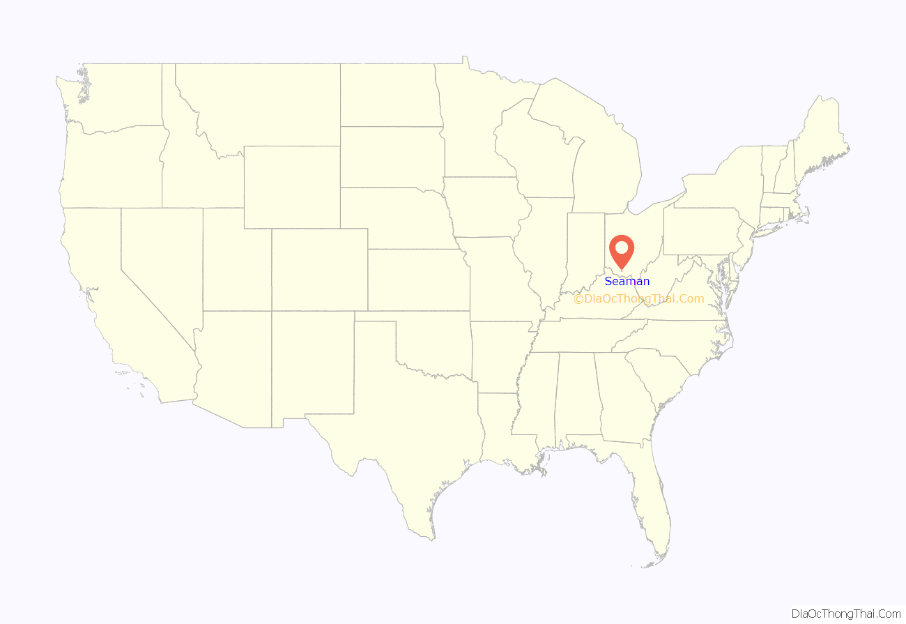
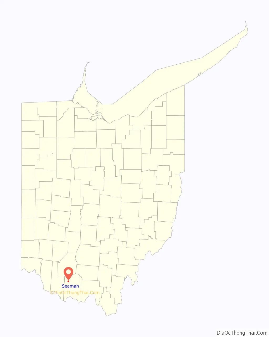
Seaman is a village in Scott Township, Adams County, Ohio, United States. The population was 973 at the 2020 census.
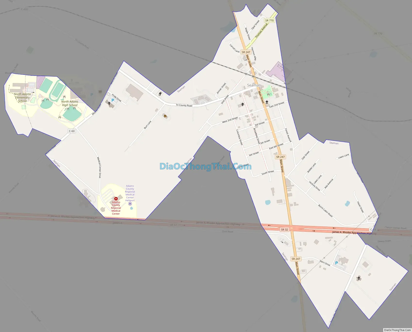
State Route 247 passes through Seaman. Seaman is adjacent to Ohio State Route 32, a four lane divided highway known as the Appalachian Highway. The Appalachian Highway links Seaman to Cincinnati. A traffic signal is at the intersection of Routes 32 and 247.
Seaman is served by North Adams High School, the Adams County/Ohio Valley School District, and the North Adams Public Library, a branch of the Adams County Public Library. Seaman is also home to the Adams County Regional Medical Center, a county hospital built in 2007.
| Name: | Seaman village |
|---|---|
| LSAD Code: | 47 |
| LSAD Description: | village (suffix) |
| State: | Ohio |
| County: | Adams County |
| Elevation: | 906 ft (276 m) |
| Total Area: | 1.07 sq mi (2.76 km²) |
| Land Area: | 1.07 sq mi (2.76 km²) |
| Water Area: | 0.00 sq mi (0.00 km²) |
| Total Population: | 973 |
| Population Density: | 911.90/sq mi (351.94/km²) |
| ZIP code: | 45679 |
| Area code: | 937, 326 |
| FIPS code: | 3971206 |
| GNISfeature ID: | 1058010 |
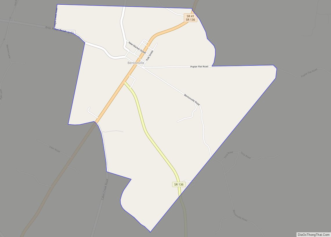
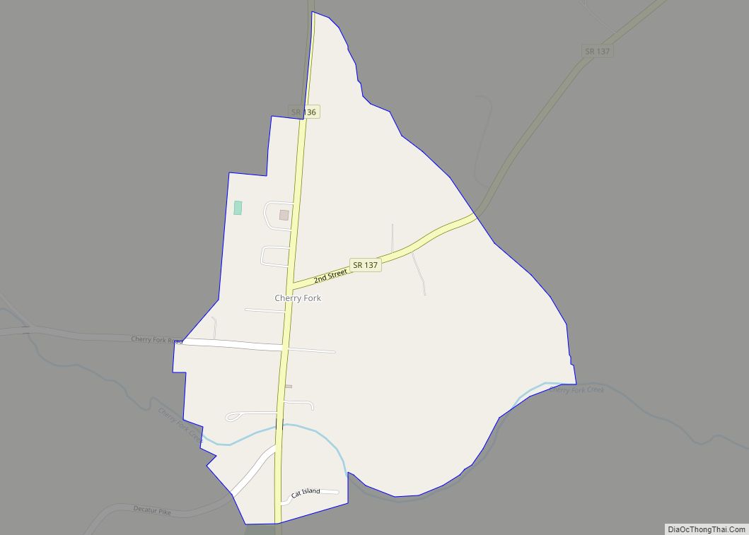
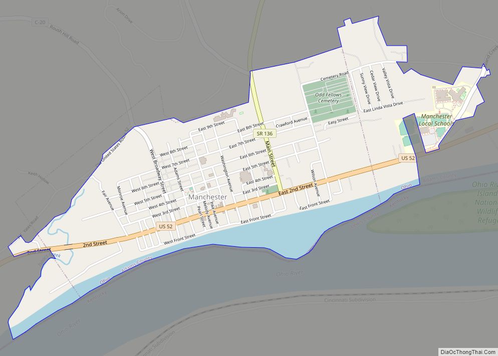
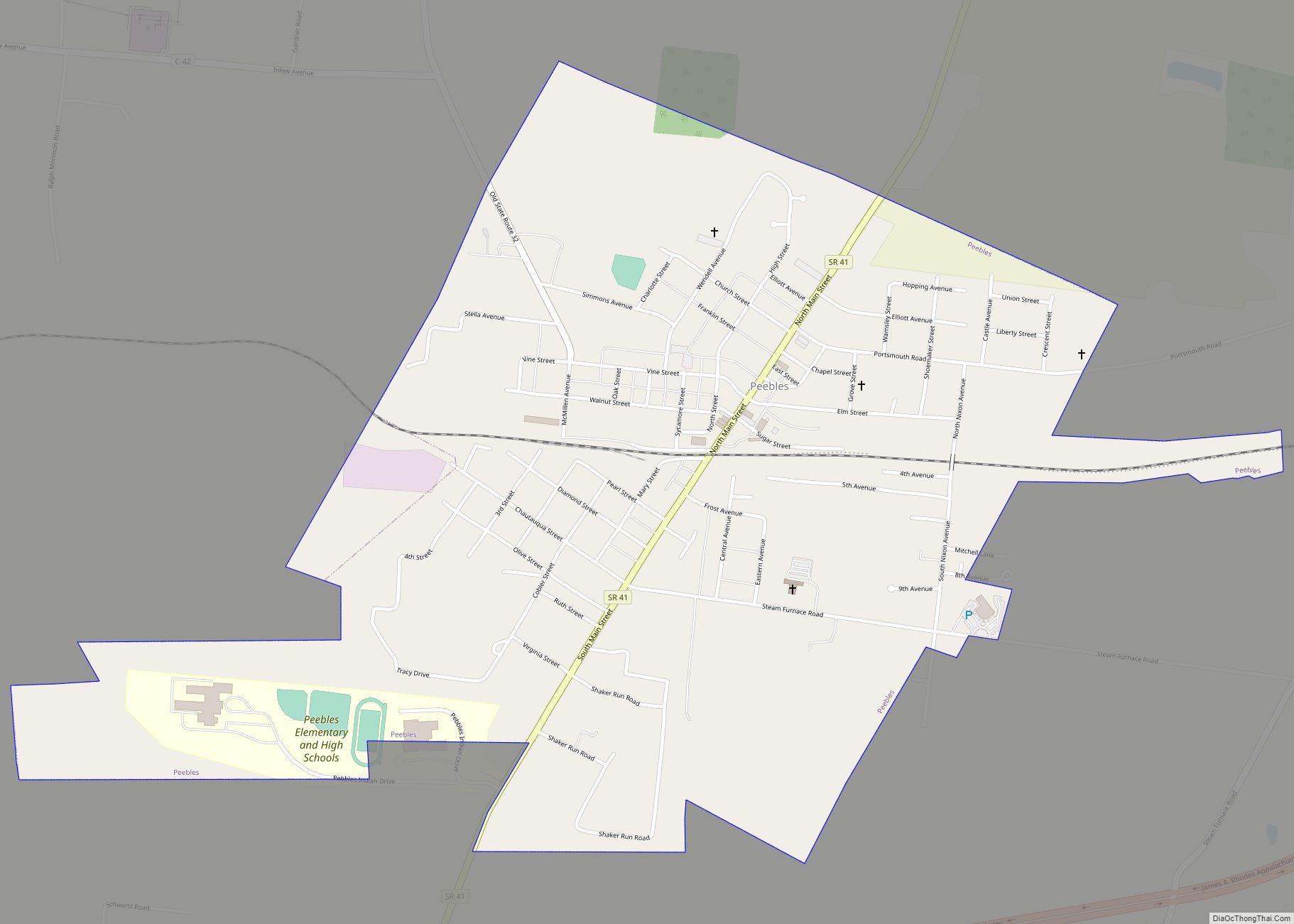
Online Interactive Map
Click on ![]() to view map in "full screen" mode.
to view map in "full screen" mode.
Seaman location map. Where is Seaman village?
History
Seaman was laid out in 1888 when the railroad was extended to that point. The Cincinnati & Eastern Railroad today is the Cincinnati Eastern Railroad (CCET). The village was named after the local Seaman family.
Seaman Road Map
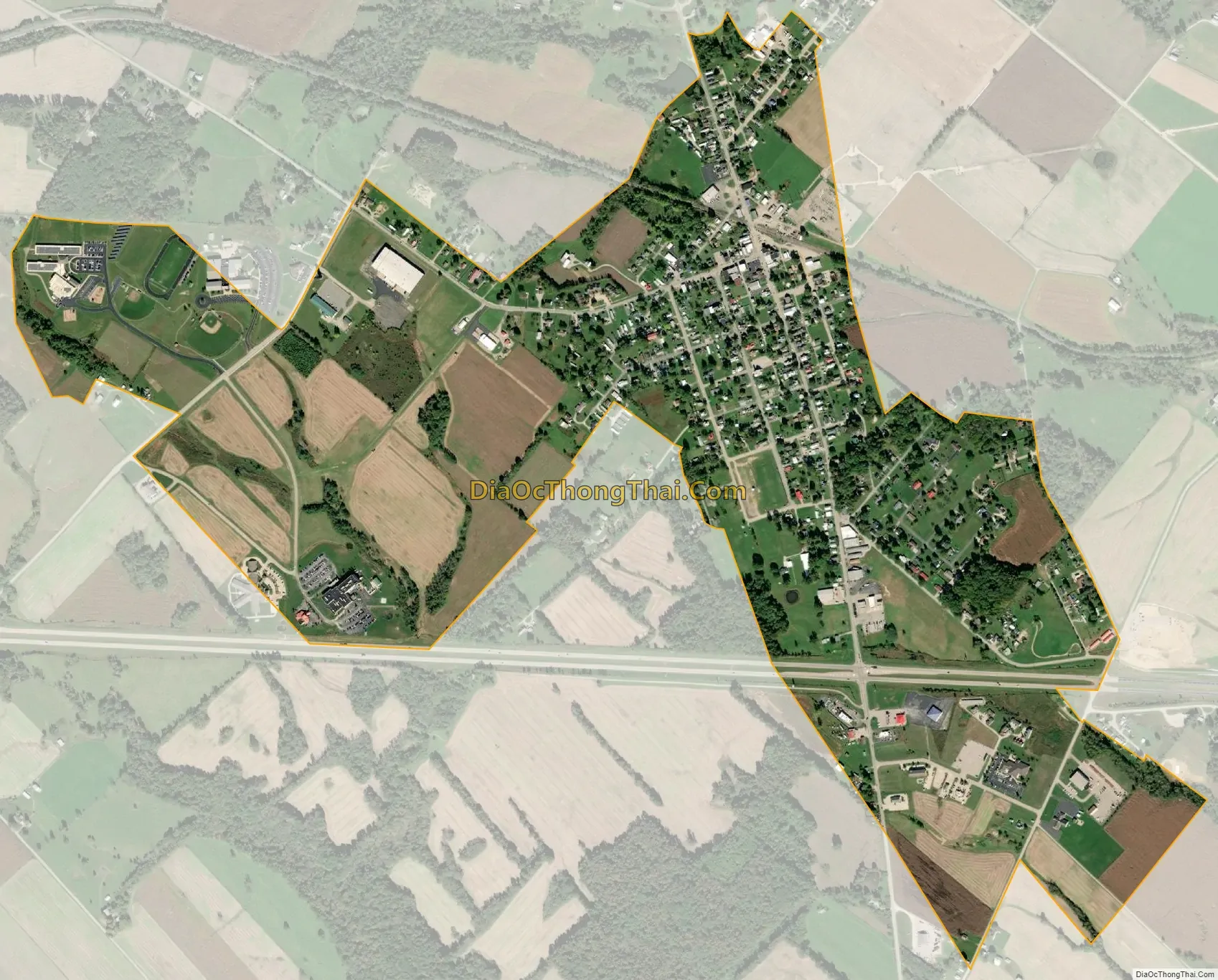
Seaman city Satellite Map
Geography
Seaman is at 38°56′20″N 83°34′23″W / 38.93889°N 83.57306°W / 38.93889; -83.57306 (38.938889, -83.573027).
According to the United States Census Bureau, the village has a total area of 1.07 square miles (2.77 km), all land.
See also
Map of Ohio State and its subdivision:- Adams
- Allen
- Ashland
- Ashtabula
- Athens
- Auglaize
- Belmont
- Brown
- Butler
- Carroll
- Champaign
- Clark
- Clermont
- Clinton
- Columbiana
- Coshocton
- Crawford
- Cuyahoga
- Darke
- Defiance
- Delaware
- Erie
- Fairfield
- Fayette
- Franklin
- Fulton
- Gallia
- Geauga
- Greene
- Guernsey
- Hamilton
- Hancock
- Hardin
- Harrison
- Henry
- Highland
- Hocking
- Holmes
- Huron
- Jackson
- Jefferson
- Knox
- Lake
- Lake Erie
- Lawrence
- Licking
- Logan
- Lorain
- Lucas
- Madison
- Mahoning
- Marion
- Medina
- Meigs
- Mercer
- Miami
- Monroe
- Montgomery
- Morgan
- Morrow
- Muskingum
- Noble
- Ottawa
- Paulding
- Perry
- Pickaway
- Pike
- Portage
- Preble
- Putnam
- Richland
- Ross
- Sandusky
- Scioto
- Seneca
- Shelby
- Stark
- Summit
- Trumbull
- Tuscarawas
- Union
- Van Wert
- Vinton
- Warren
- Washington
- Wayne
- Williams
- Wood
- Wyandot
- Alabama
- Alaska
- Arizona
- Arkansas
- California
- Colorado
- Connecticut
- Delaware
- District of Columbia
- Florida
- Georgia
- Hawaii
- Idaho
- Illinois
- Indiana
- Iowa
- Kansas
- Kentucky
- Louisiana
- Maine
- Maryland
- Massachusetts
- Michigan
- Minnesota
- Mississippi
- Missouri
- Montana
- Nebraska
- Nevada
- New Hampshire
- New Jersey
- New Mexico
- New York
- North Carolina
- North Dakota
- Ohio
- Oklahoma
- Oregon
- Pennsylvania
- Rhode Island
- South Carolina
- South Dakota
- Tennessee
- Texas
- Utah
- Vermont
- Virginia
- Washington
- West Virginia
- Wisconsin
- Wyoming