Shadyside is a village in eastern Belmont County, Ohio, United States, along the Ohio River. The population was 3,454 at the 2020 census. It is part of the Wheeling metropolitan area.
| Name: | Shadyside village |
|---|---|
| LSAD Code: | 47 |
| LSAD Description: | village (suffix) |
| State: | Ohio |
| County: | Belmont County |
| Elevation: | 689 ft (210 m) |
| Total Area: | 1.03 sq mi (2.67 km²) |
| Land Area: | 1.01 sq mi (2.62 km²) |
| Water Area: | 0.02 sq mi (0.05 km²) |
| Total Population: | 3,454 |
| Population Density: | 3,419.80/sq mi (1,320.06/km²) |
| ZIP code: | 43947 |
| Area code: | 740 |
| FIPS code: | 3971640 |
| GNISfeature ID: | 1065307 |
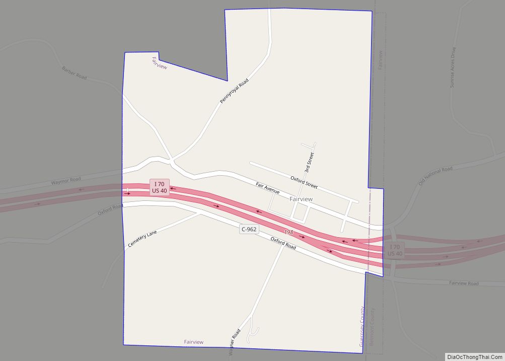
Online Interactive Map
Click on ![]() to view map in "full screen" mode.
to view map in "full screen" mode.
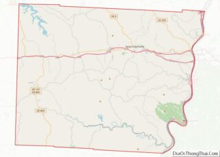
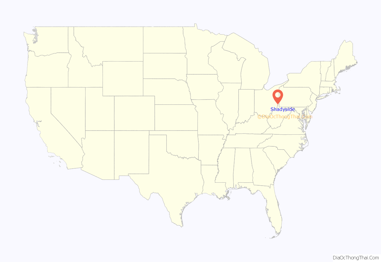
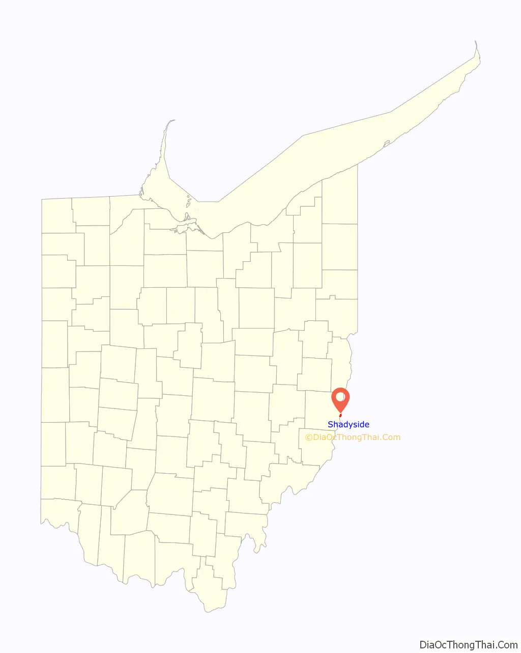
Shadyside location map. Where is Shadyside village?
History
Shadyside had its start in 1879 when the railroad was extended to that point. The town site was platted in 1901. The village was named after a local tree-lined farm.
On the evening of June 14, 1990, three to six inches (76 mm) of rain fell in less than two hours, in the ridges to the west, creating a flash flood in the Shadyside area which caused twenty-six fatalities and destroyed or damaged many buildings. Flooding occurred along Pipe Creek, Wegee Creek, and Cumberland Run. Witnesses reported seeing a “wall of water” ten to thirty feet high moving downstream. Communications issues experienced during the response to the flood, because the county’s fire departments operated on two different frequencies, contributed to the state’s decision to build an interoperable statewide radio system.
South of Shadyside was the location of the R.E. Burger Power Station. The coal fired power plant generated electricity from 1944 to 2011.
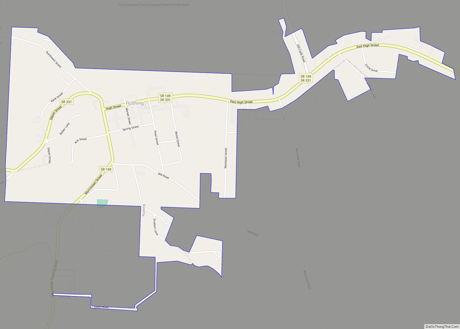
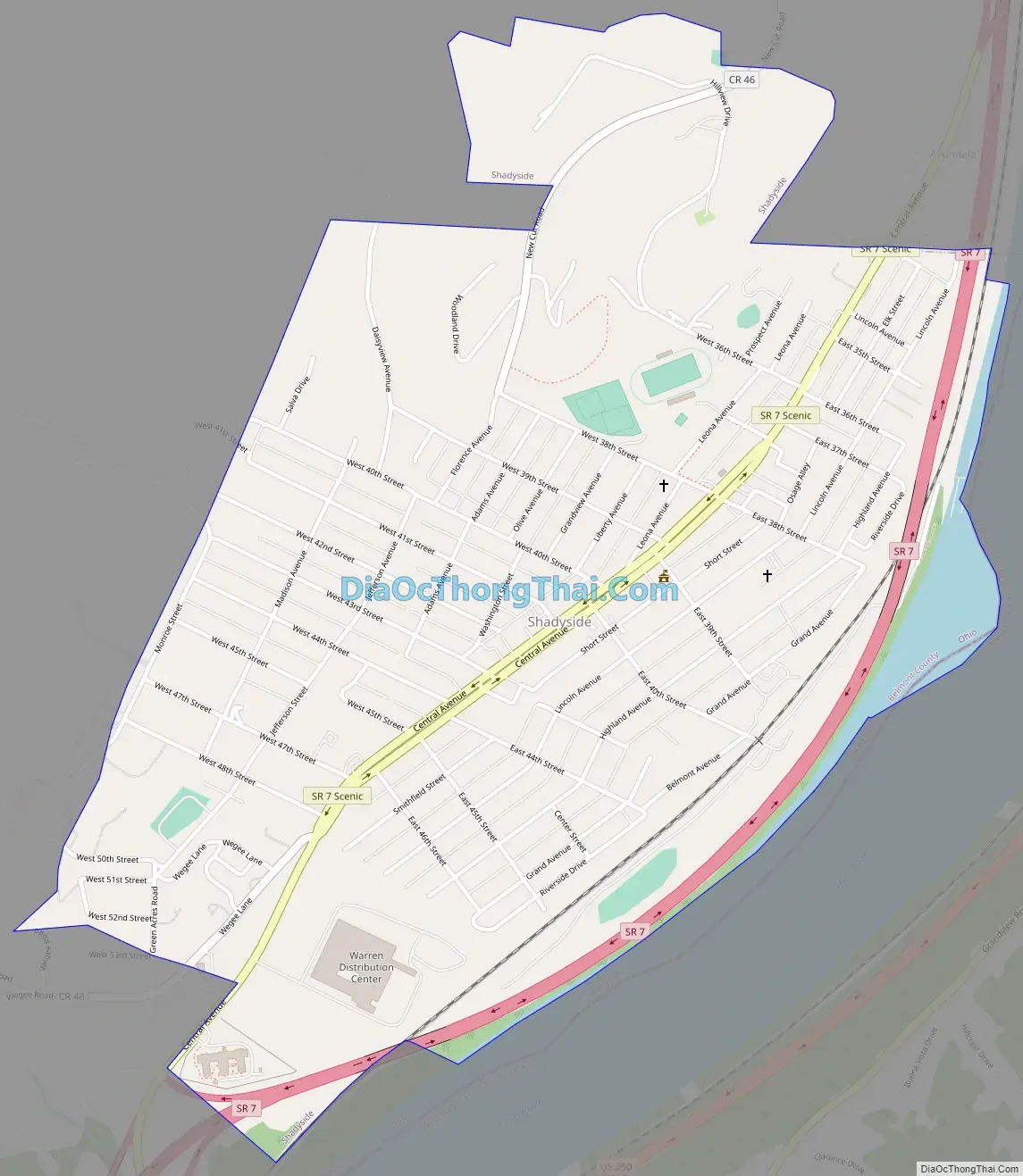
Shadyside Road Map
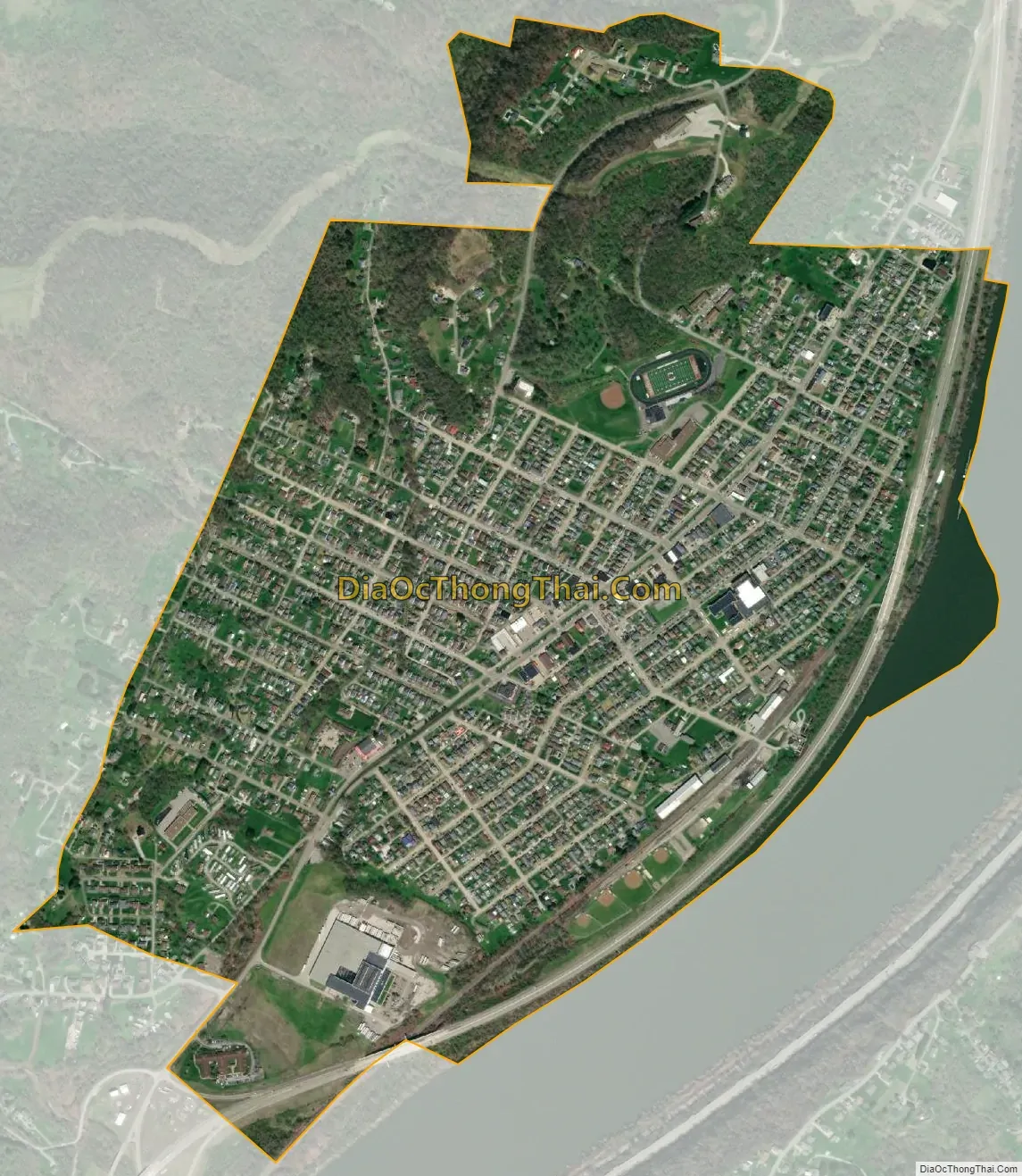
Shadyside city Satellite Map
Geography
Shadyside is located at 39°58′17″N 80°45′3″W / 39.97139°N 80.75083°W / 39.97139; -80.75083 (39.971385, -80.750752).
According to the United States Census Bureau, the village has a total area of 1.03 square miles (2.67 km), of which 1.01 square miles (2.62 km) is land and 0.02 square miles (0.05 km) is water.
See also
Map of Ohio State and its subdivision:- Adams
- Allen
- Ashland
- Ashtabula
- Athens
- Auglaize
- Belmont
- Brown
- Butler
- Carroll
- Champaign
- Clark
- Clermont
- Clinton
- Columbiana
- Coshocton
- Crawford
- Cuyahoga
- Darke
- Defiance
- Delaware
- Erie
- Fairfield
- Fayette
- Franklin
- Fulton
- Gallia
- Geauga
- Greene
- Guernsey
- Hamilton
- Hancock
- Hardin
- Harrison
- Henry
- Highland
- Hocking
- Holmes
- Huron
- Jackson
- Jefferson
- Knox
- Lake
- Lake Erie
- Lawrence
- Licking
- Logan
- Lorain
- Lucas
- Madison
- Mahoning
- Marion
- Medina
- Meigs
- Mercer
- Miami
- Monroe
- Montgomery
- Morgan
- Morrow
- Muskingum
- Noble
- Ottawa
- Paulding
- Perry
- Pickaway
- Pike
- Portage
- Preble
- Putnam
- Richland
- Ross
- Sandusky
- Scioto
- Seneca
- Shelby
- Stark
- Summit
- Trumbull
- Tuscarawas
- Union
- Van Wert
- Vinton
- Warren
- Washington
- Wayne
- Williams
- Wood
- Wyandot
- Alabama
- Alaska
- Arizona
- Arkansas
- California
- Colorado
- Connecticut
- Delaware
- District of Columbia
- Florida
- Georgia
- Hawaii
- Idaho
- Illinois
- Indiana
- Iowa
- Kansas
- Kentucky
- Louisiana
- Maine
- Maryland
- Massachusetts
- Michigan
- Minnesota
- Mississippi
- Missouri
- Montana
- Nebraska
- Nevada
- New Hampshire
- New Jersey
- New Mexico
- New York
- North Carolina
- North Dakota
- Ohio
- Oklahoma
- Oregon
- Pennsylvania
- Rhode Island
- South Carolina
- South Dakota
- Tennessee
- Texas
- Utah
- Vermont
- Virginia
- Washington
- West Virginia
- Wisconsin
- Wyoming