Tipp City is a city in Miami County, Ohio, United States, just outside Dayton. The population was 9,689 at the 2010 census. Originally known as Tippecanoe, and then Tippecanoe City, it was renamed to Tipp City in 1938 because another town in Ohio was likewise named Tippecanoe. The city lies in the Miami Valley and sits along Interstate 75 near the Interstate 70 interchange.
Tipp City is part of the Dayton Metropolitan Statistical Area.
| Name: | Tipp City city |
|---|---|
| LSAD Code: | 25 |
| LSAD Description: | city (suffix) |
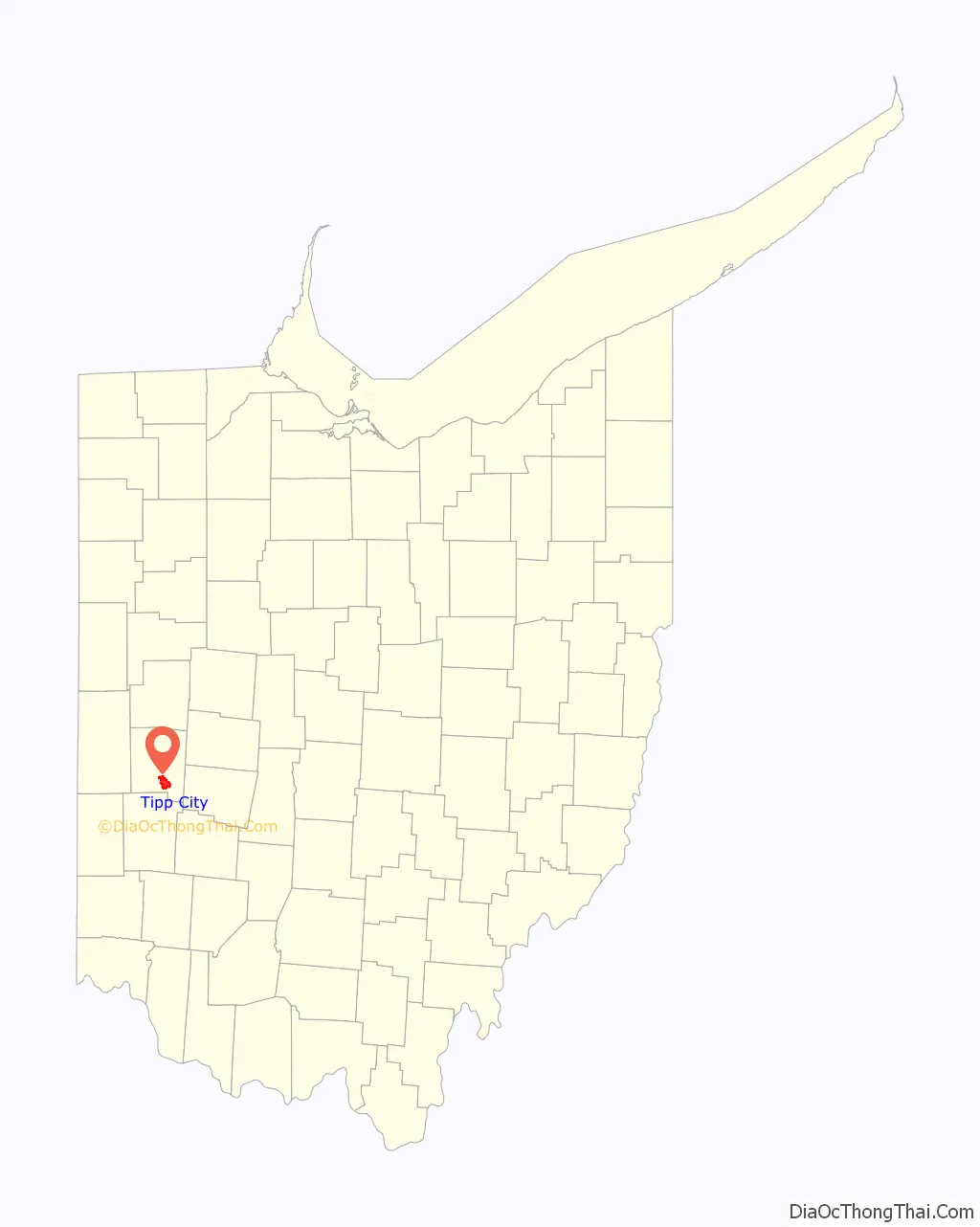
| State: | Ohio |
| County: | Miami County |
| Elevation: | 827 ft (252 m) |
| Total Area: | 8.18 sq mi (21.19 km²) |
| Land Area: | 8.03 sq mi (20.80 km²) |
| Water Area: | 0.15 sq mi (0.39 km²) |
| Total Population: | 10,274 |
| Population Density: | 1,279.13/sq mi (493.90/km²) |
| ZIP code: | 45371 |
| Area code: | 937, 326 |
| FIPS code: | 3976876 |
| GNISfeature ID: | 1061692 |
| Website: | http://www.tippcityohio.gov/ |
Online Interactive Map
Click on ![]() to view map in "full screen" mode.
to view map in "full screen" mode.
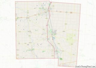
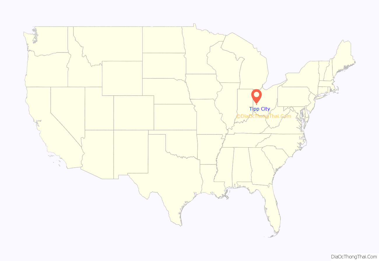
Tipp City location map. Where is Tipp City city?
History
Tippecanoe City was founded in 1840 along the developing Miami and Erie Canal. Its name derives from Presidential candidate William Henry Harrison’s nickname, Tippecanoe, which, in turn, was derived from his heroism at the Battle of Tippecanoe, November 7, 1811.
The early city was a popular stopping-off point for boatmen traveling along the Miami and Erie Canal. The original downtown purportedly included a large number of bars and a red light district. The now dry canal locks can be seen just east of downtown. As Tippecanoe City grew, it merged with Hyattsville, a contiguous village, located on present-day Hyatt Street.
Development of the railroads in the 1850s and 1860s put the canals out of business and slowed the city’s initially rapid growth. Ruins of a repair shop (yard barn) for the old Inter-Urban rail system can still be seen on the outskirts of town.
The development of U.S. Route 25 (County Road 25-A) and subsequently Interstate 75 brought construction and vibrance back to the town throughout the 20th century.
History of city name
The dramatic modern growth of the town has occurred under a new name: Tipp City. The US Postal Service abbreviated the town’s name in the 1930s to resolve a conflict with Tippecanoe, Ohio. Some local controversy exists as to whether the name can or should revert to the former Tippecanoe City.
Proponents of the change argue that ZIP codes obviate the conflict. Tipp City and Tippecanoe are 200 miles apart. Tippecanoe is too small for many Ohio maps and is not even one of the 10 incorporated municipalities of Harrison County. The sparsely populated Harrison County is the 5th smallest of Ohio’s 88 counties. Downtown Tipp City businesses that wish to play up the Tippecanoe City 19th century heritage have argued that modern geography and postal methods would alleviate any confusion in reverting to the old name.
On the other hand, residents are used to the name Tipp City. Addresses and signage would have to be changed if renaming were sought. While the city’s name was changed long ago, the high school never changed its name; Tippecanoe High School, is a constant reminder to people in the area of what “Tipp” refers to. Currently, the issue does not seem to matter enough to most residents to prompt political action.
Tipp City Tornado
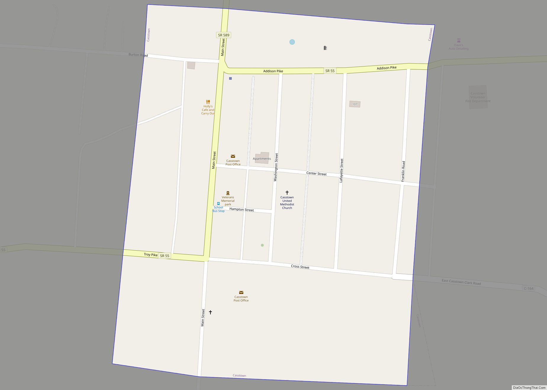
On June 8th, 2022, a tornado struck Tipp City, causing heavy damage to a Meijer distribution center in the area. The tornado strengthened just before hitting the city. This tornado traveled 13.9 miles before ending in Casstown, Ohio. This and 5 other tornadoes were part of a tornado outbreak in Ohio, which had 6 tornadoes strike the state.
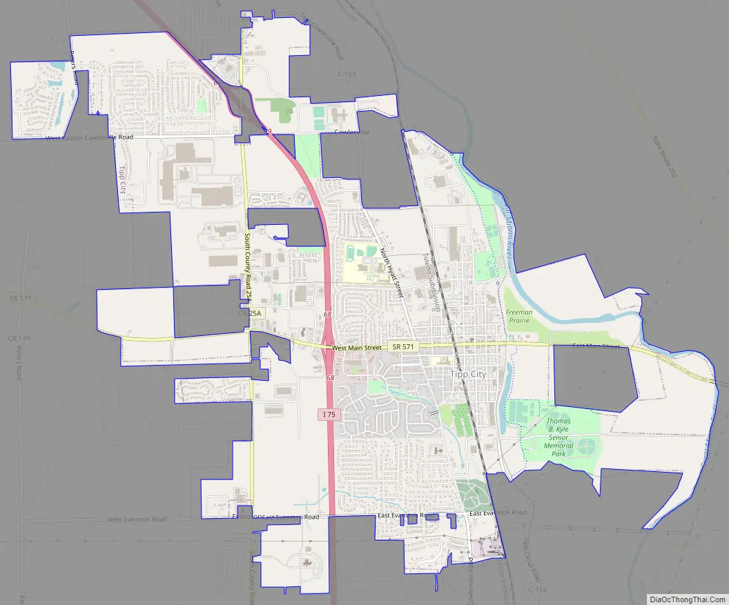
Tipp City Road Map
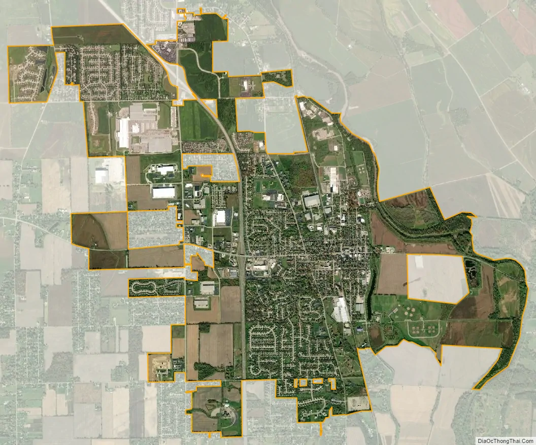
Tipp City city Satellite Map
Geography
Tipp City is located on the Miami River, approximately 10 miles north of Dayton and has direct highway access to Interstate 75. 39°57′50″N 84°11′1″W / 39.96389°N 84.18361°W / 39.96389; -84.18361 (39.963876, -84.183704).
According to the United States Census Bureau, the city has a total area of 7.64 square miles (19.79 km), of which 7.53 square miles (19.50 km) is land and 0.11 square miles (0.28 km) is water.
See also
Map of Ohio State and its subdivision:- Adams
- Allen
- Ashland
- Ashtabula
- Athens
- Auglaize
- Belmont
- Brown
- Butler
- Carroll
- Champaign
- Clark
- Clermont
- Clinton
- Columbiana
- Coshocton
- Crawford
- Cuyahoga
- Darke
- Defiance
- Delaware
- Erie
- Fairfield
- Fayette
- Franklin
- Fulton
- Gallia
- Geauga
- Greene
- Guernsey
- Hamilton
- Hancock
- Hardin
- Harrison
- Henry
- Highland
- Hocking
- Holmes
- Huron
- Jackson
- Jefferson
- Knox
- Lake
- Lake Erie
- Lawrence
- Licking
- Logan
- Lorain
- Lucas
- Madison
- Mahoning
- Marion
- Medina
- Meigs
- Mercer
- Miami
- Monroe
- Montgomery
- Morgan
- Morrow
- Muskingum
- Noble
- Ottawa
- Paulding
- Perry
- Pickaway
- Pike
- Portage
- Preble
- Putnam
- Richland
- Ross
- Sandusky
- Scioto
- Seneca
- Shelby
- Stark
- Summit
- Trumbull
- Tuscarawas
- Union
- Van Wert
- Vinton
- Warren
- Washington
- Wayne
- Williams
- Wood
- Wyandot
- Alabama
- Alaska
- Arizona
- Arkansas
- California
- Colorado
- Connecticut
- Delaware
- District of Columbia
- Florida
- Georgia
- Hawaii
- Idaho
- Illinois
- Indiana
- Iowa
- Kansas
- Kentucky
- Louisiana
- Maine
- Maryland
- Massachusetts
- Michigan
- Minnesota
- Mississippi
- Missouri
- Montana
- Nebraska
- Nevada
- New Hampshire
- New Jersey
- New Mexico
- New York
- North Carolina
- North Dakota
- Ohio
- Oklahoma
- Oregon
- Pennsylvania
- Rhode Island
- South Carolina
- South Dakota
- Tennessee
- Texas
- Utah
- Vermont
- Virginia
- Washington
- West Virginia
- Wisconsin
- Wyoming