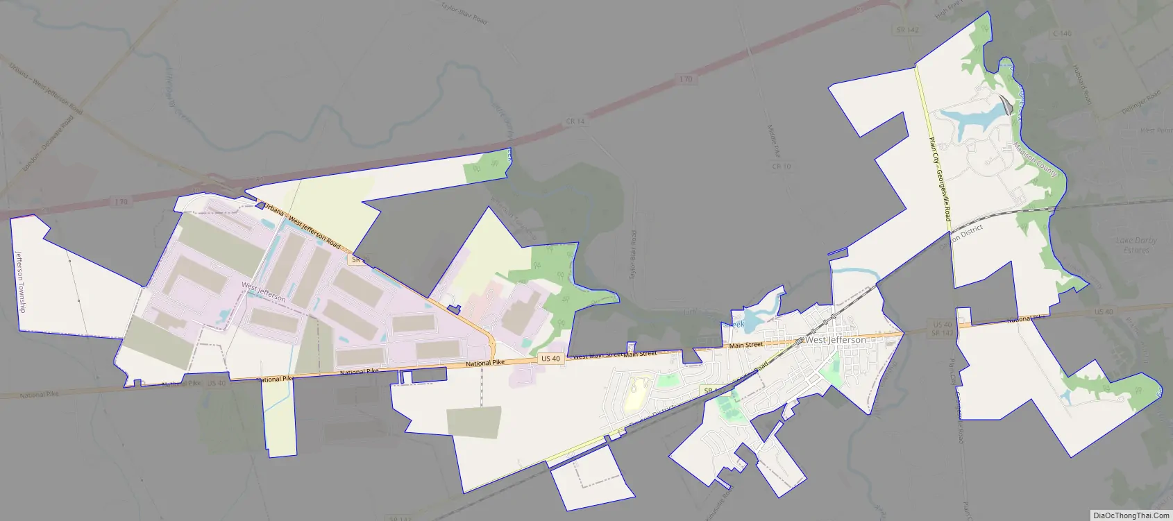
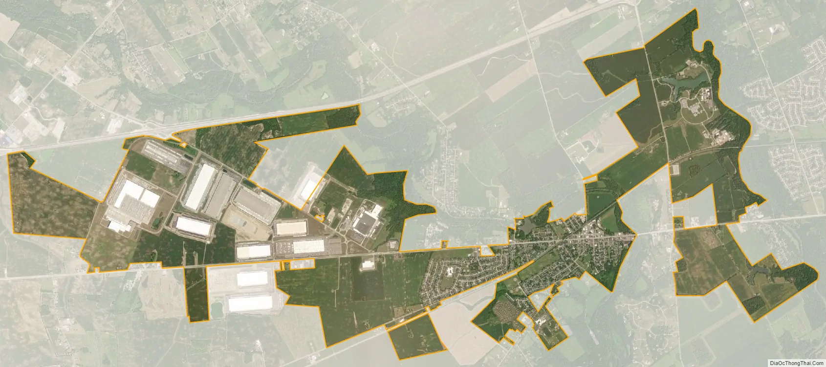
West Jefferson is a village in Madison County, Ohio, United States. The population was 4,222 at the 2010 census. Located along U.S. Route 40, the village has a fairly close relationship with the surrounding township, which include various out-of-corporation-limit neighborhoods (including Haymarket Road, Olmstead Road, Forrest Lake Estates, Goodson Road/Enchanted Valley, and North and South Road). The village has a “Commerce Park” at its western edge which include Target and Amazon Distribution Centers, a Krazy Glue factory, and Jefferson Industries.
| Name: | West Jefferson village |
|---|---|
| LSAD Code: | 47 |
| LSAD Description: | village (suffix) |
| State: | Ohio |
| County: | Madison County |
| Total Area: | 9.94 sq mi (25.74 km²) |
| Land Area: | 9.92 sq mi (25.69 km²) |
| Water Area: | 0.02 sq mi (0.05 km²) |
| Total Population: | 4,137 |
| Population Density: | 417.12/sq mi (161.04/km²) |
| ZIP code: | 43162 |
| Area code: | 614 and 380 |
| FIPS code: | 3983580 |
| Website: | www.westjeffersonohio.gov |
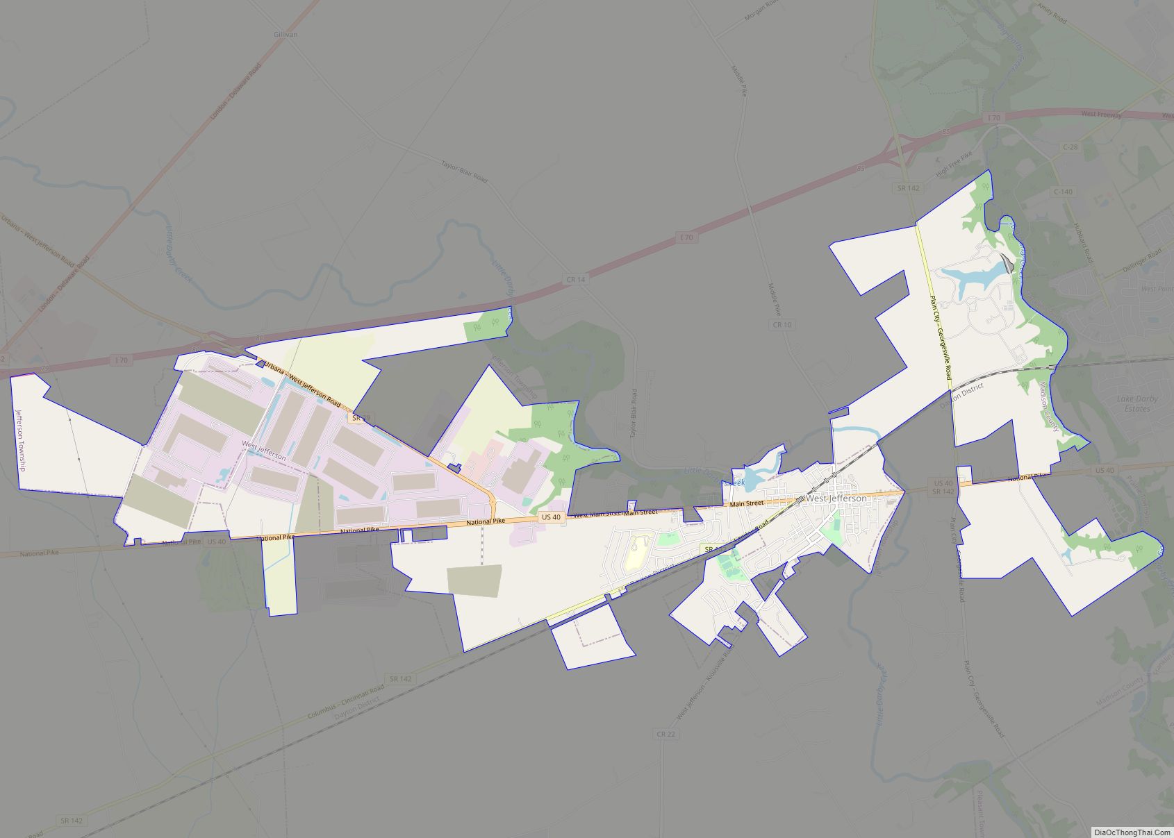
Online Interactive Map
Click on ![]() to view map in "full screen" mode.
to view map in "full screen" mode.
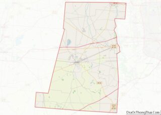
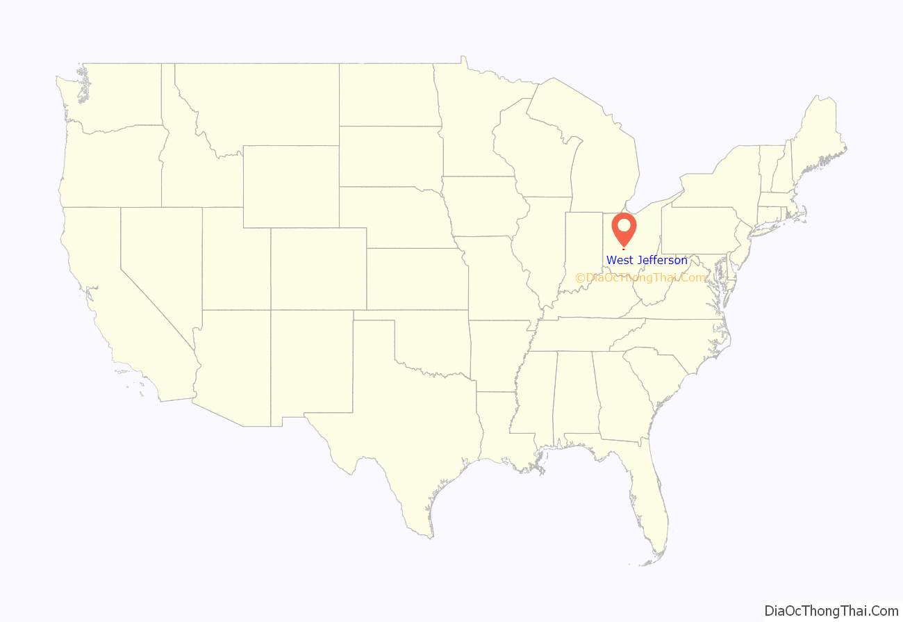
West Jefferson location map. Where is West Jefferson village?
History
West Jefferson was originally called New Hampton, and under the latter name was platted c. 1831. A post office called West Jefferson has been in operation since 1833.
2021 shooting
On May 24, 2021, a mass shooting occurred at an apartment complex in West Jefferson. Three men and one woman were killed, with three of the victims being found inside the building and one outside. A motive has not been determined for the shooting. On June 14, a suspect was arrested and charged for the killings. The shooting marked West Jefferson’s first homicides since April 2012.
West Jefferson Road Map
West Jefferson city Satellite Map
Geography
West Jefferson is located at 39°56′36″N 83°16′33″W / 39.94333°N 83.27583°W / 39.94333; -83.27583 (39.943244, −83.275855).
According to the United States Census Bureau, the village has a total area of 4.87 square miles (12.61 km), of which 4.85 square miles (12.56 km) is land and 0.02 square miles (0.05 km) is water.
See also
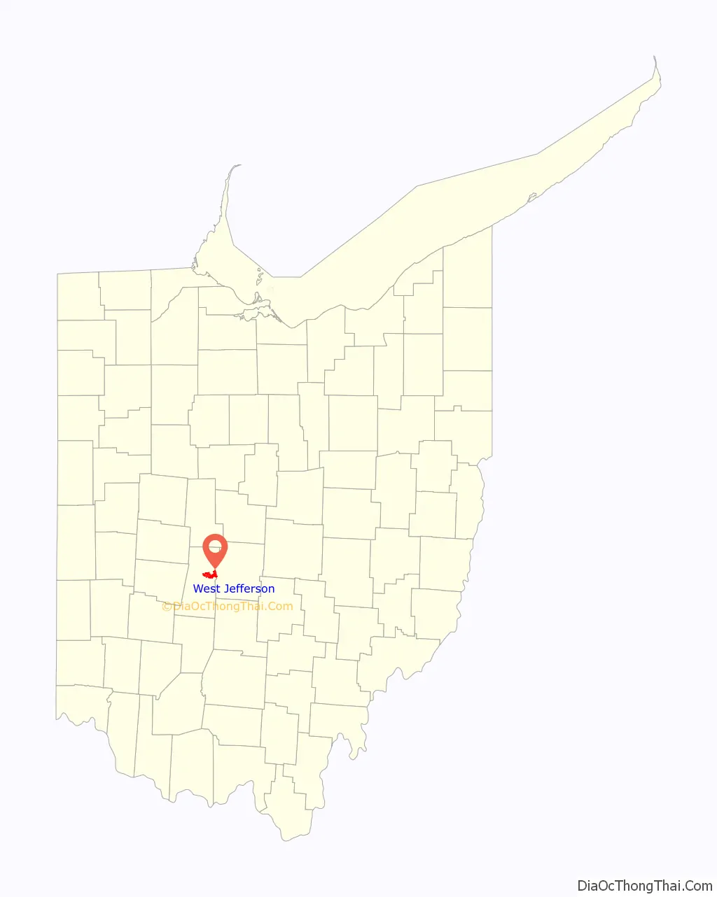
Map of Ohio State and its subdivision:- Adams
- Allen
- Ashland
- Ashtabula
- Athens
- Auglaize
- Belmont
- Brown
- Butler
- Carroll
- Champaign
- Clark
- Clermont
- Clinton
- Columbiana
- Coshocton
- Crawford
- Cuyahoga
- Darke
- Defiance
- Delaware
- Erie
- Fairfield
- Fayette
- Franklin
- Fulton
- Gallia
- Geauga
- Greene
- Guernsey
- Hamilton
- Hancock
- Hardin
- Harrison
- Henry
- Highland
- Hocking
- Holmes
- Huron
- Jackson
- Jefferson
- Knox
- Lake
- Lake Erie
- Lawrence
- Licking
- Logan
- Lorain
- Lucas
- Madison
- Mahoning
- Marion
- Medina
- Meigs
- Mercer
- Miami
- Monroe
- Montgomery
- Morgan
- Morrow
- Muskingum
- Noble
- Ottawa
- Paulding
- Perry
- Pickaway
- Pike
- Portage
- Preble
- Putnam
- Richland
- Ross
- Sandusky
- Scioto
- Seneca
- Shelby
- Stark
- Summit
- Trumbull
- Tuscarawas
- Union
- Van Wert
- Vinton
- Warren
- Washington
- Wayne
- Williams
- Wood
- Wyandot
- Alabama
- Alaska
- Arizona
- Arkansas
- California
- Colorado
- Connecticut
- Delaware
- District of Columbia
- Florida
- Georgia
- Hawaii
- Idaho
- Illinois
- Indiana
- Iowa
- Kansas
- Kentucky
- Louisiana
- Maine
- Maryland
- Massachusetts
- Michigan
- Minnesota
- Mississippi
- Missouri
- Montana
- Nebraska
- Nevada
- New Hampshire
- New Jersey
- New Mexico
- New York
- North Carolina
- North Dakota
- Ohio
- Oklahoma
- Oregon
- Pennsylvania
- Rhode Island
- South Carolina
- South Dakota
- Tennessee
- Texas
- Utah
- Vermont
- Virginia
- Washington
- West Virginia
- Wisconsin
- Wyoming