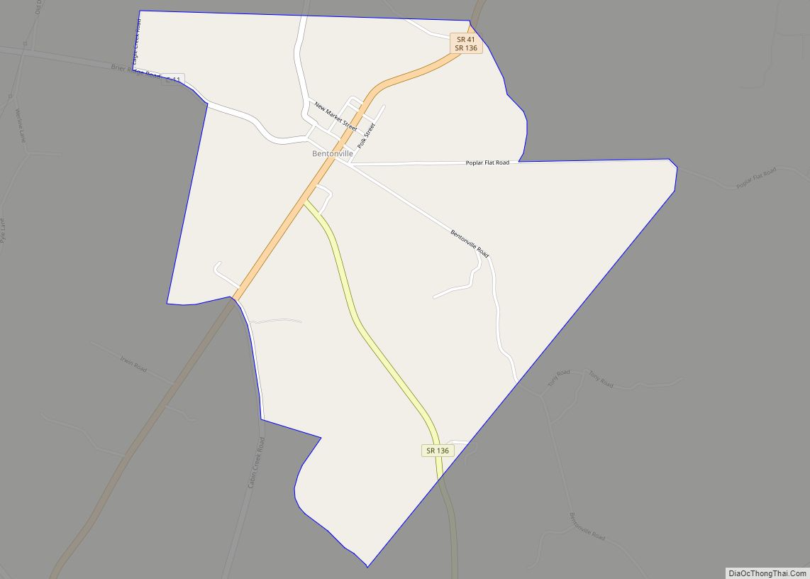
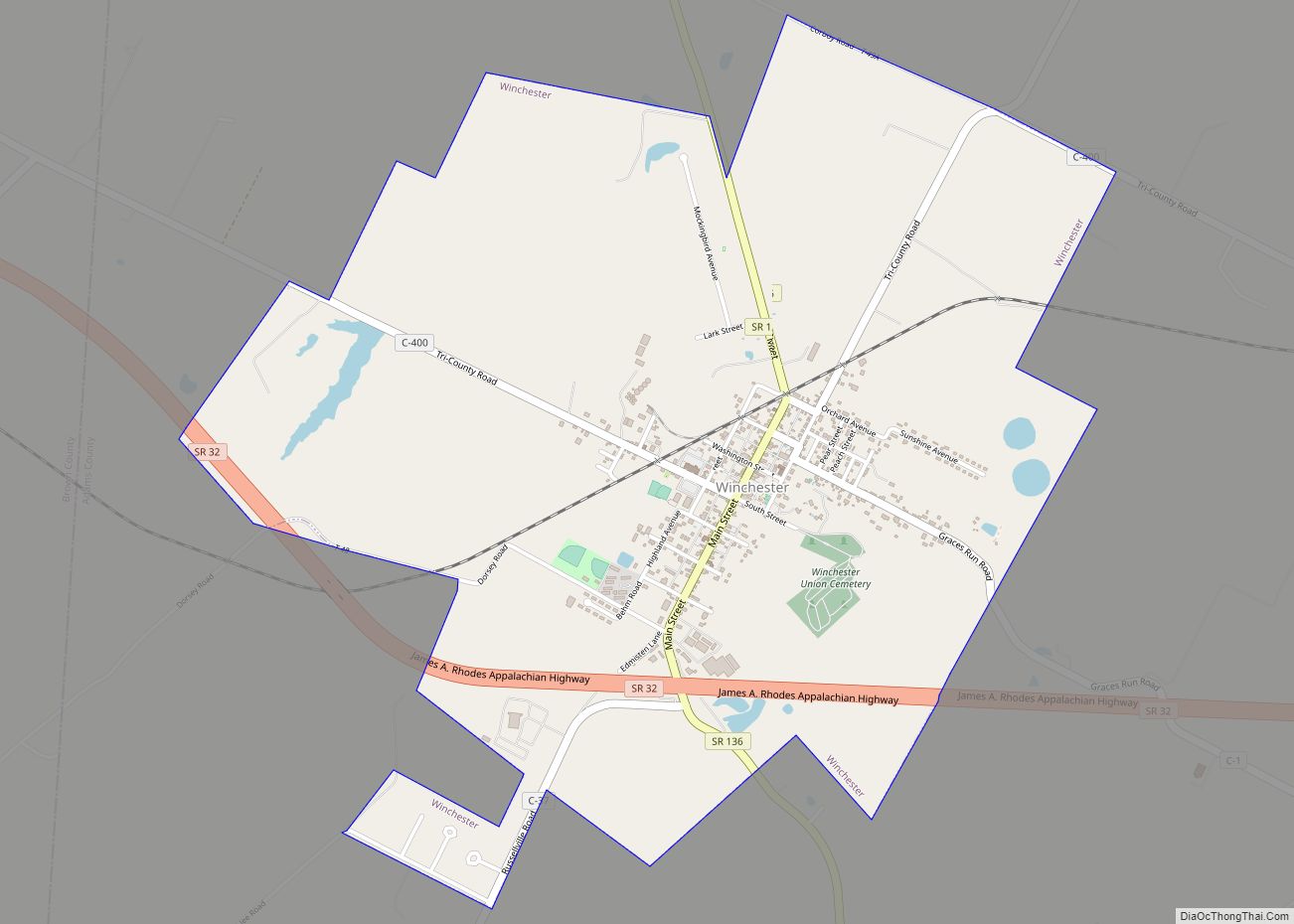
Winchester is a village in Adams County, Ohio, United States. The population was 987 at the 2020 census. The name of the surrounding township is also named Winchester.
State Route 136 passes through Winchester. Winchester is adjacent to Ohio State Route 32, a four lane divided highway known as the Appalachian Highway. The Appalachian Highway links Winchester to Cincinnati.
| Name: | Winchester village |
|---|---|
| LSAD Code: | 47 |
| LSAD Description: | village (suffix) |
| State: | Ohio |
| County: | Adams County |
| Elevation: | 906 ft (276 m) |
| Total Area: | 2.63 sq mi (6.82 km²) |
| Land Area: | 2.62 sq mi (6.78 km²) |
| Water Area: | 0.02 sq mi (0.04 km²) |
| Total Population: | 987 |
| Population Density: | 377.29/sq mi (145.67/km²) |
| ZIP code: | 45697 |
| Area code: | 937, 326 |
| FIPS code: | 3985876 |
Online Interactive Map
Click on ![]() to view map in "full screen" mode.
to view map in "full screen" mode.
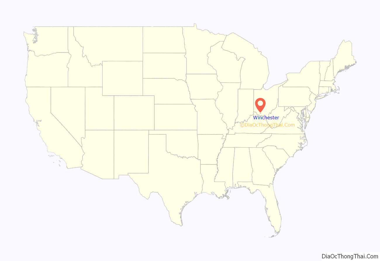
Winchester location map. Where is Winchester village?

History
Winchester was laid out in 1815 by Joseph Darlinton. It was named for Darlinton’s former hometown of Winchester, Virginia.
There is also an Ohio Historic Site in Winchester, the Dr. A. C. Lewis House. The Dr. A. C. Lewis home was built between 1845 and 1848. Dr. Lewis is considered the first resident physician of Winchester. He was a known abolitionist and used the house as a station on the underground railroad.
Winchester Road Map

Winchester city Satellite Map

Geography
Winchester is located at 38°56′25″N 83°39′11″W / 38.940248°N 83.653174°W / 38.940248; -83.653174 (38.940248, -83.653174).
According to the United States Census Bureau, the village has a total area of 2.63 square miles (6.81 km), of which 2.61 square miles (6.76 km) is land and 0.02 square miles (0.05 km) is water.
See also
Map of Ohio State and its subdivision:- Adams
- Allen
- Ashland
- Ashtabula
- Athens
- Auglaize
- Belmont
- Brown
- Butler
- Carroll
- Champaign
- Clark
- Clermont
- Clinton
- Columbiana
- Coshocton
- Crawford
- Cuyahoga
- Darke
- Defiance
- Delaware
- Erie
- Fairfield
- Fayette
- Franklin
- Fulton
- Gallia
- Geauga
- Greene
- Guernsey
- Hamilton
- Hancock
- Hardin
- Harrison
- Henry
- Highland
- Hocking
- Holmes
- Huron
- Jackson
- Jefferson
- Knox
- Lake
- Lake Erie
- Lawrence
- Licking
- Logan
- Lorain
- Lucas
- Madison
- Mahoning
- Marion
- Medina
- Meigs
- Mercer
- Miami
- Monroe
- Montgomery
- Morgan
- Morrow
- Muskingum
- Noble
- Ottawa
- Paulding
- Perry
- Pickaway
- Pike
- Portage
- Preble
- Putnam
- Richland
- Ross
- Sandusky
- Scioto
- Seneca
- Shelby
- Stark
- Summit
- Trumbull
- Tuscarawas
- Union
- Van Wert
- Vinton
- Warren
- Washington
- Wayne
- Williams
- Wood
- Wyandot
- Alabama
- Alaska
- Arizona
- Arkansas
- California
- Colorado
- Connecticut
- Delaware
- District of Columbia
- Florida
- Georgia
- Hawaii
- Idaho
- Illinois
- Indiana
- Iowa
- Kansas
- Kentucky
- Louisiana
- Maine
- Maryland
- Massachusetts
- Michigan
- Minnesota
- Mississippi
- Missouri
- Montana
- Nebraska
- Nevada
- New Hampshire
- New Jersey
- New Mexico
- New York
- North Carolina
- North Dakota
- Ohio
- Oklahoma
- Oregon
- Pennsylvania
- Rhode Island
- South Carolina
- South Dakota
- Tennessee
- Texas
- Utah
- Vermont
- Virginia
- Washington
- West Virginia
- Wisconsin
- Wyoming