Woodmere is a village in Cuyahoga County, Ohio, United States. As of the 2020 census, Woodmere had a population of 641 residents. An eastern suburb of Cleveland, it is part of the Cleveland metropolitan area.
| Name: | Woodmere village |
|---|---|
| LSAD Code: | 47 |
| LSAD Description: | village (suffix) |
| State: | Ohio |
| County: | Cuyahoga County |
| Elevation: | 1,210 ft (0 m) |
| Total Area: | 0.33 sq mi (0.85 km²) |
| Land Area: | 0.33 sq mi (0.85 km²) |
| Water Area: | 0.00 sq mi (0.00 km²) |
| Total Population: | 641 |
| Population Density: | 1,960.24/sq mi (757.87/km²) |
| Area code: | 216 |
| FIPS code: | 3986394 |
| Website: | http://www.woodmerevillage.com/ |
Online Interactive Map
Click on ![]() to view map in "full screen" mode.
to view map in "full screen" mode.
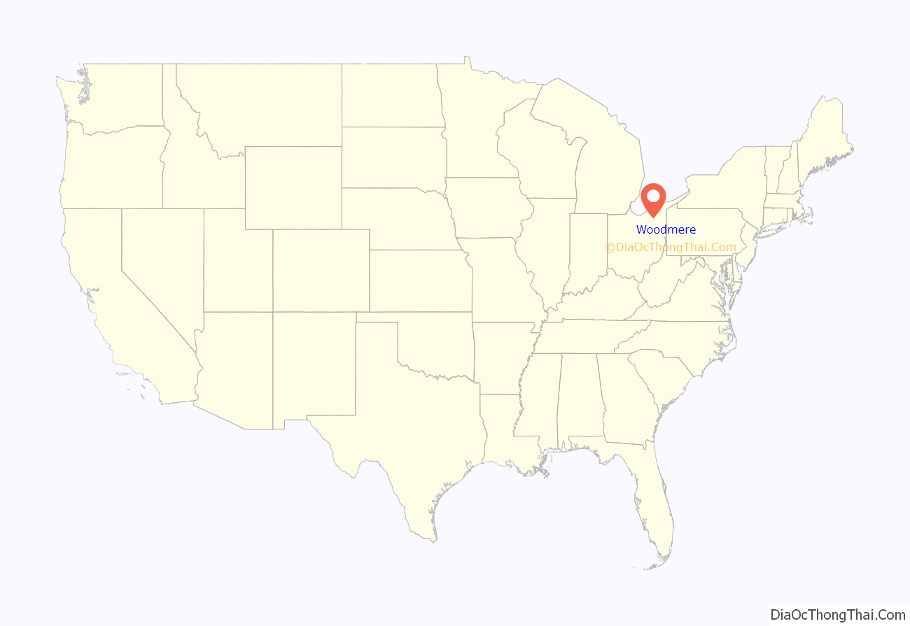
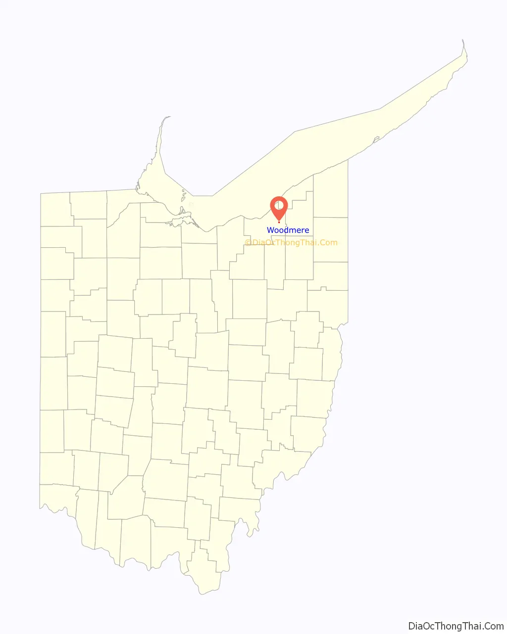
Woodmere location map. Where is Woodmere village?
History
Woodmere is one of the five municipalities, along with Hunting Valley, Moreland Hills, Orange Village and Pepper Pike, that originally formed Orange Township, the birthplace of President James A. Garfield. While the other four municipalities were established in the 1920s, Woodmere was incorporated as a village in 1944. Today, centered along Chagrin Boulevard, Woodmere serves as the primary commercial district for all parts of the original Orange Township.
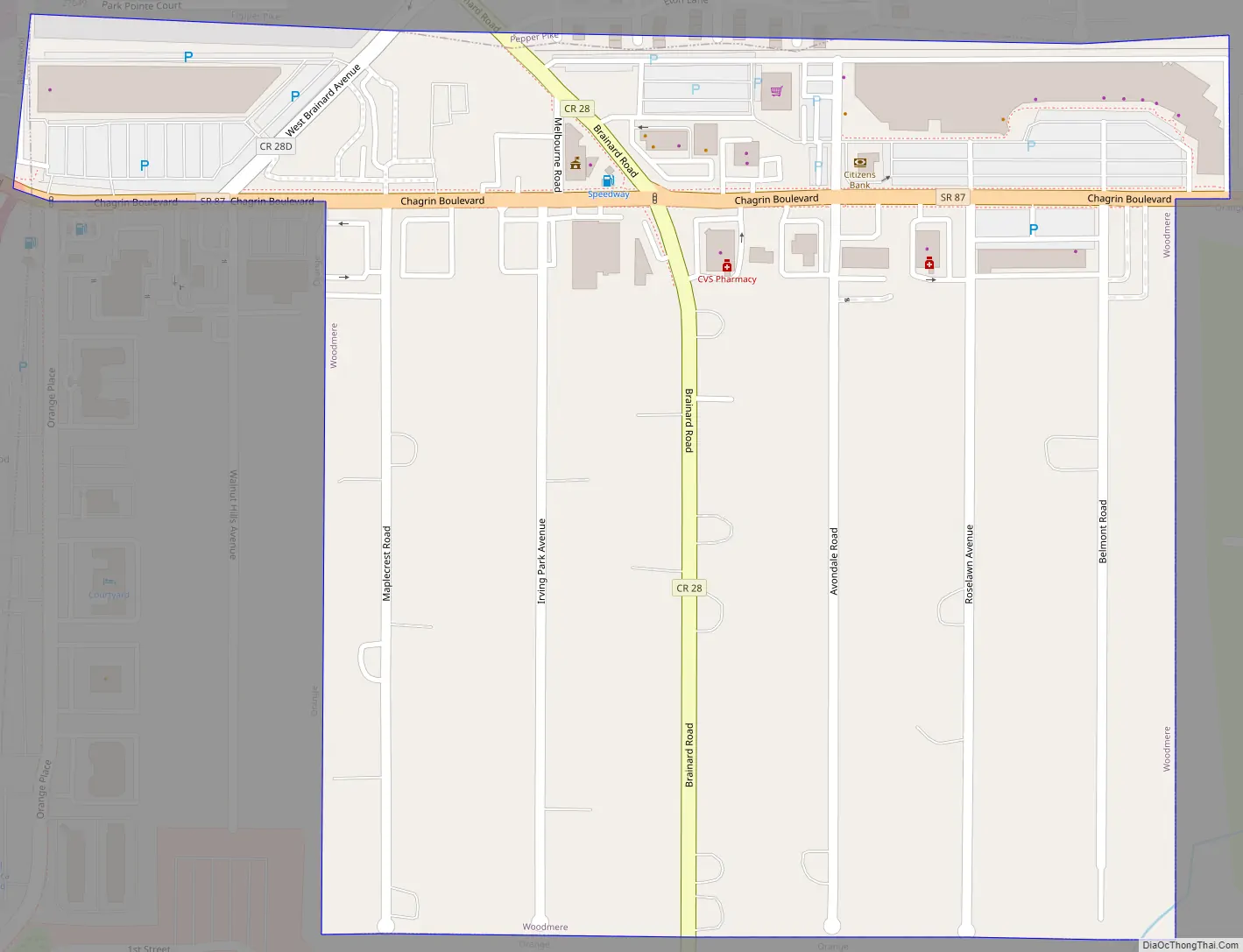
Woodmere Road Map
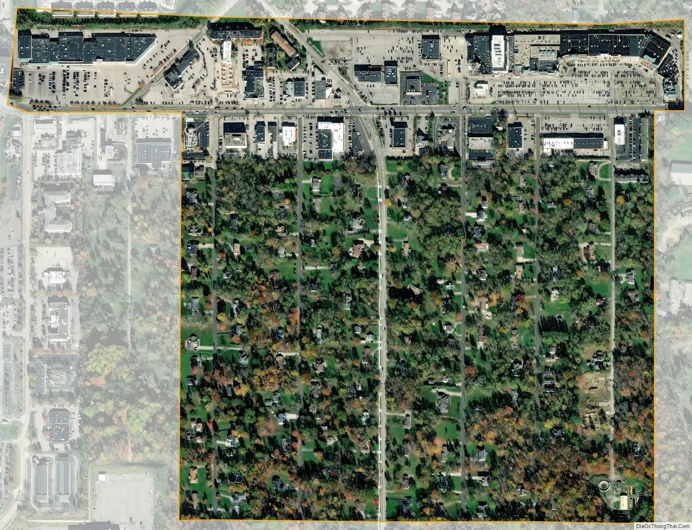
Woodmere city Satellite Map
Geography
Woodmere is located at 41°27′33″N 81°28′52″W / 41.45917°N 81.48111°W / 41.45917; -81.48111 (41.459253, -81.481010).
According to the United States Census Bureau, the village has a total area of 0.33 square miles (0.85 km), all land.
See also
Map of Ohio State and its subdivision:- Adams
- Allen
- Ashland
- Ashtabula
- Athens
- Auglaize
- Belmont
- Brown
- Butler
- Carroll
- Champaign
- Clark
- Clermont
- Clinton
- Columbiana
- Coshocton
- Crawford
- Cuyahoga
- Darke
- Defiance
- Delaware
- Erie
- Fairfield
- Fayette
- Franklin
- Fulton
- Gallia
- Geauga
- Greene
- Guernsey
- Hamilton
- Hancock
- Hardin
- Harrison
- Henry
- Highland
- Hocking
- Holmes
- Huron
- Jackson
- Jefferson
- Knox
- Lake
- Lake Erie
- Lawrence
- Licking
- Logan
- Lorain
- Lucas
- Madison
- Mahoning
- Marion
- Medina
- Meigs
- Mercer
- Miami
- Monroe
- Montgomery
- Morgan
- Morrow
- Muskingum
- Noble
- Ottawa
- Paulding
- Perry
- Pickaway
- Pike
- Portage
- Preble
- Putnam
- Richland
- Ross
- Sandusky
- Scioto
- Seneca
- Shelby
- Stark
- Summit
- Trumbull
- Tuscarawas
- Union
- Van Wert
- Vinton
- Warren
- Washington
- Wayne
- Williams
- Wood
- Wyandot
- Alabama
- Alaska
- Arizona
- Arkansas
- California
- Colorado
- Connecticut
- Delaware
- District of Columbia
- Florida
- Georgia
- Hawaii
- Idaho
- Illinois
- Indiana
- Iowa
- Kansas
- Kentucky
- Louisiana
- Maine
- Maryland
- Massachusetts
- Michigan
- Minnesota
- Mississippi
- Missouri
- Montana
- Nebraska
- Nevada
- New Hampshire
- New Jersey
- New Mexico
- New York
- North Carolina
- North Dakota
- Ohio
- Oklahoma
- Oregon
- Pennsylvania
- Rhode Island
- South Carolina
- South Dakota
- Tennessee
- Texas
- Utah
- Vermont
- Virginia
- Washington
- West Virginia
- Wisconsin
- Wyoming


