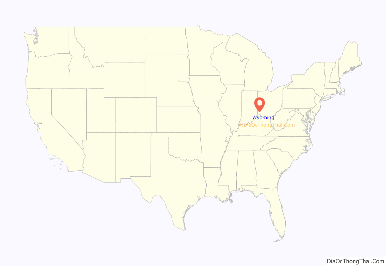
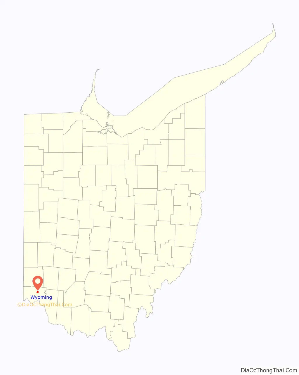
Wyoming is a city in Hamilton County, Ohio; It is located approximately 12 miles north of downtown Cincinnati and is part of the Cincinnati metropolitan area. The population was 8,756 at the 2020 census.
| Name: | Wyoming city |
|---|---|
| LSAD Code: | 25 |
| LSAD Description: | city (suffix) |
| State: | Ohio |
| County: | Hamilton County |
| Elevation: | 574 ft (175 m) |
| Total Area: | 2.88 sq mi (7.47 km²) |
| Land Area: | 2.88 sq mi (7.47 km²) |
| Water Area: | 0.00 sq mi (0.00 km²) |
| Total Population: | 8,756 |
| Population Density: | 3,036.06/sq mi (1,172.08/km²) |
| ZIP code: | 45215, 45231 |
| Area code: | 513 |
| FIPS code: | 3986730 |
| GNISfeature ID: | 1049349 |
| Website: | www.wyomingohio.gov |
Online Interactive Map
Click on ![]() to view map in "full screen" mode.
to view map in "full screen" mode.
Wyoming location map. Where is Wyoming city?
History
Among the earliest European-American settlers in what is now Wyoming was the Pendery family, who arrived in 1805. Wyoming was named after Wyoming County, Pennsylvania, where some settlers had come from.
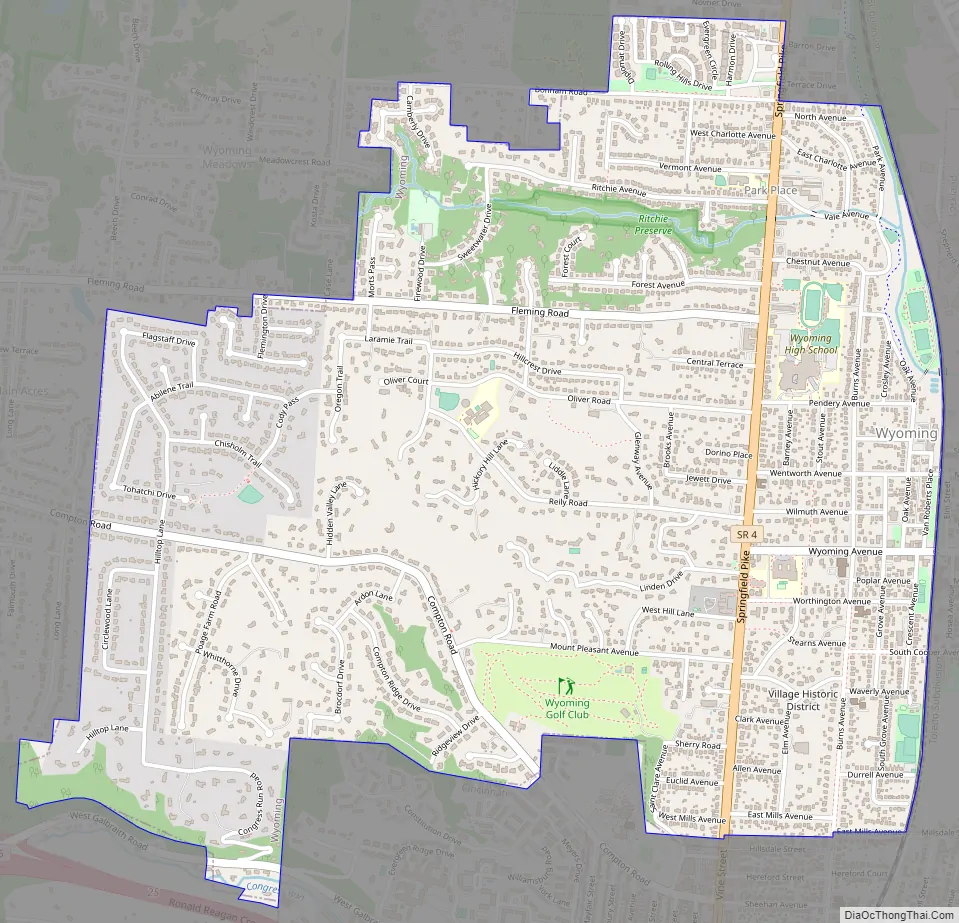
Wyoming Road Map
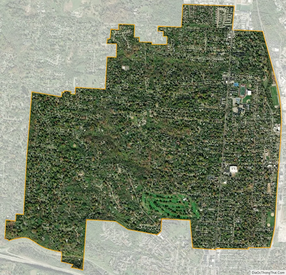
Wyoming city Satellite Map
Geography
Wyoming is located at 39°13′43″N 84°28′28″W / 39.22861°N 84.47444°W / 39.22861; -84.47444 (39.228609, −84.474391).
According to the United States Census Bureau, the city has a total area of 2.87 square miles (7.43 km), all land.
See also
Map of Ohio State and its subdivision:- Adams
- Allen
- Ashland
- Ashtabula
- Athens
- Auglaize
- Belmont
- Brown
- Butler
- Carroll
- Champaign
- Clark
- Clermont
- Clinton
- Columbiana
- Coshocton
- Crawford
- Cuyahoga
- Darke
- Defiance
- Delaware
- Erie
- Fairfield
- Fayette
- Franklin
- Fulton
- Gallia
- Geauga
- Greene
- Guernsey
- Hamilton
- Hancock
- Hardin
- Harrison
- Henry
- Highland
- Hocking
- Holmes
- Huron
- Jackson
- Jefferson
- Knox
- Lake
- Lake Erie
- Lawrence
- Licking
- Logan
- Lorain
- Lucas
- Madison
- Mahoning
- Marion
- Medina
- Meigs
- Mercer
- Miami
- Monroe
- Montgomery
- Morgan
- Morrow
- Muskingum
- Noble
- Ottawa
- Paulding
- Perry
- Pickaway
- Pike
- Portage
- Preble
- Putnam
- Richland
- Ross
- Sandusky
- Scioto
- Seneca
- Shelby
- Stark
- Summit
- Trumbull
- Tuscarawas
- Union
- Van Wert
- Vinton
- Warren
- Washington
- Wayne
- Williams
- Wood
- Wyandot
- Alabama
- Alaska
- Arizona
- Arkansas
- California
- Colorado
- Connecticut
- Delaware
- District of Columbia
- Florida
- Georgia
- Hawaii
- Idaho
- Illinois
- Indiana
- Iowa
- Kansas
- Kentucky
- Louisiana
- Maine
- Maryland
- Massachusetts
- Michigan
- Minnesota
- Mississippi
- Missouri
- Montana
- Nebraska
- Nevada
- New Hampshire
- New Jersey
- New Mexico
- New York
- North Carolina
- North Dakota
- Ohio
- Oklahoma
- Oregon
- Pennsylvania
- Rhode Island
- South Carolina
- South Dakota
- Tennessee
- Texas
- Utah
- Vermont
- Virginia
- Washington
- West Virginia
- Wisconsin
- Wyoming


