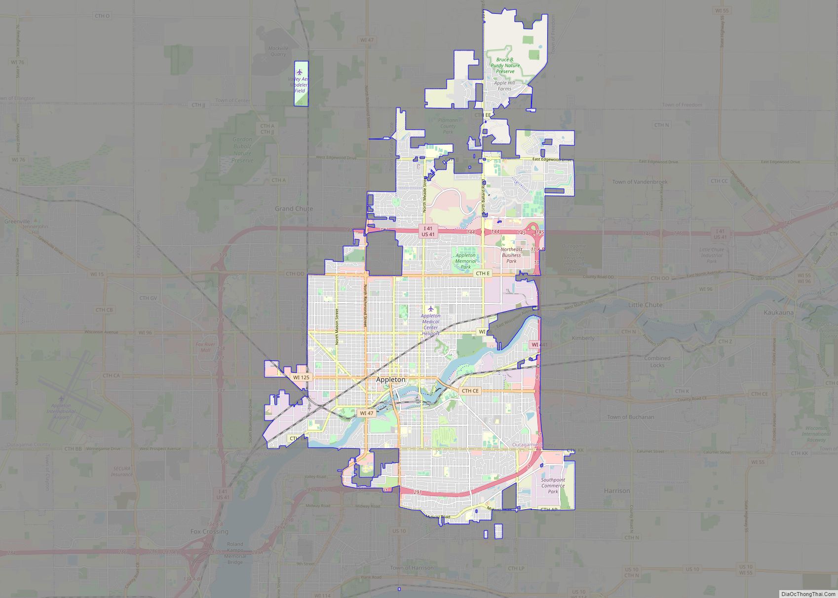
Appleton (Menominee: Ahkōnemeh) is a city in Outagamie, Calumet, and Winnebago counties in the U.S. state of Wisconsin. One of the Fox Cities, it is situated on the Fox River, 30 miles (48 km) southwest of Green Bay and 100 miles (160 km) north of Milwaukee. Appleton is the county seat of Outagamie County. As of the 2020 Census it had a population of 75,644, making it the sixth largest city in Wisconsin. Appleton is a part of the Fox Cities metropolitan area, the third largest in the state behind Milwaukee and Madison.
Appleton serves as the heart of the Fox River Valley, which is home to Lawrence University, the Fox Cities Exhibition Center, Fox Cities Performing Arts Center, Fox River Mall, Neuroscience Group Field at Fox Cities Stadium, Appleton International Airport, and the Valley’s two major hospitals: St. Elizabeth Hospital and ThedaCare Regional Medical Center–Appleton. It also hosts regional events such as Octoberfest and the Mile of Music.
| Name: | Appleton city |
|---|---|
| LSAD Code: | 25 |
| LSAD Description: | city (suffix) |
| State: | Wisconsin |
| County: | Calumet County, Outagamie County, Winnebago County |
| Incorporated: | May 2, 1857 |
| Elevation: | 790 ft (240 m) |
| Land Area: | 24.79 sq mi (64.20 km²) |
| Water Area: | 0.50 sq mi (1.29 km²) 1.97% |
| Population Density: | 2,989.15/sq mi (1,154.12/km²) |
| ZIP code: | 54911, 54912, 54913, 54914, 54915, 54919 |
| Area code: | 920 |
| FIPS code: | 5502375 |
| GNISfeature ID: | 1560914 |
| Website: | www.appleton.org |
Online Interactive Map
Click on ![]() to view map in "full screen" mode.
to view map in "full screen" mode.
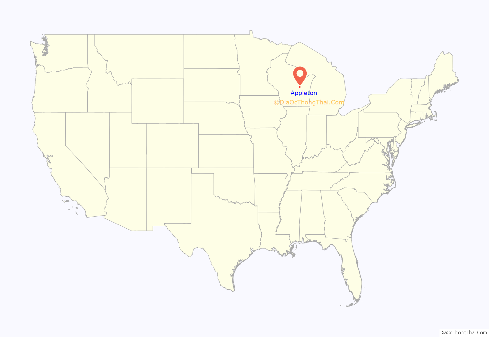
Appleton location map. Where is Appleton city?
History
Native American history
The territory where Appleton is today was traditionally occupied by the Ho-Chunk and the Menominee. The Menominee Nation ceded the territory to the United States in the Treaty of the Cedars in 1836, with Chief Oshkosh representing the Menominee. The treaty came at the end of several years of negotiations between the Menominee, the Ho-Chunk and the federal government about how to accommodate the Oneida, Stockbridge-Munsee, and Brothertown peoples who were removed from New York to Wisconsin. The Ho-Chunk never ratified the final treaty as only the Menominee ceded land. In the Menominee language, Appleton is known as Ahkōnemeh, or “watches for them place”.
The first European settlers in Appleton were fur traders seeking to do business with Fox River Valley Native Americans. Hippolyte Grignon built the White Heron in 1835 to house his family and serve as an inn and trading post.
European settlement
Appleton was settled in 1847. It was founded as three unincorporated villages along the Fox River. From south to north along the river, these were Grand Chute, Appleton, and Lawesburg. In 1853, the three were merged into the single incorporated Village of Appleton. John F. Johnston was the first resident and village president. Lawrence University, also founded in 1847, was backed financially by Amos A. Lawrence and originally known as the Lawrence Institute. Samuel Appleton, Lawrence’s father-in-law from New England who never visited Wisconsin, donated $10,000 to the newly founded college library, and the town took his name in appreciation.
The paper industry, beginning with the building of the first paper mill in the city in 1853, has been at the forefront of the development of Appleton. In order to provide electricity to the paper industry, the nation’s first hydro-electric central station, the Vulcan Street Plant on the Fox River, began operation on September 30, 1882. The power plant also powered the Hearthstone House, the first residence in the world powered by a centrally located hydroelectric station using the Edison system.
Shortly thereafter, in August 1886, Appleton was the site for another national first, the operation of a commercially successful electric streetcar company. Electric lights replaced gas lamps on College Avenue in 1912. Appleton also had the first telephone in Wisconsin, and the first incandescent light in any city outside of the East Coast.
The community was incorporated as a city on March 2, 1857, with Amos Storey as its first mayor. Early in the 20th century, it adopted the commission form of government. In 1890, 11,869 people lived in Appleton; in 1900, there were 15,085; in 1910, 16,773; in 1920, 19,571; and in 1940, 28,436.
Significant annexations to the city, taken from the Town of Grand Chute, were performed in the next two decades. The first, the “Glendale” district, was completed on November 8, 1941, growing Appleton north past Glendale Avenue. Another became official on December 22, 1950 after multi-year disputes, when the unincorporated villages of Bell Heights and Whispering Pines were annexed into the city from Grand Chute. Bell Heights added new area to the northwest edge of Appleton, and Whispering Pines, to the northeast, would include land where Appleton Memorial Hospital would later be built. Bell Heights and Whispering Pines increased the population of the city by ten percent, and its area by twenty percent, overnight.
Appleton’s tallest building, the 222 Building was built in 1952. The Valley Fair Shopping Center, built in 1954, laid claim to being the first enclosed shopping mall in the United States, although this claim is disputed by other malls. In 2007 most of the structure was demolished, leaving only its east wing and a movie theater. A Pick ‘n Save Food Center now stands in its place.
From approximately 1930–1970, Appleton was a sundown town: black people were not allowed to stay overnight, and none lived within its city limits by 1930. In 1936, the Institute of Paper Chemistry tried to hire the famous African-American chemist Percy Julian, but could not figure out how to do this without running afoul of what was stated as “an arcane law on the City of Appleton’s books”. A fight over Julian’s employment ensued, and he was hired by Glidden in Chicago instead. Appleton’s sundown status was largely de facto and not de jure; it stood by unwritten consensus and enforcement, such as by police strongly encouraging black people to leave town after dark. A partial exception was made for opera singer Marian Anderson when she sang at Lawrence University in 1941; she was allowed to stay overnight in the Conway Hotel, but even then was not allowed to eat dinner in public.
Following the Flint water crisis, a report of Wisconsin Rust Belt cities showed high levels of lead contamination in the water of Appleton, with children under the age of 1 testing positive for lead. With a state average of 1.9 per 100 for this age group, Appleton tested at 4.5 per 100 for the same age group.
Appleton Road Map
Appleton city Satellite Map
Geography
Appleton is located at 44°16′N 88°24′W / 44.267°N 88.400°W / 44.267; -88.400 (44.278819, −88.392625). According to the United States Census Bureau, the city has a total area of 24.82 square miles (64.28 km), of which, 24.33 square miles (63.01 km) is land and 0.49 square miles (1.27 km) is water.
See also
Map of Wisconsin State and its subdivision:- Adams
- Ashland
- Barron
- Bayfield
- Brown
- Buffalo
- Burnett
- Calumet
- Chippewa
- Clark
- Columbia
- Crawford
- Dane
- Dodge
- Door
- Douglas
- Dunn
- Eau Claire
- Florence
- Fond du Lac
- Forest
- Grant
- Green
- Green Lake
- Iowa
- Iron
- Jackson
- Jefferson
- Juneau
- Kenosha
- Kewaunee
- La Crosse
- Lafayette
- Lake Michigan
- Lake Superior
- Langlade
- Lincoln
- Manitowoc
- Marathon
- Marinette
- Marquette
- Menominee
- Milwaukee
- Monroe
- Oconto
- Oneida
- Outagamie
- Ozaukee
- Pepin
- Pierce
- Polk
- Portage
- Price
- Racine
- Richland
- Rock
- Rusk
- Saint Croix
- Sauk
- Sawyer
- Shawano
- Sheboygan
- Taylor
- Trempealeau
- Vernon
- Vilas
- Walworth
- Washburn
- Washington
- Waukesha
- Waupaca
- Waushara
- Winnebago
- Wood
- Alabama
- Alaska
- Arizona
- Arkansas
- California
- Colorado
- Connecticut
- Delaware
- District of Columbia
- Florida
- Georgia
- Hawaii
- Idaho
- Illinois
- Indiana
- Iowa
- Kansas
- Kentucky
- Louisiana
- Maine
- Maryland
- Massachusetts
- Michigan
- Minnesota
- Mississippi
- Missouri
- Montana
- Nebraska
- Nevada
- New Hampshire
- New Jersey
- New Mexico
- New York
- North Carolina
- North Dakota
- Ohio
- Oklahoma
- Oregon
- Pennsylvania
- Rhode Island
- South Carolina
- South Dakota
- Tennessee
- Texas
- Utah
- Vermont
- Virginia
- Washington
- West Virginia
- Wisconsin
- Wyoming
