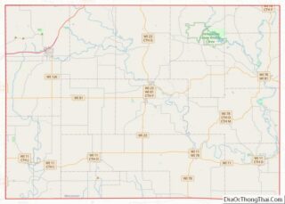
Argyle is a town in Lafayette County, Wisconsin, United States. The population was 436 at the 2010 census, down from 479 at the 2000 census. The village of Argyle is located within the town.
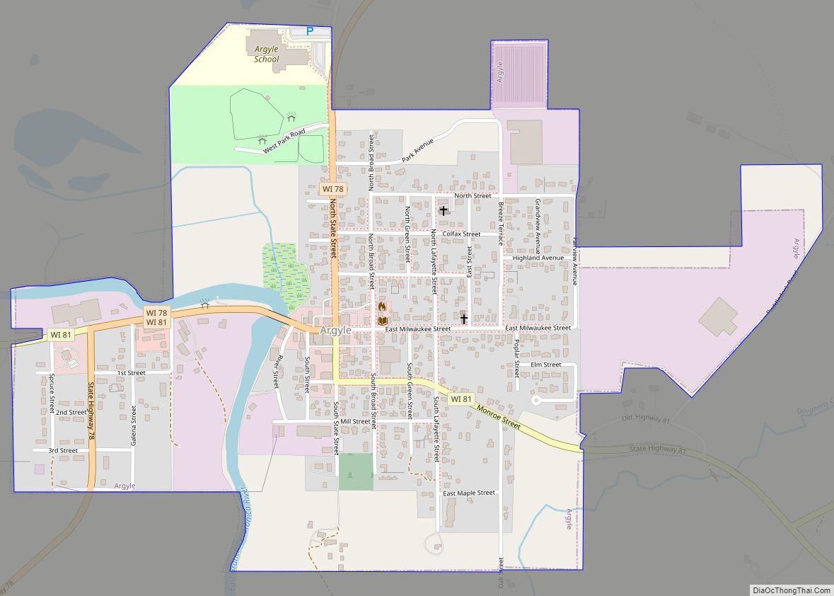
| Name: | Argyle village |
|---|---|
| LSAD Code: | 47 |
| LSAD Description: | village (suffix) |
| State: | Wisconsin |
| County: | Lafayette County |
| Elevation: | 802 ft (244 m) |
| Total Area: | 35.59 sq mi (92.18 km²) |
| Land Area: | 35.54 sq mi (92.04 km²) |
| Water Area: | 0.05 sq mi (0.14 km²) |
| Total Population: | 436 |
| Population Density: | 12/sq mi (4.7/km²) |
| Area code: | 608 |
| FIPS code: | 5502650 |
| GNISfeature ID: | 1582711 |
Online Interactive Map
Click on ![]() to view map in "full screen" mode.
to view map in "full screen" mode.
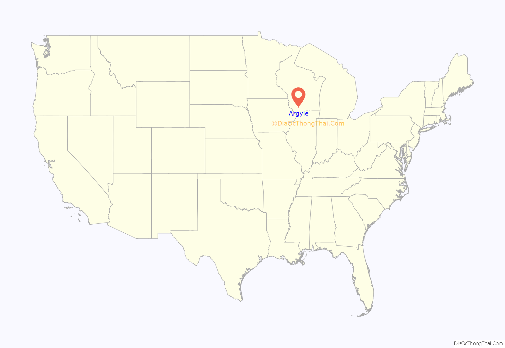
Argyle location map. Where is Argyle village?
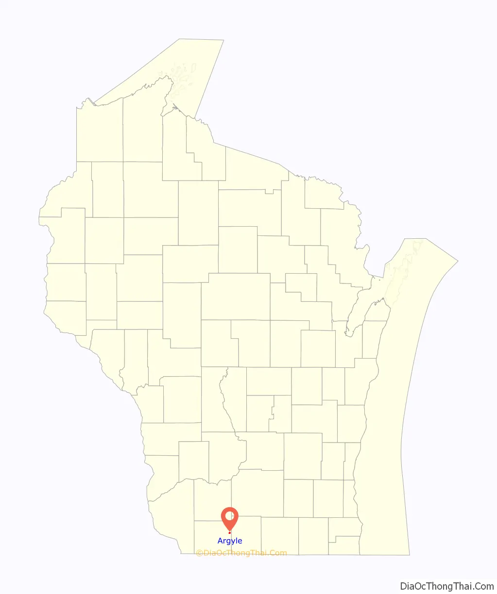
Argyle Road Map
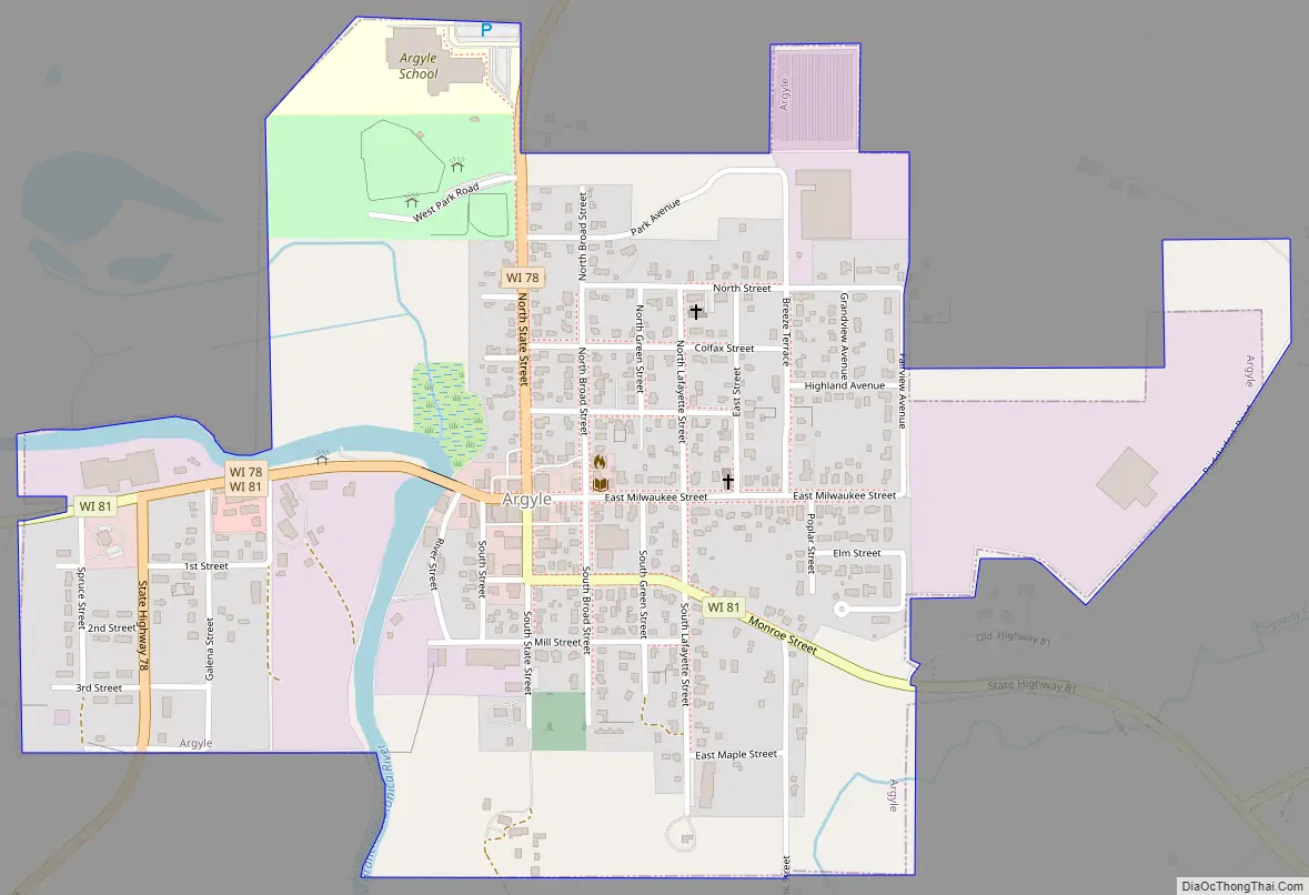
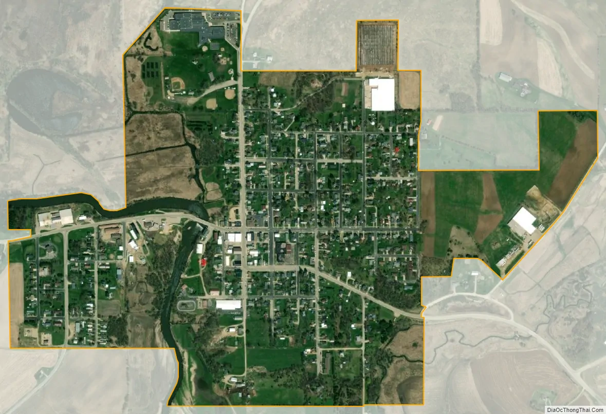
Argyle city Satellite Map
Geography
The town is in northeastern Lafayette County, with its eastern border following the Green County line. The village of Argyle is in the southeast part of the town.
According to the United States Census Bureau, the town has a total area of 35.6 square miles (92.2 km), of which 0.04 square miles (0.1 km), or 0.15%, are water. The East Branch Pecatonica River flows north-to-south through the eastern part of the town, passing the through the village of Argyle. The Yellowstone River joins the East Branch from the west, north of Argyle village. The East Branch feeds the Pecatonica River, which flows southeast to the Rock River in Illinois.
See also
Map of Wisconsin State and its subdivision:- Adams
- Ashland
- Barron
- Bayfield
- Brown
- Buffalo
- Burnett
- Calumet
- Chippewa
- Clark
- Columbia
- Crawford
- Dane
- Dodge
- Door
- Douglas
- Dunn
- Eau Claire
- Florence
- Fond du Lac
- Forest
- Grant
- Green
- Green Lake
- Iowa
- Iron
- Jackson
- Jefferson
- Juneau
- Kenosha
- Kewaunee
- La Crosse
- Lafayette
- Lake Michigan
- Lake Superior
- Langlade
- Lincoln
- Manitowoc
- Marathon
- Marinette
- Marquette
- Menominee
- Milwaukee
- Monroe
- Oconto
- Oneida
- Outagamie
- Ozaukee
- Pepin
- Pierce
- Polk
- Portage
- Price
- Racine
- Richland
- Rock
- Rusk
- Saint Croix
- Sauk
- Sawyer
- Shawano
- Sheboygan
- Taylor
- Trempealeau
- Vernon
- Vilas
- Walworth
- Washburn
- Washington
- Waukesha
- Waupaca
- Waushara
- Winnebago
- Wood
- Alabama
- Alaska
- Arizona
- Arkansas
- California
- Colorado
- Connecticut
- Delaware
- District of Columbia
- Florida
- Georgia
- Hawaii
- Idaho
- Illinois
- Indiana
- Iowa
- Kansas
- Kentucky
- Louisiana
- Maine
- Maryland
- Massachusetts
- Michigan
- Minnesota
- Mississippi
- Missouri
- Montana
- Nebraska
- Nevada
- New Hampshire
- New Jersey
- New Mexico
- New York
- North Carolina
- North Dakota
- Ohio
- Oklahoma
- Oregon
- Pennsylvania
- Rhode Island
- South Carolina
- South Dakota
- Tennessee
- Texas
- Utah
- Vermont
- Virginia
- Washington
- West Virginia
- Wisconsin
- Wyoming