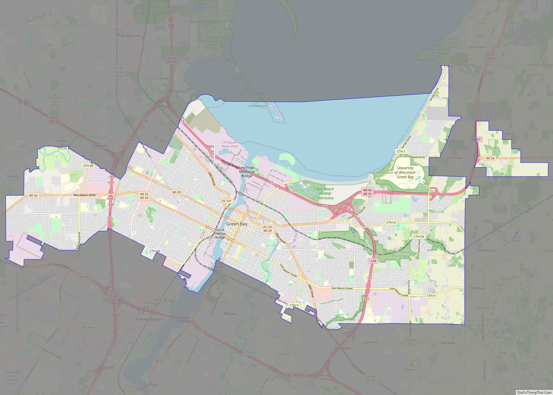
Ashwaubenon (/æʃˈwɔːbɪnɒn/) is a village in Brown County in the U.S. state of Wisconsin. The population was 16,963 at the 2010 census. A suburb of Green Bay, Ashwaubenon is part of the Green Bay Metropolitan Statistical Area and carries a Green Bay mailing address. Part of the Oneida Nation of Wisconsin is in Ashwaubenon.
| Name: | Ashwaubenon village |
|---|---|
| LSAD Code: | 47 |
| LSAD Description: | village (suffix) |
| State: | Wisconsin |
| County: | Brown County |
| Elevation: | 607 ft (185 m) |
| Total Area: | 12.83 sq mi (33.23 km²) |
| Land Area: | 12.38 sq mi (32.07 km²) |
| Water Area: | 0.45 sq mi (1.16 km²) |
| Total Population: | 16,963 |
| Population Density: | 1,386.08/sq mi (535.16/km²) |
| Area code: | 920 |
| FIPS code: | 5503425 |
| GNISfeature ID: | 1577391 |
| Website: | ashwaubenon.com |
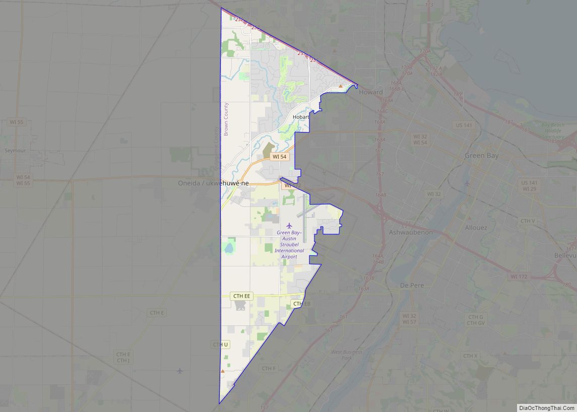
Online Interactive Map
Click on ![]() to view map in "full screen" mode.
to view map in "full screen" mode.
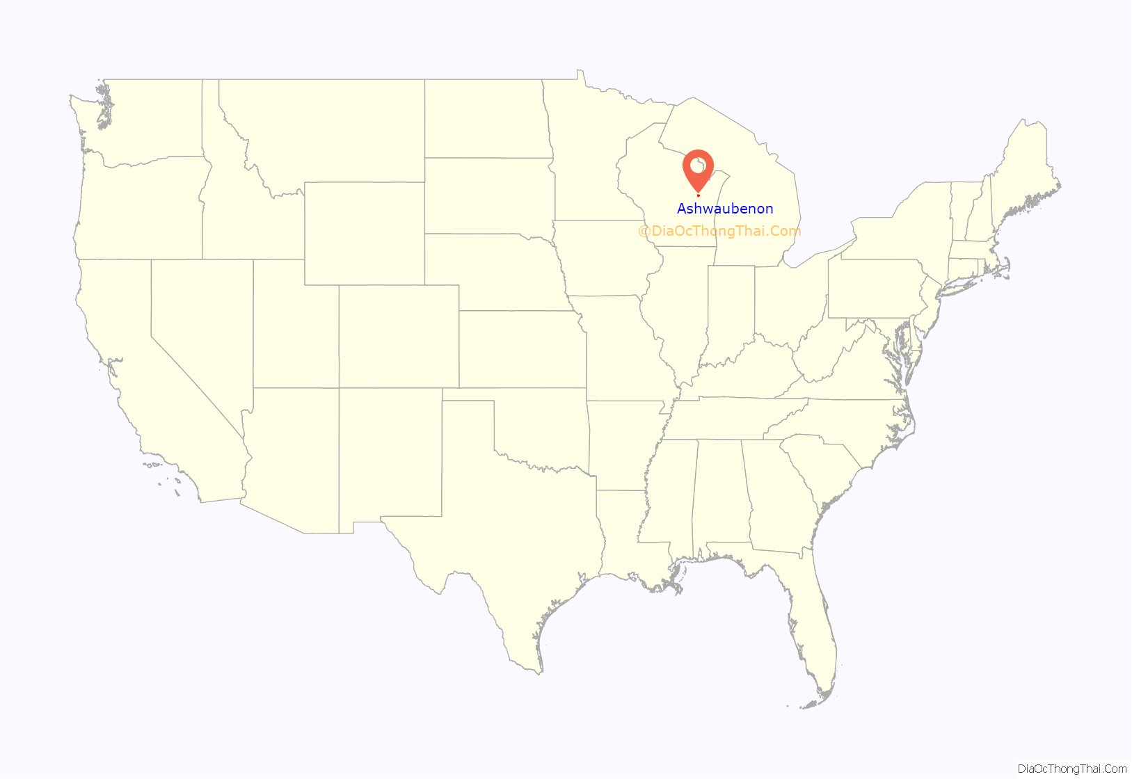
Ashwaubenon location map. Where is Ashwaubenon village?

History
The U.S. military bought most of the west side of Green Bay, Wisconsin from the Sioux in the 1850s and 1860s, except the area that would later become Ashwaubenon. That land belonged to two daughters of Chief Ashwaubamy, a Sioux chief. They began selling their land to local farmers and landowners in the late 19th century. One of the owners was Jacques Vieau.
Name origin
One theory of the origins of Ashwaubenon is of Ojibwe origin. It is derived from ashiwabiwining “place where they watch, keep a lookout”. Another theory derives the name from Chief Ashwaubamay. In the Menominee language, which is related to the Ojibwe language, the place is known as Es-Wāpanoh, “thither see the dawning”.
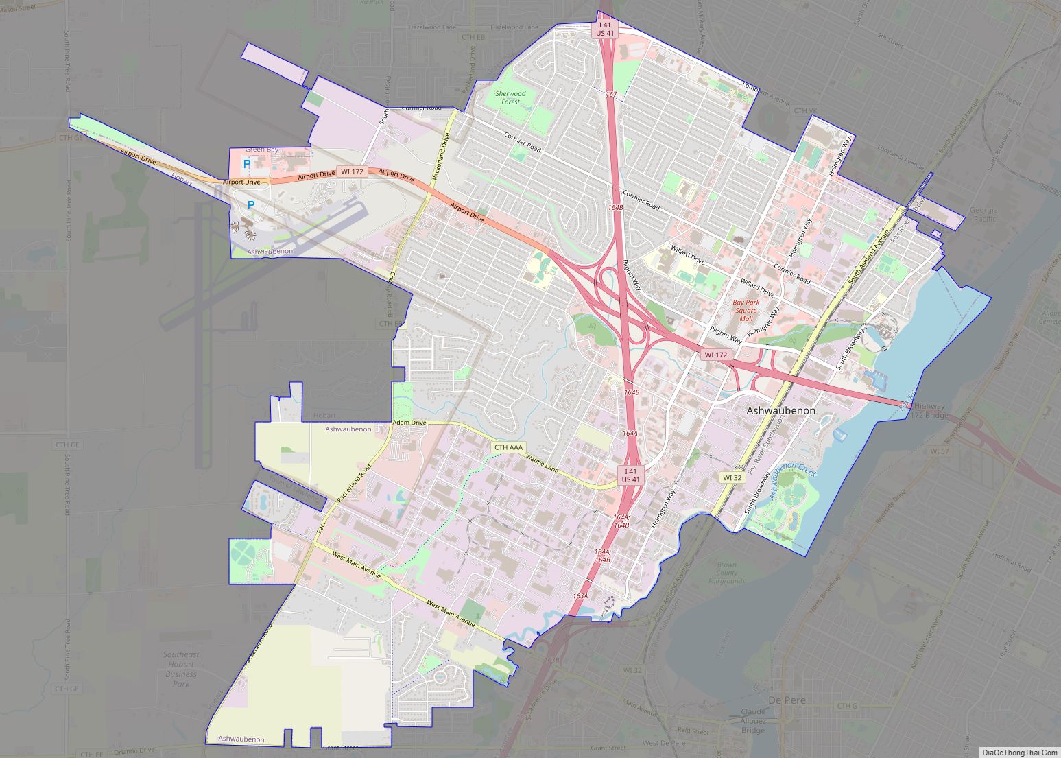
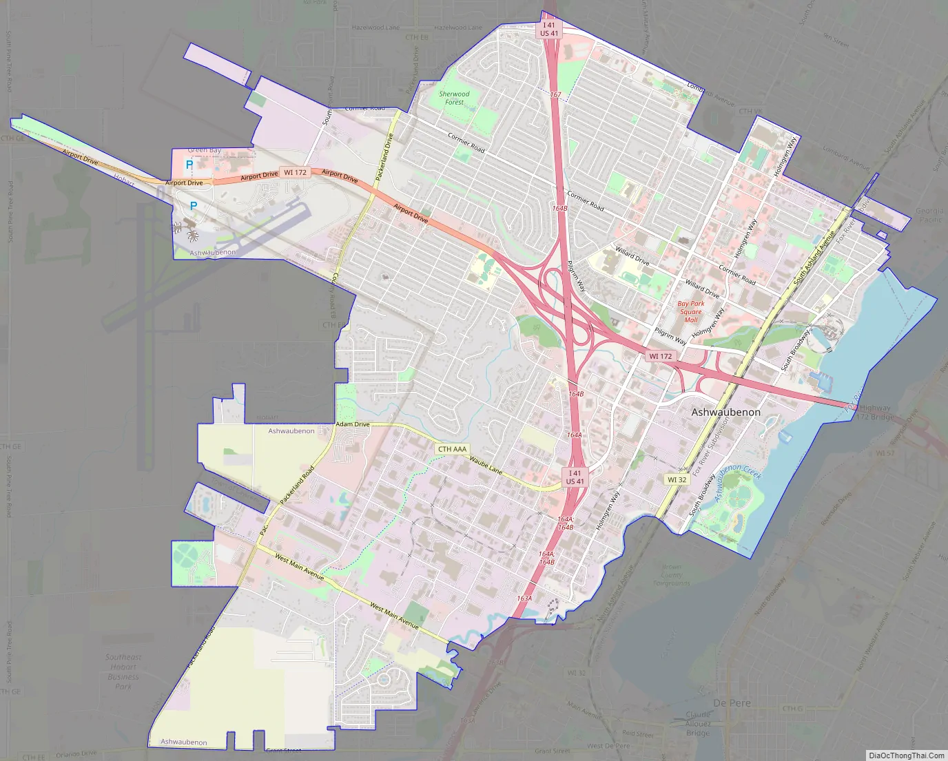
Ashwaubenon Road Map
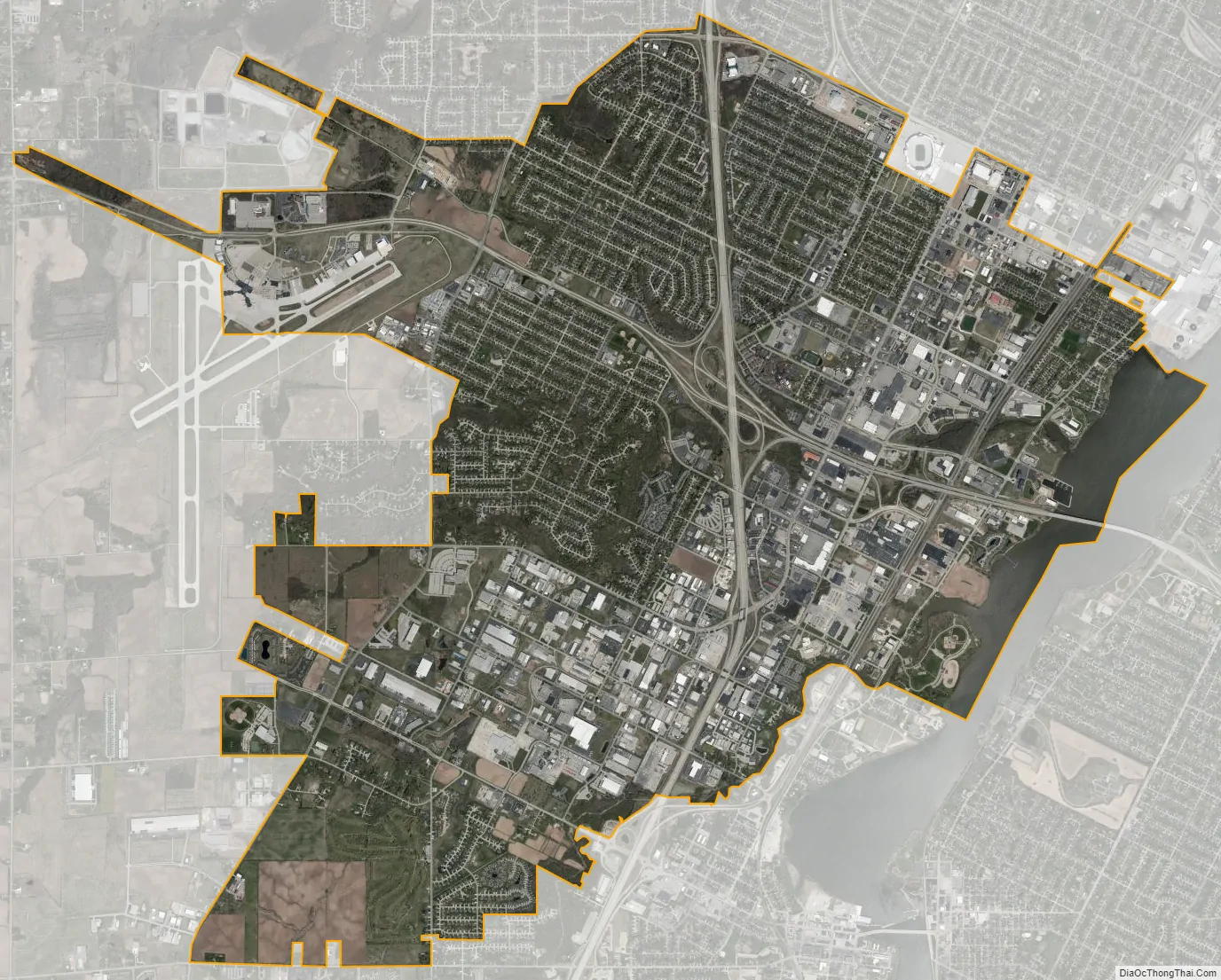
Ashwaubenon city Satellite Map
Geography
Ashwaubenon is located at 44°29′N 88°5′W / 44.483°N 88.083°W / 44.483; -88.083 (44.49, −88.08).
According to the United States Census Bureau, the village has a total area of 12.75 square miles (33.02 km), of which 12.39 square miles (32.09 km) is land and 0.36 square miles (0.93 km) is water.
See also
Map of Wisconsin State and its subdivision:- Adams
- Ashland
- Barron
- Bayfield
- Brown
- Buffalo
- Burnett
- Calumet
- Chippewa
- Clark
- Columbia
- Crawford
- Dane
- Dodge
- Door
- Douglas
- Dunn
- Eau Claire
- Florence
- Fond du Lac
- Forest
- Grant
- Green
- Green Lake
- Iowa
- Iron
- Jackson
- Jefferson
- Juneau
- Kenosha
- Kewaunee
- La Crosse
- Lafayette
- Lake Michigan
- Lake Superior
- Langlade
- Lincoln
- Manitowoc
- Marathon
- Marinette
- Marquette
- Menominee
- Milwaukee
- Monroe
- Oconto
- Oneida
- Outagamie
- Ozaukee
- Pepin
- Pierce
- Polk
- Portage
- Price
- Racine
- Richland
- Rock
- Rusk
- Saint Croix
- Sauk
- Sawyer
- Shawano
- Sheboygan
- Taylor
- Trempealeau
- Vernon
- Vilas
- Walworth
- Washburn
- Washington
- Waukesha
- Waupaca
- Waushara
- Winnebago
- Wood
- Alabama
- Alaska
- Arizona
- Arkansas
- California
- Colorado
- Connecticut
- Delaware
- District of Columbia
- Florida
- Georgia
- Hawaii
- Idaho
- Illinois
- Indiana
- Iowa
- Kansas
- Kentucky
- Louisiana
- Maine
- Maryland
- Massachusetts
- Michigan
- Minnesota
- Mississippi
- Missouri
- Montana
- Nebraska
- Nevada
- New Hampshire
- New Jersey
- New Mexico
- New York
- North Carolina
- North Dakota
- Ohio
- Oklahoma
- Oregon
- Pennsylvania
- Rhode Island
- South Carolina
- South Dakota
- Tennessee
- Texas
- Utah
- Vermont
- Virginia
- Washington
- West Virginia
- Wisconsin
- Wyoming