Auburndale is a town in Wood County, Wisconsin, United States. The population was 829 at the 2000 census. The Village of Auburndale is located within the town.
| Name: | Auburndale village |
|---|---|
| LSAD Code: | 47 |
| LSAD Description: | village (suffix) |
| State: | Wisconsin |
| County: | Wood County |
| Total Area: | 32.2 sq mi (83.5 km²) |
| Land Area: | 32.2 sq mi (83.5 km²) |
| Total Population: | 829 |
| Population Density: | 26/sq mi (9.9/km²) |
| FIPS code: | 5503775 |
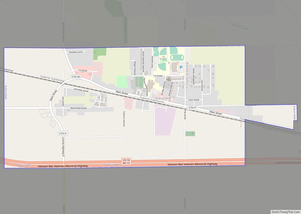
Online Interactive Map
Click on ![]() to view map in "full screen" mode.
to view map in "full screen" mode.
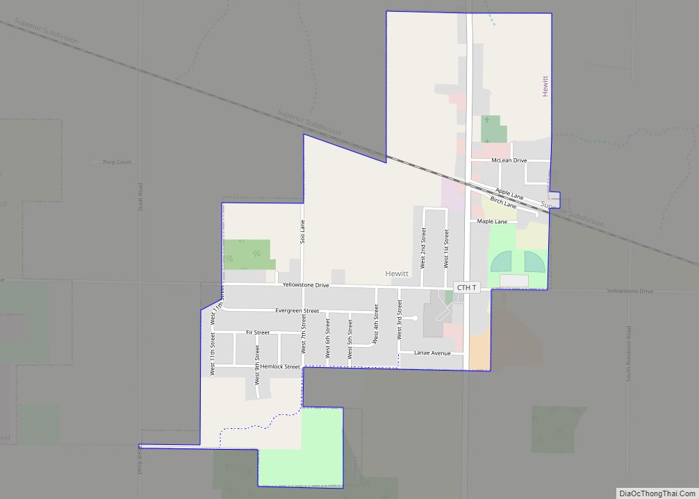
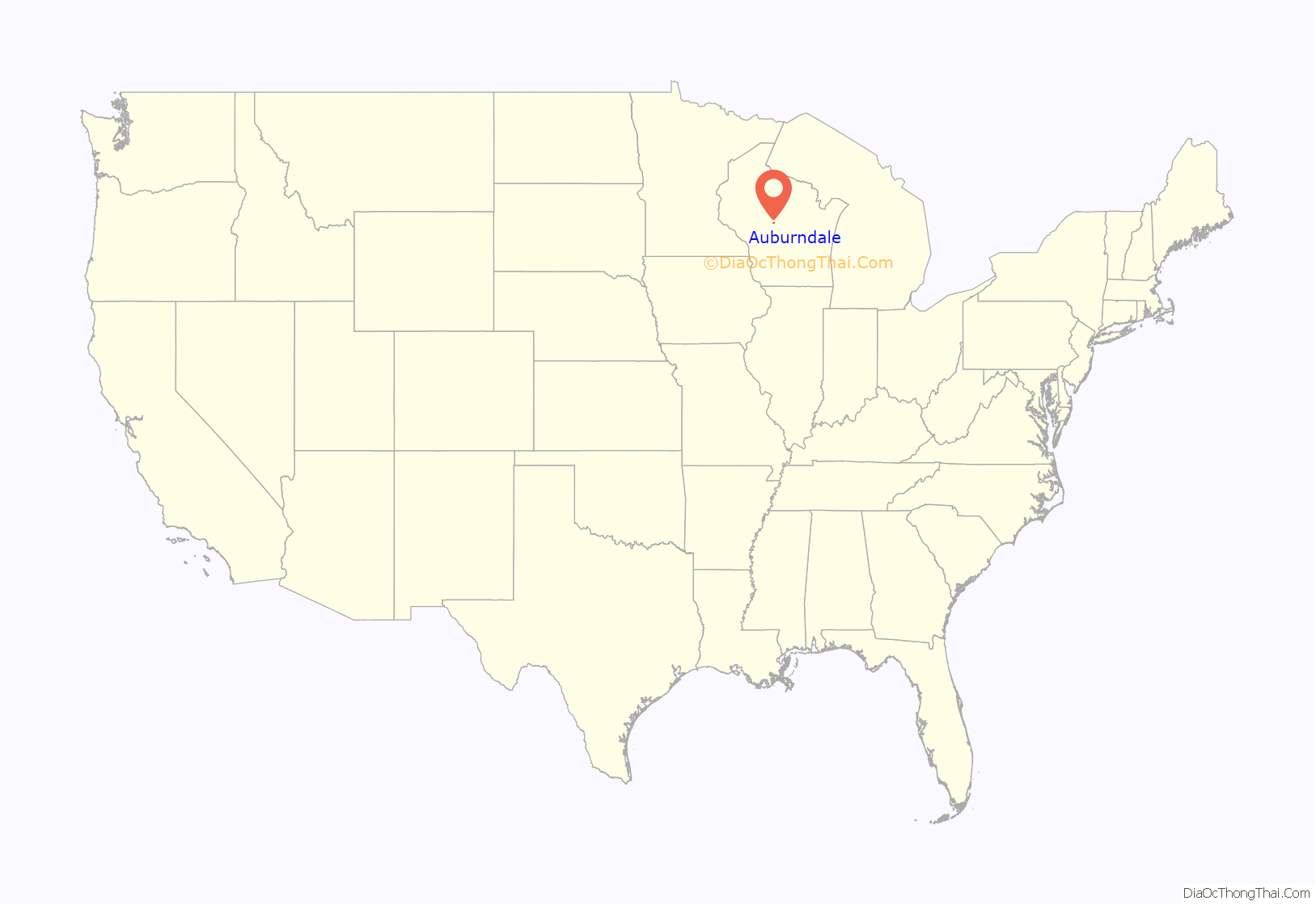
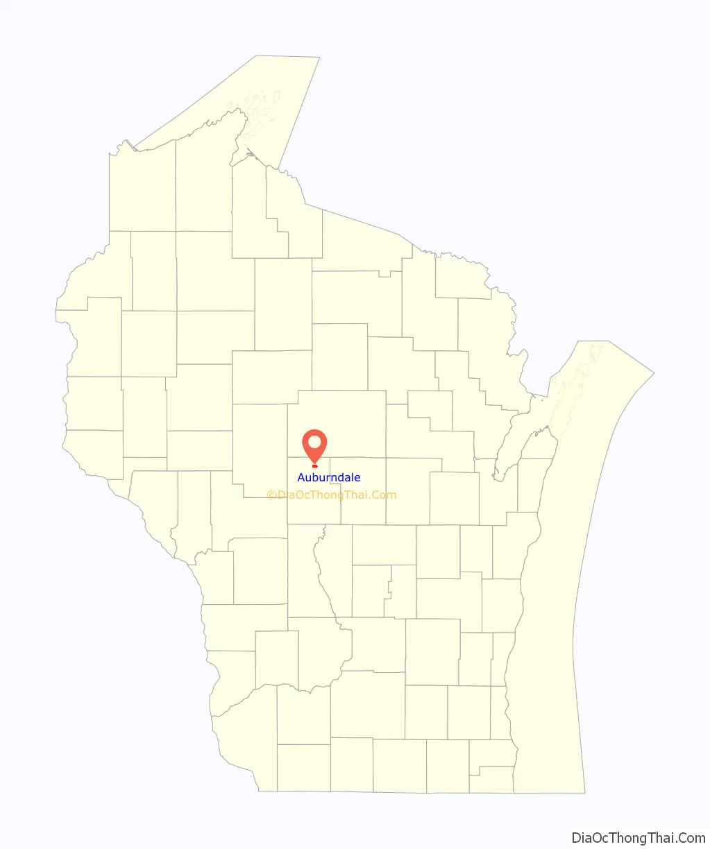
Auburndale location map. Where is Auburndale village?
History
The six mile square that would become Auburndale was first surveyed in the summer of 1851 by a crew working for the U.S. government. In November and December 1852 another crew marked its section corners, walking through the woods and wading the streams, measuring with chain and compass. When done, the deputy surveyor filed this general description:
The Town of Auburndale was established in 1874, taking its name from Auburndale.
Auburndale Road Map
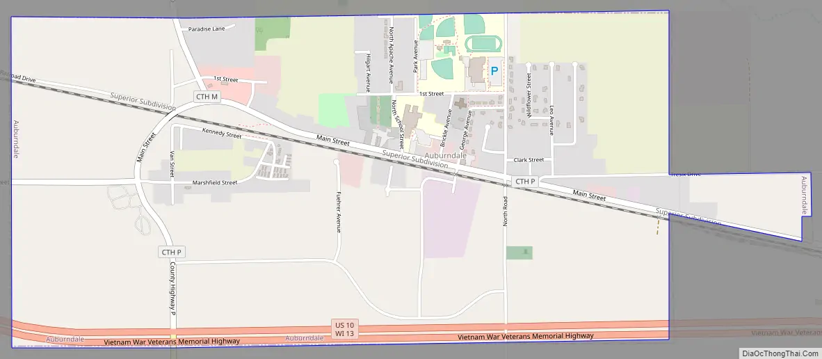
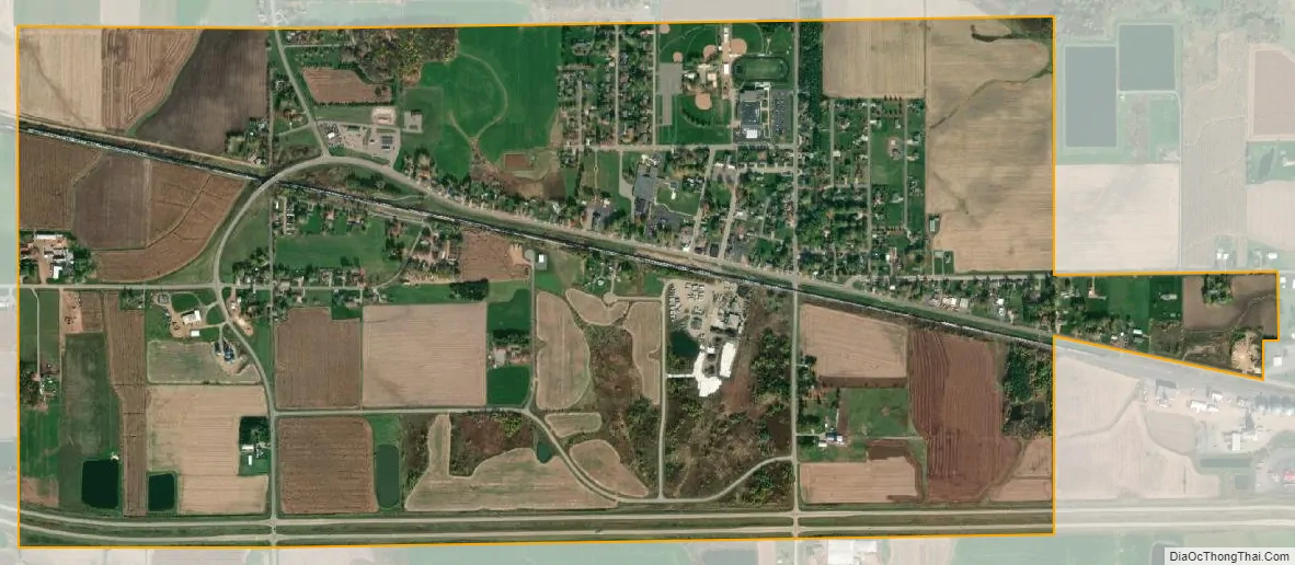
Auburndale city Satellite Map
Geography
Auburndale is roughly a square, six miles north to south and 5.75 miles east to west. According to the United States Census Bureau, the town has a total area of 32.2 square miles (83.5 km), all of it land.
See also
Map of Wisconsin State and its subdivision:- Adams
- Ashland
- Barron
- Bayfield
- Brown
- Buffalo
- Burnett
- Calumet
- Chippewa
- Clark
- Columbia
- Crawford
- Dane
- Dodge
- Door
- Douglas
- Dunn
- Eau Claire
- Florence
- Fond du Lac
- Forest
- Grant
- Green
- Green Lake
- Iowa
- Iron
- Jackson
- Jefferson
- Juneau
- Kenosha
- Kewaunee
- La Crosse
- Lafayette
- Lake Michigan
- Lake Superior
- Langlade
- Lincoln
- Manitowoc
- Marathon
- Marinette
- Marquette
- Menominee
- Milwaukee
- Monroe
- Oconto
- Oneida
- Outagamie
- Ozaukee
- Pepin
- Pierce
- Polk
- Portage
- Price
- Racine
- Richland
- Rock
- Rusk
- Saint Croix
- Sauk
- Sawyer
- Shawano
- Sheboygan
- Taylor
- Trempealeau
- Vernon
- Vilas
- Walworth
- Washburn
- Washington
- Waukesha
- Waupaca
- Waushara
- Winnebago
- Wood
- Alabama
- Alaska
- Arizona
- Arkansas
- California
- Colorado
- Connecticut
- Delaware
- District of Columbia
- Florida
- Georgia
- Hawaii
- Idaho
- Illinois
- Indiana
- Iowa
- Kansas
- Kentucky
- Louisiana
- Maine
- Maryland
- Massachusetts
- Michigan
- Minnesota
- Mississippi
- Missouri
- Montana
- Nebraska
- Nevada
- New Hampshire
- New Jersey
- New Mexico
- New York
- North Carolina
- North Dakota
- Ohio
- Oklahoma
- Oregon
- Pennsylvania
- Rhode Island
- South Carolina
- South Dakota
- Tennessee
- Texas
- Utah
- Vermont
- Virginia
- Washington
- West Virginia
- Wisconsin
- Wyoming