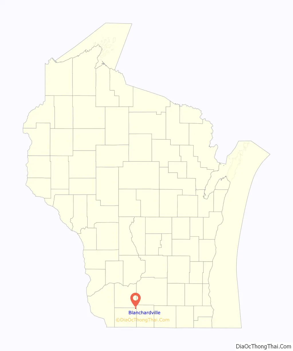
Blanchardville is a village in Iowa and Lafayette counties in the U.S. state of Wisconsin. The population was 825 at the 2010 census. Of this, 648 were in Lafayette County, and 177 were in Iowa County.
The Iowa County portion of Blanchardville is part of the Madison Metropolitan Statistical Area.
| Name: | Blanchardville village |
|---|---|
| LSAD Code: | 47 |
| LSAD Description: | village (suffix) |
| State: | Wisconsin |
| County: | Iowa County, Lafayette County |
| Elevation: | 823 ft (251 m) |
| Total Area: | 0.48 sq mi (1.25 km²) |
| Land Area: | 0.48 sq mi (1.25 km²) |
| Water Area: | 0.00 sq mi (0.00 km²) |
| Total Population: | 825 |
| Population Density: | 1,644.49/sq mi (634.74/km²) |
| Area code: | 608 608 |
| FIPS code: | 5508125 |
| GNISfeature ID: | 1561917 |
| Website: | blanchardville.com |
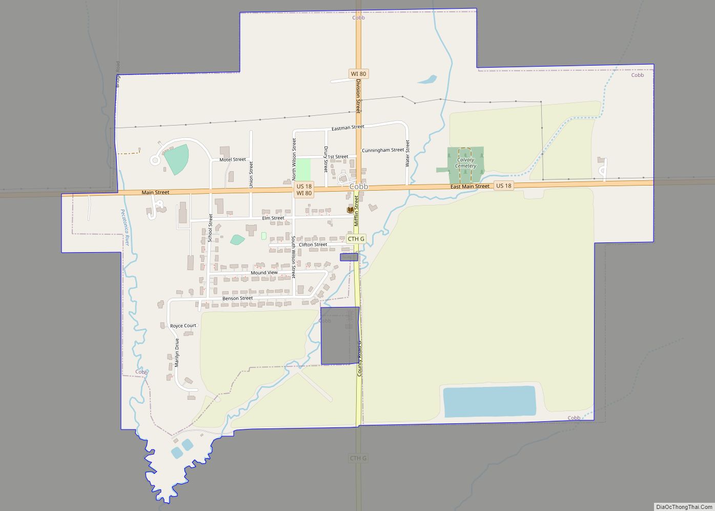
Online Interactive Map
Click on ![]() to view map in "full screen" mode.
to view map in "full screen" mode.
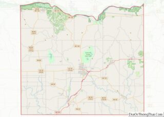
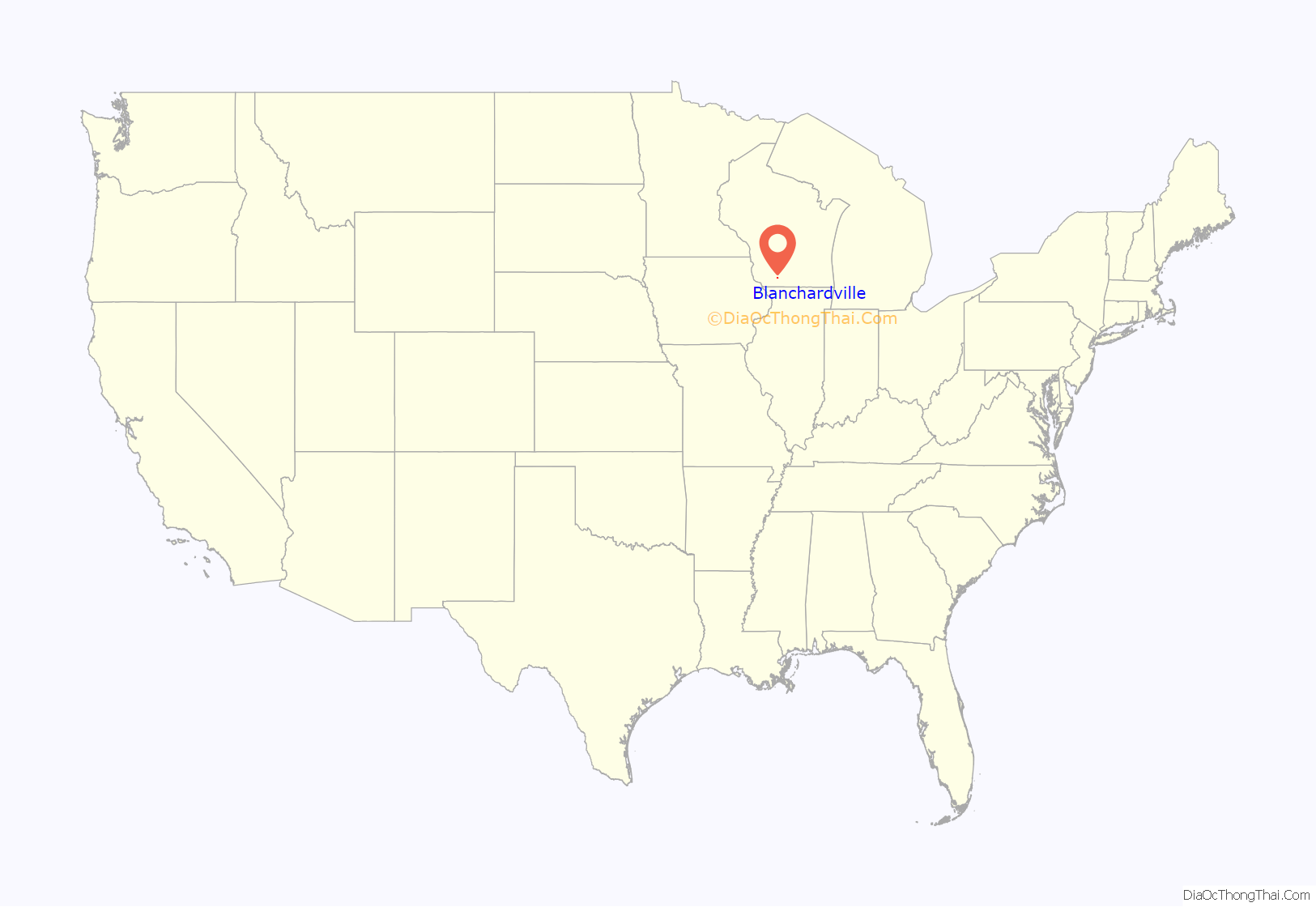
Blanchardville location map. Where is Blanchardville village?
History
The community was originally settled by members of the Church of Jesus Christ of Latter Day Saints (Strangite) in the early 1840s, who named it Zarahemla. The Mormon settlers mined lead ore and farmed. Blanchardville’s first mill was built in 1840.
In 1856, Alvin Blanchard moved to the area from his farm near Dodgeville. He purchased the mill on the Pecatonica river from the Mormons, who mostly left the area. Along with Cyrus Newkirk, he platted the village which currently bears his name in 1857. The village received its first post office the next year. The Yankee settlers established a Methodist church in 1852. A Norwegian Lutheran congregation shared the church from 1864 until 1892 when their own separate church was built. The village’s most prominent ethnic group is the Norwegians, as the village is between the large historic Blue Mounds and Wiota Norwegian settlements. Yankee, Irish, Swiss, and German settlers were in the village also and in 1898 the first Catholic church was built. Nearby rural churches in the area included Norwegian Lutheran congregations in York, Yellowstone, and Adams townships, and an Irish Catholic congregation in Yellowstone as well.
The village’s main park, McKellar Park, was given to the village in 1930 by the wife of the most prominent village doctor, Dr. Archibald McKellar, after his death. Today the park is host to many activities including an annual car show and Fathers’ Day Barbeque. The school district is Pecatonica Area Schools, formed after combining with the neighboring village of Hollandale in 1971. The school mascot is the Viking, in tribute to the strength of a Norwegian Heritage.
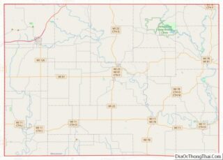
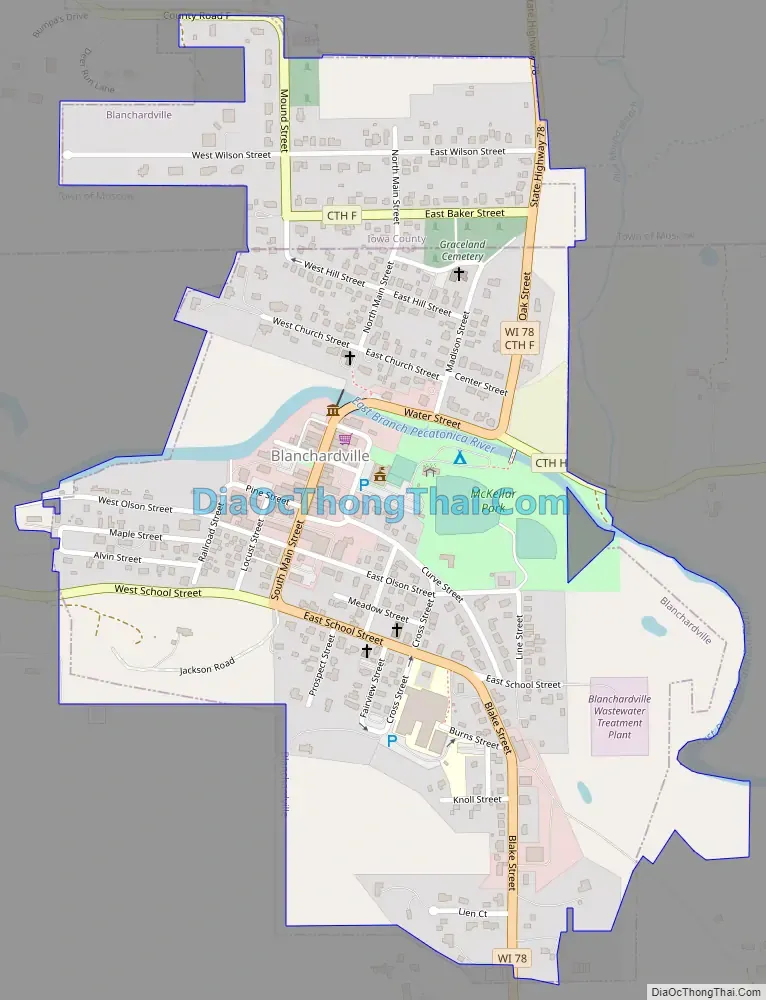
Blanchardville Road Map
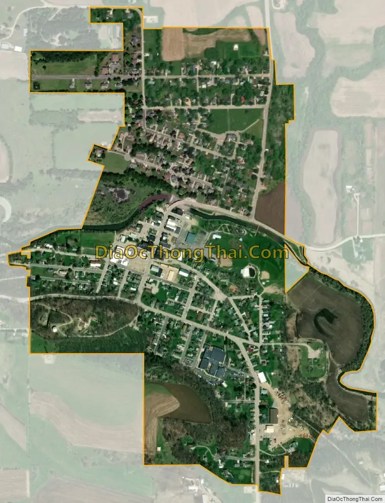
Blanchardville city Satellite Map
Geography
Blanchardville is located on the East Branch Pecatonica River. The community is served by Wisconsin Highway 78 and routes F and H.
According to the United States Census Bureau, the village has a total area of 0.50 square miles (1.29 km), all of it land.
See also
Map of Wisconsin State and its subdivision:- Adams
- Ashland
- Barron
- Bayfield
- Brown
- Buffalo
- Burnett
- Calumet
- Chippewa
- Clark
- Columbia
- Crawford
- Dane
- Dodge
- Door
- Douglas
- Dunn
- Eau Claire
- Florence
- Fond du Lac
- Forest
- Grant
- Green
- Green Lake
- Iowa
- Iron
- Jackson
- Jefferson
- Juneau
- Kenosha
- Kewaunee
- La Crosse
- Lafayette
- Lake Michigan
- Lake Superior
- Langlade
- Lincoln
- Manitowoc
- Marathon
- Marinette
- Marquette
- Menominee
- Milwaukee
- Monroe
- Oconto
- Oneida
- Outagamie
- Ozaukee
- Pepin
- Pierce
- Polk
- Portage
- Price
- Racine
- Richland
- Rock
- Rusk
- Saint Croix
- Sauk
- Sawyer
- Shawano
- Sheboygan
- Taylor
- Trempealeau
- Vernon
- Vilas
- Walworth
- Washburn
- Washington
- Waukesha
- Waupaca
- Waushara
- Winnebago
- Wood
- Alabama
- Alaska
- Arizona
- Arkansas
- California
- Colorado
- Connecticut
- Delaware
- District of Columbia
- Florida
- Georgia
- Hawaii
- Idaho
- Illinois
- Indiana
- Iowa
- Kansas
- Kentucky
- Louisiana
- Maine
- Maryland
- Massachusetts
- Michigan
- Minnesota
- Mississippi
- Missouri
- Montana
- Nebraska
- Nevada
- New Hampshire
- New Jersey
- New Mexico
- New York
- North Carolina
- North Dakota
- Ohio
- Oklahoma
- Oregon
- Pennsylvania
- Rhode Island
- South Carolina
- South Dakota
- Tennessee
- Texas
- Utah
- Vermont
- Virginia
- Washington
- West Virginia
- Wisconsin
- Wyoming