Brice Prairie is a census-designated place (CDP) in La Crosse County, Wisconsin, United States. The population was 1,887 at the 2010 census. Brice Prairie is located in the town of Onalaska.
| Name: | Brice Prairie CDP |
|---|---|
| LSAD Code: | 57 |
| LSAD Description: | CDP (suffix) |
| State: | Wisconsin |
| County: | La Crosse County |
| Elevation: | 666 ft (203 m) |
| Total Area: | 4.59 sq mi (11.88 km²) |
| Land Area: | 4.59 sq mi (11.88 km²) |
| Water Area: | 0.0 sq mi (0.0 km²) |
| Total Population: | 1,887 |
| Population Density: | 410/sq mi (160/km²) |
| ZIP code: | 54650 (Onalaska) |
| Area code: | 608 |
| FIPS code: | 5509465 |
| GNISfeature ID: | 1867653 |
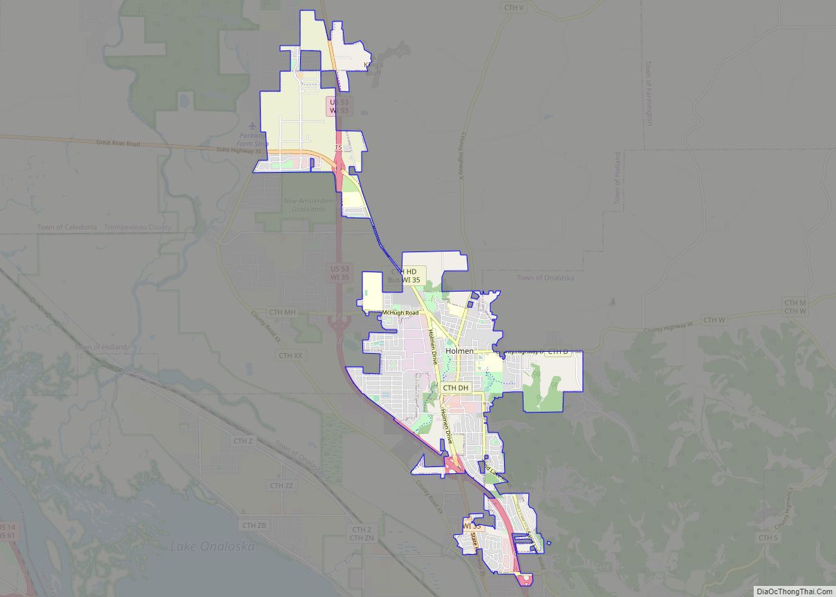
Online Interactive Map
Click on ![]() to view map in "full screen" mode.
to view map in "full screen" mode.
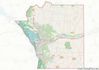
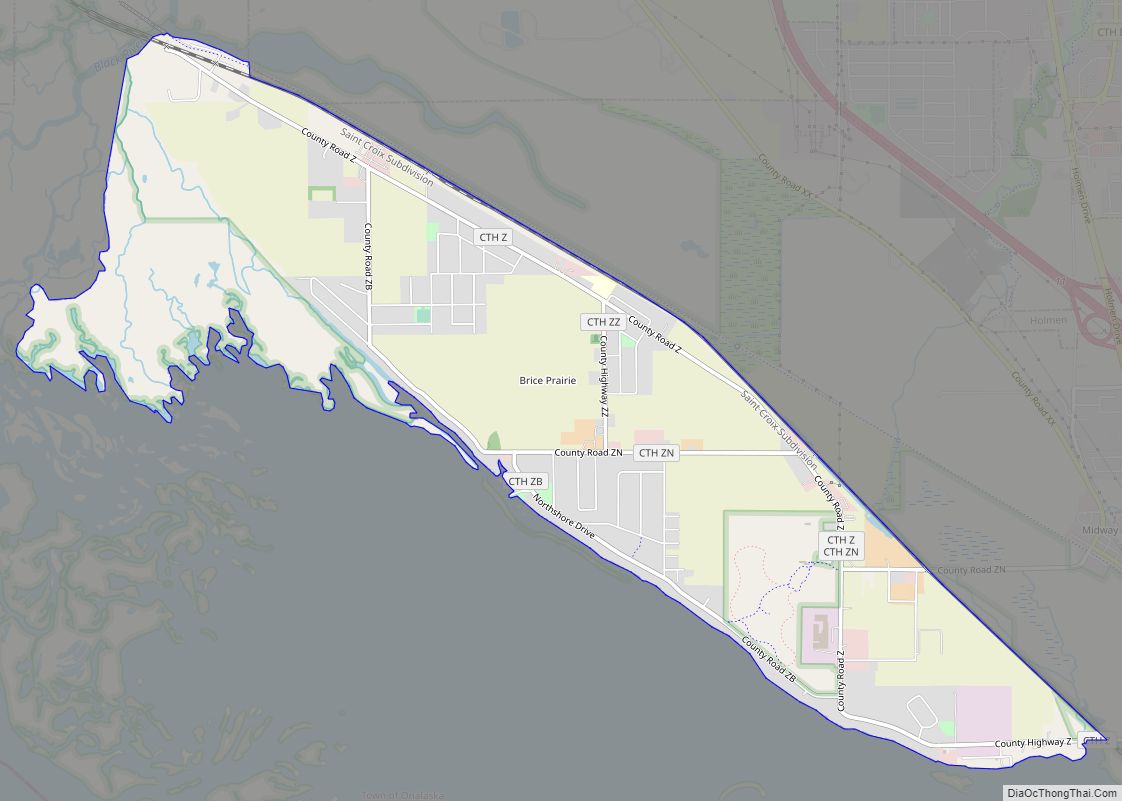
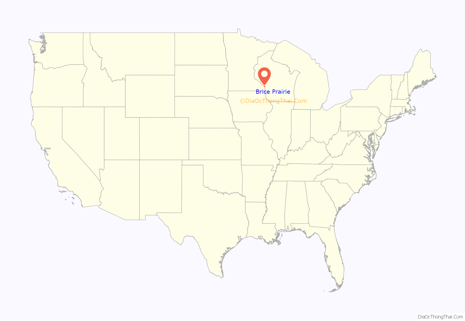
Brice Prairie location map. Where is Brice Prairie CDP?

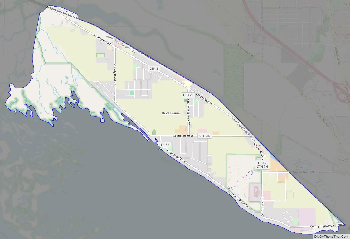
Brice Prairie Road Map
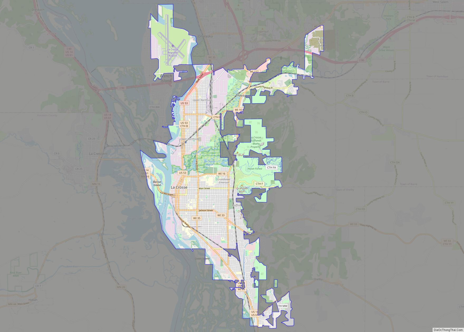
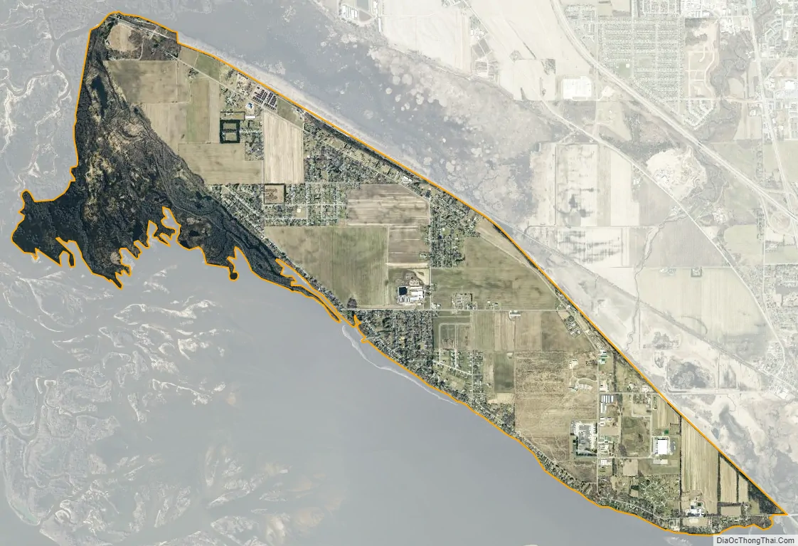
Brice Prairie city Satellite Map
Geography
Brice Prairie is located in northwestern La Crosse County at 43°56′24″N 91°18′37″W / 43.94000°N 91.31028°W / 43.94000; -91.31028 (43.939909, -91.310356), on the east bank of the Mississippi River waterway system. It is 6 miles (10 km) northwest of the center of the city of Onalaska and 11 miles (18 km) north of La Crosse, the county seat.
Brice Prairie borders the Mississippi’s Lake Onalaska to the southwest and the Black River to the northwest. Halfway Creek empties into Lake Onalaska at the southeastern corner of Brice Prairie. The Upper Mississippi River National Wildlife and Fish Refuge, La Crosse District, borders the CDP to the west and north, and in part to the southeast. Historically, the area has been divided into Lower Brice Prairie and Upper Brice Prairie.
According to the United States Census Bureau, the CDP has a total area of 4.6 square miles (11.9 km), all of it land.
See also
Map of Wisconsin State and its subdivision:- Adams
- Ashland
- Barron
- Bayfield
- Brown
- Buffalo
- Burnett
- Calumet
- Chippewa
- Clark
- Columbia
- Crawford
- Dane
- Dodge
- Door
- Douglas
- Dunn
- Eau Claire
- Florence
- Fond du Lac
- Forest
- Grant
- Green
- Green Lake
- Iowa
- Iron
- Jackson
- Jefferson
- Juneau
- Kenosha
- Kewaunee
- La Crosse
- Lafayette
- Lake Michigan
- Lake Superior
- Langlade
- Lincoln
- Manitowoc
- Marathon
- Marinette
- Marquette
- Menominee
- Milwaukee
- Monroe
- Oconto
- Oneida
- Outagamie
- Ozaukee
- Pepin
- Pierce
- Polk
- Portage
- Price
- Racine
- Richland
- Rock
- Rusk
- Saint Croix
- Sauk
- Sawyer
- Shawano
- Sheboygan
- Taylor
- Trempealeau
- Vernon
- Vilas
- Walworth
- Washburn
- Washington
- Waukesha
- Waupaca
- Waushara
- Winnebago
- Wood
- Alabama
- Alaska
- Arizona
- Arkansas
- California
- Colorado
- Connecticut
- Delaware
- District of Columbia
- Florida
- Georgia
- Hawaii
- Idaho
- Illinois
- Indiana
- Iowa
- Kansas
- Kentucky
- Louisiana
- Maine
- Maryland
- Massachusetts
- Michigan
- Minnesota
- Mississippi
- Missouri
- Montana
- Nebraska
- Nevada
- New Hampshire
- New Jersey
- New Mexico
- New York
- North Carolina
- North Dakota
- Ohio
- Oklahoma
- Oregon
- Pennsylvania
- Rhode Island
- South Carolina
- South Dakota
- Tennessee
- Texas
- Utah
- Vermont
- Virginia
- Washington
- West Virginia
- Wisconsin
- Wyoming