Brodhead is a city in Green and Rock counties in the U.S. state of Wisconsin. The population was 3,274 at the 2020 census. In February 2000, the city annexed a portion of land from the Town of Spring Valley in Rock County.
| Name: | Brodhead city |
|---|---|
| LSAD Code: | 25 |
| LSAD Description: | city (suffix) |
| State: | Wisconsin |
| County: | Green County, Rock County |
| Elevation: | 794 ft (242 m) |
| Total Area: | 1.79 sq mi (4.65 km²) |
| Land Area: | 1.79 sq mi (4.65 km²) |
| Water Area: | 0.00 sq mi (0.00 km²) |
| Total Population: | 3,274 |
| Population Density: | 1,808.91/sq mi (698.49/km²) |
| Area code: | 608 |
| FIPS code: | 5509925 |
| GNISfeature ID: | 1562229 |
| Website: | cityofbrodheadwi.us |
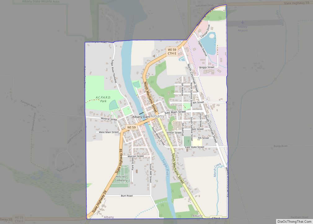
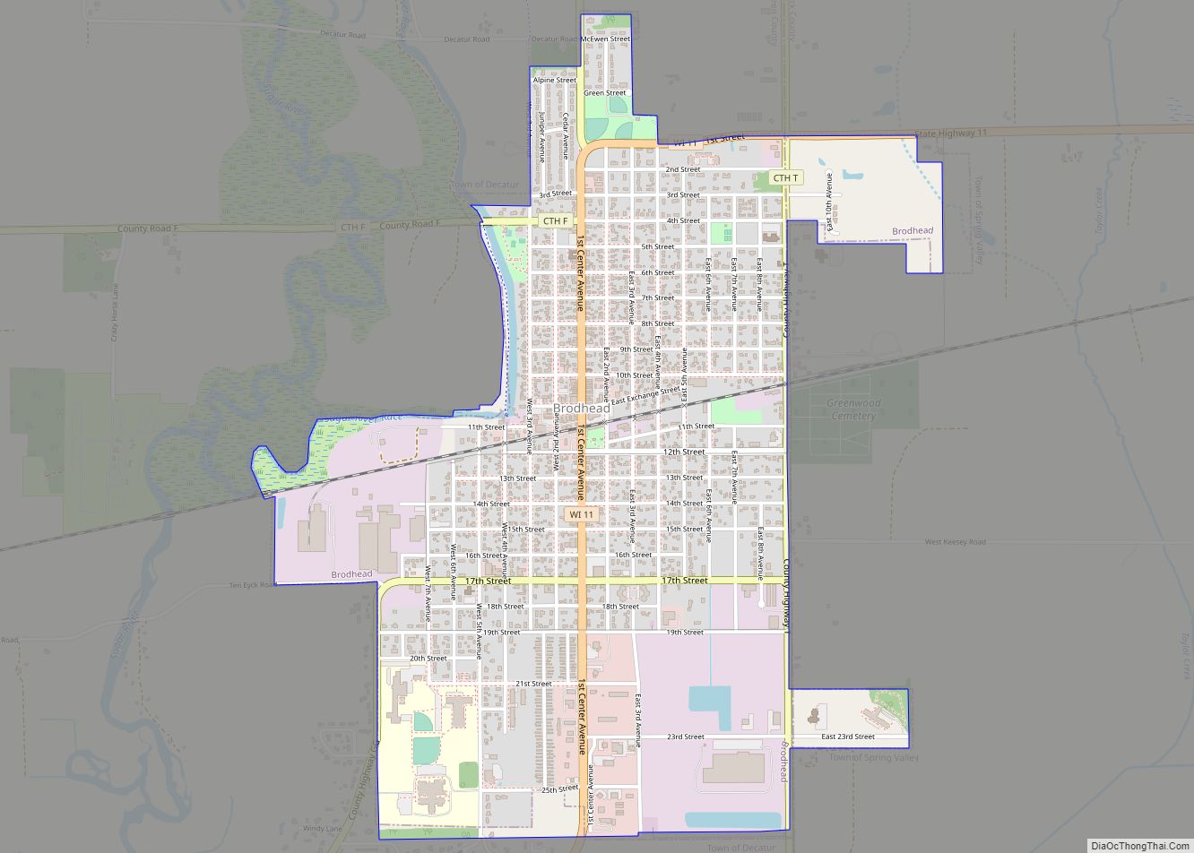
Online Interactive Map
Click on ![]() to view map in "full screen" mode.
to view map in "full screen" mode.
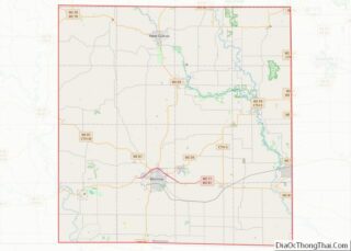
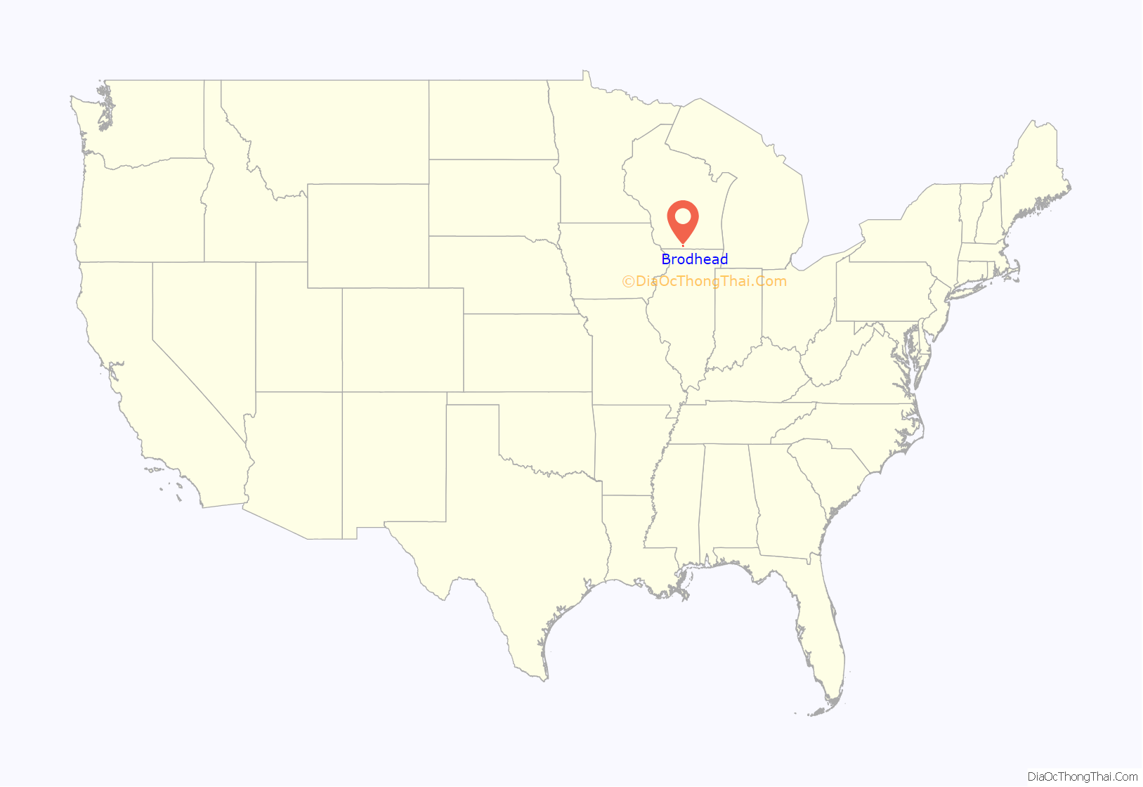
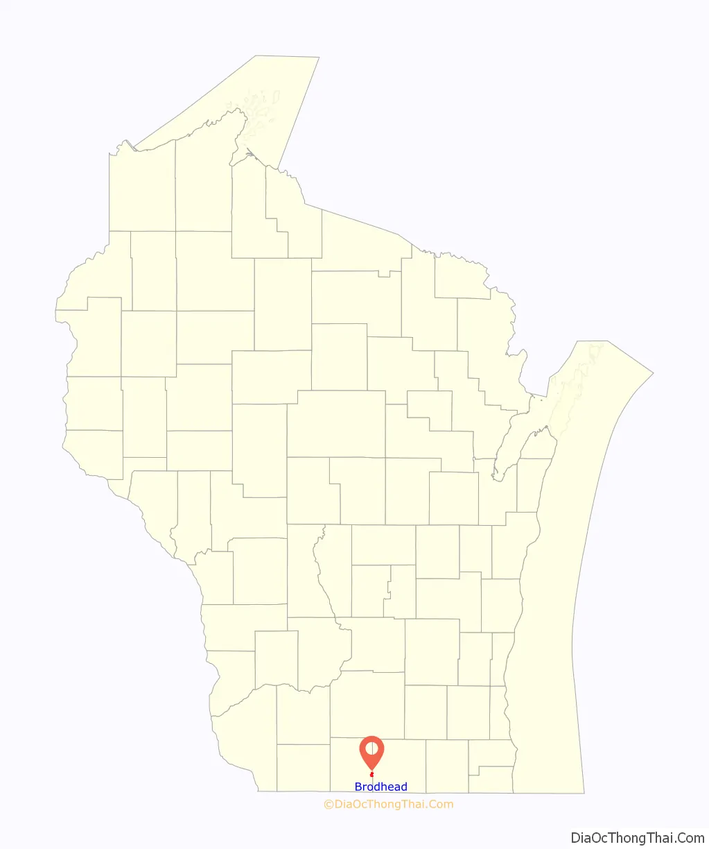
Brodhead location map. Where is Brodhead city?
History
Just south of town is a historic marker for the Half-Way Tree, a bur oak supposedly identified by Native Americans as the halfway point on a foot trail between Lake Michigan and the Mississippi River.
The railroad track that runs east and west through town features a small museum with a train and army tank on display, adjacent to the park and bandstand pavilion. The museum curator said that the railroad was being wooed by two different towns and decided to split the difference and created Brodhead.
A nearby raceway was dredged off of a branch of the Sugar River that diverted a long canal to a hydroelectric generator that supplied electricity to the town. This gave Brodhead the distinction of having electrical service before other larger cities such as Chicago, and perhaps the first electrical service in Wisconsin.
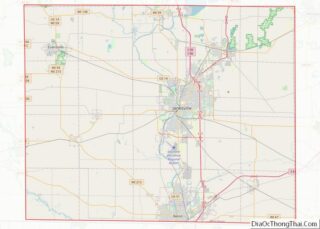
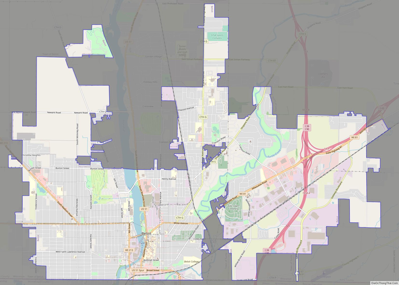
Brodhead Road Map
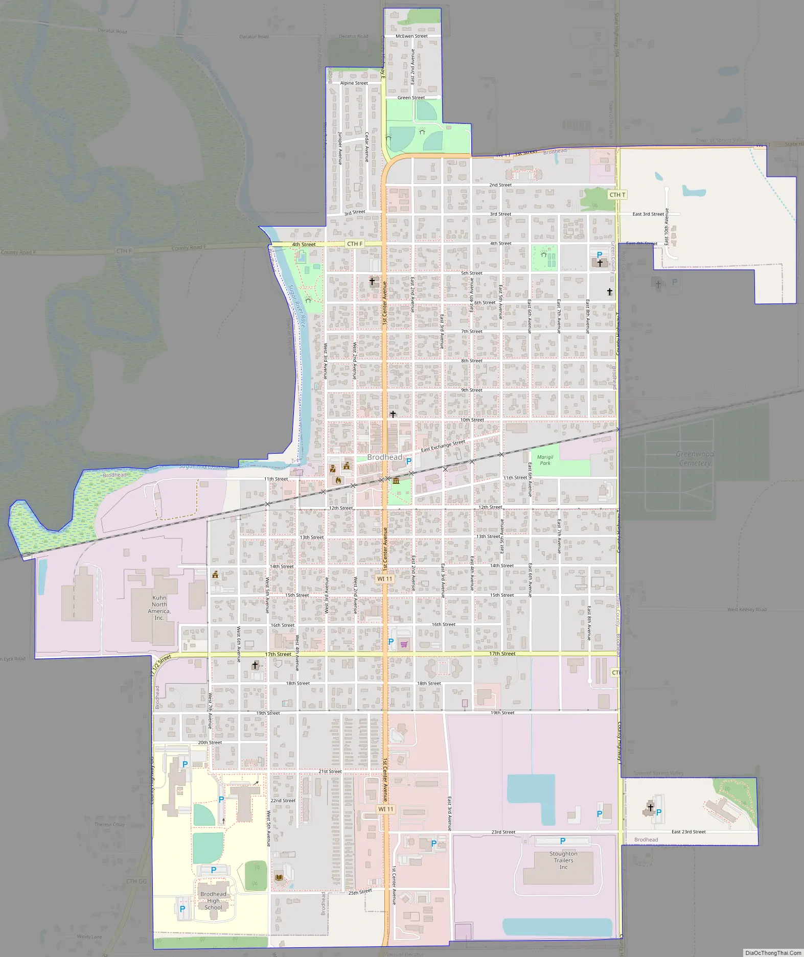
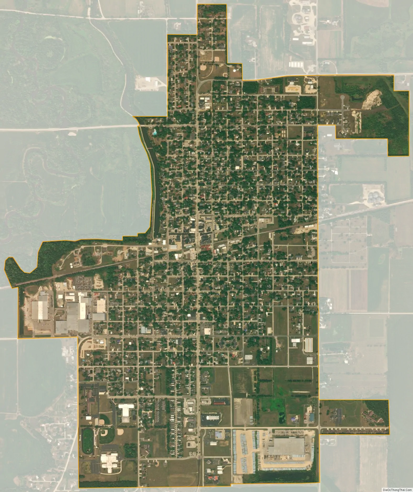
Brodhead city Satellite Map
Geography
Brodhead is located at 42°37′7″N 89°22′35″W / 42.61861°N 89.37639°W / 42.61861; -89.37639 (42.618540, -89.376291).
According to the United States Census Bureau, the city has a total area of 1.84 square miles (4.77 km), all of it land.
See also
Map of Wisconsin State and its subdivision:- Adams
- Ashland
- Barron
- Bayfield
- Brown
- Buffalo
- Burnett
- Calumet
- Chippewa
- Clark
- Columbia
- Crawford
- Dane
- Dodge
- Door
- Douglas
- Dunn
- Eau Claire
- Florence
- Fond du Lac
- Forest
- Grant
- Green
- Green Lake
- Iowa
- Iron
- Jackson
- Jefferson
- Juneau
- Kenosha
- Kewaunee
- La Crosse
- Lafayette
- Lake Michigan
- Lake Superior
- Langlade
- Lincoln
- Manitowoc
- Marathon
- Marinette
- Marquette
- Menominee
- Milwaukee
- Monroe
- Oconto
- Oneida
- Outagamie
- Ozaukee
- Pepin
- Pierce
- Polk
- Portage
- Price
- Racine
- Richland
- Rock
- Rusk
- Saint Croix
- Sauk
- Sawyer
- Shawano
- Sheboygan
- Taylor
- Trempealeau
- Vernon
- Vilas
- Walworth
- Washburn
- Washington
- Waukesha
- Waupaca
- Waushara
- Winnebago
- Wood
- Alabama
- Alaska
- Arizona
- Arkansas
- California
- Colorado
- Connecticut
- Delaware
- District of Columbia
- Florida
- Georgia
- Hawaii
- Idaho
- Illinois
- Indiana
- Iowa
- Kansas
- Kentucky
- Louisiana
- Maine
- Maryland
- Massachusetts
- Michigan
- Minnesota
- Mississippi
- Missouri
- Montana
- Nebraska
- Nevada
- New Hampshire
- New Jersey
- New Mexico
- New York
- North Carolina
- North Dakota
- Ohio
- Oklahoma
- Oregon
- Pennsylvania
- Rhode Island
- South Carolina
- South Dakota
- Tennessee
- Texas
- Utah
- Vermont
- Virginia
- Washington
- West Virginia
- Wisconsin
- Wyoming