Cassville is a village in Grant County, Wisconsin, United States. The population was 777 at the 2020 census. The village is located along the Mississippi River, opposite from the mouth of the Turkey River. It is surrounded by the Town of Cassville.
| Name: | Cassville village |
|---|---|
| LSAD Code: | 47 |
| LSAD Description: | village (suffix) |
| State: | Wisconsin |
| County: | Grant County |
| Elevation: | 955 ft (291 m) |
| Total Area: | 1.10 sq mi (2.85 km²) |
| Land Area: | 1.04 sq mi (2.69 km²) |
| Water Area: | 0.06 sq mi (0.16 km²) |
| Total Population: | 777 |
| Population Density: | 747.8/sq mi (288.7/km²) |
| Area code: | 608 |
| FIPS code: | 5513050 |
| GNISfeature ID: | 1582927 |
| Website: | www.cassville.org |
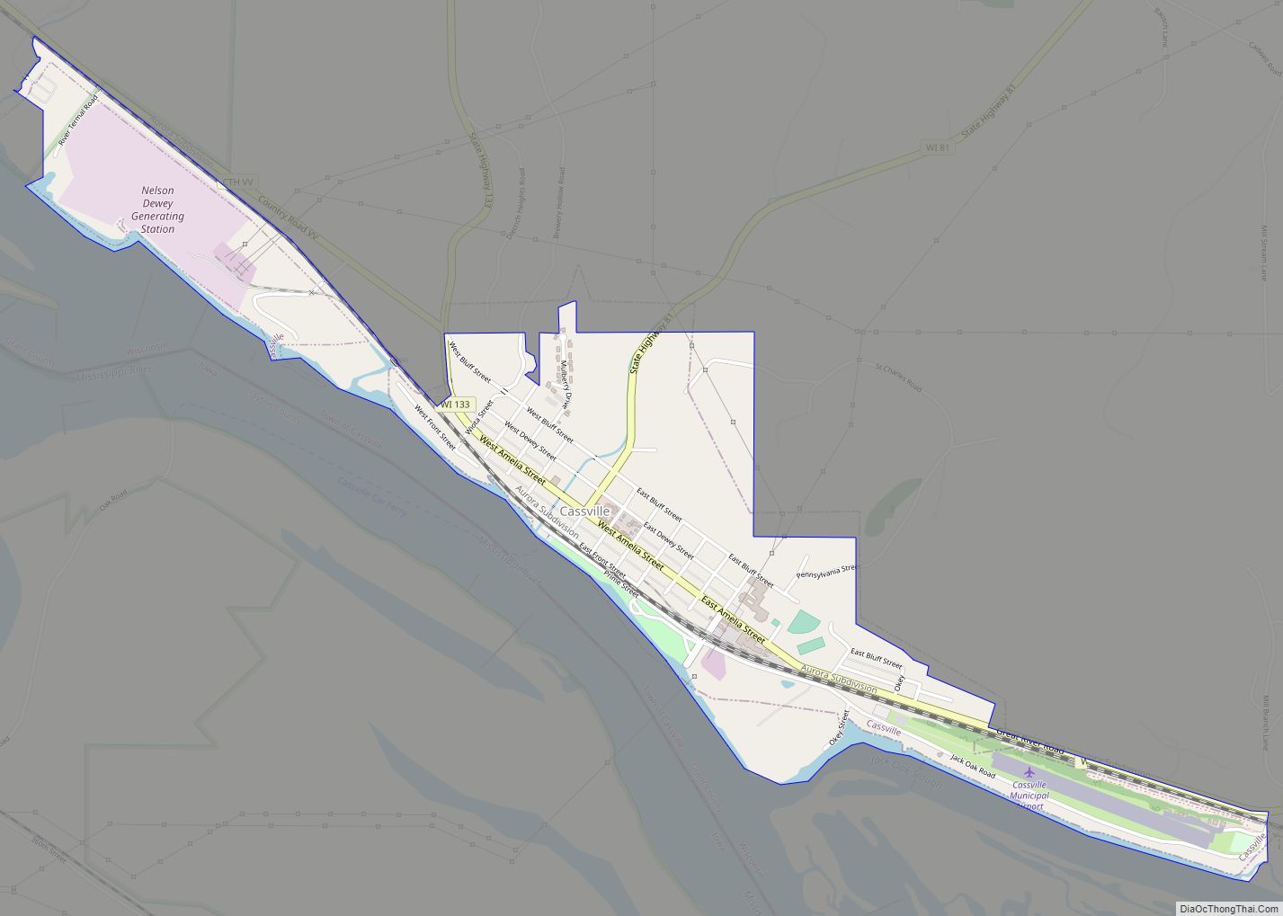
Online Interactive Map
Click on ![]() to view map in "full screen" mode.
to view map in "full screen" mode.
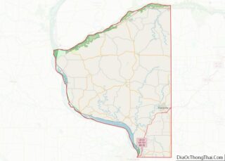
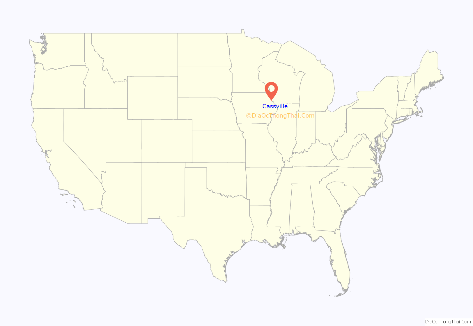
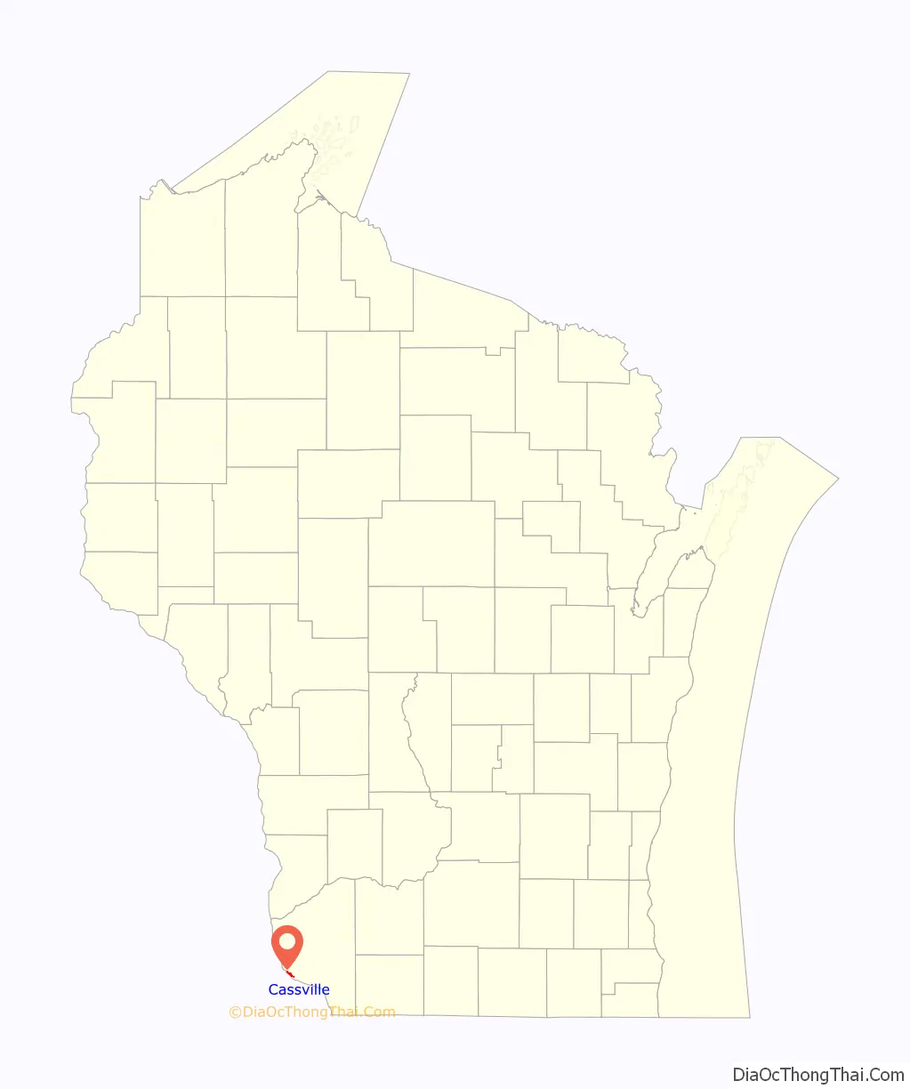
Cassville location map. Where is Cassville village?
History
The site of Cassville was occupied by the Meskwaki people before European settlement. In 1820, Henry Schoolcraft observed a Meskwaki village consisting of twelve substantial log lodges and cultivated fields in the locality.
The Euro-American settlement of Cassville began in 1827, when Judge John Sawyer of Illinois established a smelting furnace to serve lead miners who were expanding northward from Galena, Illinois. The town attracted sixty to seventy people in its first year. By the early 1830s, Cassville held several log cabins, a tavern, a general store, and a blockhouse constructed during the Black Hawk War.
Cassville experienced a brief boom in 1836, when real estate speculators incorrectly bet that the river landing would become the capital city of the newly established Wisconsin Territory. A group of investors from Albany, New York, doing business as Daniels, Denniston & Co., purchased most of the town site. They also financed the construction of the Denniston House, a substantial brick lodging house reputed to cost $45,000 in 1836. Cassville’s failure to become capital, combined with the Panic of 1837, caused an abrupt halt in the town’s growth, and much of the land was locked in legal disputes for the following decade.
Nelson Dewey settled in Cassville in 1836 as a clerk for Daniels, Denniston & Co. He later became first Governor of Wisconsin from 1848-1852. Following his term as governor, Dewey invested in the completion of the Denniston House as a hotel in the 1850s and promoted Cassville’s development, albeit with only limited success. Dewey established his personal estate, Stonefield, on the north side of Cassville in the 1860s. The estate grounds later became Nelson Dewey State Park, and in 1953 the Wisconsin Historical Society established Stonefield Historic Site at Dewey’s former mansion.
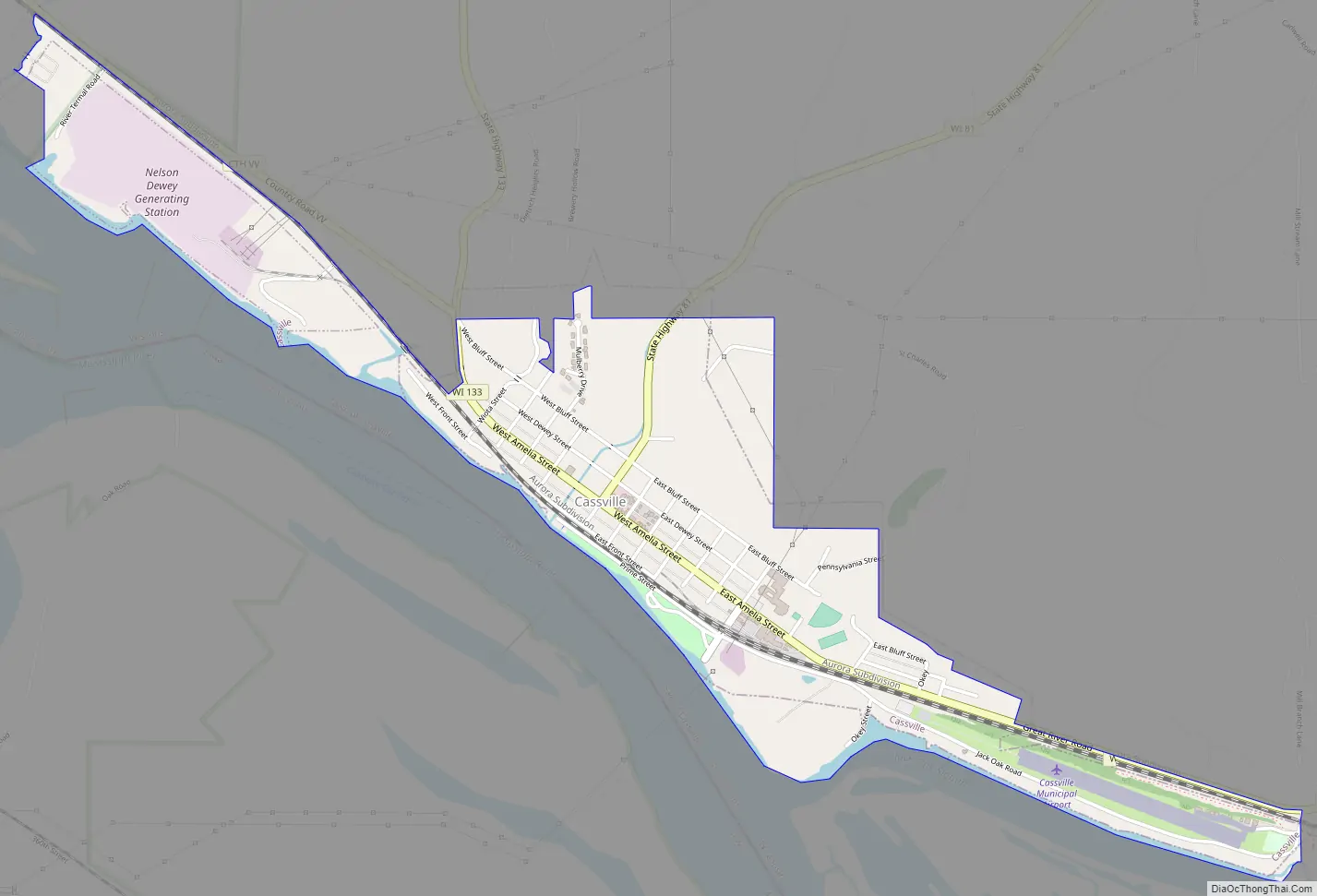
Cassville Road Map
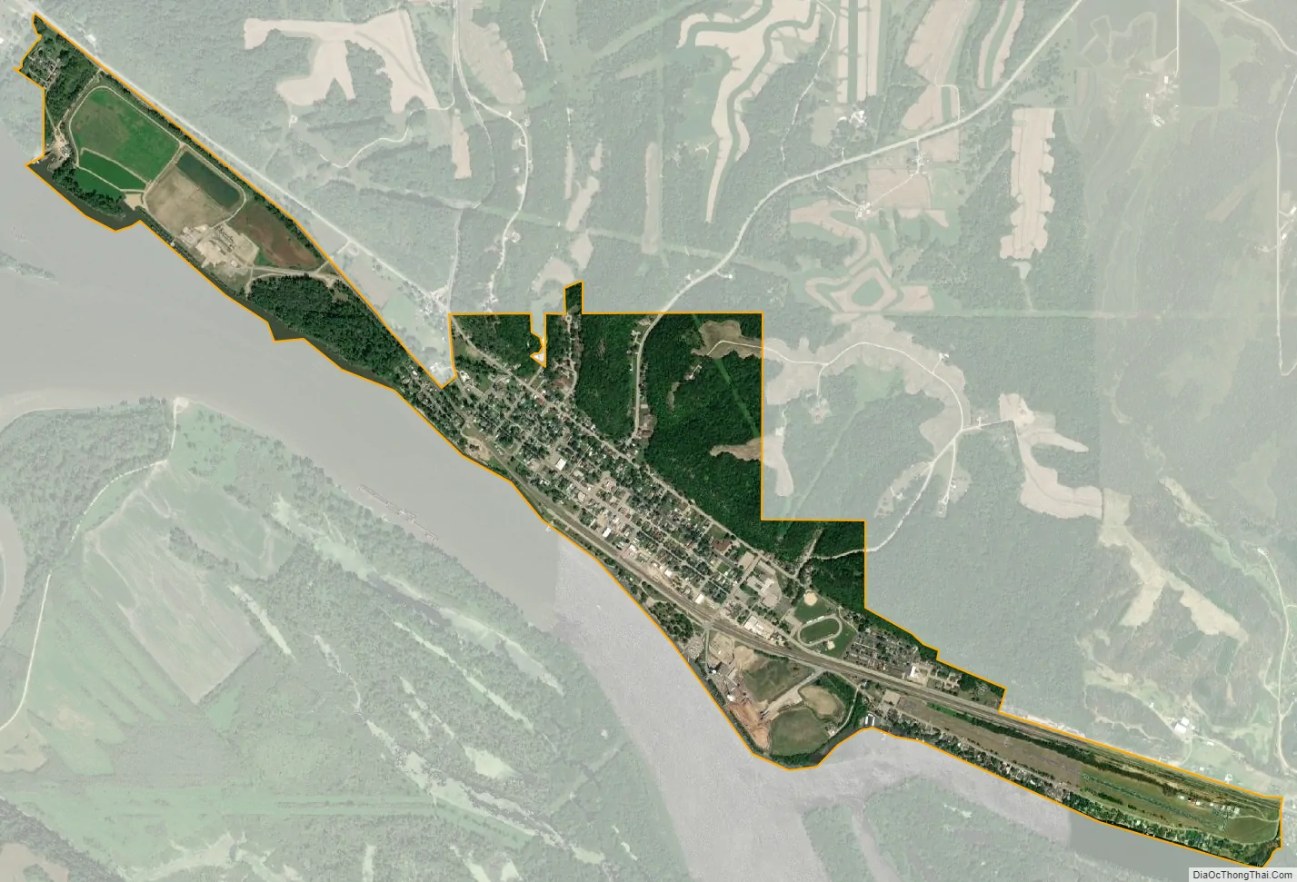
Cassville city Satellite Map
Geography
Cassville is located at 42°42′55.34″N 90°59′26.08″W / 42.7153722°N 90.9905778°W / 42.7153722; -90.9905778.
According to the United States Census Bureau, the village has a total area of 1.1 square miles (2.8 km), of which 1.04 square miles (2.7 km) is land and 0.06 square miles (0.16 km) is water.
See also
Map of Wisconsin State and its subdivision:- Adams
- Ashland
- Barron
- Bayfield
- Brown
- Buffalo
- Burnett
- Calumet
- Chippewa
- Clark
- Columbia
- Crawford
- Dane
- Dodge
- Door
- Douglas
- Dunn
- Eau Claire
- Florence
- Fond du Lac
- Forest
- Grant
- Green
- Green Lake
- Iowa
- Iron
- Jackson
- Jefferson
- Juneau
- Kenosha
- Kewaunee
- La Crosse
- Lafayette
- Lake Michigan
- Lake Superior
- Langlade
- Lincoln
- Manitowoc
- Marathon
- Marinette
- Marquette
- Menominee
- Milwaukee
- Monroe
- Oconto
- Oneida
- Outagamie
- Ozaukee
- Pepin
- Pierce
- Polk
- Portage
- Price
- Racine
- Richland
- Rock
- Rusk
- Saint Croix
- Sauk
- Sawyer
- Shawano
- Sheboygan
- Taylor
- Trempealeau
- Vernon
- Vilas
- Walworth
- Washburn
- Washington
- Waukesha
- Waupaca
- Waushara
- Winnebago
- Wood
- Alabama
- Alaska
- Arizona
- Arkansas
- California
- Colorado
- Connecticut
- Delaware
- District of Columbia
- Florida
- Georgia
- Hawaii
- Idaho
- Illinois
- Indiana
- Iowa
- Kansas
- Kentucky
- Louisiana
- Maine
- Maryland
- Massachusetts
- Michigan
- Minnesota
- Mississippi
- Missouri
- Montana
- Nebraska
- Nevada
- New Hampshire
- New Jersey
- New Mexico
- New York
- North Carolina
- North Dakota
- Ohio
- Oklahoma
- Oregon
- Pennsylvania
- Rhode Island
- South Carolina
- South Dakota
- Tennessee
- Texas
- Utah
- Vermont
- Virginia
- Washington
- West Virginia
- Wisconsin
- Wyoming