Durand is a city in and the county seat of Pepin County, Wisconsin, United States. Situated on the banks of the Chippewa River approximately 15 miles (24 km) from its confluence with the Mississippi River, the city borders the Town of Durand. The population was 1,854 at the 2020 census.
| Name: | Durand city |
|---|---|
| LSAD Code: | 25 |
| LSAD Description: | city (suffix) |
| State: | Wisconsin |
| County: | Pepin County |
| Elevation: | 721 ft (219 m) |
| Total Area: | 1.76 sq mi (4.55 km²) |
| Land Area: | 1.75 sq mi (4.53 km²) |
| Water Area: | 0.01 sq mi (0.02 km²) |
| Total Population: | 1,854 |
| Population Density: | 1,029.16/sq mi (397.33/km²) |
| ZIP code: | 54736 |
| Area code: | 715 & 534 |
| FIPS code: | 5521225 |
| GNISfeature ID: | 1564195 |
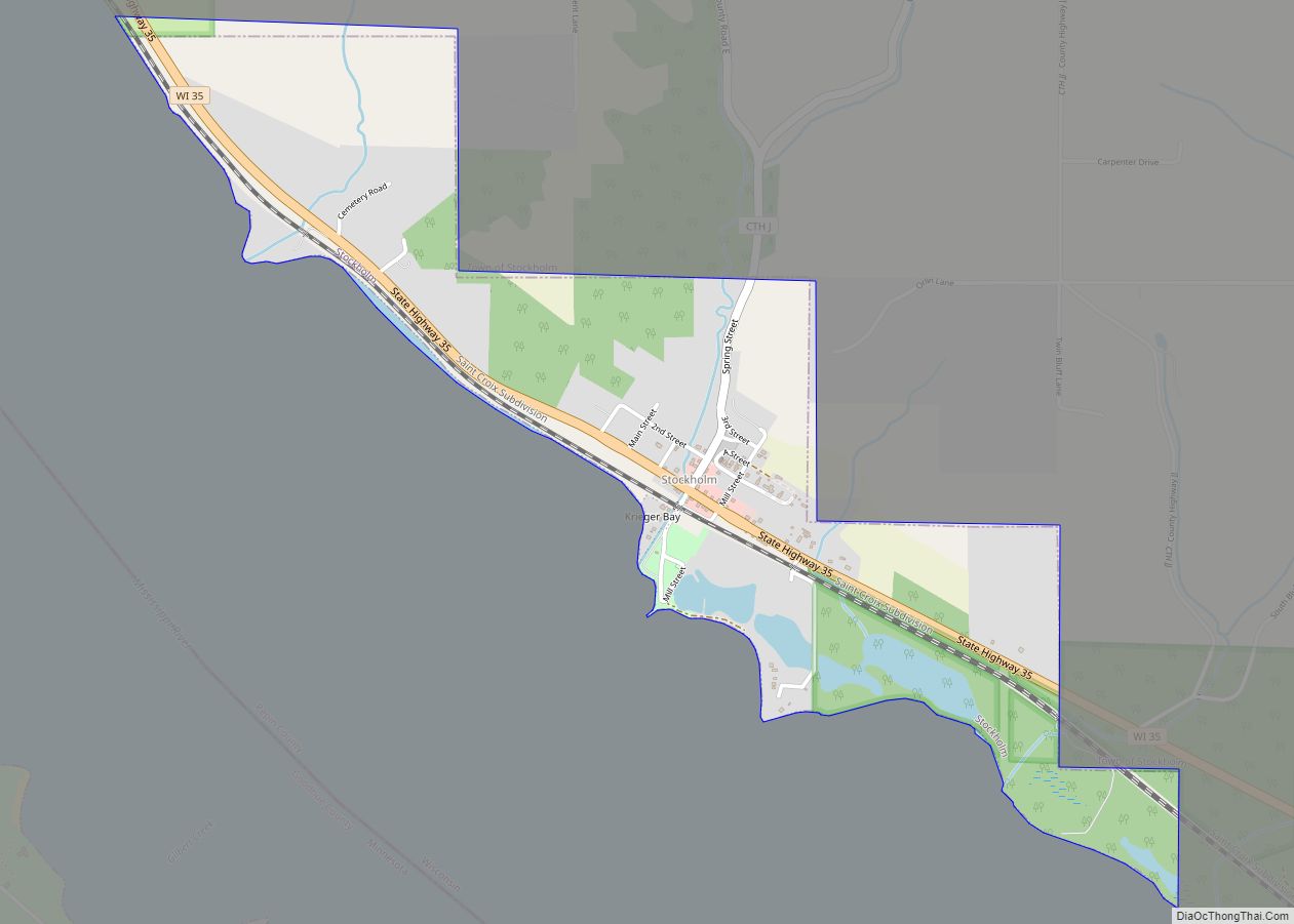
Online Interactive Map
Click on ![]() to view map in "full screen" mode.
to view map in "full screen" mode.
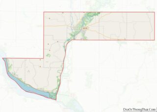
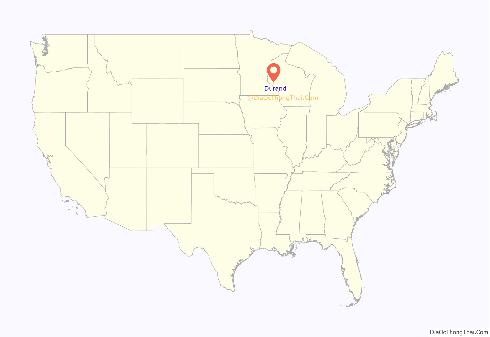
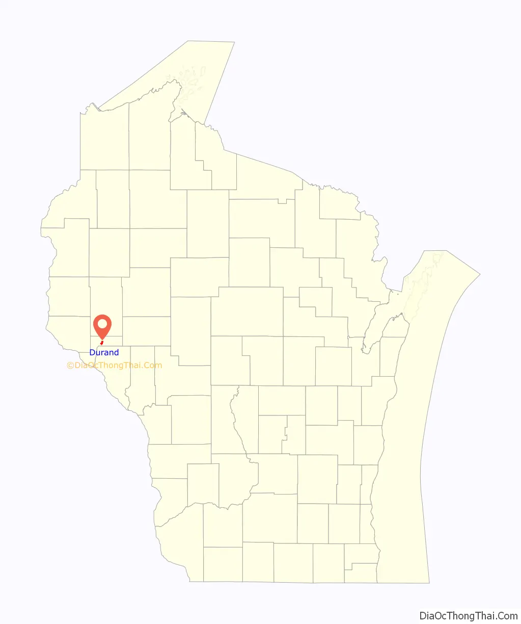
Durand location map. Where is Durand city?
History
The Durand area was first settled in 1856 when 21-year-old Miles Durand Prindle came up the river in a keel boat named the “Dutch Lady,” and took government land on the site of the present city. Originally named Bear Creek, Durand was incorporated on April 12, 1887.
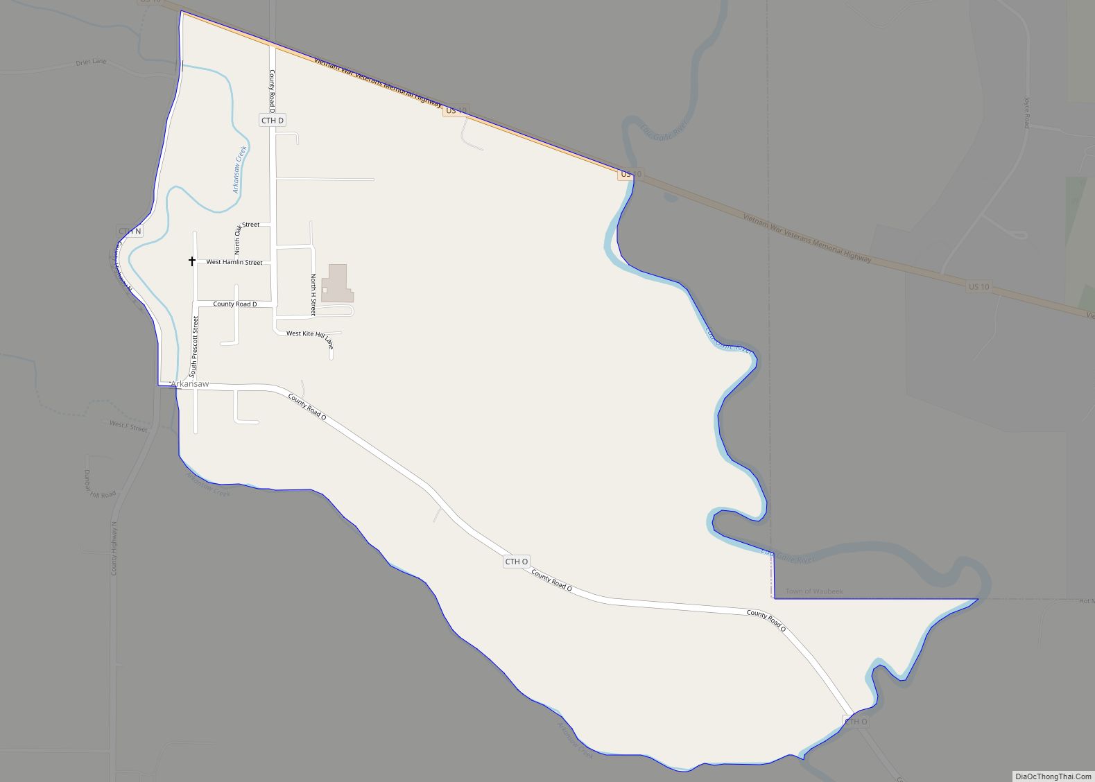
Durand Road Map
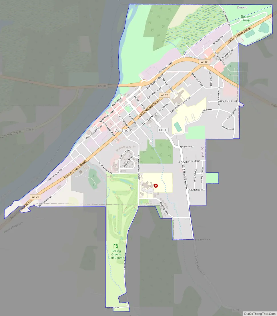
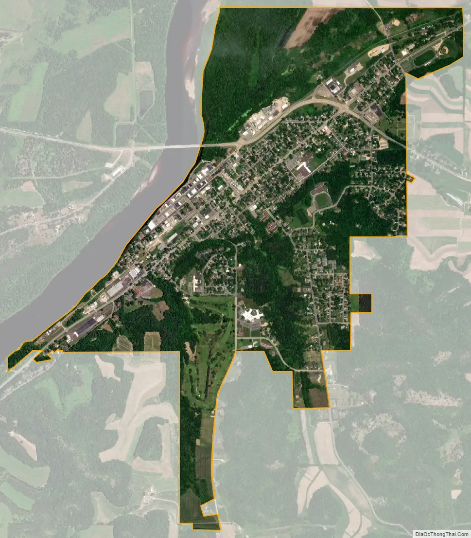
Durand city Satellite Map
Geography
Durand is located at 44°37′42″N 91°57′42″W / 44.62833°N 91.96167°W / 44.62833; -91.96167 (44.628512, -91.961718).
According to the United States Census Bureau, the city has a total area of 1.86 square miles (4.82 km), of which, 1.75 square miles (4.53 km) is land and 0.11 square miles (0.28 km) is water.
See also
Map of Wisconsin State and its subdivision:- Adams
- Ashland
- Barron
- Bayfield
- Brown
- Buffalo
- Burnett
- Calumet
- Chippewa
- Clark
- Columbia
- Crawford
- Dane
- Dodge
- Door
- Douglas
- Dunn
- Eau Claire
- Florence
- Fond du Lac
- Forest
- Grant
- Green
- Green Lake
- Iowa
- Iron
- Jackson
- Jefferson
- Juneau
- Kenosha
- Kewaunee
- La Crosse
- Lafayette
- Lake Michigan
- Lake Superior
- Langlade
- Lincoln
- Manitowoc
- Marathon
- Marinette
- Marquette
- Menominee
- Milwaukee
- Monroe
- Oconto
- Oneida
- Outagamie
- Ozaukee
- Pepin
- Pierce
- Polk
- Portage
- Price
- Racine
- Richland
- Rock
- Rusk
- Saint Croix
- Sauk
- Sawyer
- Shawano
- Sheboygan
- Taylor
- Trempealeau
- Vernon
- Vilas
- Walworth
- Washburn
- Washington
- Waukesha
- Waupaca
- Waushara
- Winnebago
- Wood
- Alabama
- Alaska
- Arizona
- Arkansas
- California
- Colorado
- Connecticut
- Delaware
- District of Columbia
- Florida
- Georgia
- Hawaii
- Idaho
- Illinois
- Indiana
- Iowa
- Kansas
- Kentucky
- Louisiana
- Maine
- Maryland
- Massachusetts
- Michigan
- Minnesota
- Mississippi
- Missouri
- Montana
- Nebraska
- Nevada
- New Hampshire
- New Jersey
- New Mexico
- New York
- North Carolina
- North Dakota
- Ohio
- Oklahoma
- Oregon
- Pennsylvania
- Rhode Island
- South Carolina
- South Dakota
- Tennessee
- Texas
- Utah
- Vermont
- Virginia
- Washington
- West Virginia
- Wisconsin
- Wyoming