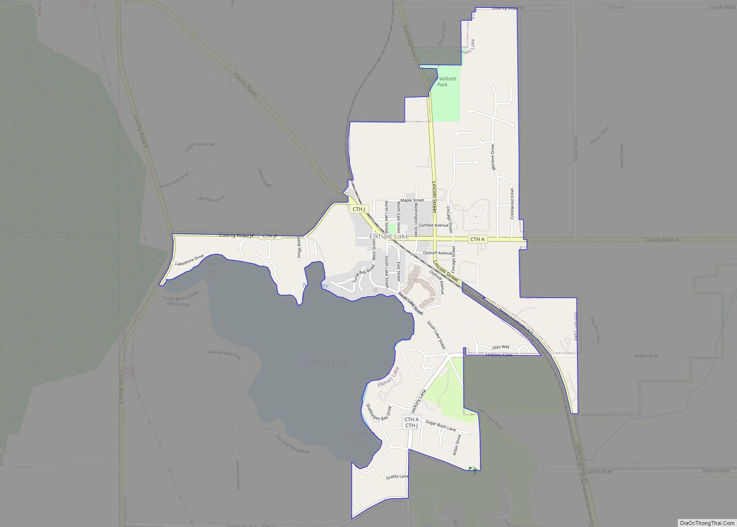
Elkhart Lake is a village in Sheboygan County, Wisconsin, United States, located within the northwestern part of the county within the Town of Rhine. The population was 967 at the 2010 census. It is included in the Sheboygan, Wisconsin Metropolitan Statistical Area. Elkhart Lake may be best known for hosting road races on public county roads during the 1950s, later moving to a dedicated race track called Road America, which is located a few miles south of the village.
| Name: | Elkhart Lake village |
|---|---|
| LSAD Code: | 47 |
| LSAD Description: | village (suffix) |
| State: | Wisconsin |
| County: | Sheboygan County |
| Elevation: | 948 ft (289 m) |
| Total Area: | 1.29 sq mi (3.34 km²) |
| Land Area: | 1.28 sq mi (3.32 km²) |
| Water Area: | 0.01 sq mi (0.02 km²) |
| Total Population: | 967 |
| Population Density: | 792.51/sq mi (306.10/km²) |
| Area code: | 920 |
| FIPS code: | 5523275 |
| GNISfeature ID: | 1584500 |
| Website: | www.elkhartlakewi.gov |
Online Interactive Map
Click on ![]() to view map in "full screen" mode.
to view map in "full screen" mode.
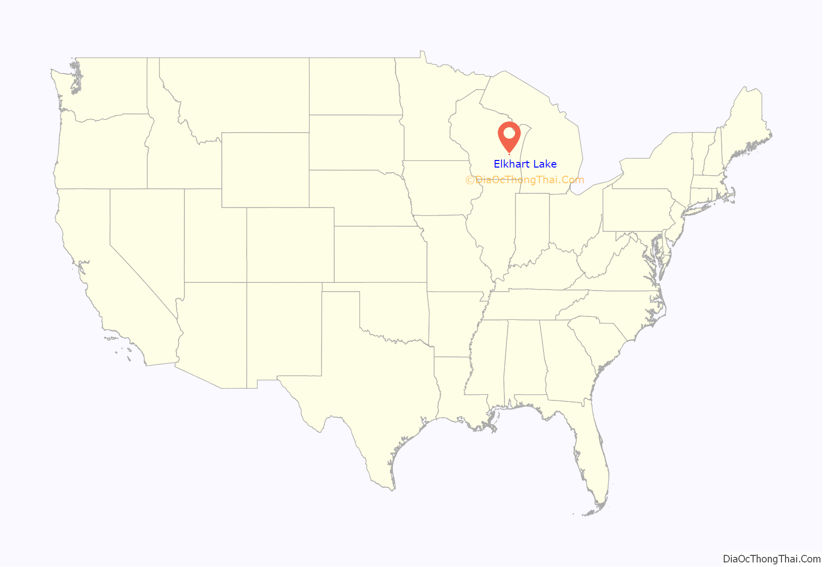
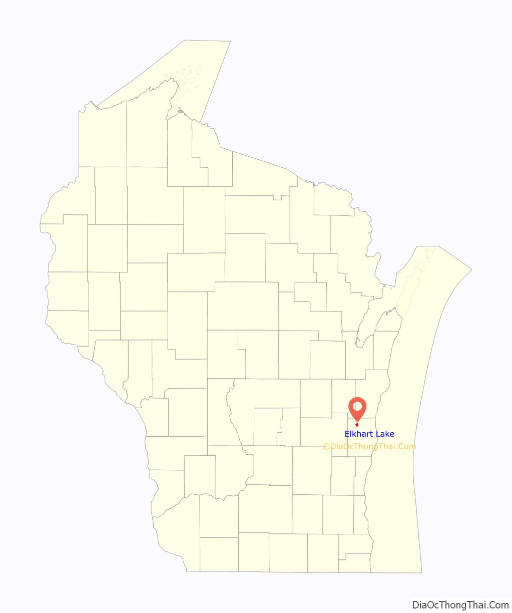
Elkhart Lake location map. Where is Elkhart Lake village?
History
The area was first inhabited by the Potawatomi Indians and they named the area “Me-shay-way-odeh-ni-bis”, or Great Elk Heart Lake, because the lake resembles an elk’s heart. Few people traveled to the area until the 1860s when the Mississippi Railroad came to Glenbeulah, making it possible for them to take a stagecoach the rest of the way to Elkhart. In 1872 the Milwaukee and Northern Railroad came into Elkhart and brought more travelers. The area was incorporated as Elkhart Lake in 1894.
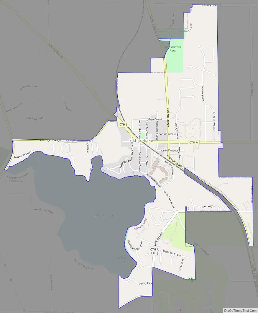
Elkhart Lake Road Map
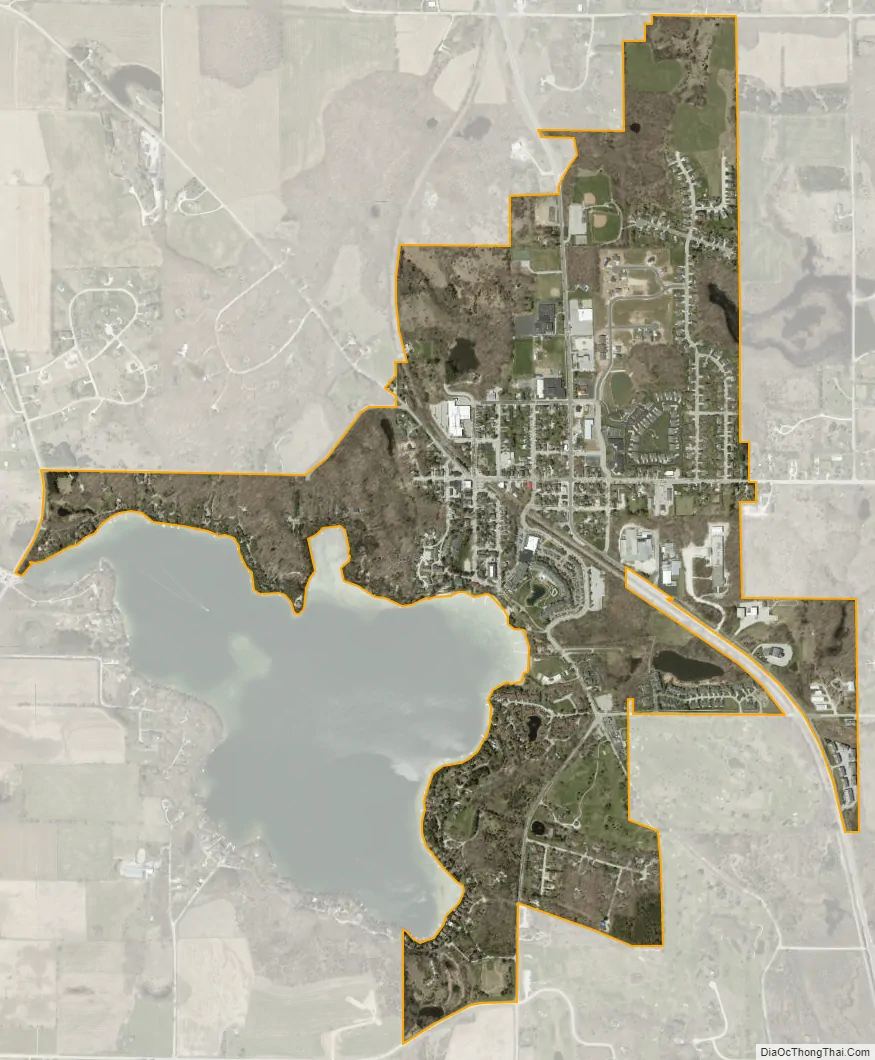
Elkhart Lake city Satellite Map
Geography
Elkhart Lake is located at 43°49′55″N 88°1′3″W / 43.83194°N 88.01750°W / 43.83194; -88.01750 (43.832057, -88.017440).
According to the United States Census Bureau, the village has a total area of 1.29 square miles (3.34 km), of which, 1.28 square miles (3.32 km) of it is land and 0.01 square miles (0.03 km) is water.
See also
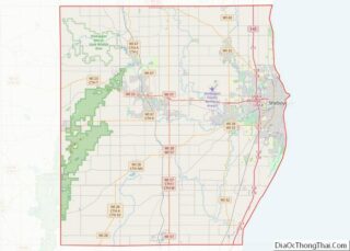
Map of Wisconsin State and its subdivision:- Adams
- Ashland
- Barron
- Bayfield
- Brown
- Buffalo
- Burnett
- Calumet
- Chippewa
- Clark
- Columbia
- Crawford
- Dane
- Dodge
- Door
- Douglas
- Dunn
- Eau Claire
- Florence
- Fond du Lac
- Forest
- Grant
- Green
- Green Lake
- Iowa
- Iron
- Jackson
- Jefferson
- Juneau
- Kenosha
- Kewaunee
- La Crosse
- Lafayette
- Lake Michigan
- Lake Superior
- Langlade
- Lincoln
- Manitowoc
- Marathon
- Marinette
- Marquette
- Menominee
- Milwaukee
- Monroe
- Oconto
- Oneida
- Outagamie
- Ozaukee
- Pepin
- Pierce
- Polk
- Portage
- Price
- Racine
- Richland
- Rock
- Rusk
- Saint Croix
- Sauk
- Sawyer
- Shawano
- Sheboygan
- Taylor
- Trempealeau
- Vernon
- Vilas
- Walworth
- Washburn
- Washington
- Waukesha
- Waupaca
- Waushara
- Winnebago
- Wood
- Alabama
- Alaska
- Arizona
- Arkansas
- California
- Colorado
- Connecticut
- Delaware
- District of Columbia
- Florida
- Georgia
- Hawaii
- Idaho
- Illinois
- Indiana
- Iowa
- Kansas
- Kentucky
- Louisiana
- Maine
- Maryland
- Massachusetts
- Michigan
- Minnesota
- Mississippi
- Missouri
- Montana
- Nebraska
- Nevada
- New Hampshire
- New Jersey
- New Mexico
- New York
- North Carolina
- North Dakota
- Ohio
- Oklahoma
- Oregon
- Pennsylvania
- Rhode Island
- South Carolina
- South Dakota
- Tennessee
- Texas
- Utah
- Vermont
- Virginia
- Washington
- West Virginia
- Wisconsin
- Wyoming