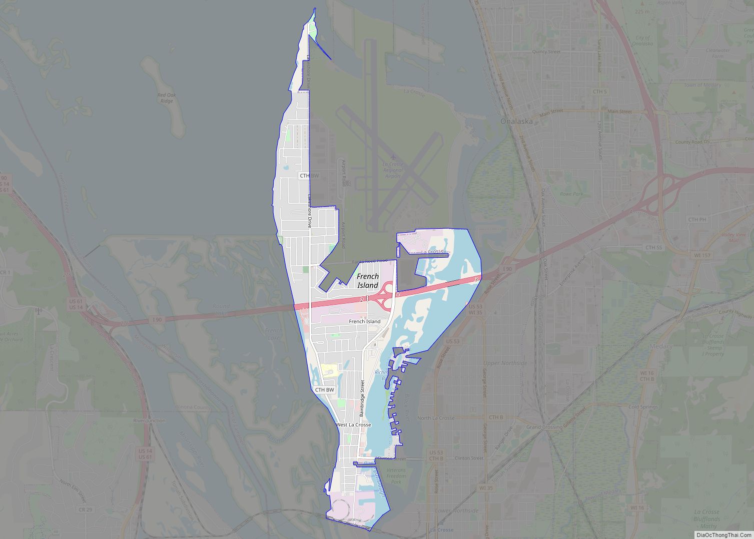
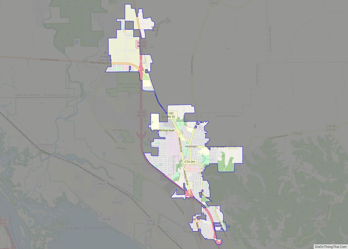
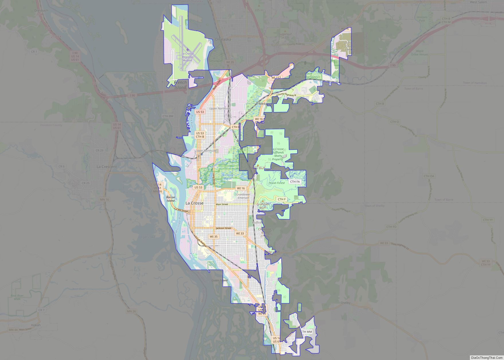
French Island is a census-designated place (CDP) in La Crosse County, Wisconsin, United States. The population was 4,207 at the 2010 census. It lies on an island of the same name, though they are not coextensive; a portion of the island is part of the city of La Crosse. All of the island is part of the La Crosse Metropolitan Statistical Area. French Island is part of the town of Campbell and contains all of its population, because the balance of Campbell is uninhabited.
[[File:|thumb|French Island, Wisconsin]]
| Name: | French Island CDP |
|---|---|
| LSAD Code: | 57 |
| LSAD Description: | CDP (suffix) |
| State: | Wisconsin |
| County: | La Crosse County |
| Elevation: | 653 ft (199 m) |
| Total Area: | 2.52 sq mi (6.53 km²) |
| Land Area: | 2.02 sq mi (5.24 km²) |
| Water Area: | 0.50 sq mi (1.29 km²) |
| Total Population: | 4,207 |
| Population Density: | 2,081/sq mi (803.3/km²) |
| ZIP code: | 54603 (La Crosse) |
| Area code: | 608 |
| FIPS code: | 5527875 |
| GNISfeature ID: | 2393013 |
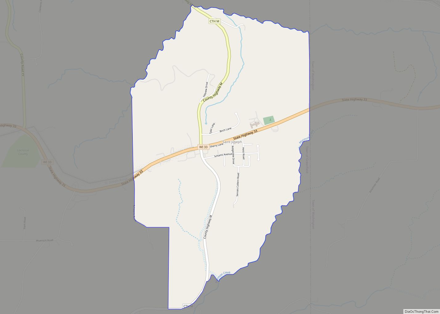
Online Interactive Map
Click on ![]() to view map in "full screen" mode.
to view map in "full screen" mode.
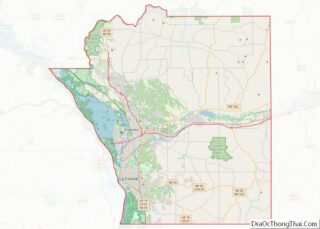
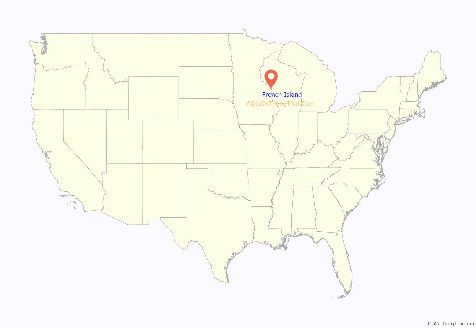
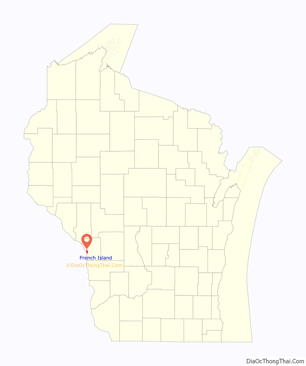
French Island location map. Where is French Island CDP?
French Island Road Map
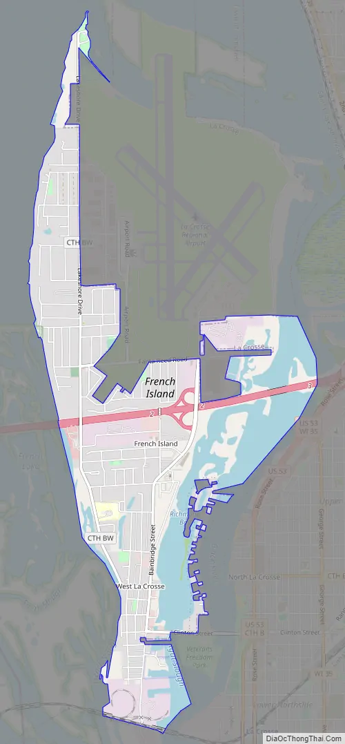
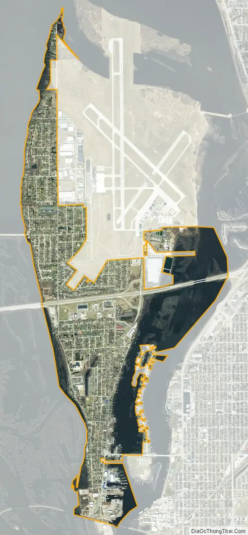
French Island city Satellite Map
Geography
French Island is located in western La Crosse County. It is surrounded by waterways connected to the Mississippi River: French Slough, French Lake, and Lake Onalaska to the west, and the Black River and Richmond Bay to the east. Two parts of the dam forming Lake Onalaska on the Mississippi connect to French Island: one at the head of French Lake, and the other impounding the Black River.
The neighborhood of West La Crosse is in the southern part of the CDP.
According to the United States Census Bureau, the French Island CDP has a total area of 2.520 square miles (6.527 square kilometres), of which 2.022 square miles (5.237 square kilometres) are land and 0.498 square miles (1.290 square kilometres), or 19.76%, are water. The entire island’s land area is 4.549 square miles (11.781 square kilometres).
See also
Map of Wisconsin State and its subdivision:- Adams
- Ashland
- Barron
- Bayfield
- Brown
- Buffalo
- Burnett
- Calumet
- Chippewa
- Clark
- Columbia
- Crawford
- Dane
- Dodge
- Door
- Douglas
- Dunn
- Eau Claire
- Florence
- Fond du Lac
- Forest
- Grant
- Green
- Green Lake
- Iowa
- Iron
- Jackson
- Jefferson
- Juneau
- Kenosha
- Kewaunee
- La Crosse
- Lafayette
- Lake Michigan
- Lake Superior
- Langlade
- Lincoln
- Manitowoc
- Marathon
- Marinette
- Marquette
- Menominee
- Milwaukee
- Monroe
- Oconto
- Oneida
- Outagamie
- Ozaukee
- Pepin
- Pierce
- Polk
- Portage
- Price
- Racine
- Richland
- Rock
- Rusk
- Saint Croix
- Sauk
- Sawyer
- Shawano
- Sheboygan
- Taylor
- Trempealeau
- Vernon
- Vilas
- Walworth
- Washburn
- Washington
- Waukesha
- Waupaca
- Waushara
- Winnebago
- Wood
- Alabama
- Alaska
- Arizona
- Arkansas
- California
- Colorado
- Connecticut
- Delaware
- District of Columbia
- Florida
- Georgia
- Hawaii
- Idaho
- Illinois
- Indiana
- Iowa
- Kansas
- Kentucky
- Louisiana
- Maine
- Maryland
- Massachusetts
- Michigan
- Minnesota
- Mississippi
- Missouri
- Montana
- Nebraska
- Nevada
- New Hampshire
- New Jersey
- New Mexico
- New York
- North Carolina
- North Dakota
- Ohio
- Oklahoma
- Oregon
- Pennsylvania
- Rhode Island
- South Carolina
- South Dakota
- Tennessee
- Texas
- Utah
- Vermont
- Virginia
- Washington
- West Virginia
- Wisconsin
- Wyoming