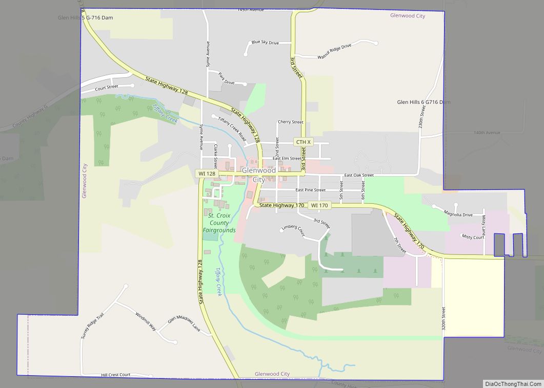
Glenwood City is a city in St. Croix County, Wisconsin, United States. The population was 1,242 at the 2010 census. Glenwood City is the site of the yearly St. Croix County fair and is known as the “City of 57 Hills.”
| Name: | Glenwood City city |
|---|---|
| LSAD Code: | 25 |
| LSAD Description: | city (suffix) |
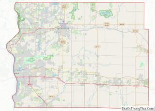
| State: | Wisconsin |
| County: | St. Croix County |
| Elevation: | 1,030 ft (314 m) |
| Total Area: | 3.47 sq mi (9.00 km²) |
| Land Area: | 3.47 sq mi (9.00 km²) |
| Water Area: | 0.00 sq mi (0.00 km²) |
| Total Population: | 1,242 |
| Population Density: | 345.81/sq mi (133.50/km²) |
| Area code: | 715 & 534 |
| FIPS code: | 5529625 |
| GNISfeature ID: | 1581635 |
| Website: | glenwoodcitywi.com |
Online Interactive Map
Click on ![]() to view map in "full screen" mode.
to view map in "full screen" mode.
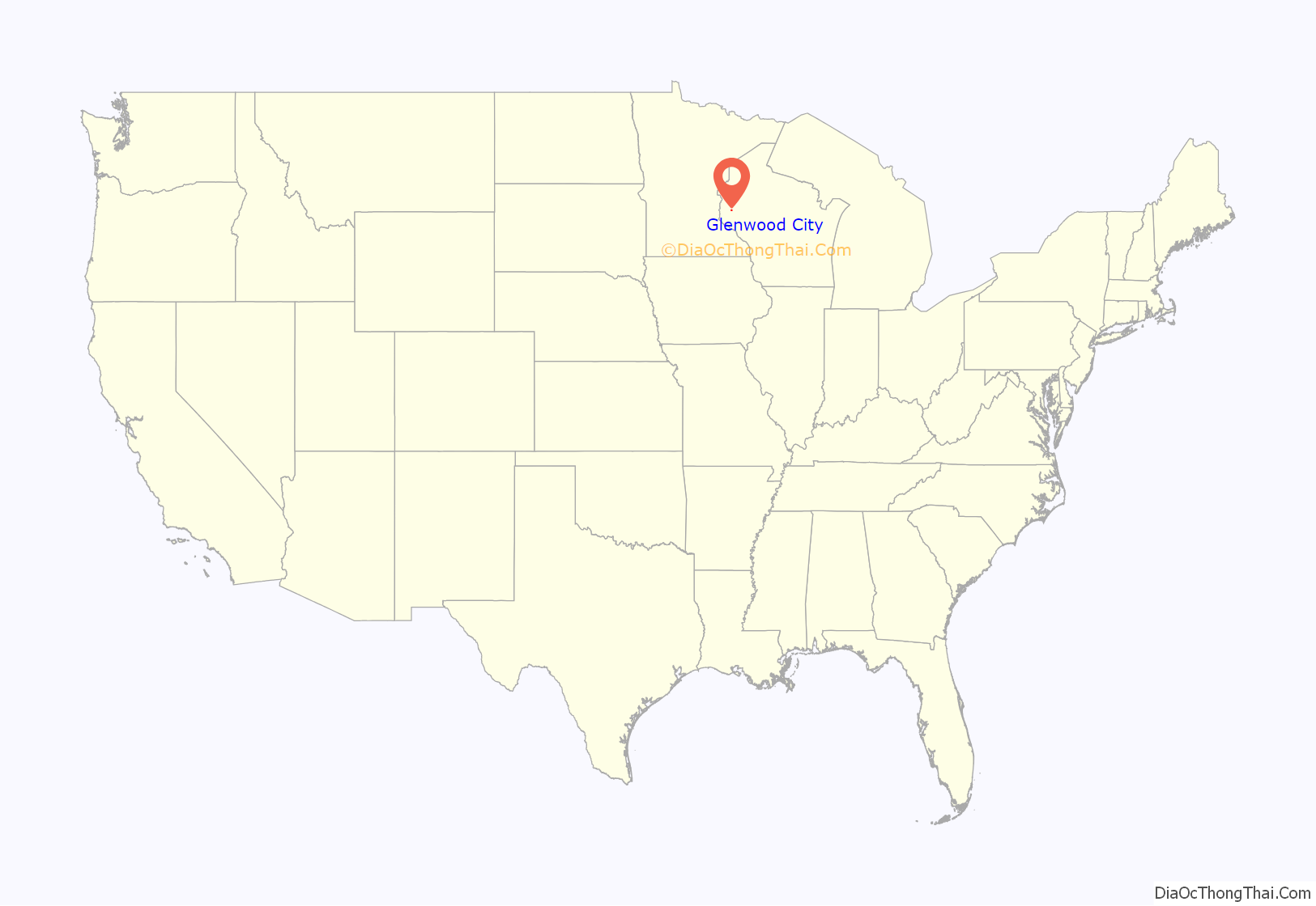
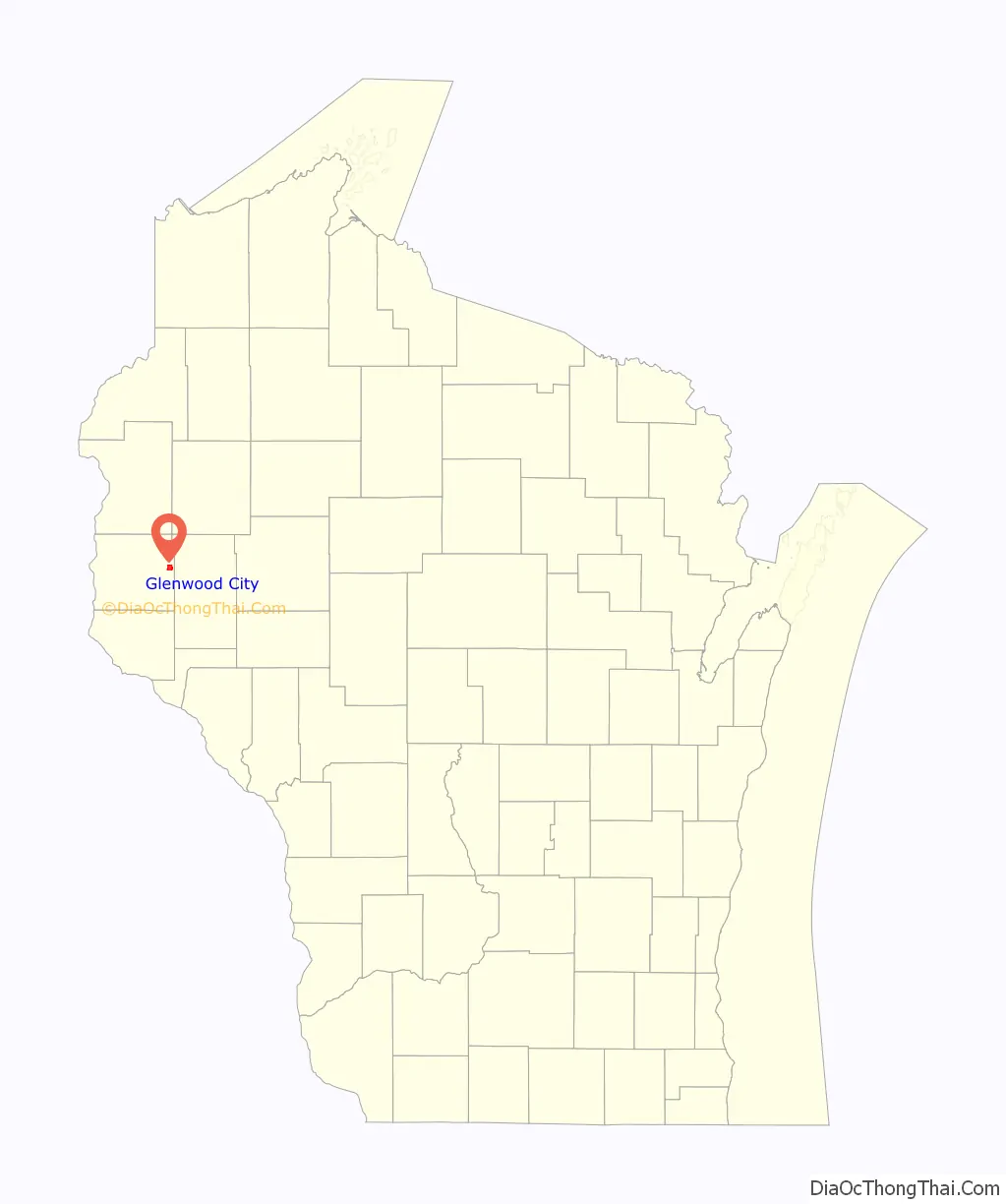
Glenwood City location map. Where is Glenwood City city?
History
The city was founded on the banks of Tiffany Creek, in 1880. It was once a stop on the Wisconsin Central Railway, but the line to Glenwood City is now abandoned.
Glenwood City is home to the St. Croix County Fair in July, and also hosts a PRCA Rodeo each June.
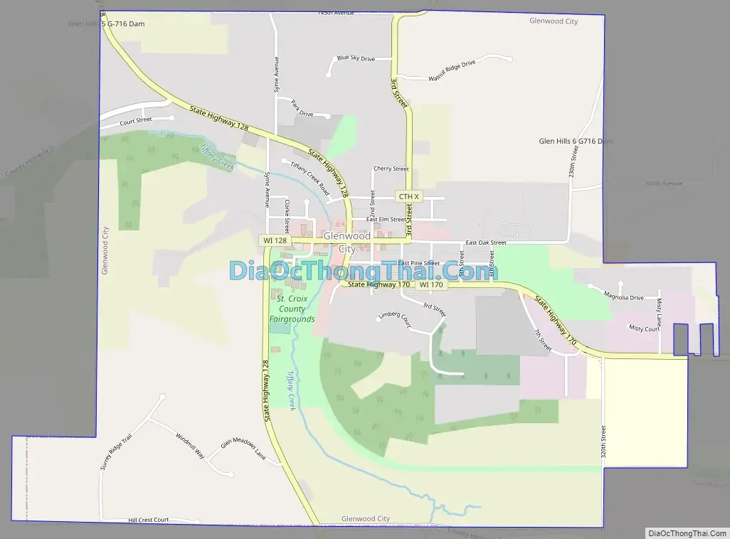
Glenwood City Road Map
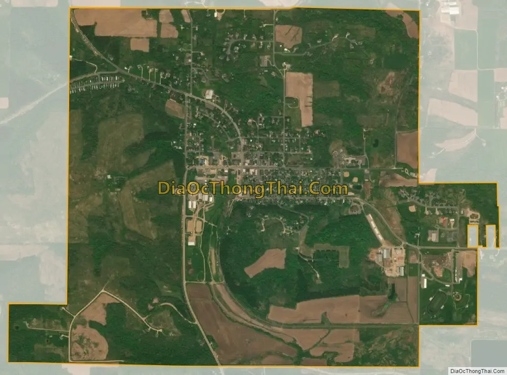
Glenwood City city Satellite Map
Geography
Glenwood City is located at 45°3′26″N 92°10′12″W / 45.05722°N 92.17000°W / 45.05722; -92.17000 (45.057220, -92.169991).
According to the United States Census Bureau, the city has a total area of 2.49 square miles (6.45 km), all of it land.
See also
Map of Wisconsin State and its subdivision:- Adams
- Ashland
- Barron
- Bayfield
- Brown
- Buffalo
- Burnett
- Calumet
- Chippewa
- Clark
- Columbia
- Crawford
- Dane
- Dodge
- Door
- Douglas
- Dunn
- Eau Claire
- Florence
- Fond du Lac
- Forest
- Grant
- Green
- Green Lake
- Iowa
- Iron
- Jackson
- Jefferson
- Juneau
- Kenosha
- Kewaunee
- La Crosse
- Lafayette
- Lake Michigan
- Lake Superior
- Langlade
- Lincoln
- Manitowoc
- Marathon
- Marinette
- Marquette
- Menominee
- Milwaukee
- Monroe
- Oconto
- Oneida
- Outagamie
- Ozaukee
- Pepin
- Pierce
- Polk
- Portage
- Price
- Racine
- Richland
- Rock
- Rusk
- Saint Croix
- Sauk
- Sawyer
- Shawano
- Sheboygan
- Taylor
- Trempealeau
- Vernon
- Vilas
- Walworth
- Washburn
- Washington
- Waukesha
- Waupaca
- Waushara
- Winnebago
- Wood
- Alabama
- Alaska
- Arizona
- Arkansas
- California
- Colorado
- Connecticut
- Delaware
- District of Columbia
- Florida
- Georgia
- Hawaii
- Idaho
- Illinois
- Indiana
- Iowa
- Kansas
- Kentucky
- Louisiana
- Maine
- Maryland
- Massachusetts
- Michigan
- Minnesota
- Mississippi
- Missouri
- Montana
- Nebraska
- Nevada
- New Hampshire
- New Jersey
- New Mexico
- New York
- North Carolina
- North Dakota
- Ohio
- Oklahoma
- Oregon
- Pennsylvania
- Rhode Island
- South Carolina
- South Dakota
- Tennessee
- Texas
- Utah
- Vermont
- Virginia
- Washington
- West Virginia
- Wisconsin
- Wyoming