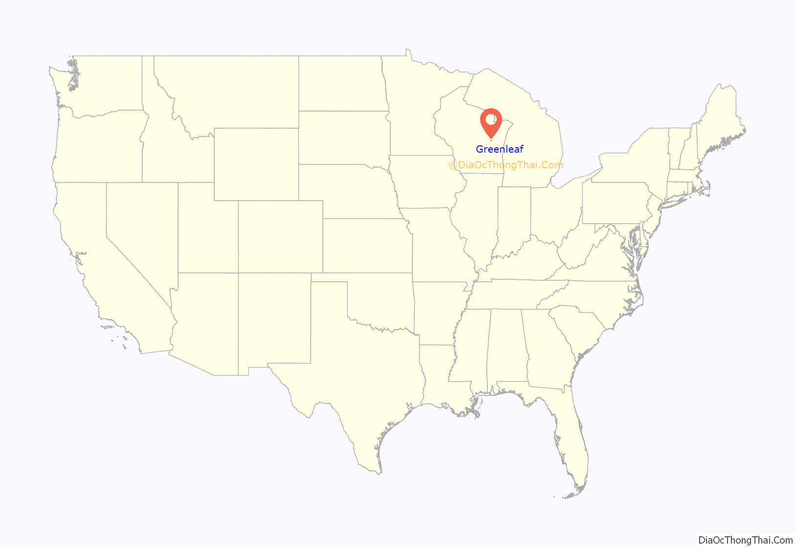
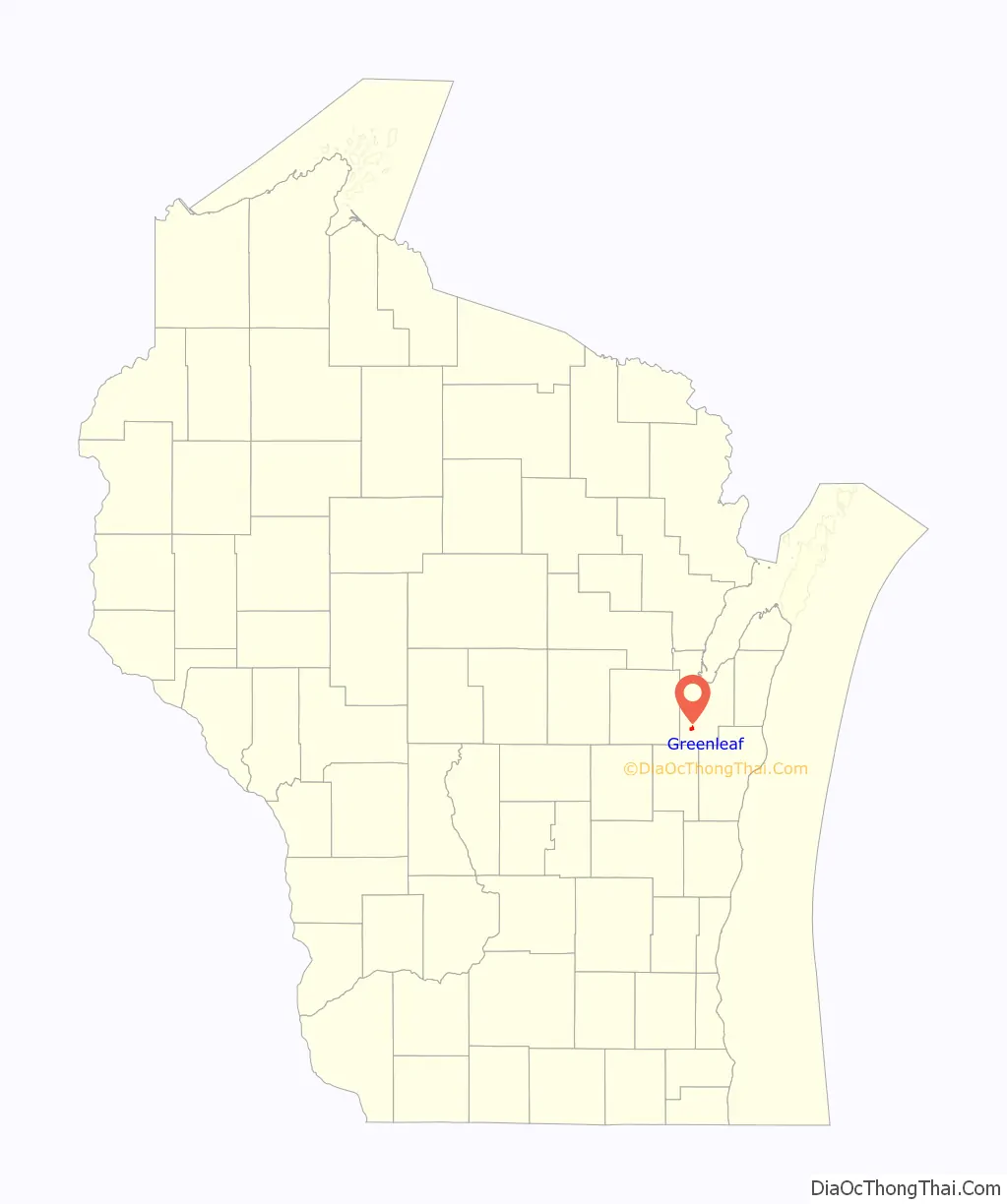
Greenleaf is an unincorporated census-designated place in Brown County, Wisconsin, United States, in the town of Wrightstown.
| Name: | Greenleaf CDP |
|---|---|
| LSAD Code: | 57 |
| LSAD Description: | CDP (suffix) |
| State: | Wisconsin |
| County: | Brown County |
| Elevation: | 712 ft (217 m) |
| Total Area: | 1.042 sq mi (2.70 km²) |
| Land Area: | 1.042 sq mi (2.70 km²) |
| Water Area: | 0 sq mi (0 km²) |
| Total Population: | 607 |
| Population Density: | 580/sq mi (220/km²) |
| Area code: | 920 |
| FIPS code: | 5531375 |
| GNISfeature ID: | 1565848 |
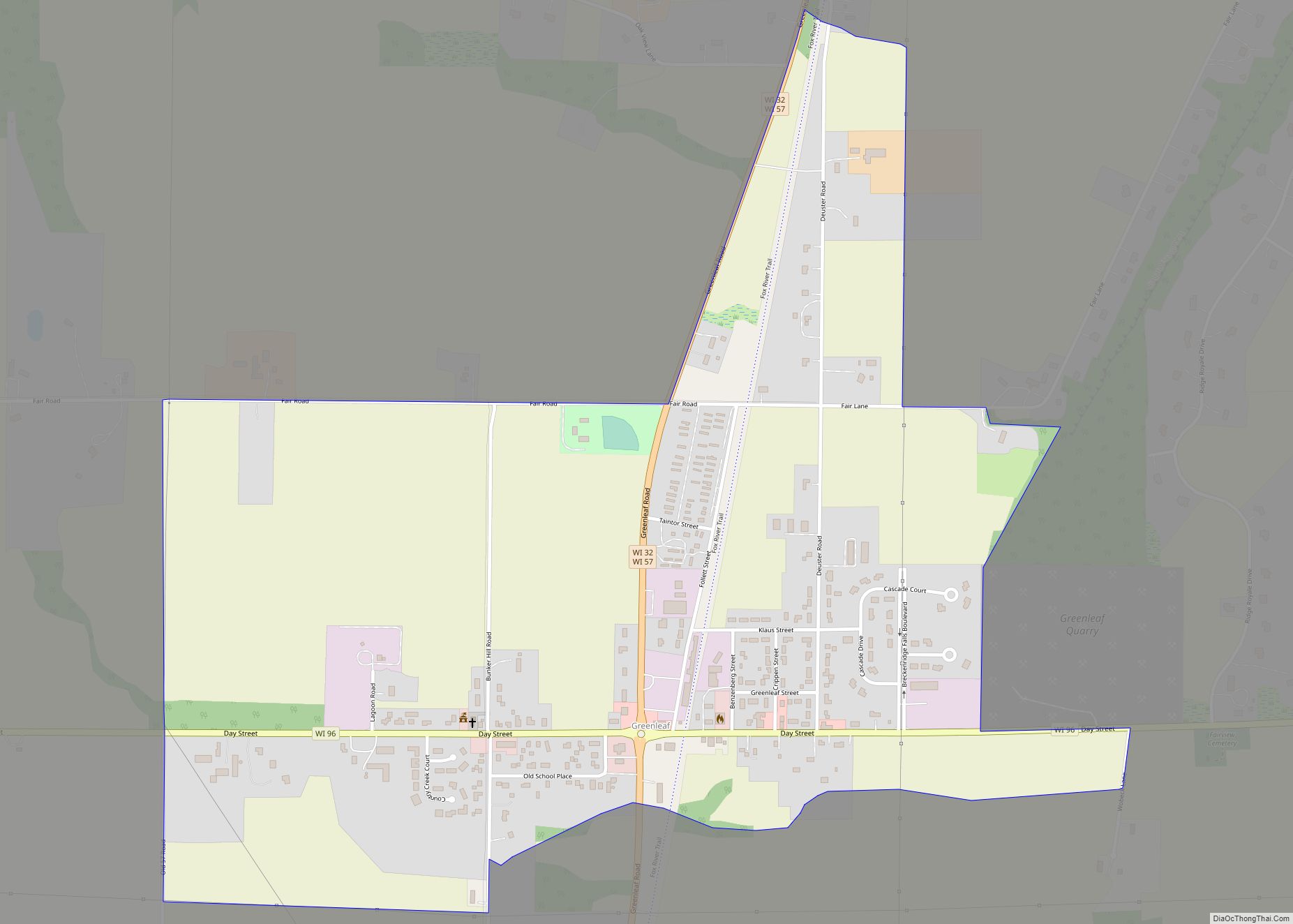
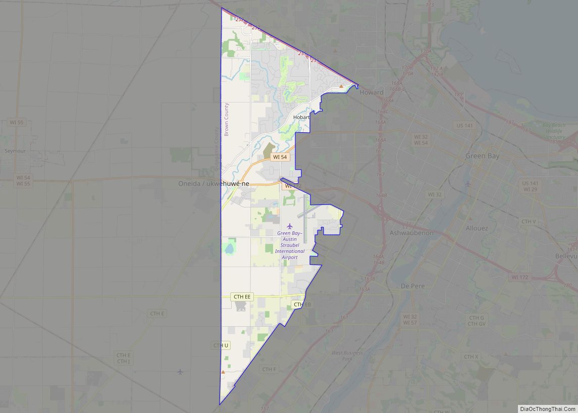
Online Interactive Map
Click on ![]() to view map in "full screen" mode.
to view map in "full screen" mode.
Greenleaf location map. Where is Greenleaf CDP?
History
As of the 2010 census it had a population of 607. Greenleaf was named for Emery B. Greenleaf, the general manager of the Milwaukee & Northern railroad at the time the Greenleaf post office was established in 1873.
Incorporation as a Village
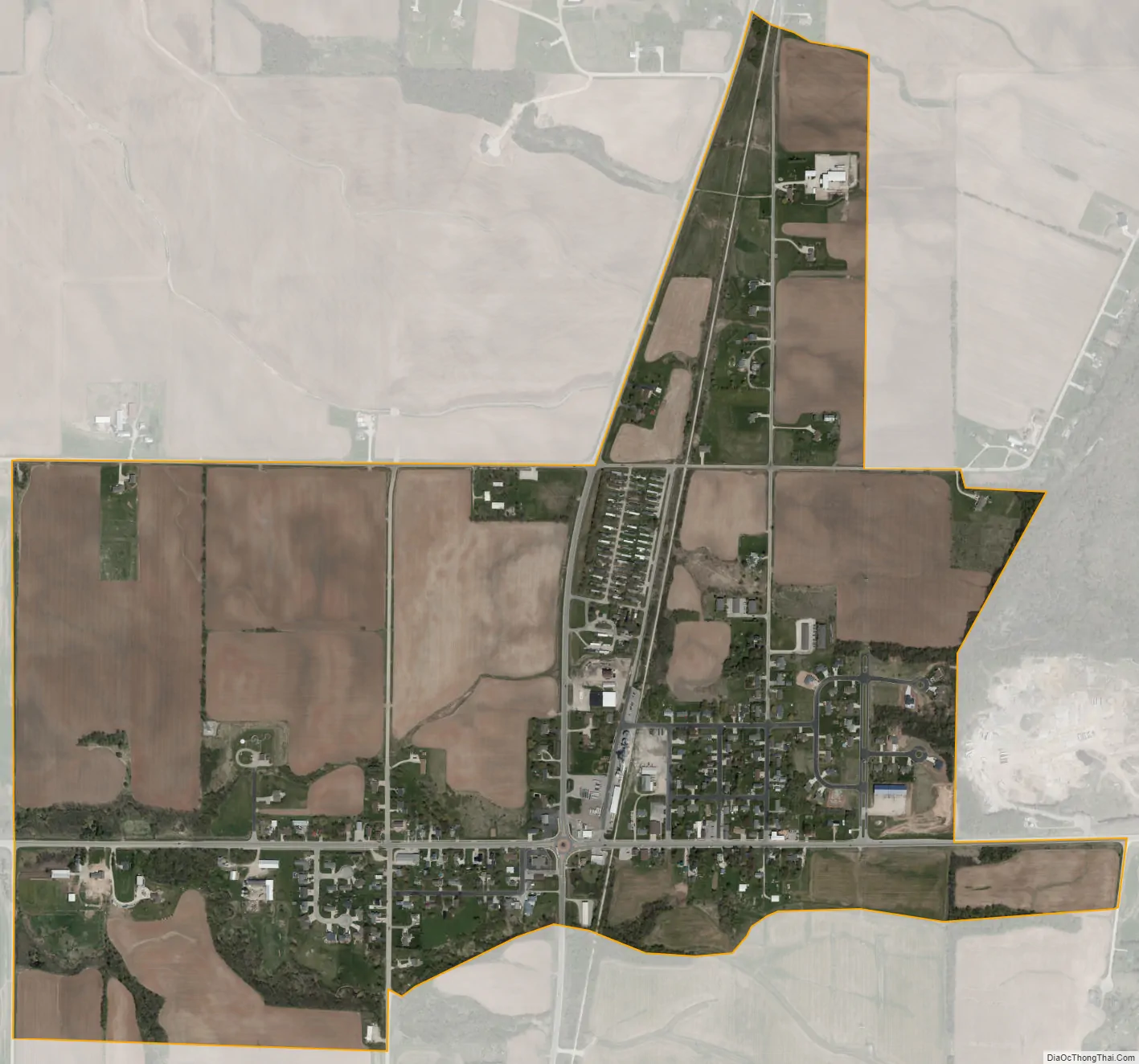
In 2020, 800 residents of the community petitioned the state of Wisconsin to become a village. The Wisconsin Incorporation Review Board denied the petition’s “characteristics of the territory” requirement as the petition included 2 separate areas: one in the vicinity of a roundabout of state highways WIS 57 and Wisconsin Highway 96 and another isolated area to the east of the Niagara Escarpment. The second area is isolated from the first by the escarpment, a quarry and vacant lands.
A revised proposal was approved on April 13, 2022.
Greenleaf Road Map
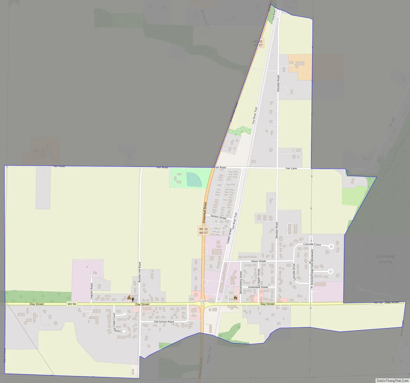
Greenleaf city Satellite Map
Geography
It is located at the intersection of Wisconsin Highways 57/32 and 96. It uses ZIP code 54126. Greenleaf has an area of 1.042 square miles (2.70 km), all of it land. The community is part of the Green Bay Metropolitan Statistical Area.
See also
Map of Wisconsin State and its subdivision:- Adams
- Ashland
- Barron
- Bayfield
- Brown
- Buffalo
- Burnett
- Calumet
- Chippewa
- Clark
- Columbia
- Crawford
- Dane
- Dodge
- Door
- Douglas
- Dunn
- Eau Claire
- Florence
- Fond du Lac
- Forest
- Grant
- Green
- Green Lake
- Iowa
- Iron
- Jackson
- Jefferson
- Juneau
- Kenosha
- Kewaunee
- La Crosse
- Lafayette
- Lake Michigan
- Lake Superior
- Langlade
- Lincoln
- Manitowoc
- Marathon
- Marinette
- Marquette
- Menominee
- Milwaukee
- Monroe
- Oconto
- Oneida
- Outagamie
- Ozaukee
- Pepin
- Pierce
- Polk
- Portage
- Price
- Racine
- Richland
- Rock
- Rusk
- Saint Croix
- Sauk
- Sawyer
- Shawano
- Sheboygan
- Taylor
- Trempealeau
- Vernon
- Vilas
- Walworth
- Washburn
- Washington
- Waukesha
- Waupaca
- Waushara
- Winnebago
- Wood
- Alabama
- Alaska
- Arizona
- Arkansas
- California
- Colorado
- Connecticut
- Delaware
- District of Columbia
- Florida
- Georgia
- Hawaii
- Idaho
- Illinois
- Indiana
- Iowa
- Kansas
- Kentucky
- Louisiana
- Maine
- Maryland
- Massachusetts
- Michigan
- Minnesota
- Mississippi
- Missouri
- Montana
- Nebraska
- Nevada
- New Hampshire
- New Jersey
- New Mexico
- New York
- North Carolina
- North Dakota
- Ohio
- Oklahoma
- Oregon
- Pennsylvania
- Rhode Island
- South Carolina
- South Dakota
- Tennessee
- Texas
- Utah
- Vermont
- Virginia
- Washington
- West Virginia
- Wisconsin
- Wyoming