Kaukauna (/kəˈkɔːnə/ (listen)) is a city in Outagamie and Calumet counties, Wisconsin, United States. It is situated on the Fox River, approximately 100 miles (160 km) north of Milwaukee. The population was 15,462 at the 2010 census. It is a part of the Appleton, Wisconsin Metropolitan Statistical Area.
| Name: | Kaukauna city |
|---|---|
| LSAD Code: | 25 |
| LSAD Description: | city (suffix) |
| State: | Wisconsin |
| County: | Outagamie County |
| Incorporated: | 1885 |
| Elevation: | 650 ft (198 m) |
| Land Area: | 7.82 sq mi (20.25 km²) |
| Water Area: | 0.41 sq mi (1.07 km²) 4.96% |
| Population Density: | 2,100/sq mi (800/km²) |
| ZIP code: | 54130 |
| Area code: | 920 |
| FIPS code: | 5538800 |
| GNISfeature ID: | 1567364 |
| Website: | www.cityofkaukauna.com |
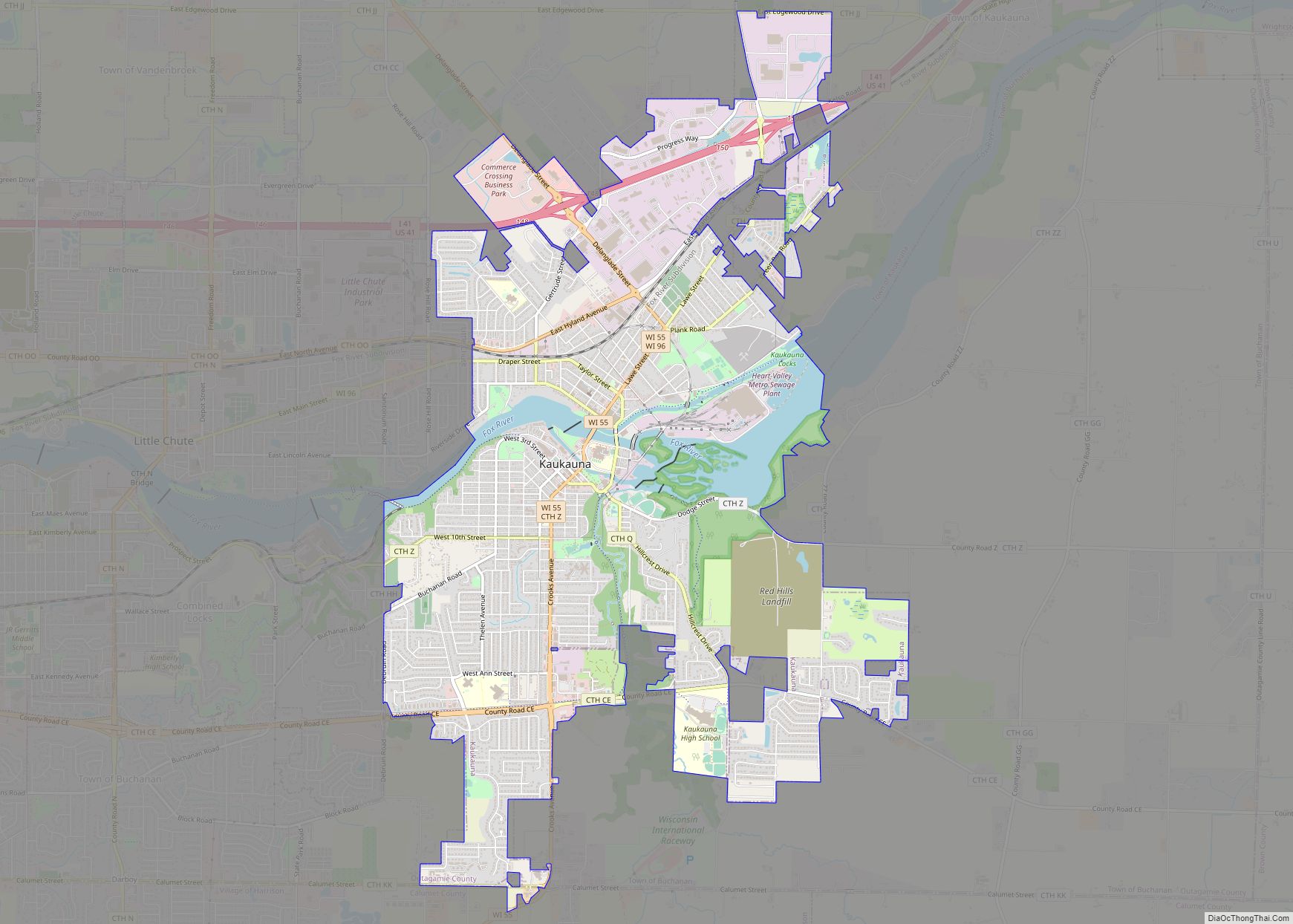
Online Interactive Map
Click on ![]() to view map in "full screen" mode.
to view map in "full screen" mode.
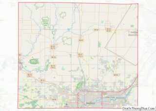
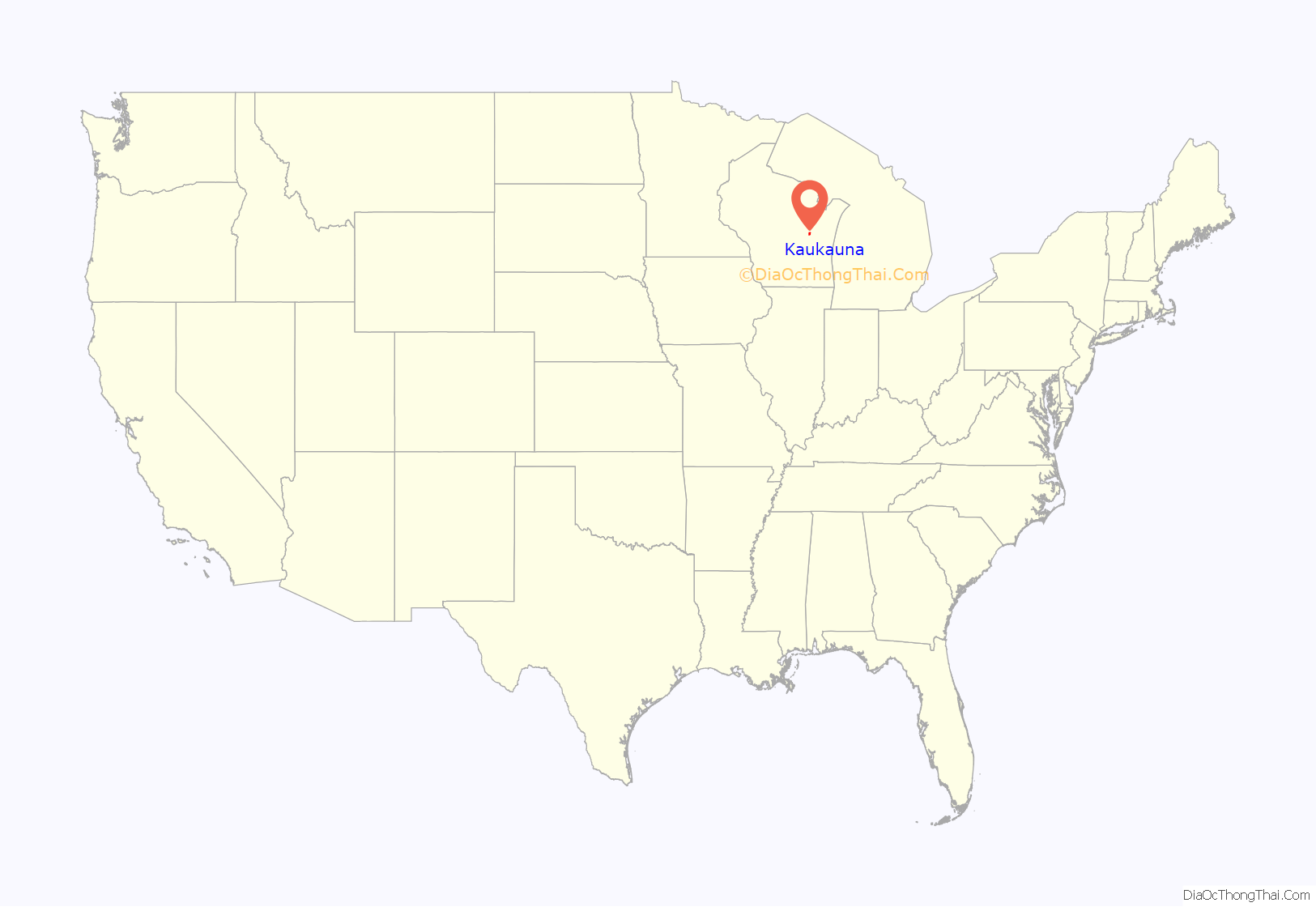
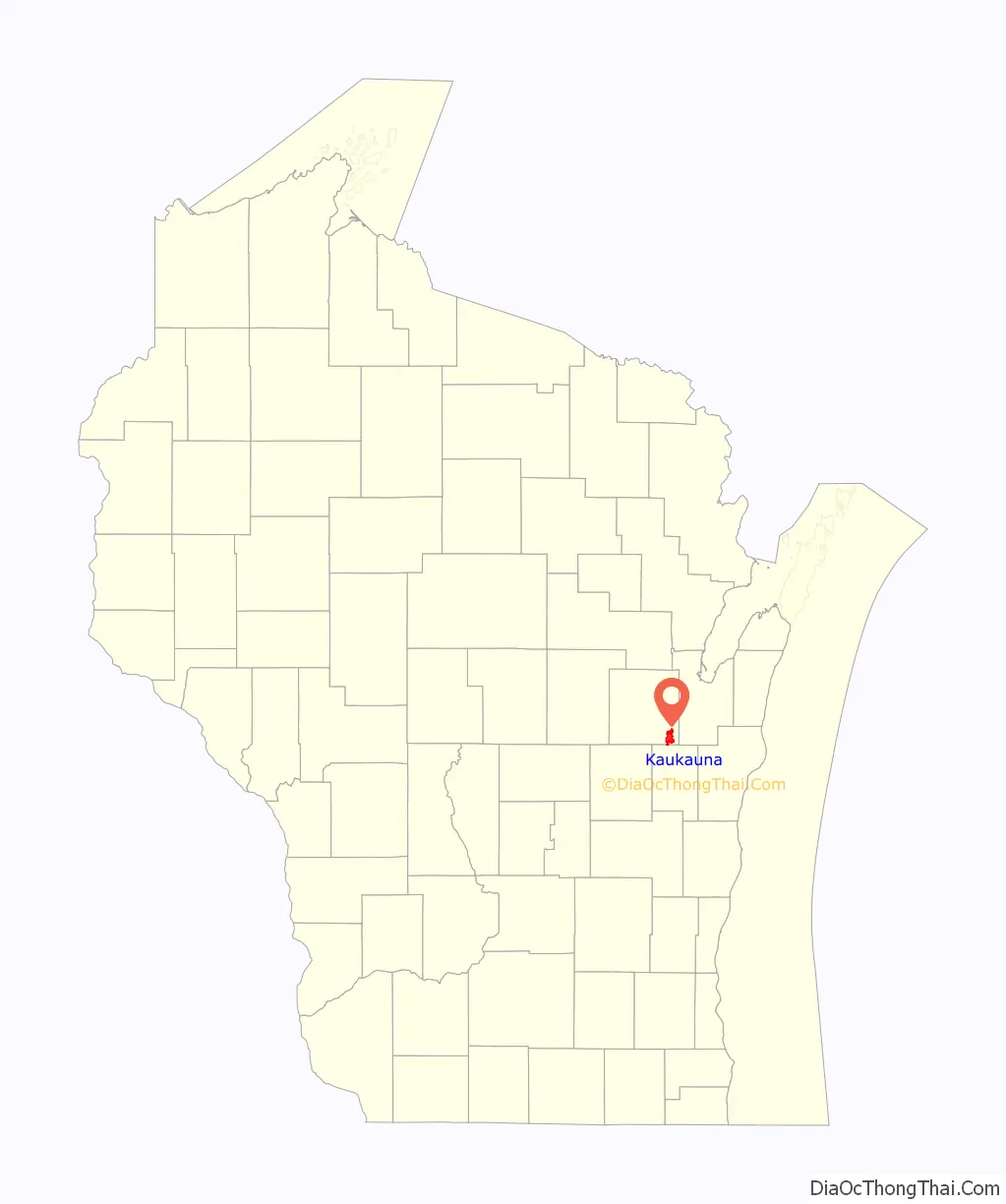
Kaukauna location map. Where is Kaukauna city?
History
Kaukauna is a Native American word and in various languages means “portage”, “long portage”, “place where pickerel are caught”, and “place of pike”. This area was traditionally home to the Ho-Chunk and Menominee peoples. The first Europeans in the area were the French. The first Catholic missionary in the area, Fr. Claude Allouez, commented on the “apple trees and vine stalks in abundance” that he found the people of Kaukauna cultivating. Kaukauna became an outpost of trade in Green Bay and saw much intermarriage between French and Menominee people, leading to a Métis culture which produced local leaders such as Augustin Grignon.
In 1836, following years of negotiations about how to accommodate the Oneida, Stockbridge-Munsee, and Brothertown peoples who were removed from New York, the Menominee ceded over four million acres of land to the United States in the Treaty of the Cedars. Grignon of Kaukauna was one of the signatories of the treaty.
Prior to 1880, and shortly afterwards, Kaukauna was known as “The Lion on the Fox”. This nickname was changed to “The Electric City” upon the completion of the hydroelectric plant. When the city was incorporated in 1885, it was separated from the adjacent rural parts of the town. The first recorded land deed in Wisconsin was assigned to Dominique Ducharme in 1793. He obtained 1,281 acres (518 ha) from the Menominee Indians for two barrels of rum and other gifts. These acres are the original site of the town of Kaukauna. The property was purchased by Charles A. Grignon (and recorded Dec. 18, 1828), who built a mansion on the river on Kaukauna’s north side. The home, which bears Grignon’s name, is operated as a museum by the Outagamie County Historical Society.
Kaukauna Road Map
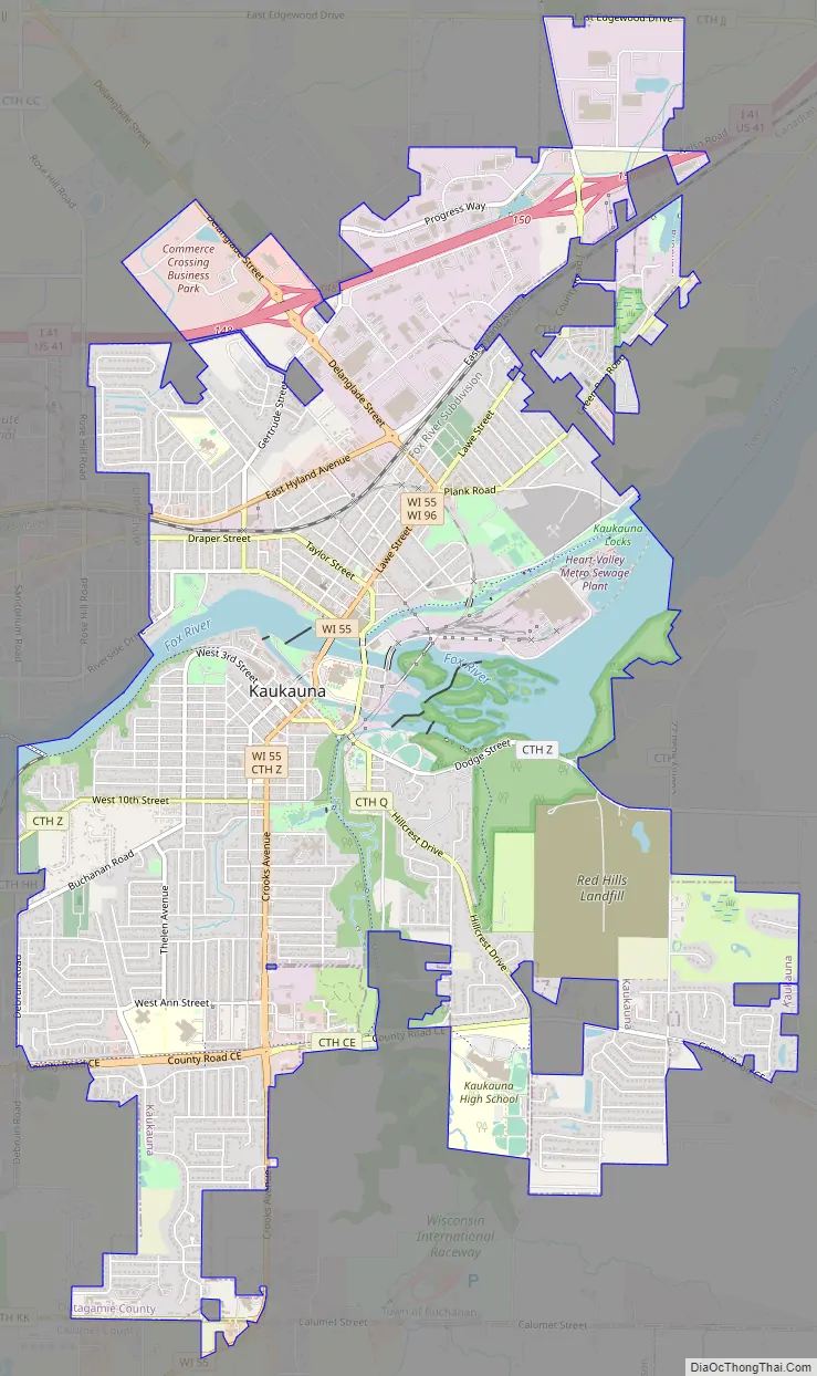
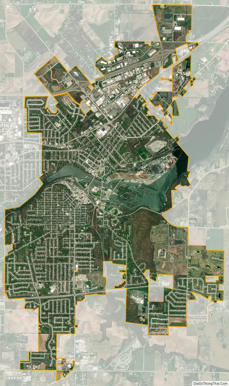
Kaukauna city Satellite Map
Geography
Kaukauna is located in southeastern Outagamie County, with a small portion extending south into Calumet County along State Highway 55 (Friendship Drive). According to the United States Census Bureau, the city has a total area of 8.06 square miles (20.88 km), of which 7.66 square miles (19.84 km) is land and 0.40 square miles (1.04 km) is water.
The city is divided into the North Side and South Side by the Fox River, which is spanned by four bridges.
See also
Map of Wisconsin State and its subdivision:- Adams
- Ashland
- Barron
- Bayfield
- Brown
- Buffalo
- Burnett
- Calumet
- Chippewa
- Clark
- Columbia
- Crawford
- Dane
- Dodge
- Door
- Douglas
- Dunn
- Eau Claire
- Florence
- Fond du Lac
- Forest
- Grant
- Green
- Green Lake
- Iowa
- Iron
- Jackson
- Jefferson
- Juneau
- Kenosha
- Kewaunee
- La Crosse
- Lafayette
- Lake Michigan
- Lake Superior
- Langlade
- Lincoln
- Manitowoc
- Marathon
- Marinette
- Marquette
- Menominee
- Milwaukee
- Monroe
- Oconto
- Oneida
- Outagamie
- Ozaukee
- Pepin
- Pierce
- Polk
- Portage
- Price
- Racine
- Richland
- Rock
- Rusk
- Saint Croix
- Sauk
- Sawyer
- Shawano
- Sheboygan
- Taylor
- Trempealeau
- Vernon
- Vilas
- Walworth
- Washburn
- Washington
- Waukesha
- Waupaca
- Waushara
- Winnebago
- Wood
- Alabama
- Alaska
- Arizona
- Arkansas
- California
- Colorado
- Connecticut
- Delaware
- District of Columbia
- Florida
- Georgia
- Hawaii
- Idaho
- Illinois
- Indiana
- Iowa
- Kansas
- Kentucky
- Louisiana
- Maine
- Maryland
- Massachusetts
- Michigan
- Minnesota
- Mississippi
- Missouri
- Montana
- Nebraska
- Nevada
- New Hampshire
- New Jersey
- New Mexico
- New York
- North Carolina
- North Dakota
- Ohio
- Oklahoma
- Oregon
- Pennsylvania
- Rhode Island
- South Carolina
- South Dakota
- Tennessee
- Texas
- Utah
- Vermont
- Virginia
- Washington
- West Virginia
- Wisconsin
- Wyoming