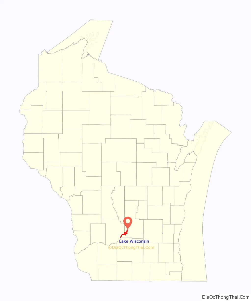
Lake Wisconsin is a census-designated place (CDP) in Columbia and Sauk counties, in the towns of Lodi and Merrimac, in Wisconsin, United States. The population was 4,189 at the 2010 census.
The Columbia County portion of the Lake Wisconsin is part of the Madison Metropolitan Statistical Area, while the Sauk County portion is part of the Baraboo Micropolitan Statistical Area.
| Name: | Lake Wisconsin CDP |
|---|---|
| LSAD Code: | 57 |
| LSAD Description: | CDP (suffix) |
| State: | Wisconsin |
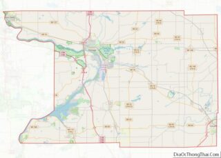
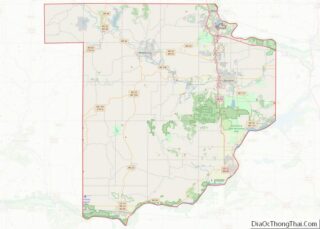
| County: | Columbia County, Sauk County |
| Elevation: | 807 ft (246 m) |
| Total Area: | 21.456 sq mi (55.57 km²) |
| Land Area: | 12.134 sq mi (31.43 km²) |
| Water Area: | 9.322 sq mi (24.14 km²) |
| Total Population: | 4,189 |
| Population Density: | 200/sq mi (75/km²) |
| Area code: | 608 |
| FIPS code: | 5542012 |
| GNISfeature ID: | 1867661 |
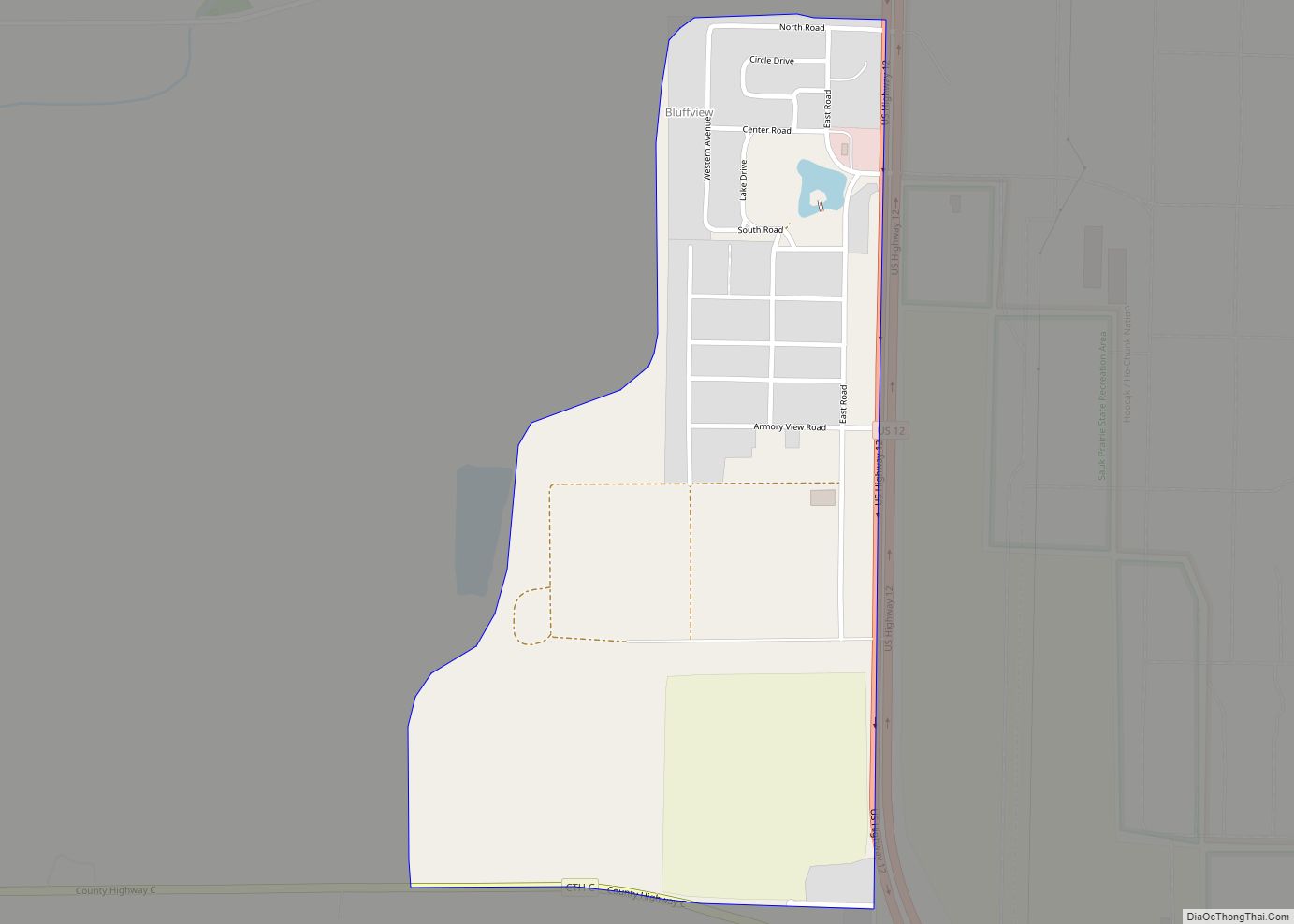
Online Interactive Map
Click on ![]() to view map in "full screen" mode.
to view map in "full screen" mode.
Lake Wisconsin location map. Where is Lake Wisconsin CDP?
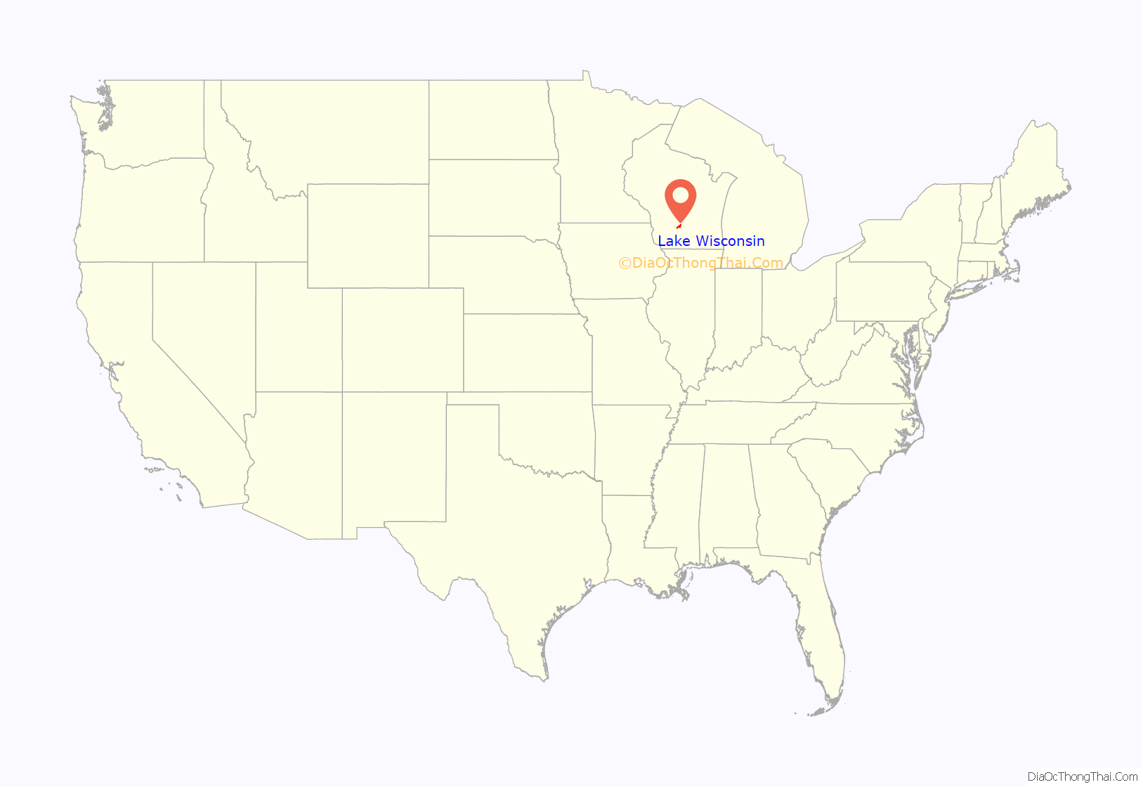
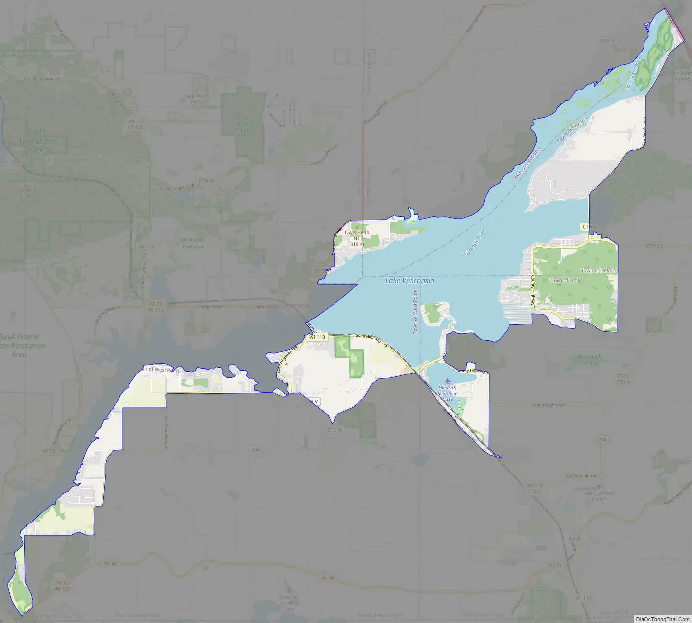
Lake Wisconsin Road Map
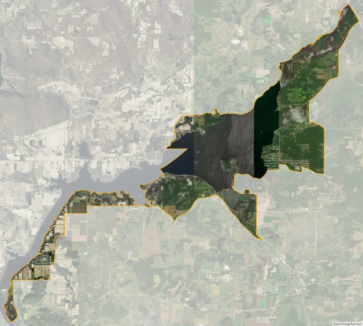
Lake Wisconsin city Satellite Map
Geography
Lake Wisconsin is located at 43°22′24″N 89°34′32″W / 43.37333°N 89.57556°W / 43.37333; -89.57556 (43.373461, -89.575676).
According to the United States Census Bureau, the CDP has a total area of 21.5 square miles (55.6 km), of which, 12.1 square miles (31.4 km) of it is land and 9.3 square miles (24.1 km) of it (43.45%) is water.
See also
Map of Wisconsin State and its subdivision:- Adams
- Ashland
- Barron
- Bayfield
- Brown
- Buffalo
- Burnett
- Calumet
- Chippewa
- Clark
- Columbia
- Crawford
- Dane
- Dodge
- Door
- Douglas
- Dunn
- Eau Claire
- Florence
- Fond du Lac
- Forest
- Grant
- Green
- Green Lake
- Iowa
- Iron
- Jackson
- Jefferson
- Juneau
- Kenosha
- Kewaunee
- La Crosse
- Lafayette
- Lake Michigan
- Lake Superior
- Langlade
- Lincoln
- Manitowoc
- Marathon
- Marinette
- Marquette
- Menominee
- Milwaukee
- Monroe
- Oconto
- Oneida
- Outagamie
- Ozaukee
- Pepin
- Pierce
- Polk
- Portage
- Price
- Racine
- Richland
- Rock
- Rusk
- Saint Croix
- Sauk
- Sawyer
- Shawano
- Sheboygan
- Taylor
- Trempealeau
- Vernon
- Vilas
- Walworth
- Washburn
- Washington
- Waukesha
- Waupaca
- Waushara
- Winnebago
- Wood
- Alabama
- Alaska
- Arizona
- Arkansas
- California
- Colorado
- Connecticut
- Delaware
- District of Columbia
- Florida
- Georgia
- Hawaii
- Idaho
- Illinois
- Indiana
- Iowa
- Kansas
- Kentucky
- Louisiana
- Maine
- Maryland
- Massachusetts
- Michigan
- Minnesota
- Mississippi
- Missouri
- Montana
- Nebraska
- Nevada
- New Hampshire
- New Jersey
- New Mexico
- New York
- North Carolina
- North Dakota
- Ohio
- Oklahoma
- Oregon
- Pennsylvania
- Rhode Island
- South Carolina
- South Dakota
- Tennessee
- Texas
- Utah
- Vermont
- Virginia
- Washington
- West Virginia
- Wisconsin
- Wyoming