New Holstein is a city in Calumet County in the U.S. state of Wisconsin. The population was 3,236 at the 2010 census. The city is located within the Town of New Holstein.
| Name: | New Holstein city |
|---|---|
| LSAD Code: | 25 |
| LSAD Description: | city (suffix) |
| State: | Wisconsin |
| County: | Calumet County |
| Elevation: | 932 ft (284 m) |
| Total Area: | 2.51 sq mi (6.50 km²) |
| Land Area: | 2.51 sq mi (6.49 km²) |
| Water Area: | 0.00 sq mi (0.01 km²) |
| Total Population: | 3,236 |
| Population Density: | 1,236.84/sq mi (477.61/km²) |
| Area code: | 920 |
| FIPS code: | 5556800 |
| GNISfeature ID: | 1570219 |
| Website: | cityofnewholstein.org |
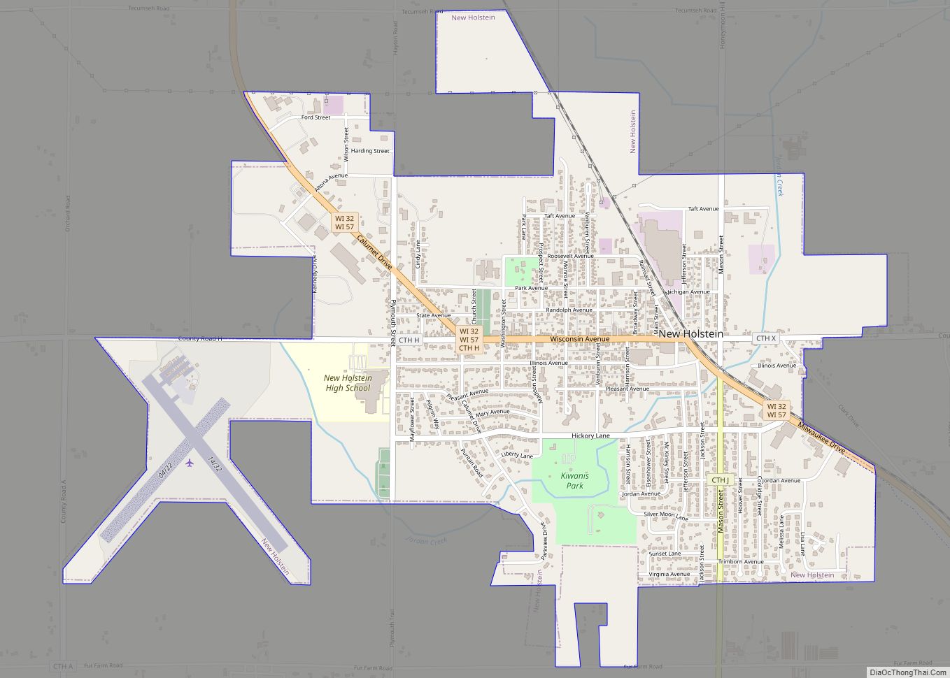
Online Interactive Map
Click on ![]() to view map in "full screen" mode.
to view map in "full screen" mode.
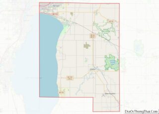
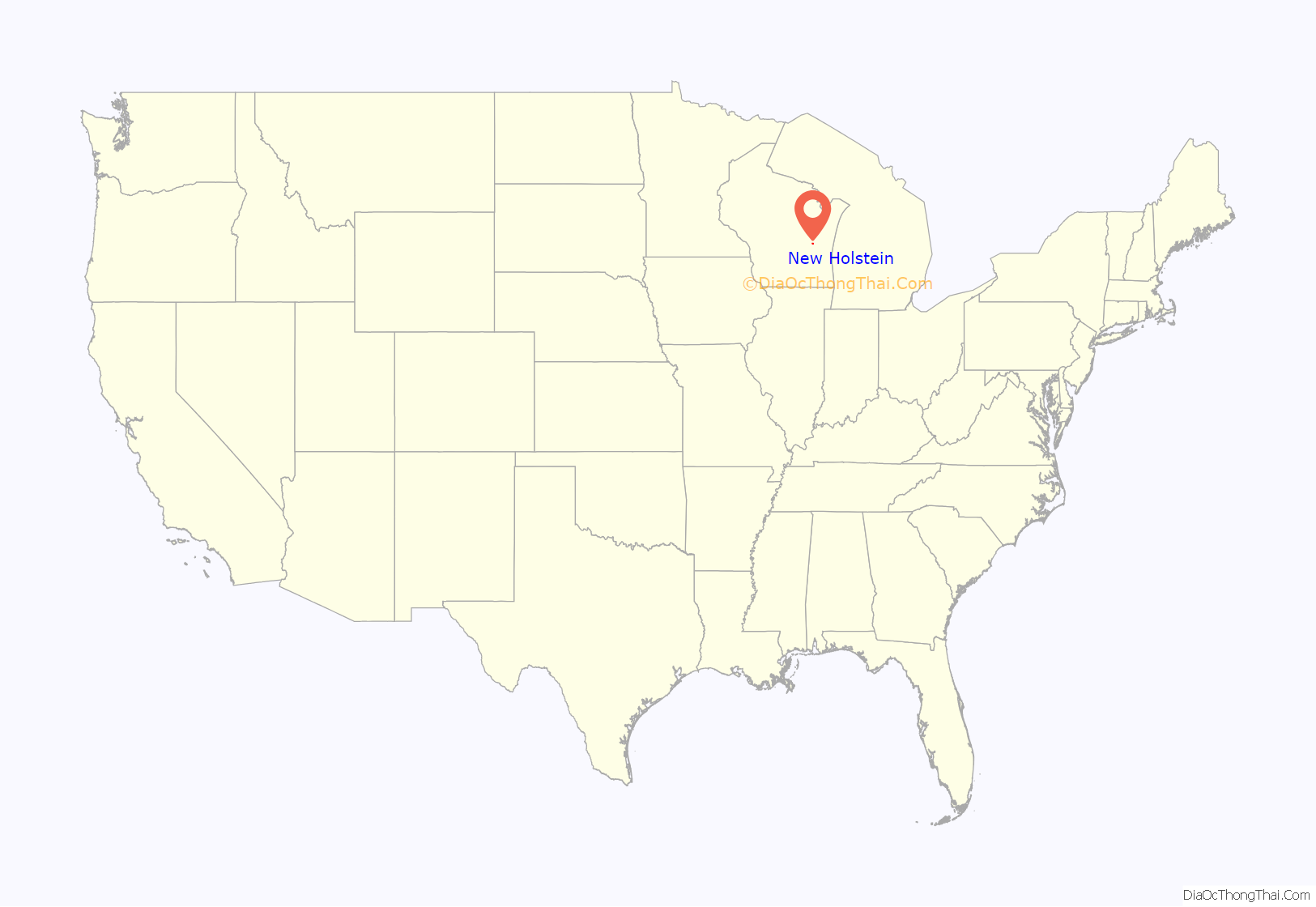
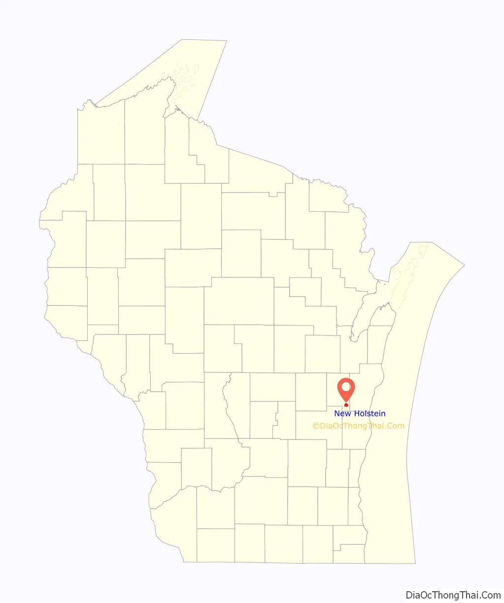
New Holstein location map. Where is New Holstein city?
History
New Holstein is named after the German duchy of Holstein from which many early settlers emigrated. In 1848, 70 people from Hamburg, Germany emigrated to the New Holstein area, forming the basis of what would become the present city. Many settlers were intellectuals who feared an impending war as a result of competing claims to the territory. Settlers originally named the community Altona after Altona, Hamburg, Germany. As the amount of mail received in Altona increased, the United States Post Office wanted Altona to be renamed because the community’s name was too close to Altoona in western Wisconsin.
In the early years, settlers traveled for supplies to Calumetville, Wisconsin, a larger neighboring community. Wild game, such as passenger pigeons, was available for food.
The first settlers in the city were Charles Greening and two of his companions. Dr. Charles Bock arrived shortly afterwards. The first postmaster was Monsignor Puchner, a Roman Catholic priest. In 1849 the town was organized, with the first chairman being Greening, who was named county judge in 1855. Settlers continued arriving from Germany throughout the mid-nineteenth century. A drama troupe was organized in 1851.
Railroad service was planned at meetings in 1871. A depot was built and the railroad arrived in 1872. The railroad named the station “New Holstein” after the town. Mail then came to the community on trains instead of via the Pony Express. The first post office was built shortly after rail service started.
By 1881, the community comprised about 400 residents, all of whom were either Germans or of German descent. The village covered over one square mile. That year it had two public halls, three hotels, a fire insurance company, and a cemetery. New Holstein’s principal business was a flour mill. Near the railroad depot was a grain elevator owned by Herman Timm.
In 1900 the census reported a population of 569. New Holstein was incorporated as a village the following year. The first lights were installed in the city in 1912.
New Holstein became a city in April 1926. The first city council was: Mayor Edward Funke, City Clerk Harvey C. Hansen, City Council President Peter Hass, Aldermen Gilbert Hipke, Robert Schilling, Louie Schaar, Edgar Lange, W. W. Lauson, Henry Schmitt, and Harry C. Hass, Superintendent of Water Works Henry Aggen, Fire Chief Walter Mathes, Assessor Arthur Roehl, and City Attorney George M. Goggins.
The current mayor is Richard Snelson. The current chief of police is Eric Fisher. The current fire chief is Denis Mayer.
New Holstein Road Map
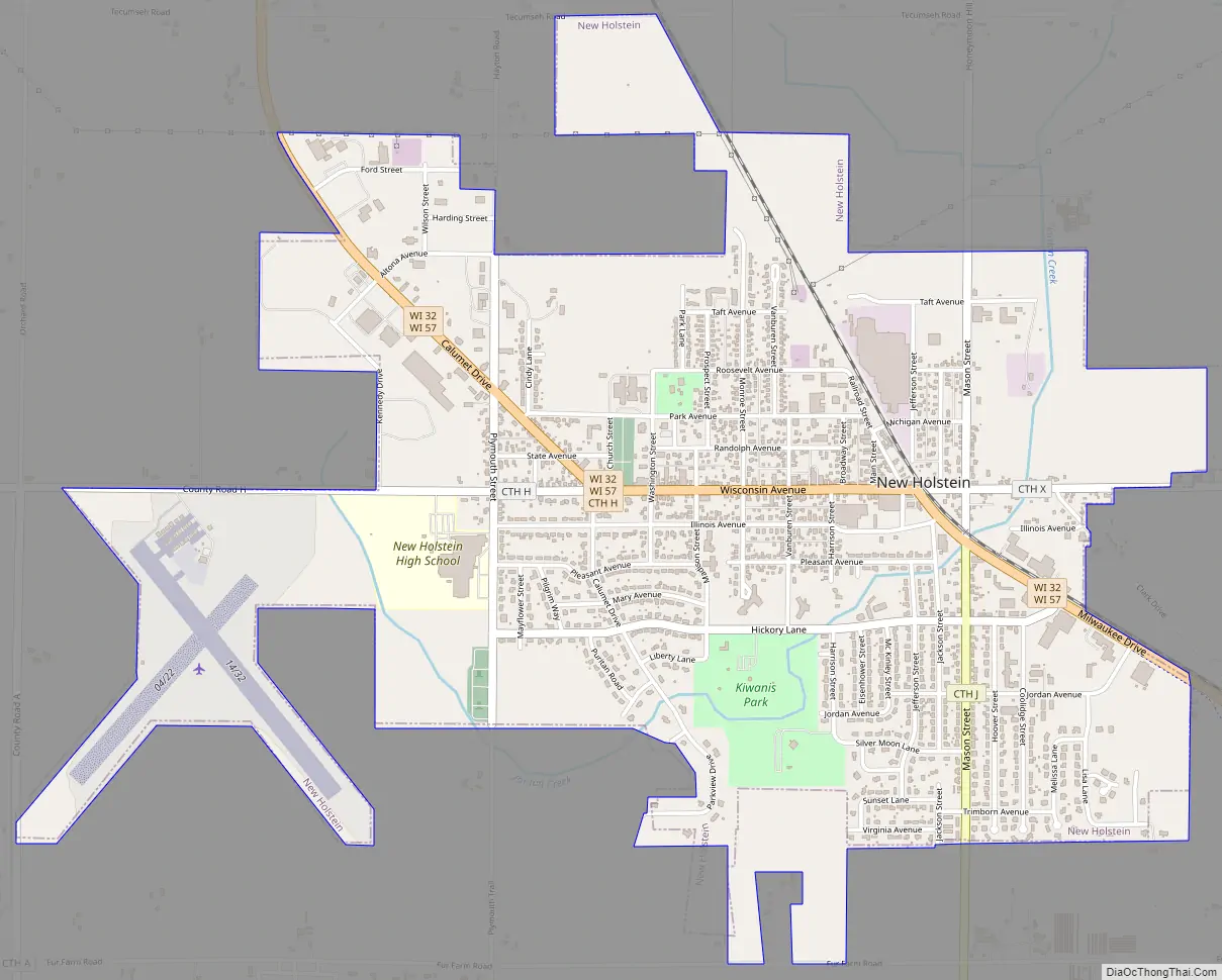
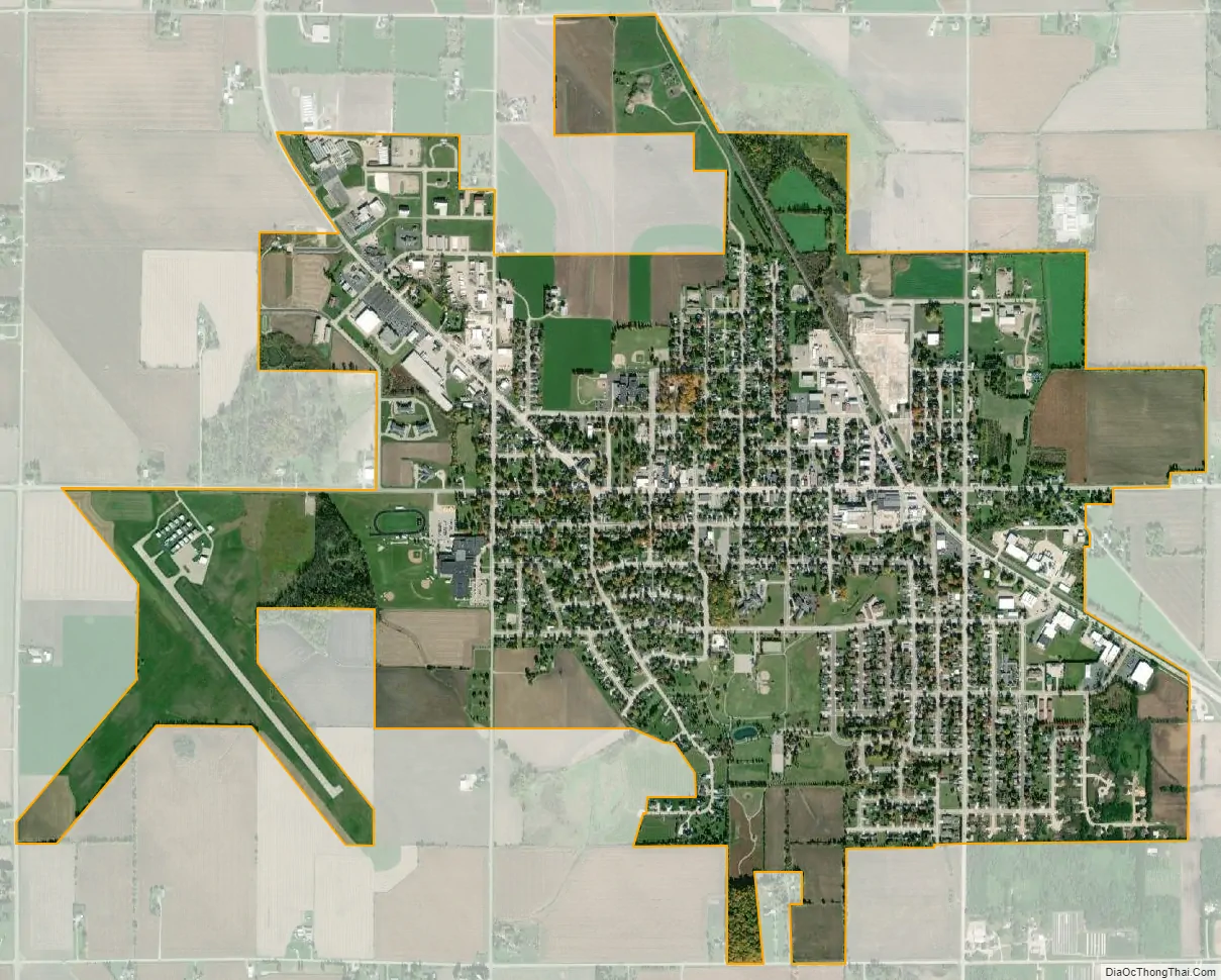
New Holstein city Satellite Map
Geography
New Holstein is located at 43°56′53″N 88°5′27″W / 43.94806°N 88.09083°W / 43.94806; -88.09083 (43.948185, -88.090931).
According to the United States Census Bureau, the city has a total area of 2.50 square miles (6.47 km), all of it land.
See also
Map of Wisconsin State and its subdivision:- Adams
- Ashland
- Barron
- Bayfield
- Brown
- Buffalo
- Burnett
- Calumet
- Chippewa
- Clark
- Columbia
- Crawford
- Dane
- Dodge
- Door
- Douglas
- Dunn
- Eau Claire
- Florence
- Fond du Lac
- Forest
- Grant
- Green
- Green Lake
- Iowa
- Iron
- Jackson
- Jefferson
- Juneau
- Kenosha
- Kewaunee
- La Crosse
- Lafayette
- Lake Michigan
- Lake Superior
- Langlade
- Lincoln
- Manitowoc
- Marathon
- Marinette
- Marquette
- Menominee
- Milwaukee
- Monroe
- Oconto
- Oneida
- Outagamie
- Ozaukee
- Pepin
- Pierce
- Polk
- Portage
- Price
- Racine
- Richland
- Rock
- Rusk
- Saint Croix
- Sauk
- Sawyer
- Shawano
- Sheboygan
- Taylor
- Trempealeau
- Vernon
- Vilas
- Walworth
- Washburn
- Washington
- Waukesha
- Waupaca
- Waushara
- Winnebago
- Wood
- Alabama
- Alaska
- Arizona
- Arkansas
- California
- Colorado
- Connecticut
- Delaware
- District of Columbia
- Florida
- Georgia
- Hawaii
- Idaho
- Illinois
- Indiana
- Iowa
- Kansas
- Kentucky
- Louisiana
- Maine
- Maryland
- Massachusetts
- Michigan
- Minnesota
- Mississippi
- Missouri
- Montana
- Nebraska
- Nevada
- New Hampshire
- New Jersey
- New Mexico
- New York
- North Carolina
- North Dakota
- Ohio
- Oklahoma
- Oregon
- Pennsylvania
- Rhode Island
- South Carolina
- South Dakota
- Tennessee
- Texas
- Utah
- Vermont
- Virginia
- Washington
- West Virginia
- Wisconsin
- Wyoming