Powers Lake is a census-designated place (CDP) in the towns of Randall and Wheatland, in Kenosha County in the U.S. state of Wisconsin. As of the 2020 census, the CDP had a population of 1,401. Part of the Powers Lake CDP was in Walworth County, but on December 20, 2011, it became part of the village of Bloomfield.
| Name: | Powers Lake CDP |
|---|---|
| LSAD Code: | 57 |
| LSAD Description: | CDP (suffix) |
| State: | Wisconsin |
| County: | Kenosha County, Walworth County |
| Elevation: | 869 ft (265 m) |
| Total Area: | 3.074 sq mi (7.96 km²) |
| Land Area: | 2.217 sq mi (5.74 km²) |
| Water Area: | 0.857 sq mi (2.22 km²) |
| Total Population: | 1,401 |
| Population Density: | 728.5/sq mi (281.3/km²) |
| ZIP code: | 53159 |
| Area code: | 262 |
| FIPS code: | 5564825 |
| GNISfeature ID: | 1571858 |
| Website: | districtofpowerslake.com |
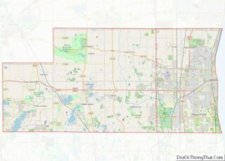
Online Interactive Map
Click on ![]() to view map in "full screen" mode.
to view map in "full screen" mode.
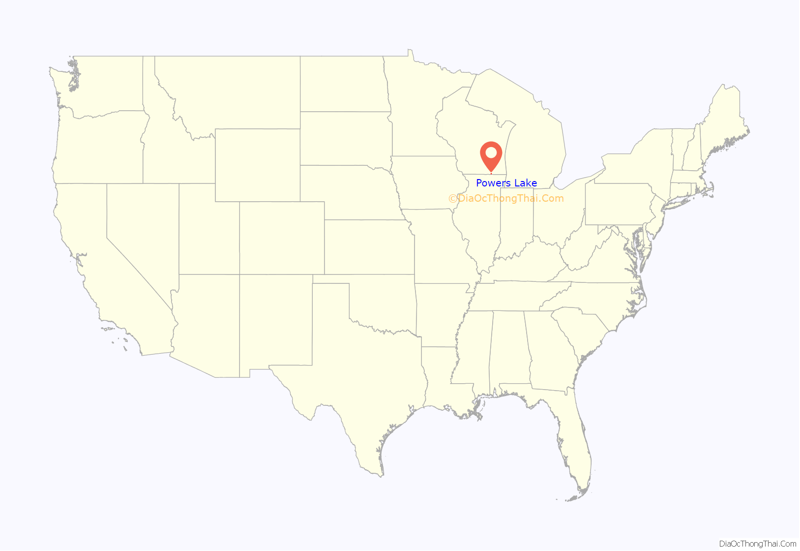
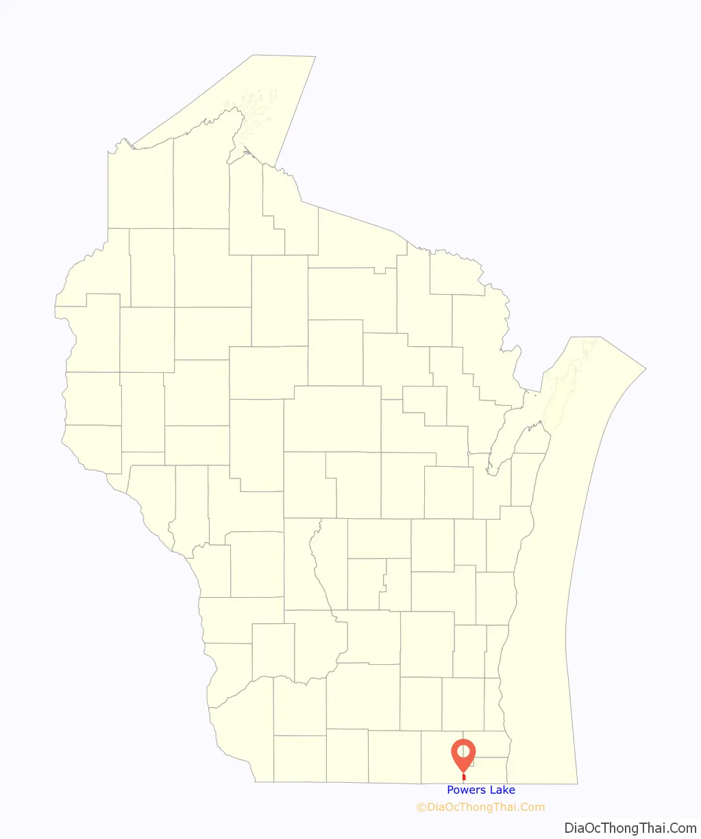
Powers Lake location map. Where is Powers Lake CDP?
History
Originally called Lakeville and then Nippersink, Powers Lake was named after James B. Powers, one of its early settlers, convivial neighbor, and one of our first postmasters. The farming community appreciated our fertile Wisconsin soil and access to a water supply.Recreational activities garnered interest around the lakes in the 1880’s, but it was in the 1890’s that fishermen and others, primarily from Chicago, enjoyed long visits in the area and eventually developed the North Shore of Powers Lake. Ice companies also ‘mined’ the south shores of Powers Lake and the north shore of Benedict Lake in the 1890’s, eventually establishing five ice houses on Powers Lake.
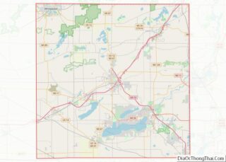
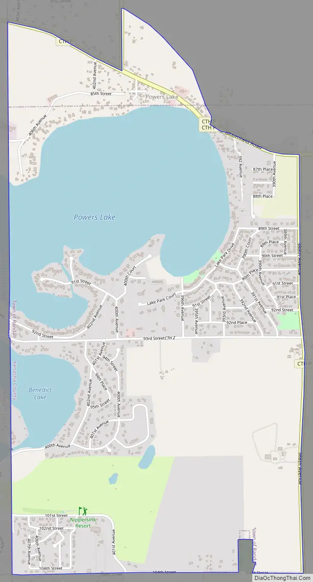
Powers Lake Road Map
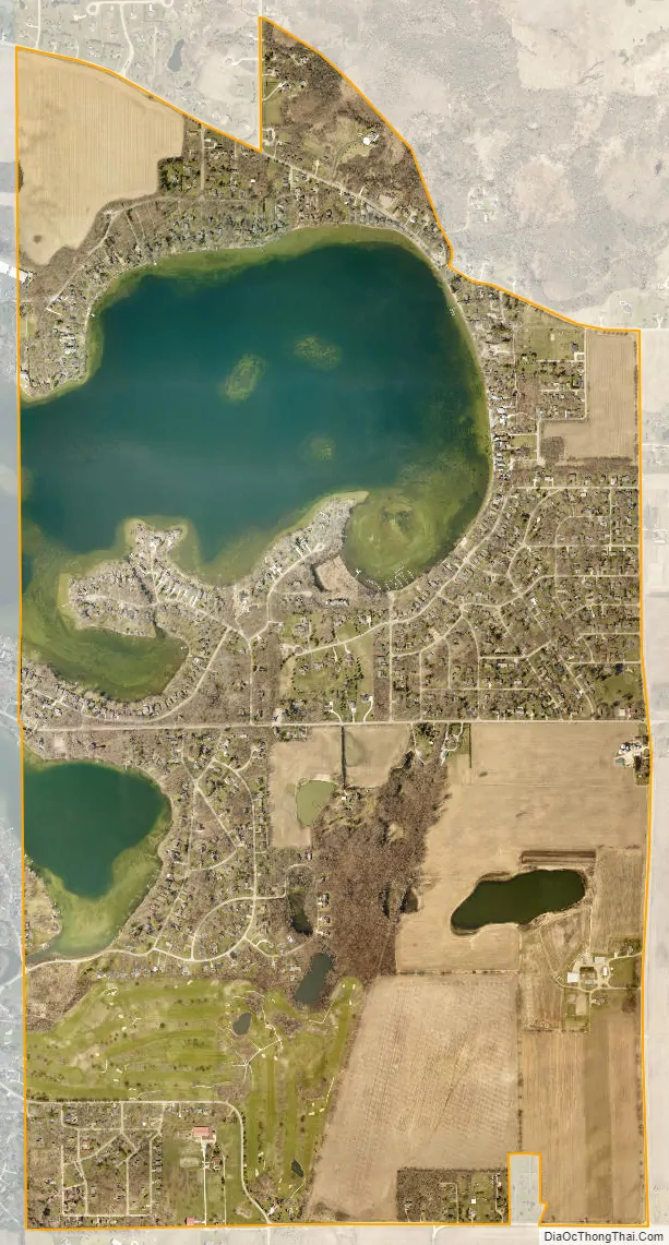
Powers Lake city Satellite Map
Geography
Powers Lake is located at 42°32’20” North, 88°17’53” West (42.538813, -88.298027).
According to the United States Census Bureau, the CDP has a total area of 3.1 square miles (8.0 km), of which, 2.2 square miles (5.7 km) of it is land and 0.9 square miles (2.2 km) of it is water. The total area is 27.88% water.
See also
Map of Wisconsin State and its subdivision:- Adams
- Ashland
- Barron
- Bayfield
- Brown
- Buffalo
- Burnett
- Calumet
- Chippewa
- Clark
- Columbia
- Crawford
- Dane
- Dodge
- Door
- Douglas
- Dunn
- Eau Claire
- Florence
- Fond du Lac
- Forest
- Grant
- Green
- Green Lake
- Iowa
- Iron
- Jackson
- Jefferson
- Juneau
- Kenosha
- Kewaunee
- La Crosse
- Lafayette
- Lake Michigan
- Lake Superior
- Langlade
- Lincoln
- Manitowoc
- Marathon
- Marinette
- Marquette
- Menominee
- Milwaukee
- Monroe
- Oconto
- Oneida
- Outagamie
- Ozaukee
- Pepin
- Pierce
- Polk
- Portage
- Price
- Racine
- Richland
- Rock
- Rusk
- Saint Croix
- Sauk
- Sawyer
- Shawano
- Sheboygan
- Taylor
- Trempealeau
- Vernon
- Vilas
- Walworth
- Washburn
- Washington
- Waukesha
- Waupaca
- Waushara
- Winnebago
- Wood
- Alabama
- Alaska
- Arizona
- Arkansas
- California
- Colorado
- Connecticut
- Delaware
- District of Columbia
- Florida
- Georgia
- Hawaii
- Idaho
- Illinois
- Indiana
- Iowa
- Kansas
- Kentucky
- Louisiana
- Maine
- Maryland
- Massachusetts
- Michigan
- Minnesota
- Mississippi
- Missouri
- Montana
- Nebraska
- Nevada
- New Hampshire
- New Jersey
- New Mexico
- New York
- North Carolina
- North Dakota
- Ohio
- Oklahoma
- Oregon
- Pennsylvania
- Rhode Island
- South Carolina
- South Dakota
- Tennessee
- Texas
- Utah
- Vermont
- Virginia
- Washington
- West Virginia
- Wisconsin
- Wyoming