St. Joseph is an unincorporated community and census-designated place (CDP) in the town of Greenfield, La Crosse County, Wisconsin, United States. It is part of the La Crosse Metropolitan Statistical Area. The community is located at the junction of State Highway 33 and county trunk highway M. As of the 2010 census, its population was 503.
| Name: | St. Joseph CDP |
|---|---|
| LSAD Code: | 57 |
| LSAD Description: | CDP (suffix) |
| State: | Wisconsin |
| County: | La Crosse County |
| Elevation: | 1,299 ft (396 m) |
| Total Area: | 1.896 sq mi (4.91 km²) |
| Land Area: | 1.896 sq mi (4.91 km²) |
| Water Area: | 0 sq mi (0 km²) |
| Total Population: | 503 |
| Population Density: | 270/sq mi (100/km²) |
| ZIP code: | 54601 (La Crosse) |
| Area code: | 608 |
| FIPS code: | 5570800 |
| GNISfeature ID: | 1573142 |
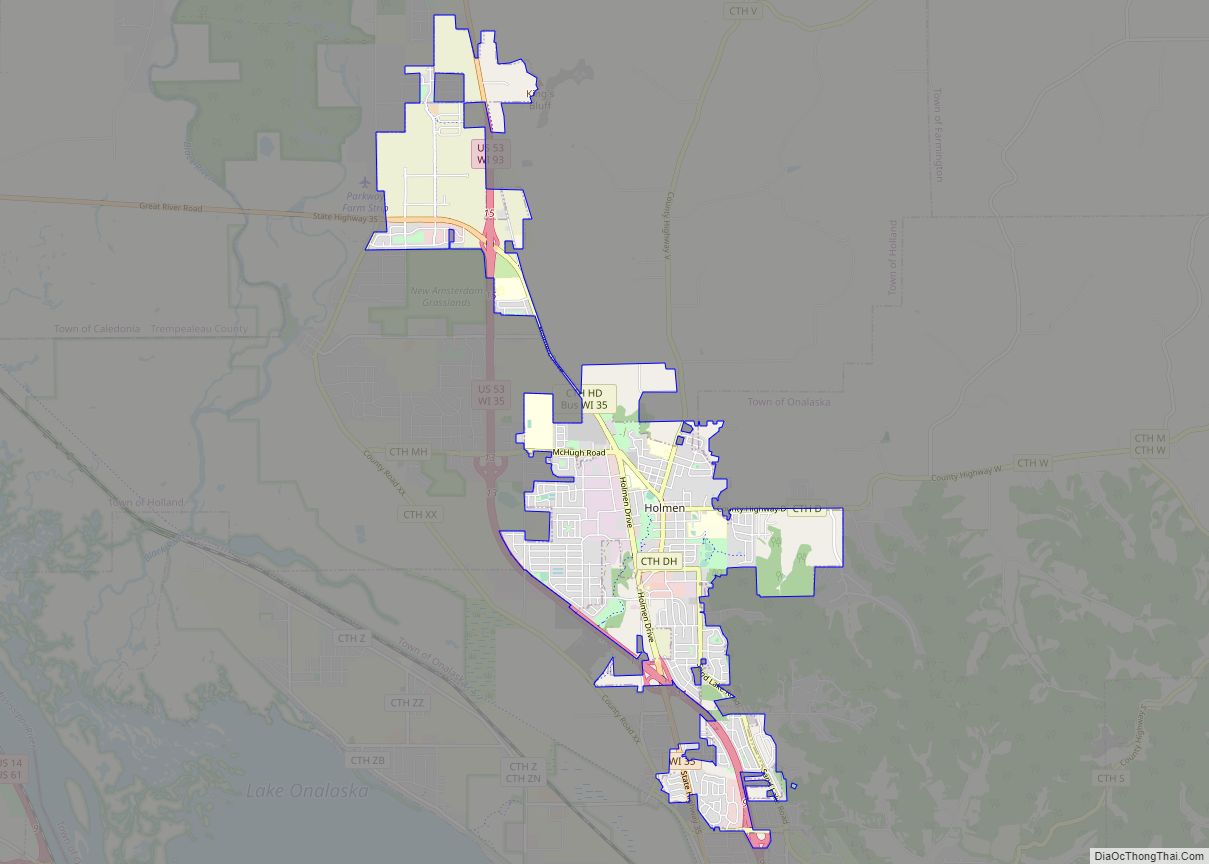
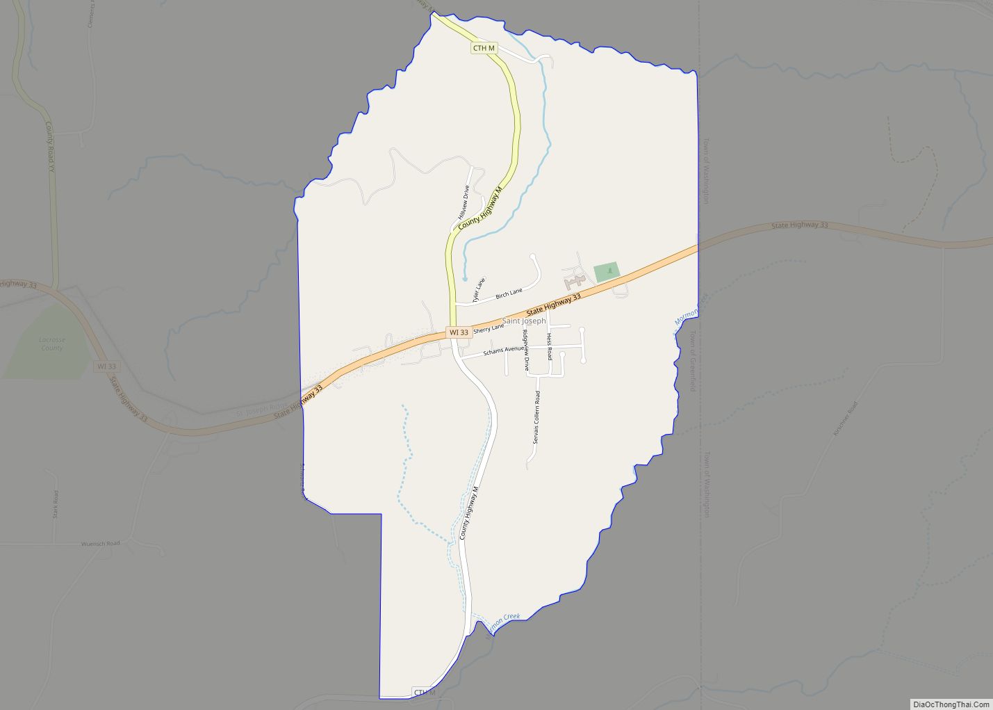
Online Interactive Map
Click on ![]() to view map in "full screen" mode.
to view map in "full screen" mode.
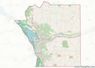
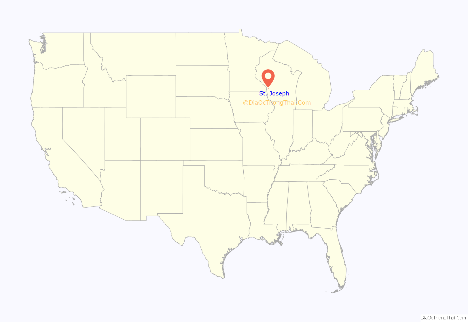
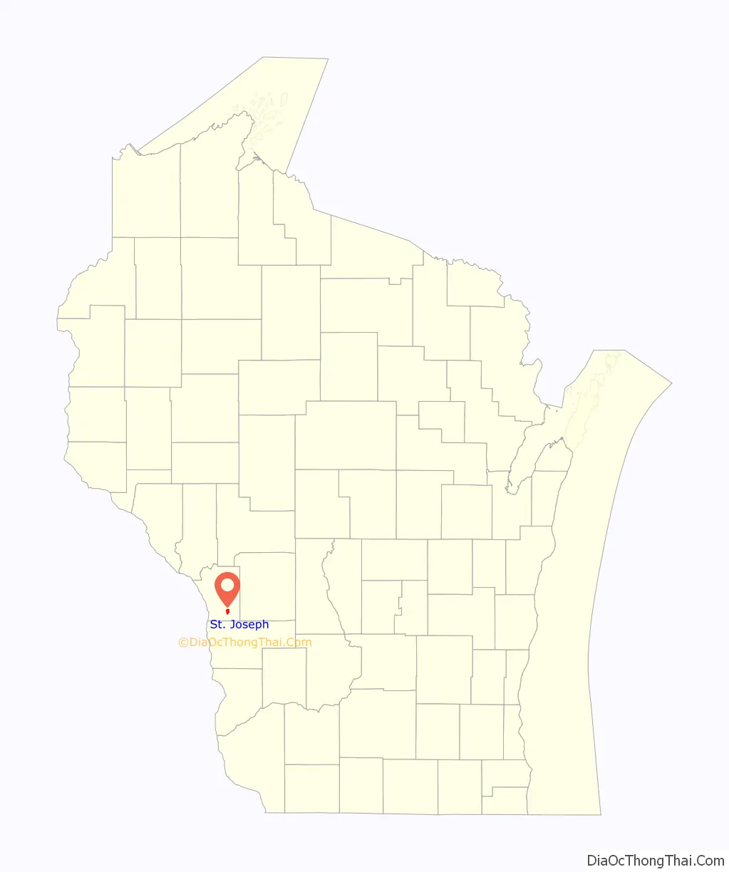
St. Joseph location map. Where is St. Joseph CDP?
St. Joseph Road Map
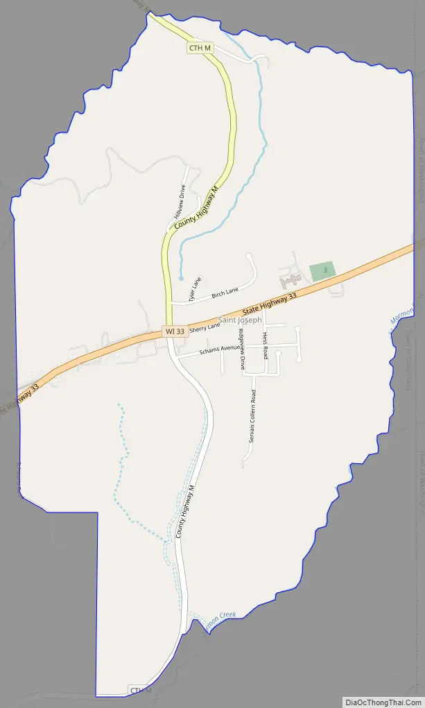
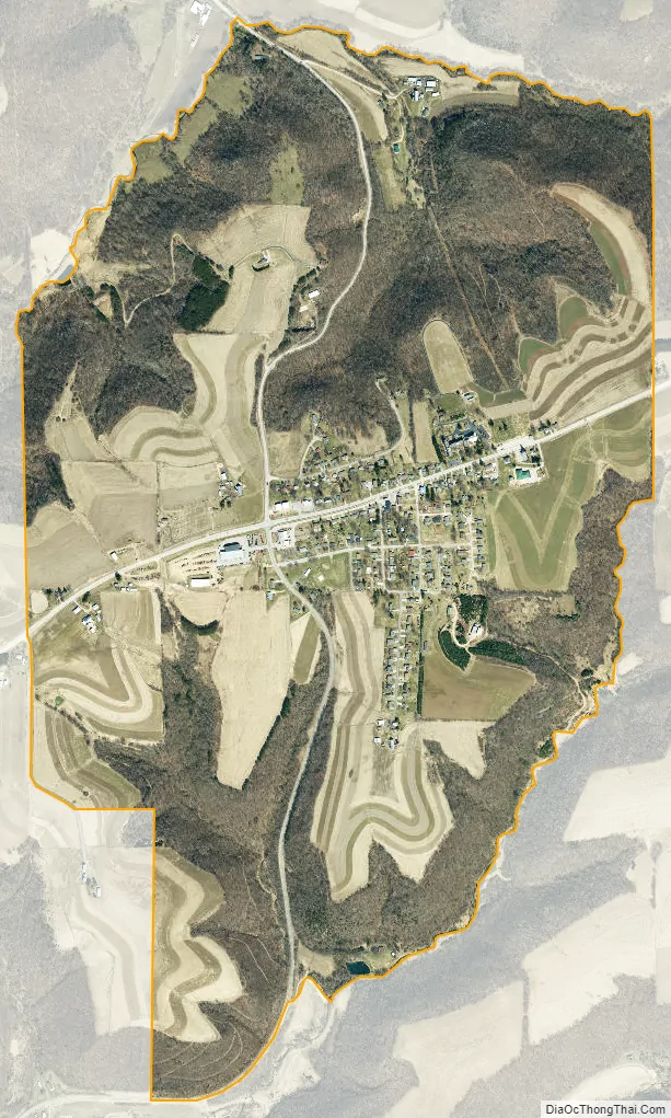
St. Joseph city Satellite Map
Geography
St. Joseph is in southern La Crosse County, in the northeast part of the town of Greenfield. It is bordered to the west by the town of Washington. It is the only named community in the town of Greenfield. Via State Highway 33, it is 12 miles (19 km) east-southeast of La Crosse and 17 miles (27 km) west-northwest of Cashton.
According to the U.S. Census Bureau, the St. Joseph CDP has an area of 1.9 square miles (4.9 km), comprising the actual settlement of St. Joseph plus surrounding rural land. The community sits atop St. Joseph Ridge at an elevation of 1,300 feet (400 m), or 400 feet (120 m) above the surrounding valleys. To the north, St. Joseph Coulee leads to Bostwick Creek, a west-flowing tributary of the La Crosse River, which joins the Mississippi at La Crosse. To the south, tributaries run to Mormon Creek, which flows west directly to the Mississippi south of La Crosse.
See also
Map of Wisconsin State and its subdivision:- Adams
- Ashland
- Barron
- Bayfield
- Brown
- Buffalo
- Burnett
- Calumet
- Chippewa
- Clark
- Columbia
- Crawford
- Dane
- Dodge
- Door
- Douglas
- Dunn
- Eau Claire
- Florence
- Fond du Lac
- Forest
- Grant
- Green
- Green Lake
- Iowa
- Iron
- Jackson
- Jefferson
- Juneau
- Kenosha
- Kewaunee
- La Crosse
- Lafayette
- Lake Michigan
- Lake Superior
- Langlade
- Lincoln
- Manitowoc
- Marathon
- Marinette
- Marquette
- Menominee
- Milwaukee
- Monroe
- Oconto
- Oneida
- Outagamie
- Ozaukee
- Pepin
- Pierce
- Polk
- Portage
- Price
- Racine
- Richland
- Rock
- Rusk
- Saint Croix
- Sauk
- Sawyer
- Shawano
- Sheboygan
- Taylor
- Trempealeau
- Vernon
- Vilas
- Walworth
- Washburn
- Washington
- Waukesha
- Waupaca
- Waushara
- Winnebago
- Wood
- Alabama
- Alaska
- Arizona
- Arkansas
- California
- Colorado
- Connecticut
- Delaware
- District of Columbia
- Florida
- Georgia
- Hawaii
- Idaho
- Illinois
- Indiana
- Iowa
- Kansas
- Kentucky
- Louisiana
- Maine
- Maryland
- Massachusetts
- Michigan
- Minnesota
- Mississippi
- Missouri
- Montana
- Nebraska
- Nevada
- New Hampshire
- New Jersey
- New Mexico
- New York
- North Carolina
- North Dakota
- Ohio
- Oklahoma
- Oregon
- Pennsylvania
- Rhode Island
- South Carolina
- South Dakota
- Tennessee
- Texas
- Utah
- Vermont
- Virginia
- Washington
- West Virginia
- Wisconsin
- Wyoming