Stoughton is a city in Dane County, Wisconsin, United States. It straddles the Yahara River about 20 miles southeast of the state capital, Madison. Stoughton is part of the Madison Metropolitan Statistical Area. As of the 2020 census, the population was 13,173.
Known for its Norwegian heritage, Stoughton hosts a citywide celebration of Syttende Mai, the Norwegian constitution day. Part of the city’s celebration of its Norwegian heritage is the Stoughton Norwegian Dancers dance group, sponsored by Stoughton High School, as well as Norwegian flags and memorabilia displayed throughout the town.
| Name: | Stoughton city |
|---|---|
| LSAD Code: | 25 |
| LSAD Description: | city (suffix) |
| State: | Wisconsin |
| County: | Dane County |
| Elevation: | 876 ft (267 m) |
| Total Area: | 6.35 sq mi (16.45 km²) |
| Land Area: | 6.02 sq mi (15.58 km²) |
| Water Area: | 0.33 sq mi (0.86 km²) |
| Total Population: | 13,173 |
| Population Density: | 2,179.49/sq mi (841.54/km²) |
| ZIP code: | 53589 |
| Area code: | 608 |
| FIPS code: | 5577675 |
| GNISfeature ID: | 1574965 |
| Website: | cityofstoughton.com |
Online Interactive Map
Click on ![]() to view map in "full screen" mode.
to view map in "full screen" mode.
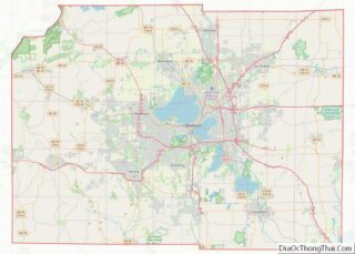
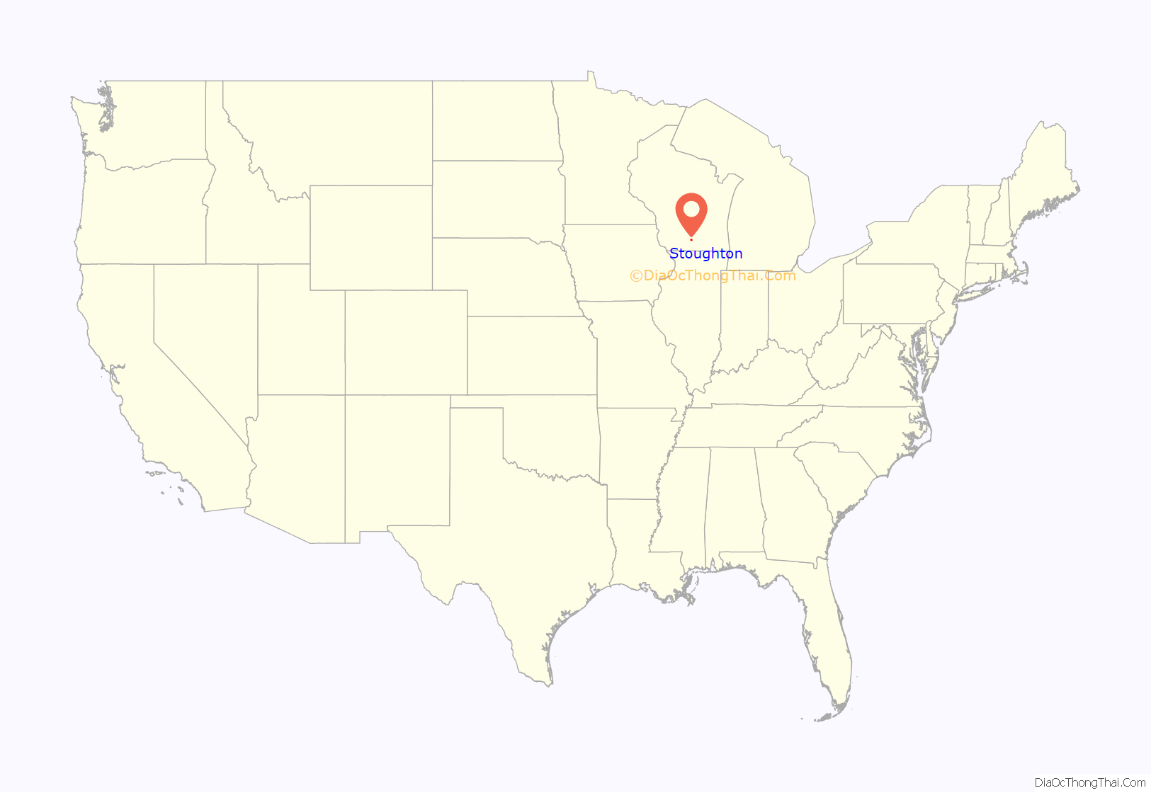
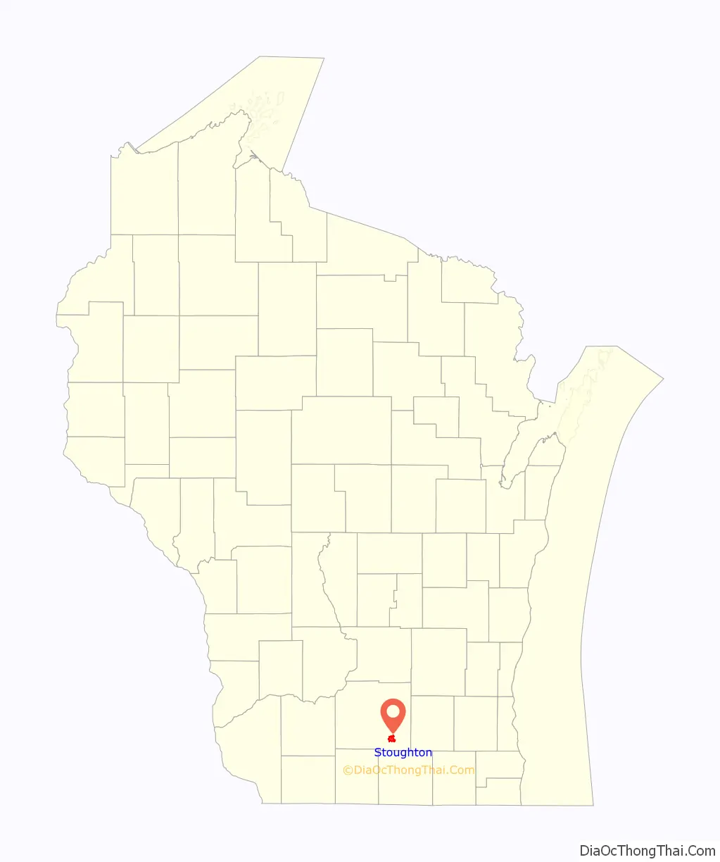
Stoughton location map. Where is Stoughton city?
History
Stoughton was founded in 1847 by Luke Stoughton, an Englishman from Vermont. Many Norwegian immigrants settled in the town from 1865 through the early 1900s.
Stoughton claims to be the birthplace of the “coffee break”, and hosts a small yearly parade to celebrate the distinction.
For much of its history, Stoughton has been Dane County’s second-largest and economically important city, after Madison.
In 1919, the Stoughton Wagon Company began putting custom wagon bodies on Model T chassis; by 1929 Ford was by far the biggest seller of station wagons.
On August 18, 2005, an F3 tornado cut a 10-mile path across rural subdivisions and farms north of Stoughton, killing one person and damaging hundreds of homes.
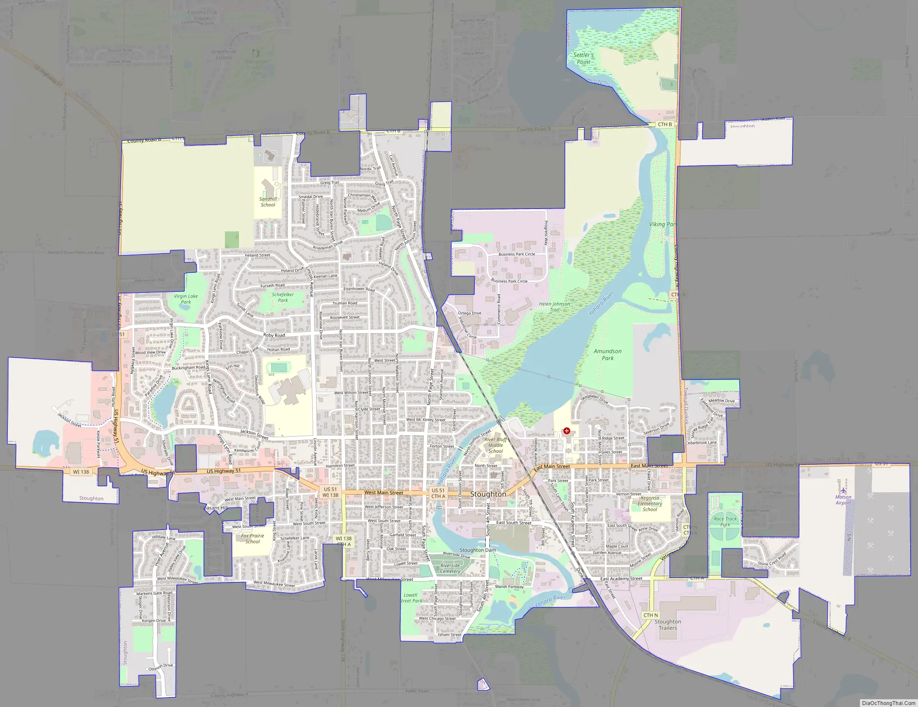
Stoughton Road Map
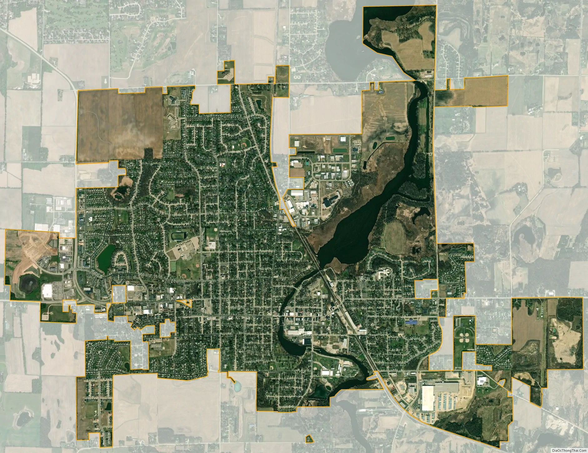
Stoughton city Satellite Map
Geography
According to the United States Census Bureau, the city has a total area of 5.09 square miles (13.18 km), of which, 4.92 square miles (12.74 km) is land and 0.17 square miles (0.44 km) is water.
See also
Map of Wisconsin State and its subdivision:- Adams
- Ashland
- Barron
- Bayfield
- Brown
- Buffalo
- Burnett
- Calumet
- Chippewa
- Clark
- Columbia
- Crawford
- Dane
- Dodge
- Door
- Douglas
- Dunn
- Eau Claire
- Florence
- Fond du Lac
- Forest
- Grant
- Green
- Green Lake
- Iowa
- Iron
- Jackson
- Jefferson
- Juneau
- Kenosha
- Kewaunee
- La Crosse
- Lafayette
- Lake Michigan
- Lake Superior
- Langlade
- Lincoln
- Manitowoc
- Marathon
- Marinette
- Marquette
- Menominee
- Milwaukee
- Monroe
- Oconto
- Oneida
- Outagamie
- Ozaukee
- Pepin
- Pierce
- Polk
- Portage
- Price
- Racine
- Richland
- Rock
- Rusk
- Saint Croix
- Sauk
- Sawyer
- Shawano
- Sheboygan
- Taylor
- Trempealeau
- Vernon
- Vilas
- Walworth
- Washburn
- Washington
- Waukesha
- Waupaca
- Waushara
- Winnebago
- Wood
- Alabama
- Alaska
- Arizona
- Arkansas
- California
- Colorado
- Connecticut
- Delaware
- District of Columbia
- Florida
- Georgia
- Hawaii
- Idaho
- Illinois
- Indiana
- Iowa
- Kansas
- Kentucky
- Louisiana
- Maine
- Maryland
- Massachusetts
- Michigan
- Minnesota
- Mississippi
- Missouri
- Montana
- Nebraska
- Nevada
- New Hampshire
- New Jersey
- New Mexico
- New York
- North Carolina
- North Dakota
- Ohio
- Oklahoma
- Oregon
- Pennsylvania
- Rhode Island
- South Carolina
- South Dakota
- Tennessee
- Texas
- Utah
- Vermont
- Virginia
- Washington
- West Virginia
- Wisconsin
- Wyoming