Valders is a village in Manitowoc County, Wisconsin, United States. The population was 962 at the 2010 census.
| Name: | Valders village |
|---|---|
| LSAD Code: | 47 |
| LSAD Description: | village (suffix) |
| State: | Wisconsin |
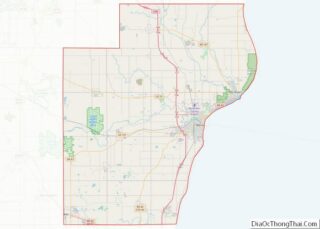
| County: | Manitowoc County |
| Elevation: | 833 ft (254 m) |
| Total Area: | 1.44 sq mi (3.73 km²) |
| Land Area: | 1.44 sq mi (3.73 km²) |
| Water Area: | 0.00 sq mi (0.01 km²) |
| Total Population: | 962 |
| Population Density: | 639.33/sq mi (246.87/km²) |
| Area code: | 920 |
| FIPS code: | 5582200 |
| GNISfeature ID: | 1576014 |
| Website: | www.valders.org |
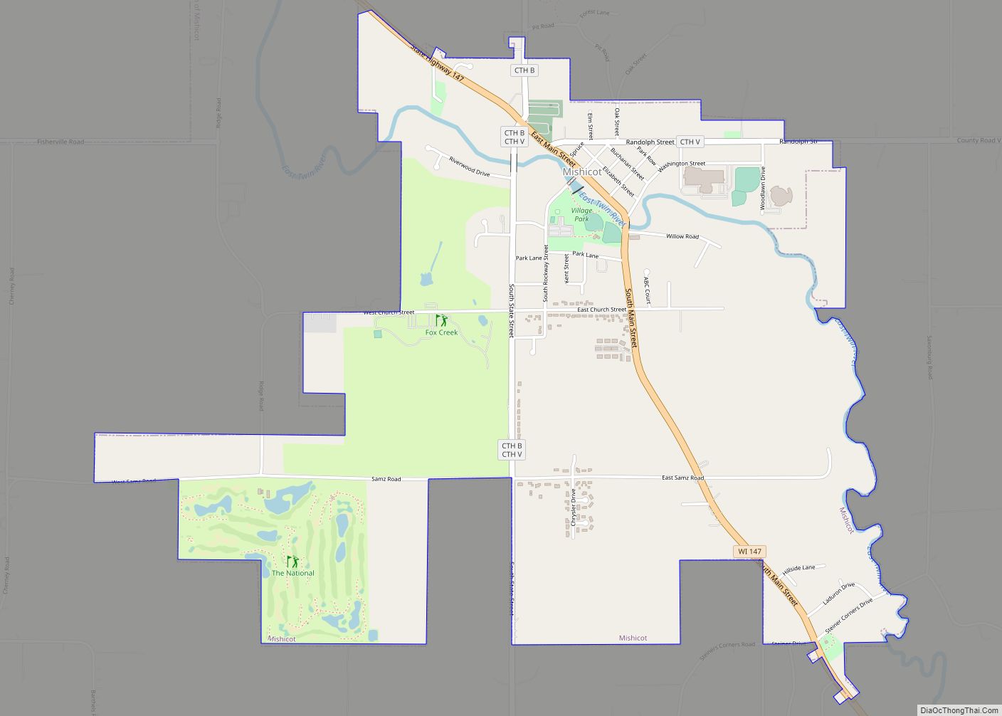
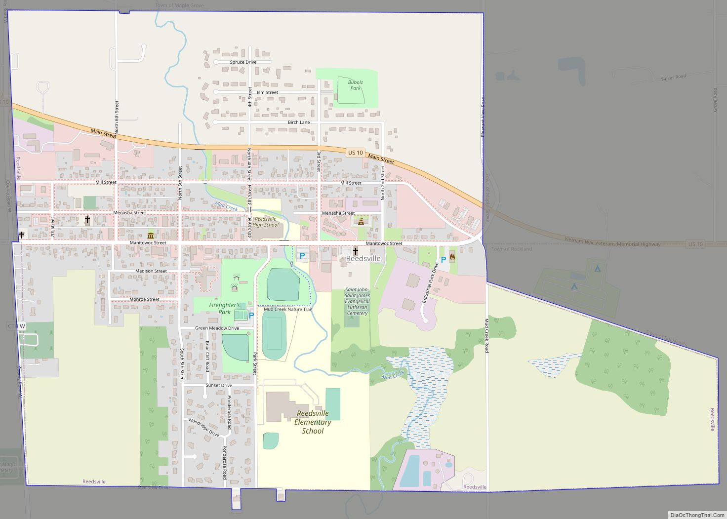
Online Interactive Map
Click on ![]() to view map in "full screen" mode.
to view map in "full screen" mode.
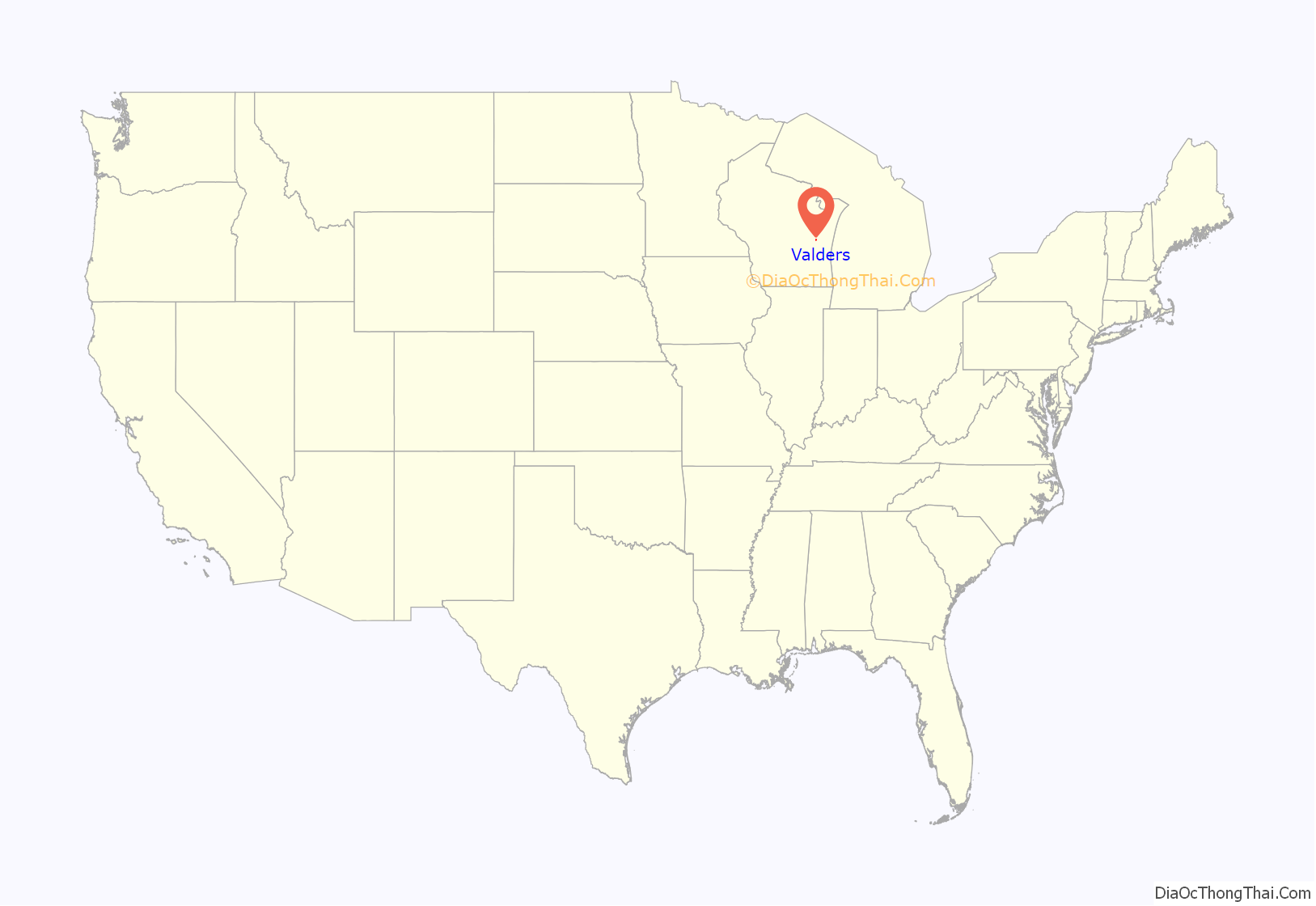
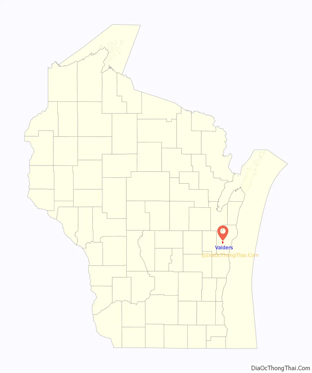
Valders location map. Where is Valders village?
History
Valders was settled in the 1850s by immigrants from the Valdres mountainous region of Norway. The largest town in Valdres is Fagernes, but many immigrants arriving in Wisconsin came from the valleys of Vestre Slidre and Øystre Slidre, when hunger (sult) in these rocky hillside farms was far from unheard of. Valders did not really develop as a village until the arrival of the railroad in 1896, the traditional year of its founding. It was incorporated as a village under Wisconsin law in 1921, with William F. Christel as the first village president. As the village was founded by Norwegians, it was natural that the first churches were Lutheran: Valders Lutheran parish, Our Savior Lutheran parish, and Gjerpin Lutheran parish. These were later combined into Faith Lutheran parish (ELCA). There is also a small Protestant Conference parish. After the arrival of the railroad, many German settlers moved in who were primarily Catholic, but no parish was developed for them. To this day, there is still a significant population of Catholics, including most of the area farmers, who worship at St. Gregory in St. Nazianz to the south, St. Mary of the Immaculate Conception in Clarks Mills to the north (presently joined to St. Michael in Whitelaw), or St. Thomas the Apostle in Newton to the east.
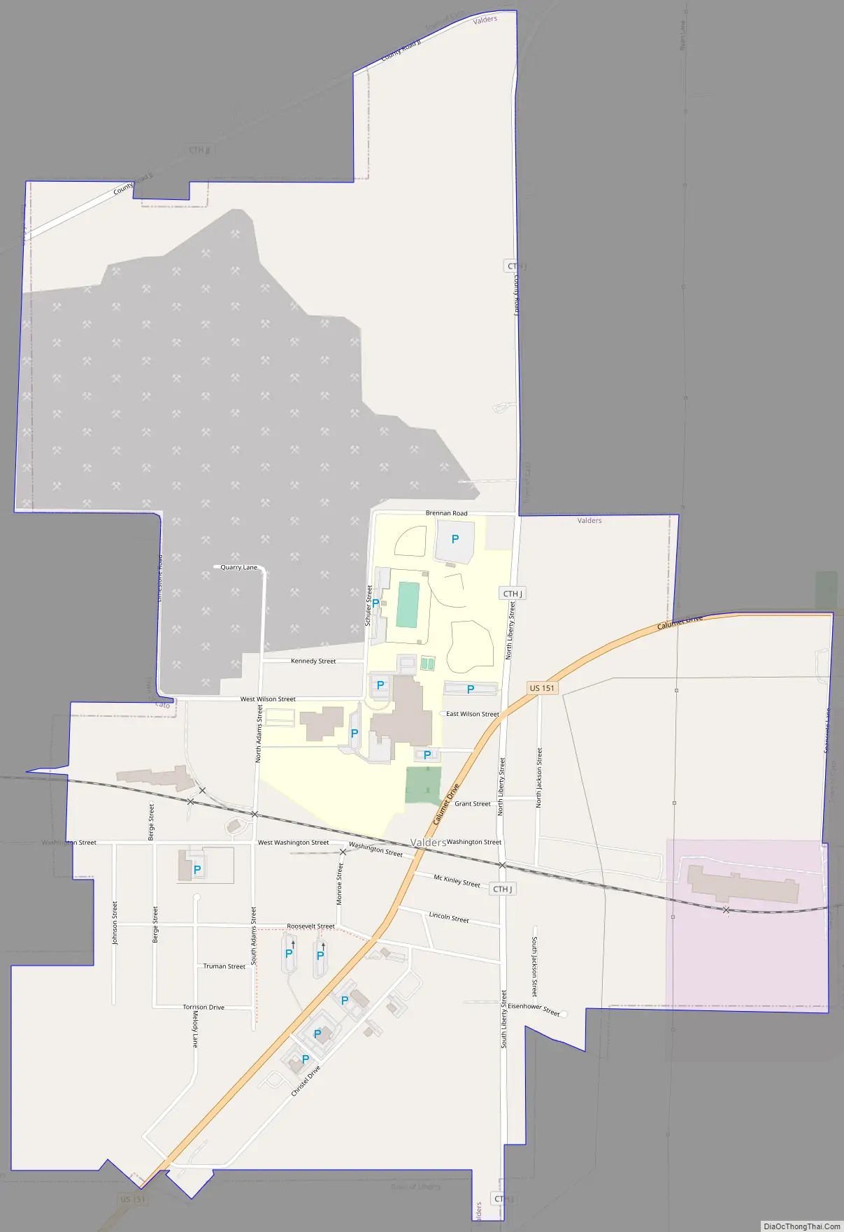
Valders Road Map
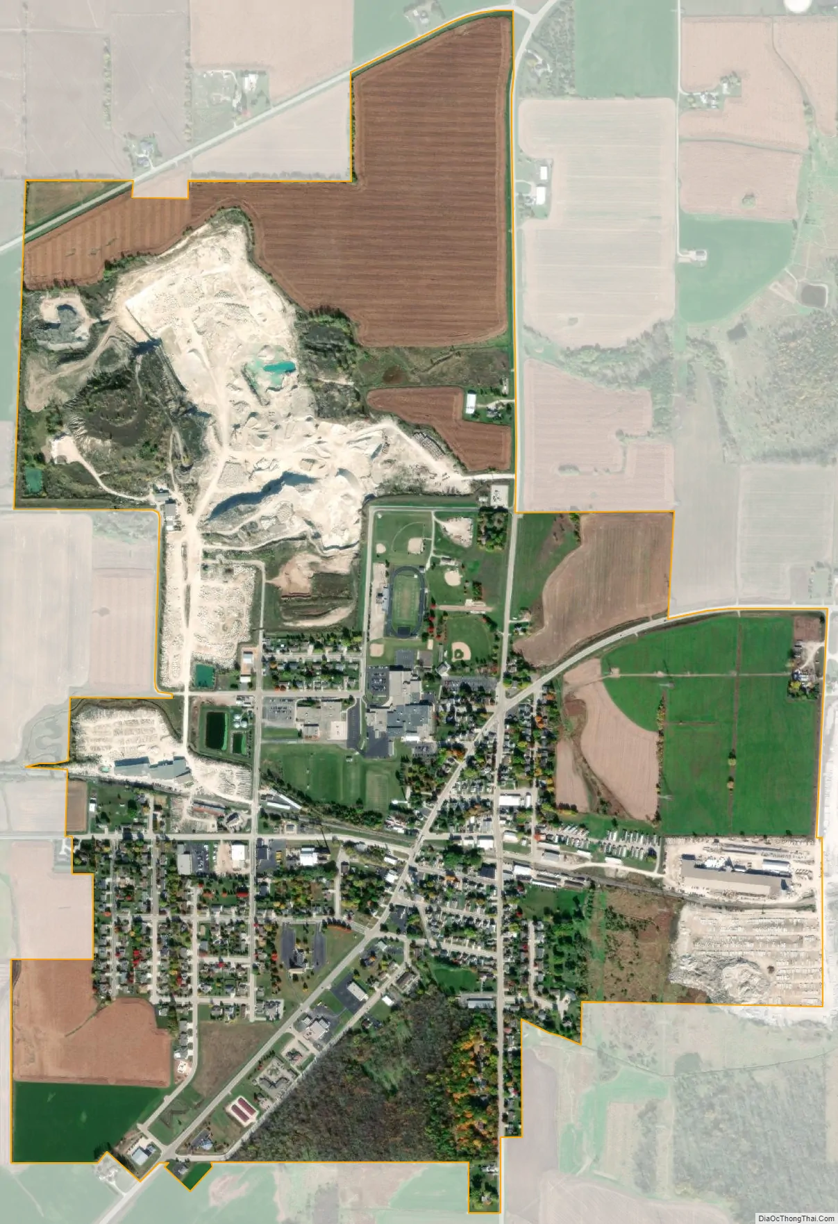
Valders city Satellite Map
Geography
Valders is located on U.S. Route 151 two miles east of the Manitowoc River. The city of Manitowoc lies ten miles to the east on Lake Michigan.
According to the United States Census Bureau, the village has a total area of 1.47 square miles (3.81 km), all of it land.
See also
Map of Wisconsin State and its subdivision:- Adams
- Ashland
- Barron
- Bayfield
- Brown
- Buffalo
- Burnett
- Calumet
- Chippewa
- Clark
- Columbia
- Crawford
- Dane
- Dodge
- Door
- Douglas
- Dunn
- Eau Claire
- Florence
- Fond du Lac
- Forest
- Grant
- Green
- Green Lake
- Iowa
- Iron
- Jackson
- Jefferson
- Juneau
- Kenosha
- Kewaunee
- La Crosse
- Lafayette
- Lake Michigan
- Lake Superior
- Langlade
- Lincoln
- Manitowoc
- Marathon
- Marinette
- Marquette
- Menominee
- Milwaukee
- Monroe
- Oconto
- Oneida
- Outagamie
- Ozaukee
- Pepin
- Pierce
- Polk
- Portage
- Price
- Racine
- Richland
- Rock
- Rusk
- Saint Croix
- Sauk
- Sawyer
- Shawano
- Sheboygan
- Taylor
- Trempealeau
- Vernon
- Vilas
- Walworth
- Washburn
- Washington
- Waukesha
- Waupaca
- Waushara
- Winnebago
- Wood
- Alabama
- Alaska
- Arizona
- Arkansas
- California
- Colorado
- Connecticut
- Delaware
- District of Columbia
- Florida
- Georgia
- Hawaii
- Idaho
- Illinois
- Indiana
- Iowa
- Kansas
- Kentucky
- Louisiana
- Maine
- Maryland
- Massachusetts
- Michigan
- Minnesota
- Mississippi
- Missouri
- Montana
- Nebraska
- Nevada
- New Hampshire
- New Jersey
- New Mexico
- New York
- North Carolina
- North Dakota
- Ohio
- Oklahoma
- Oregon
- Pennsylvania
- Rhode Island
- South Carolina
- South Dakota
- Tennessee
- Texas
- Utah
- Vermont
- Virginia
- Washington
- West Virginia
- Wisconsin
- Wyoming