Manitowoc (/ˈmænɪtəwɔːk/) is a city in and the county seat of Manitowoc County, Wisconsin, United States. The city is located on Lake Michigan at the mouth of the Manitowoc River. According to the 2020 census, Manitowoc had a population of 34,626, with over 50,000 residents in the surrounding communities.
| Name: | Manitowoc city |
|---|---|
| LSAD Code: | 25 |
| LSAD Description: | city (suffix) |
| State: | Wisconsin |
| County: | Manitowoc County |
| Total Area: | 18.14 sq mi (46.98 km²) |
| Land Area: | 17.78 sq mi (46.05 km²) |
| Water Area: | 0.36 sq mi (0.93 km²) |
| Total Population: | 34,626 |
| Population Density: | 1,900/sq mi (740/km²) |
| Area code: | 920 |
| FIPS code: | 5548500 |
| Website: | www.manitowoc.org |
Online Interactive Map
Click on ![]() to view map in "full screen" mode.
to view map in "full screen" mode.
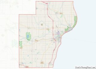
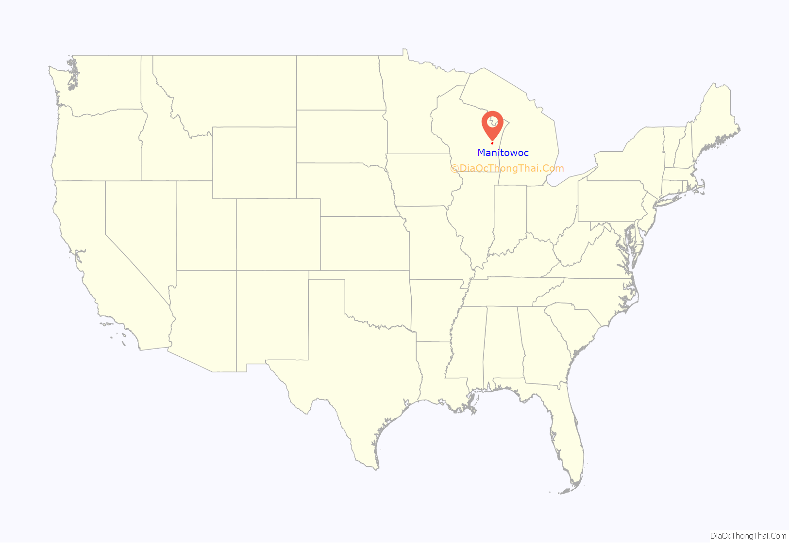
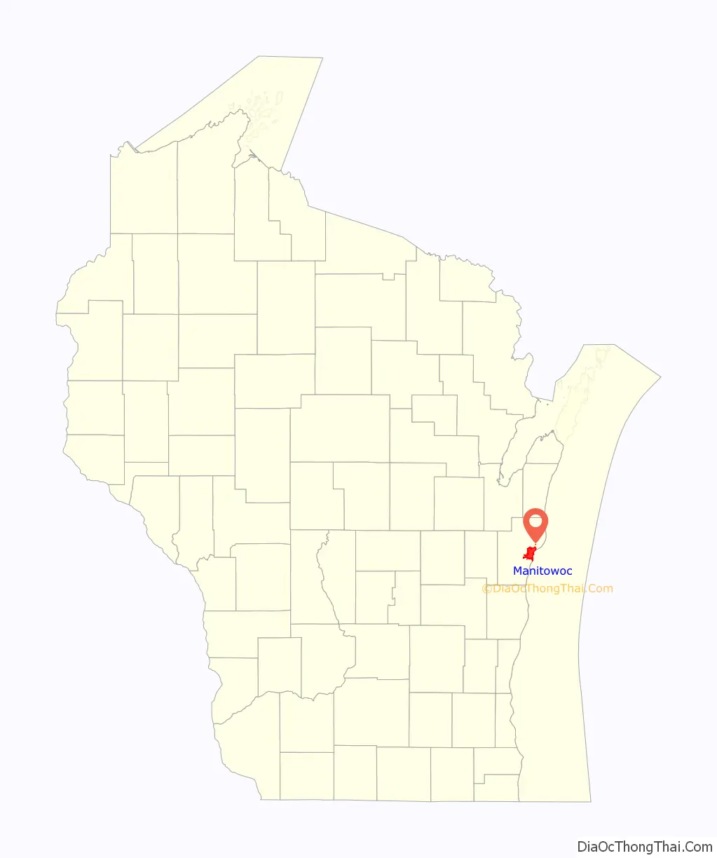
Manitowoc location map. Where is Manitowoc city?
History
Purported to mean dwelling of the great spirit, Manitowoc derived its name from either the Ojibwe word manidoowaak(wag), meaning spirit-spawn(s), or manidoowaak(oog), meaning spirit-wood(s), or manidoowak(iin), meaning spirit-land(s). In the Menominee language, it is called Manetōwak, which means “place of the spirits”. The Menominee ceded this land to the United States in the 1836 Treaty of the Cedars, following years of negotiations over how to accommodate the Oneida, Stockbridge-Munsee, and Brothertown peoples who had been removed from New York to Wisconsin. In 1838, an act of the Territorial Legislature separated Manitowoc County from Brown County, keeping the native name for the region.
The first Europeans in the area were French fur traders who arrived in 1673. The Northwest Fur Company established a trading post in 1795. In 1835, before the transfer of land from the Menominee Nation to the United States, President Andrew Jackson authorized land sales for the region, drawing the interest of land speculators. William Jones and Louis Fizette were the two first recorded buyers on August 3, 1835, with the majority of the land being procured by the Chicago firm Jones, King, & Co. Benjamin Jones, brother of William, took the Wisconsin property as his share and is considered the founder of Manitowoc. Early immigrant groups included Germans, Norwegians, British, Irish, and Canadians.
The first school in Manitowoc was held in the Jones warehouse, with S. M. Peake instructing the twelve children of the community. The first religious organization in the county, St. James’ Episcopal Church, first met in 1841. Manitowoc was chartered as a village on March 6, 1851 and on March 12, 1870, was incorporated as a city. Manitowoc replaced neighboring Manitowoc Rapids as the county seat of Manitowoc County in 1853. The current Manitowoc County Courthouse was built in the city in 1906.
In 1847, Joseph Edwards built the first schooner in the area, the Citizen, a modest precursor to the shipbuilding industry that produced schooners and clippers used for fishing and trading in the Great Lakes and beyond the St. Lawrence River. In addition, landing craft, tankers and submarines became the local contributions to U.S. efforts in World War II.
On September 5, 1962, a 20-pound (9.1 kg) piece of the seven-ton Sputnik 4 crashed on North 8th Street. Sputnik 4 was a USSR satellite, part of the Sputnik program and a test-flight of the Vostok spacecraft that would be used for the first human spaceflight. It was launched on May 15, 1960.
A bug in the guidance system had pointed the capsule in the wrong direction, so instead of dropping into the atmosphere the satellite moved into a higher orbit. It re-entered the atmosphere on or about September 5, 1962. A cast was made from the original piece before the Soviets claimed it, and the cast was displayed at the Rahr West Art Museum. A customer in a nearby art gallery jokingly suggested that the city should hold a festival to celebrate the crash. The city held the first Sputnikfest in 2008, which was organized by the head of both museums.
Manitowoc was historically a sundown town that prohibited African Americans from staying overnight. In 1968, the policy forced a visiting Gwendolyn Brooks to stay at Holy Family College, just outside of Manitowoc, after a poetry reading.
Manitowoc is home to the Wisconsin Maritime Museum, and is one endpoint of the ferry route of the SS Badger, which connects U.S. Route 10 to Ludington, Michigan.
Since the late 1990s, several new shopping centers have opened in the city, mostly on the southwest side of the city along Interstate 43, including the new Harbor Town Center shopping complex. The downtown area has also seen a resurgence, with several new restaurants opening, and the recent announcement of new $100,000+ condominiums on the Manitowoc River, along with a completion of the riverwalk trail. The bulk of the redevelopment in the city has been undertaken by the public/private partnership the Manitowoc County Economic Development Corporation.
In December 2022, Manitowoc was designated Wisconsin’s World War II Heritage City by the US National Park Service.
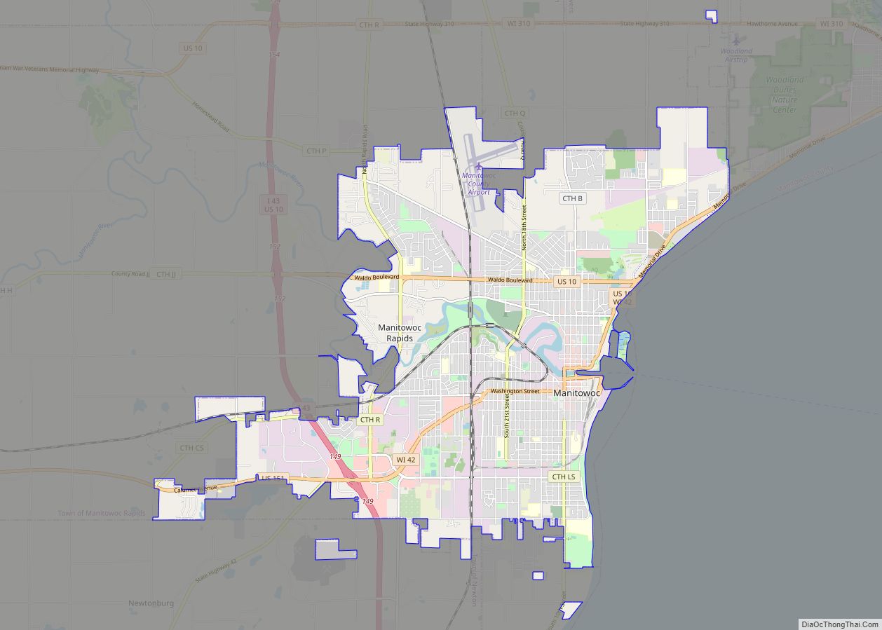
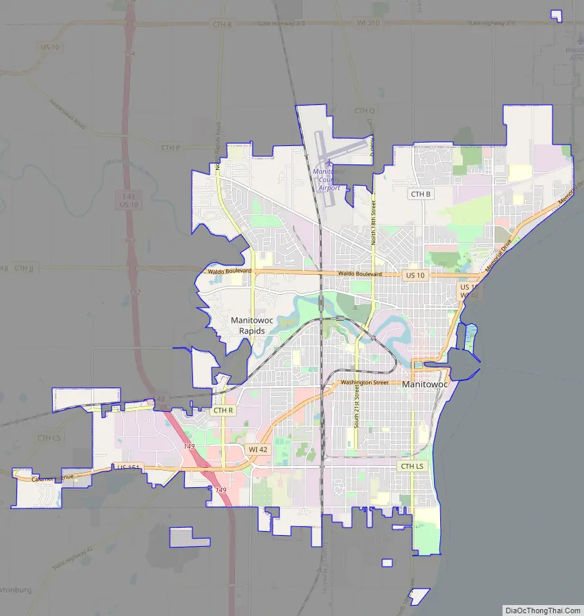
Manitowoc Road Map
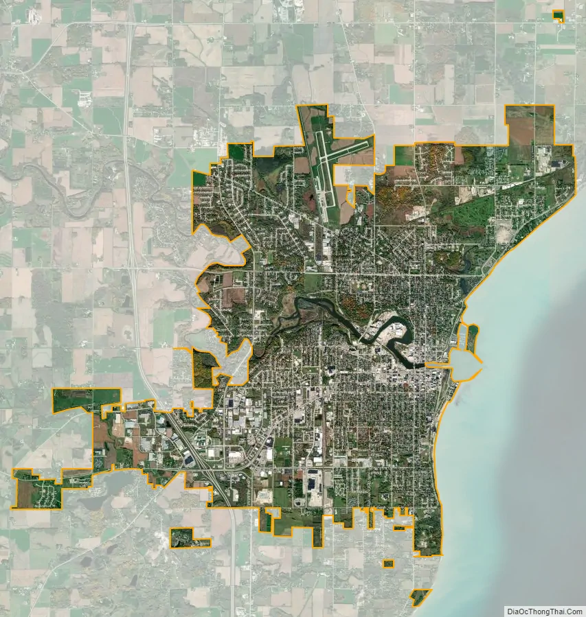
Manitowoc city Satellite Map
Geography
According to the United States Census Bureau, the city has a total area of 17.99 square miles (46.59 km), of which 17.63 square miles (45.66 km) is land and 0.36 square miles (0.93 km) is water.
The city is located at 44°5′47″N 87°40′30″W / 44.09639°N 87.67500°W / 44.09639; -87.67500, on Lake Michigan at the mouth of the Manitowoc River.
The nearest other cities are Green Bay, 40 miles (64 km) away, Sheboygan 28 miles (45 km) away, Appleton 47 miles (76 km) away, and Milwaukee 80 miles (130 km) away. Together with Two Rivers and the surrounding towns, the Manitowoc micropolitan area was, according to the 2000 census, home to 52,197 people. The city forms the core of the United States Census Bureau’s Manitowoc Micropolitan Statistical Area, which includes all of Manitowoc County (2000 population: 82,887).
Climate
Manitowoc has a humid continental climate. Lake Michigan has a moderating effect on its climate compared to regions more inland, making it warmer in the winter and cooler in the summer than most nearby cities. Manitowoc has a yearly average high of 52 °F (11 °C) and a yearly average low of 38.5 °F (4 °C). Manitowoc also has an extreme high and extreme low of 105 °F (41 °C) and −27 °F (−33 °C), respectively. The city receives an average of 31.17 in (792 mm) of precipitation every year, in the form of rain and snow, with rain being more prevalent in months April–November, and snow being more prevalent in months December–March. Precipitation is spread fairly evenly throughout the year, with the wettest month being August, with 3.58 in (91 mm) of precipitation, and the driest month being February, with 1.38 in (35 mm) of precipitation.
See also
Map of Wisconsin State and its subdivision:- Adams
- Ashland
- Barron
- Bayfield
- Brown
- Buffalo
- Burnett
- Calumet
- Chippewa
- Clark
- Columbia
- Crawford
- Dane
- Dodge
- Door
- Douglas
- Dunn
- Eau Claire
- Florence
- Fond du Lac
- Forest
- Grant
- Green
- Green Lake
- Iowa
- Iron
- Jackson
- Jefferson
- Juneau
- Kenosha
- Kewaunee
- La Crosse
- Lafayette
- Lake Michigan
- Lake Superior
- Langlade
- Lincoln
- Manitowoc
- Marathon
- Marinette
- Marquette
- Menominee
- Milwaukee
- Monroe
- Oconto
- Oneida
- Outagamie
- Ozaukee
- Pepin
- Pierce
- Polk
- Portage
- Price
- Racine
- Richland
- Rock
- Rusk
- Saint Croix
- Sauk
- Sawyer
- Shawano
- Sheboygan
- Taylor
- Trempealeau
- Vernon
- Vilas
- Walworth
- Washburn
- Washington
- Waukesha
- Waupaca
- Waushara
- Winnebago
- Wood
- Alabama
- Alaska
- Arizona
- Arkansas
- California
- Colorado
- Connecticut
- Delaware
- District of Columbia
- Florida
- Georgia
- Hawaii
- Idaho
- Illinois
- Indiana
- Iowa
- Kansas
- Kentucky
- Louisiana
- Maine
- Maryland
- Massachusetts
- Michigan
- Minnesota
- Mississippi
- Missouri
- Montana
- Nebraska
- Nevada
- New Hampshire
- New Jersey
- New Mexico
- New York
- North Carolina
- North Dakota
- Ohio
- Oklahoma
- Oregon
- Pennsylvania
- Rhode Island
- South Carolina
- South Dakota
- Tennessee
- Texas
- Utah
- Vermont
- Virginia
- Washington
- West Virginia
- Wisconsin
- Wyoming