Friendly is a town in Tyler County, West Virginia, United States. The population was 100 at the 2020 census.
| Name: | Friendly town |
|---|---|
| LSAD Code: | 43 |
| LSAD Description: | town (suffix) |
| State: | West Virginia |
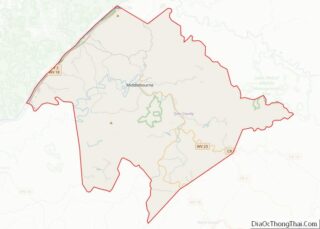
| County: | Tyler County |
| Elevation: | 627 ft (191 m) |
| Total Area: | 0.10 sq mi (0.26 km²) |
| Land Area: | 0.10 sq mi (0.26 km²) |
| Water Area: | 0.00 sq mi (0.00 km²) |
| Total Population: | 100 |
| Population Density: | 1,198.02/sq mi (462.73/km²) |
| ZIP code: | 26146 |
| Area code: | 304 |
| FIPS code: | 5429404 |
| GNISfeature ID: | 1554513 |
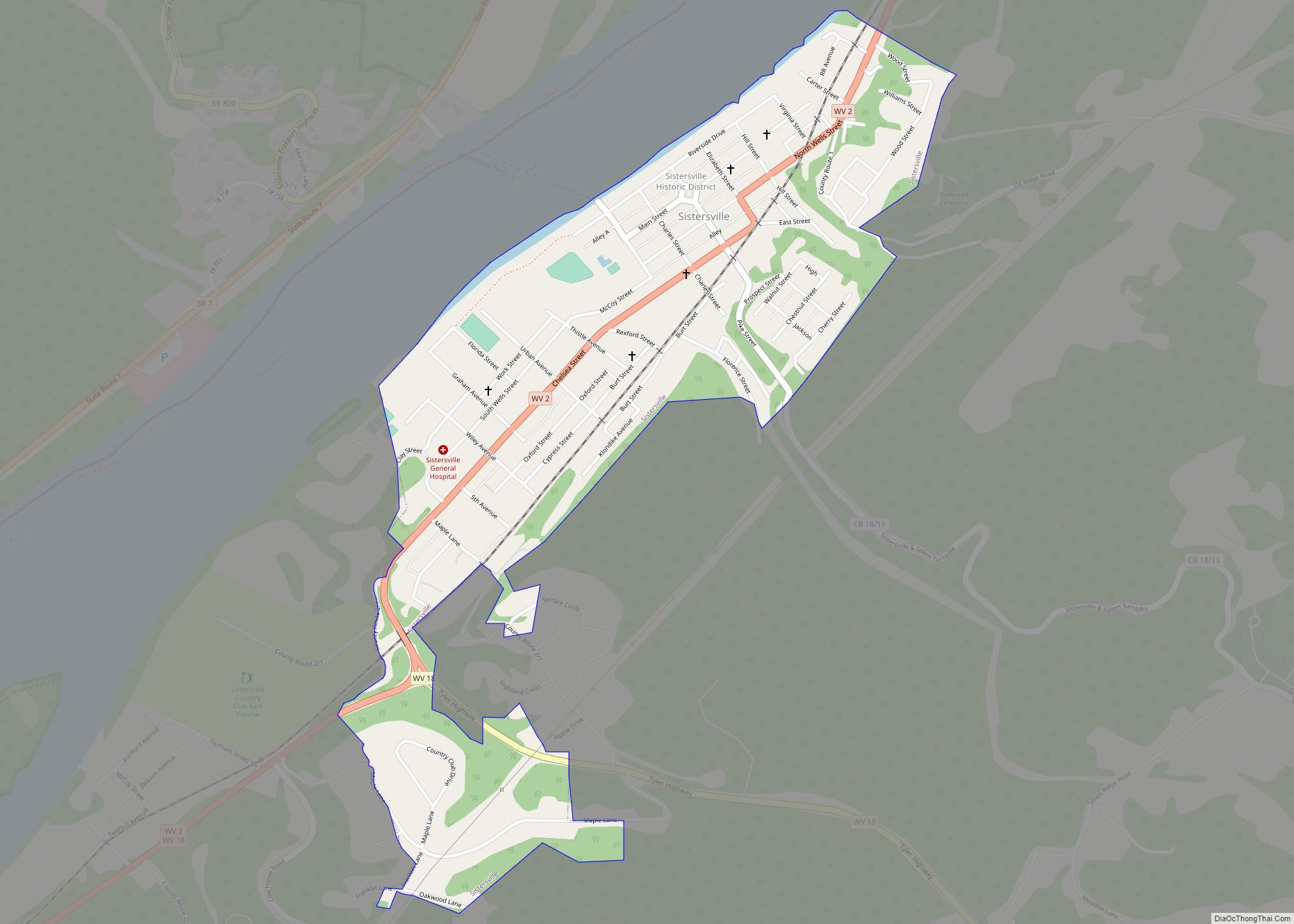
Online Interactive Map
Click on ![]() to view map in "full screen" mode.
to view map in "full screen" mode.
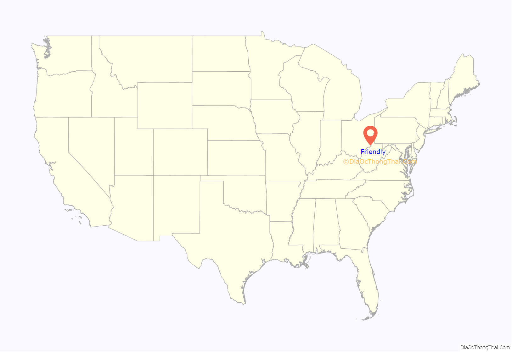
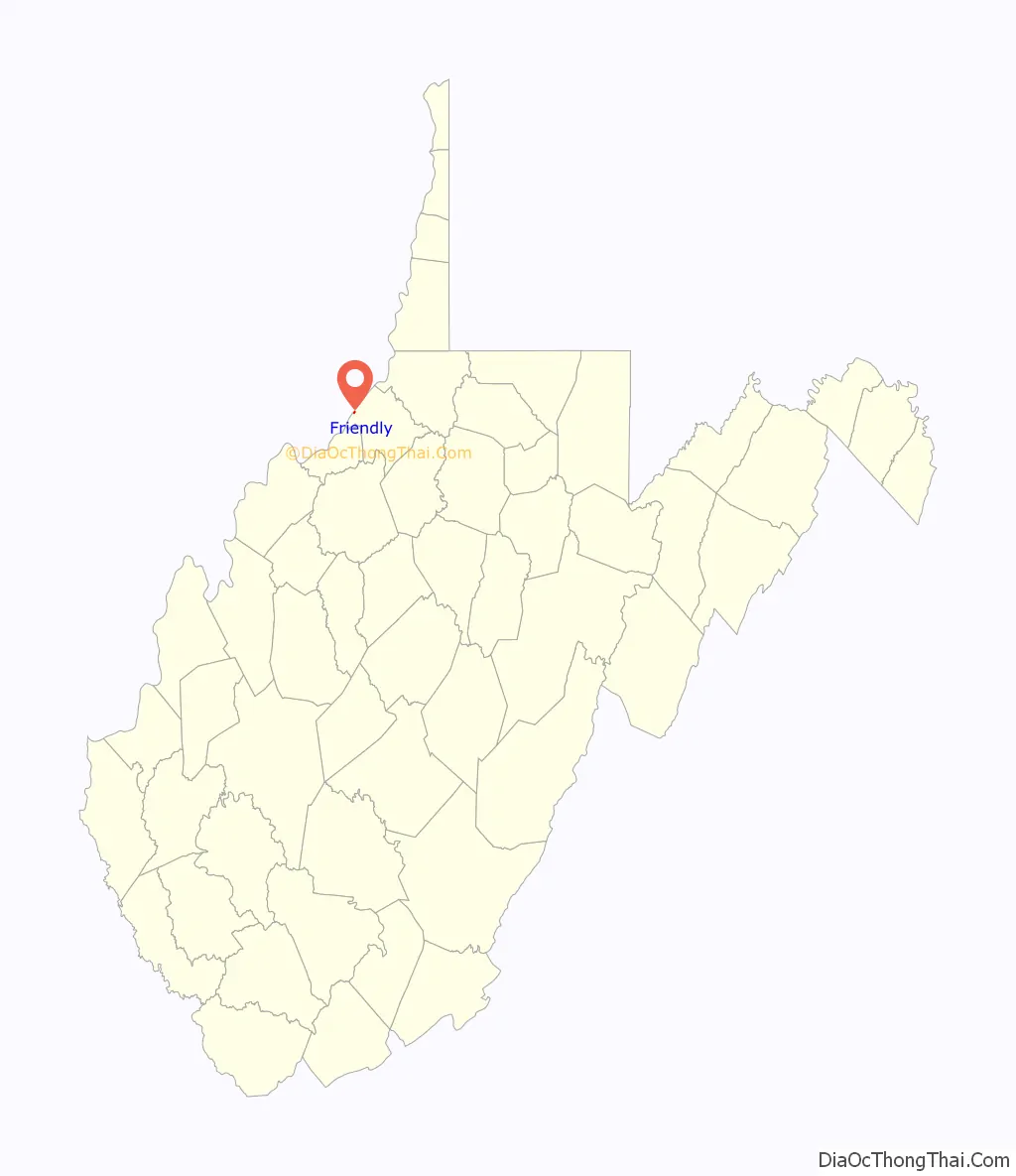
Friendly location map. Where is Friendly town?
History
The town was likely named for Friend Cochrane Williamson, an early settler. Friendly was incorporated in 1898.
It is the setting of the novel Shiloh.
The 1884 Heirloom tomato variety was said to be discovered by James Lyde Williamson growing in a pile of flood debris along the Ohio River near Friendly, after the Great Flood of 1884.
In 1903 the Parkersburg and Ohio Valley Electric Railway began to build a major electric interurban railway between Wheeling and Parkersburg. It only opened five miles (8 km) between Sistersville and Friendly, and operated until 1918. Friendly was claimed to have been one of the smallest settlements in the US with a dedicated interurban service, since it only had 217 residents at the time.
The Friendly City Building and Jail has been listed on the National Register of Historic Places.
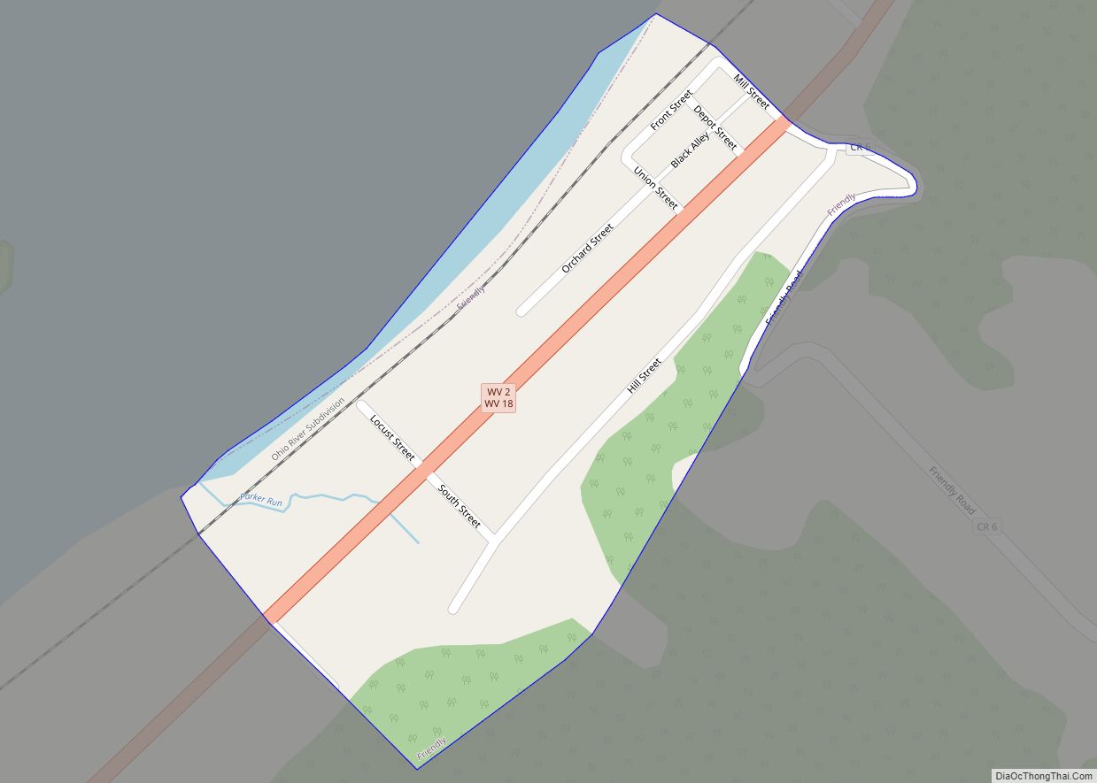
Friendly Road Map

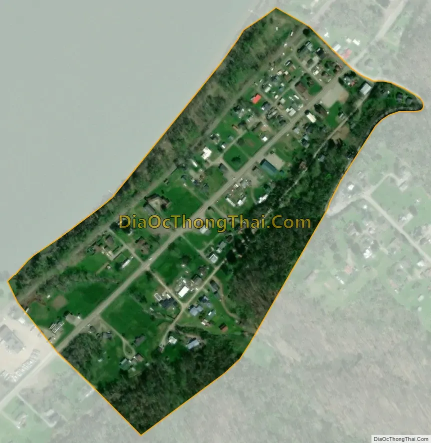
Friendly city Satellite Map
Geography
Friendly is located at 39°30′54″N 81°3′40″W / 39.51500°N 81.06111°W / 39.51500; -81.06111 (39.514888, -81.061011), along the Ohio River; directly across from Matamoras, Ohio.
According to the United States Census Bureau, the town has a total area of 0.09 square miles (0.23 km), all land.
See also
Map of West Virginia State and its subdivision:- Barbour
- Berkeley
- Boone
- Braxton
- Brooke
- Cabell
- Calhoun
- Clay
- Doddridge
- Fayette
- Gilmer
- Grant
- Greenbrier
- Hampshire
- Hancock
- Hardy
- Harrison
- Jackson
- Jefferson
- Kanawha
- Lewis
- Lincoln
- Logan
- Marion
- Marshall
- Mason
- McDowell
- Mercer
- Mineral
- Mingo
- Monongalia
- Monroe
- Morgan
- Nicholas
- Ohio
- Pendleton
- Pleasants
- Pocahontas
- Preston
- Putnam
- Raleigh
- Randolph
- Ritchie
- Roane
- Summers
- Taylor
- Tucker
- Tyler
- Upshur
- Wayne
- Webster
- Wetzel
- Wirt
- Wood
- Wyoming
- Alabama
- Alaska
- Arizona
- Arkansas
- California
- Colorado
- Connecticut
- Delaware
- District of Columbia
- Florida
- Georgia
- Hawaii
- Idaho
- Illinois
- Indiana
- Iowa
- Kansas
- Kentucky
- Louisiana
- Maine
- Maryland
- Massachusetts
- Michigan
- Minnesota
- Mississippi
- Missouri
- Montana
- Nebraska
- Nevada
- New Hampshire
- New Jersey
- New Mexico
- New York
- North Carolina
- North Dakota
- Ohio
- Oklahoma
- Oregon
- Pennsylvania
- Rhode Island
- South Carolina
- South Dakota
- Tennessee
- Texas
- Utah
- Vermont
- Virginia
- Washington
- West Virginia
- Wisconsin
- Wyoming