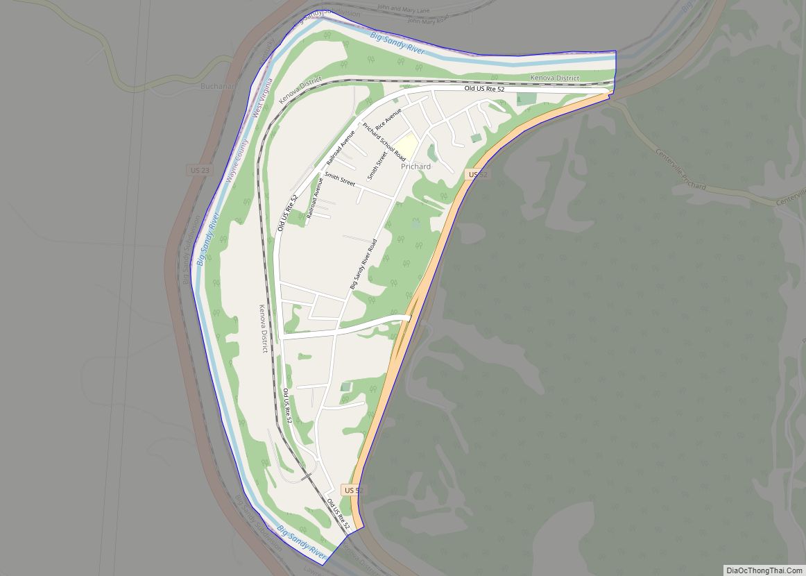
Prichard is a census-designated place (CDP) in Wayne County, West Virginia, United States. As of the 2020 census, its population was 461. It is located along the Big Sandy River and U.S. Route 52. It is part of the Huntington–Ashland, WV–KY–OH, Metropolitan Statistical Area (MSA), which had a population of 287,702 according to the US Census (2010). The community was named after James Pritchard.
| Name: | Prichard CDP |
|---|---|
| LSAD Code: | 57 |
| LSAD Description: | CDP (suffix) |
| State: | West Virginia |
| County: | Wayne County |
| Elevation: | 587 ft (179 m) |
| Total Area: | 1.263 sq mi (3.27 km²) |
| Land Area: | 1.107 sq mi (2.87 km²) |
| Water Area: | 0.156 sq mi (0.40 km²) |
| Total Population: | 461 |
| Population Density: | 370/sq mi (140/km²) |
| ZIP code: | 25555 |
| Area code: | 304 & 681 |
| FIPS code: | 5465596 |
| GNISfeature ID: | 1555412 |
Online Interactive Map
Click on ![]() to view map in "full screen" mode.
to view map in "full screen" mode.
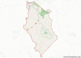
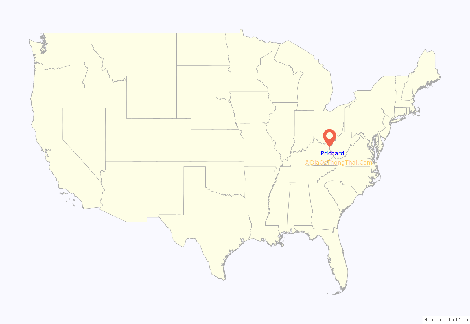
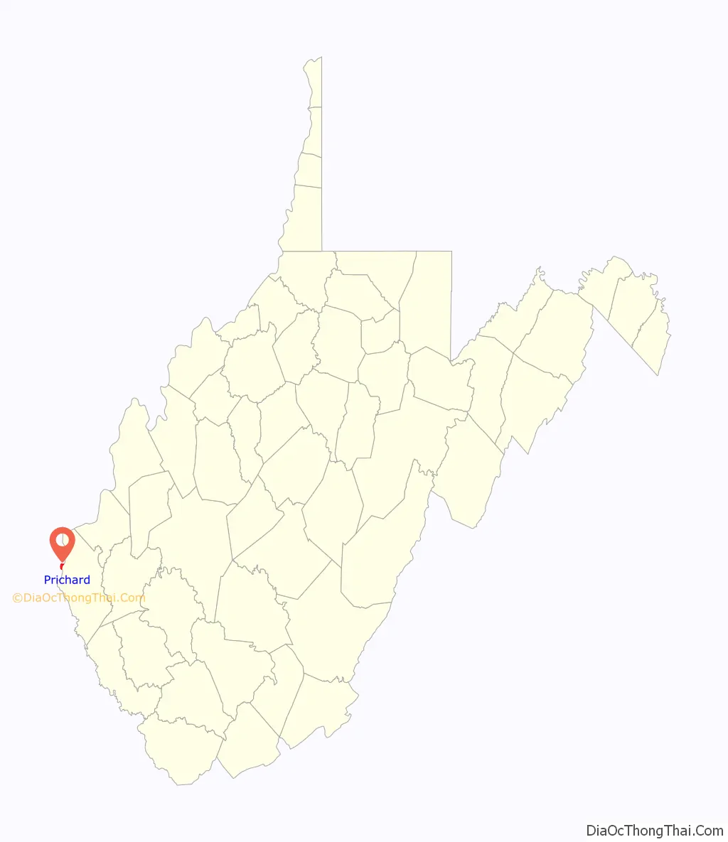
Prichard location map. Where is Prichard CDP?
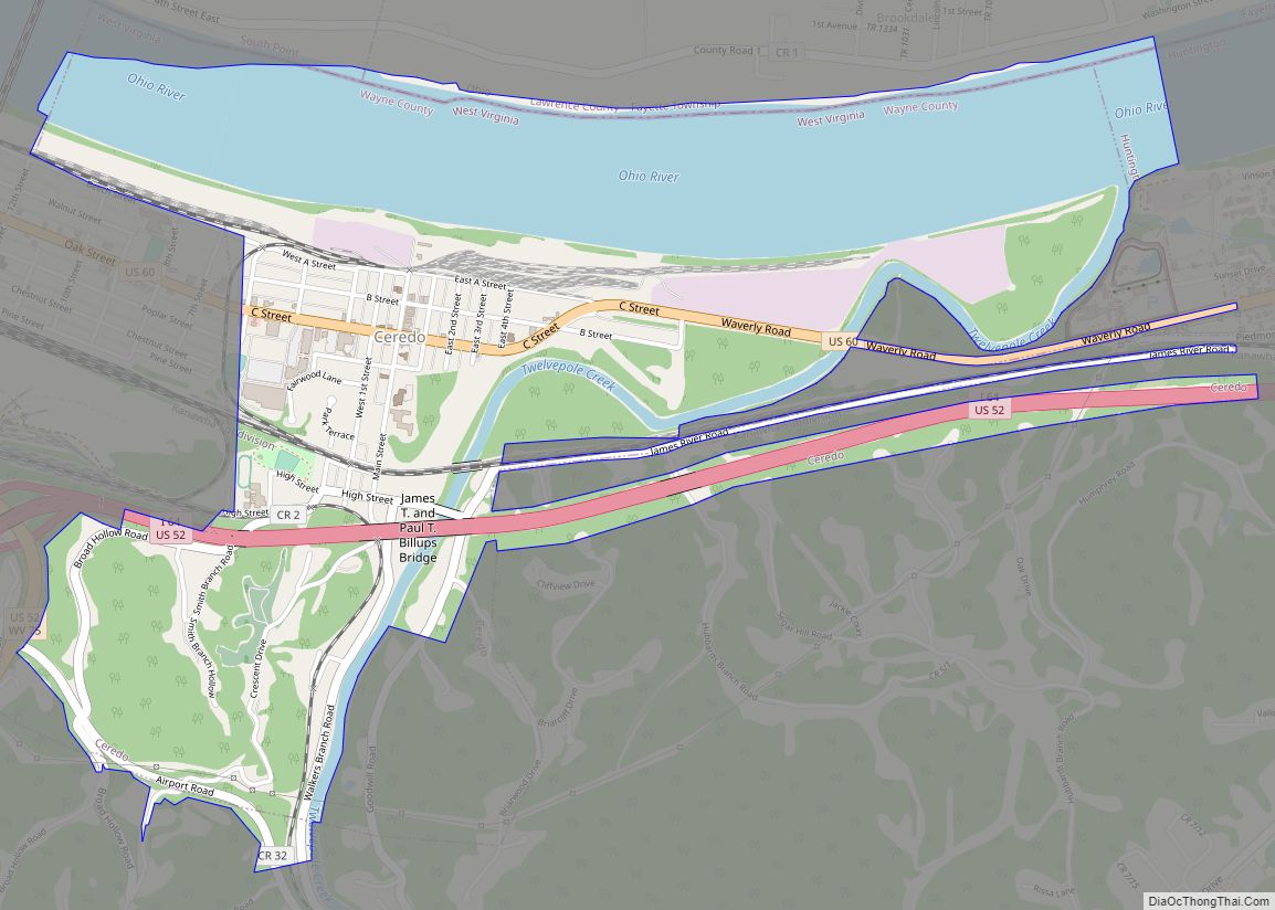
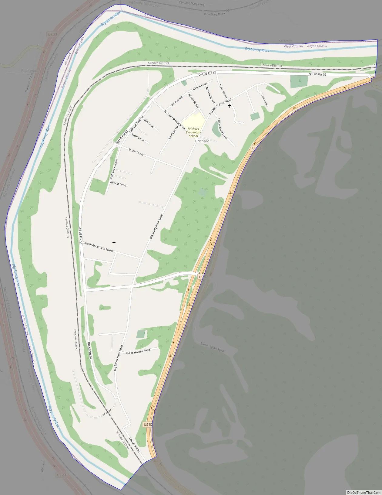
Prichard Road Map
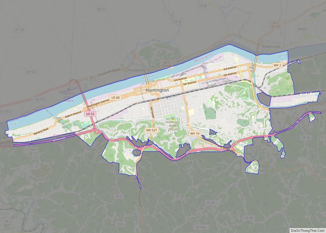
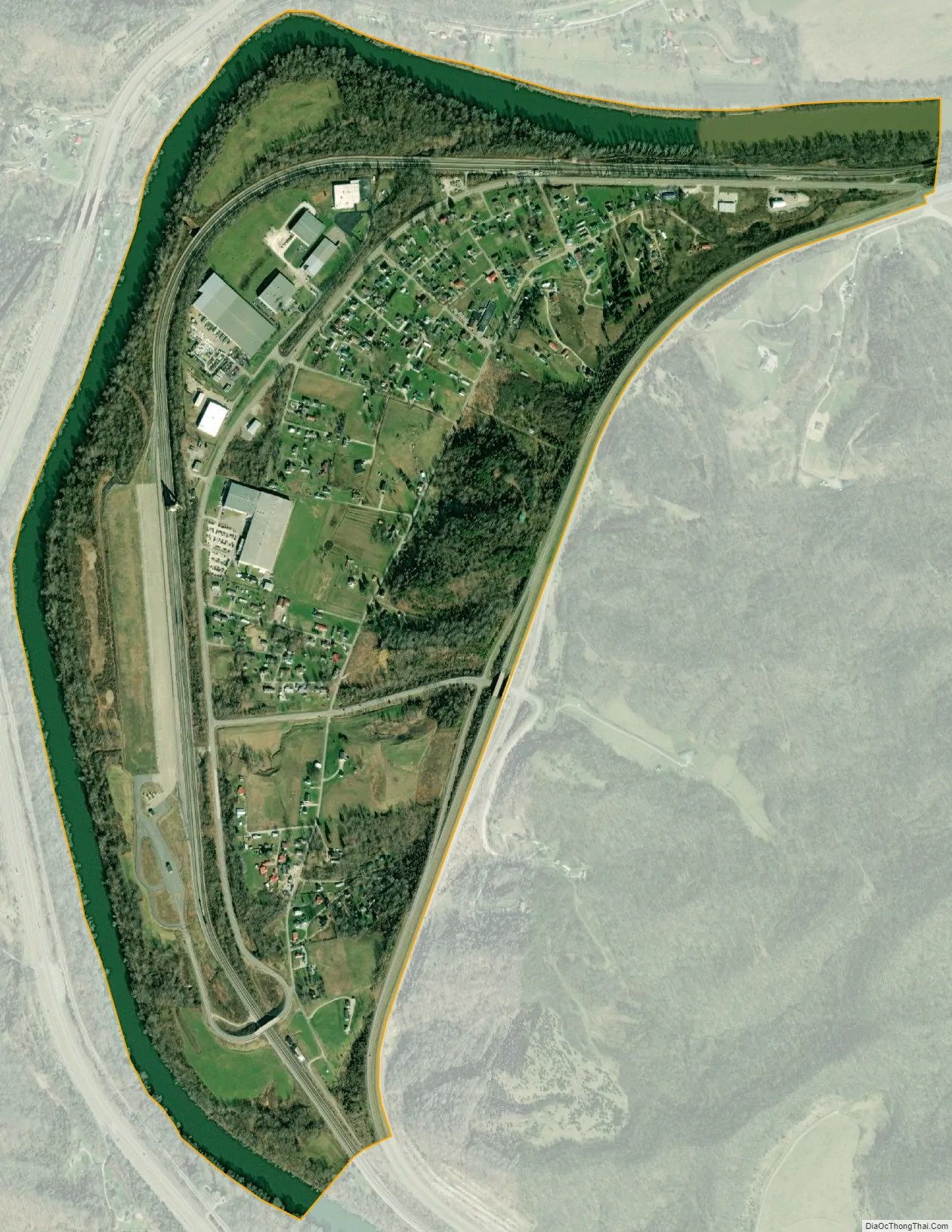
Prichard city Satellite Map
See also
Map of West Virginia State and its subdivision:- Barbour
- Berkeley
- Boone
- Braxton
- Brooke
- Cabell
- Calhoun
- Clay
- Doddridge
- Fayette
- Gilmer
- Grant
- Greenbrier
- Hampshire
- Hancock
- Hardy
- Harrison
- Jackson
- Jefferson
- Kanawha
- Lewis
- Lincoln
- Logan
- Marion
- Marshall
- Mason
- McDowell
- Mercer
- Mineral
- Mingo
- Monongalia
- Monroe
- Morgan
- Nicholas
- Ohio
- Pendleton
- Pleasants
- Pocahontas
- Preston
- Putnam
- Raleigh
- Randolph
- Ritchie
- Roane
- Summers
- Taylor
- Tucker
- Tyler
- Upshur
- Wayne
- Webster
- Wetzel
- Wirt
- Wood
- Wyoming
- Alabama
- Alaska
- Arizona
- Arkansas
- California
- Colorado
- Connecticut
- Delaware
- District of Columbia
- Florida
- Georgia
- Hawaii
- Idaho
- Illinois
- Indiana
- Iowa
- Kansas
- Kentucky
- Louisiana
- Maine
- Maryland
- Massachusetts
- Michigan
- Minnesota
- Mississippi
- Missouri
- Montana
- Nebraska
- Nevada
- New Hampshire
- New Jersey
- New Mexico
- New York
- North Carolina
- North Dakota
- Ohio
- Oklahoma
- Oregon
- Pennsylvania
- Rhode Island
- South Carolina
- South Dakota
- Tennessee
- Texas
- Utah
- Vermont
- Virginia
- Washington
- West Virginia
- Wisconsin
- Wyoming